Lack of snowcover January 29th 2013
After Sundays ice storm and the 2 other systems that effected us this week its turning out to be a very active week. The latest active weather is all a part of 2 weather systems that past through the past 3 days. Monday night one which surprised many local residents, including me produced thunderstorms Monday Night and early Tuesday Morning. Then a second storm system which was a part of the same system that brought a large swath of heavy rain and severe storms to parts southern plain states brought us snow and cooler temperatures and a back to reality slap of cold air that were in January.
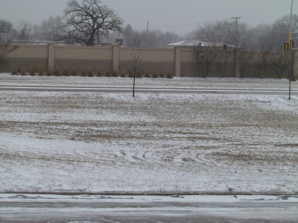
Interesting Note: Before the snow hit though the entire area was snow free for most of this month and even now snowcover is poor. This is the 2nd winter in a row with a poor snowcover in the month of January
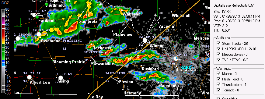
Radar shot of the cells that moved through January 28th and 29th
There were 2 rounds of thunderstorms one Monday Night and the other early Tuesday Morning many were surprising woken up by full fledged January thunderstorms, complete with thunder, lightning and heavy downpours! Many including me were not expecting it at all. In fact I was so not expecting it that getting ready for bed when I heard heavy rain on the roof and I did not remember what that sounded like, then when I heard thunder I was very surprised. A warm front moving up through Iowa sparked thunderstorms near the Minnesota boarder from there they moved northeast and brought heavy downpours, hail, thunder and lightning. Rainfall amounts ranged from 0.41" at Cannon Falls on the high end to 0.14 at Dodge Center and 0.22" here at my station in West Downtown Rochester. I still to this moment and surprised we got thunderstorms in the month of January its un believable and is absolutely unheard of to me but I could not find any historical information on just how rare January thunderstorms are, everyone I've talked to said it is usual. Even more surprising the temperature at my location was 33.F at the time the thunderstorms occurred. The temperature warmed to 37.F at about 1am.
Snowfall January 30th 2013
If I had to some up weather this winter so far it would be extremely changeable. We went from thunderstorms on Tuesday to snow on Wednesday.The low pressure system mentioned above that moved through the plain states moved northeast through Northeast Illinois. This put the very west edge of the swath of snow from a winter into our area. It was mostly light in nature and the entire area had minor accumulations occur area wide but it ranged from a trace in the west and north to 3" in the east. Here in Rochester it was 0.50" The bulk of this snow occurred in Southern Wisconsin, where 5-8" of snow fell. Like with all storm systems this time of year cold air was also brought in as well and strong northwest winds 35 to 40MPH. Temperatures went from the 30s on Tuesday night to below zero Wednesday Night.
Snowfall Reports
Winona 3.0"
West Downtown Rochester-My Station 0.50"
Dodge Center Trace
Red Wing Trace


No comments:
Post a Comment