Map Image Legend Image

Iowa Weather Network Warnings Map

Iowa Weather Network Warnings Map

Winter Weather Advisory

Thursday, May 30, 2013

May 29th-30th Severe Storms causing wind damage and widespread flooding on area rivers and streams


 photo 0529131456_zps8c1de868.jpg
 Severe storm line approaching Cresco May 29th 2013

A very active stretch of weather for the area these past couple days. The latest round of weather was with a warm front/boundary that set up west of the area and was the focus for showers and thunderstorms late in the day north of Des Monies developing around the noon hour. This storm activity moved northeast though the afternoon and reached North Iowa and Far Southern Minnesota by around 3pm bringing territorial rain, hail and high winds to many areas south of I-90. I was at work at the time the line of storms moved in from. the Mason City area, here in Cresco, the storms came with strong southwest winds and torrential downpours. Local wind gauges reported a 45MPH wind gust in Cresco. Territorial rains from the storms on top of very soggy grounds lead to significant run off which caused area creeks and rivers to flood and even some overland flooding in various communities across the area, but especially across the central and south part of the area.

Storm Reports

Nashua,IA 60MPH gust

Ionia,IA 62MPH gust

New Hampton,IA 63MPH gust

Cherry Grove,MN Shed destroyed, shingles removed from garage. 
 photo IMG_5960_zpsd1dc0ed3.jpg


Raging Turkey River May 30th 2013

Significant river and overland flooding was seen from this storm activity because the area has been hit by consistent rain which has fallen for the last month. Over the past month we have revived 5 to nearly 8 inches of rain, in this storm activity 1.50 up to 3 inches of rain was reported. After the 1st initial line of storms went through in the afternoon, thunderstorms re developed over Floyd Mitchell and Howard Counties causing more problems. All of the area from these storms ran off into river and streams causing significant flooding of much of the areas rivers and streams. Overland flooding is still a common problem across much of the area even where there is no rivers and streams. My yard here in Cresco has standing water in it and I am far from any river.

Flash Flooding Reports

Decorah 2.23" Widespread street flooding in town

Charles City 1.89"

Ionia 1.34"

Cresco 1.47"

Protivin Sand bagging operations under way against Bohemian Creek 

Caledonia Water flowing over the intersection of Hwy 76 and Hwy 22

3 miles N Caledonia, water flowing over fields

Fort Akinson 3.40" Water half way over Hwy 24

Calmer 3.43"

New Hampton, Street flooding, widespread flooding across eastern Chickasaw County

Charles City, Some streets underwater

Riceville, Flooding on area creeks

Osage, Street Flooding

Sunday, May 26, 2013

Very active weather ahead. Storm systems arrival is expected to bring muiltple problems to the area including Severe Weather heavy rainfall and flooding.

 photo 303_zps2432f804.png
Regional Weather View

A very potent and active weather system will produce a wide range of issues for the Upper Midwest this weekend. With the weather pattern is set up the way it is currently, several waves weather are expected to pass through the region bringing concerns of heavy rainfall and river flash flooding and severe thunderstorms and tornadoes to a wide part of the region, but especially across the state of Iowa. The cause of the active weather is a warm front which has been parked over the region the pass few days and will continue to remain over the area. Warmer temperatures and more humid air will result as the warm front inches farther north into the state of Iowa and Southern Minnesota.

 photo 304_zps212b152d.png
Local weather view

Local overview

The warm front mentioned above will make a slow move northward through our area and then park its self over the area over the period of the next several days. The warm front will force in much warmer more humid air, however significant amounts of moisture will be available which will spark several waves of rain and thunderstorms and this will cause problems for the local area. With the expected system locals can expect concerns of very heavy rain and river flash flooding and several severe thunderstorms risks. Widespread very heavy rain is likely with amounts ranging from 3-5" over the Iowa communities and 1-3" across the Minnesota Communities. Rivers are already very high from the past few weeks rainfall. Flooding concerns are to a very high level for areas and communities along creeks and rivers with the areas of highest concern are along and south of the Iowa border where much of the heavy soaking rains. Also a concern is that conditions are right for several waves of severe thunderstorms with hail and highs winds as well as a tornado threat. People should be aware that there will be several days in a row with these risks. Monday through Friday will carry the risks for severe storms and heavy rain.

Memorial Day, Times of rain and thunderstorms, some storms could be severe and contain heavy rainfall. Highs in the upper 60s. Monday Night, Times Showers and thunderstorms, lows in the low 60s. Some storms could be strong and produce heavy rain

Tuesday, Warm and humid. Times of rain and thunderstorms. Some storms could be severe and contain heavy rainfall. Highs in the upper 70s to lower 80s. Tuesday Night, humid, Showers and thunderstorms, lows in the lower 60s.

Wednesday, Warm and humid. Thunderstorms developing, some storms could be strong to severe and contain heavy rainfall. Highs in the low 80s. Wednesday Night, Partly Cloudy, lows in the middle 60s

Thursday Partly Cloudy, Thunderstorms developing, some storms could be strong to severe. Highs in the upper 70s to lower 80s. Thursday Night, Thunderstorms, some could be severe and have heavy rain

Friday, Partly Cloudy, Thunderstorms, developing, some storms could be severe and contain heavy rain. Highs in the upper 70s to low 80s. Friday Night, Thunderstorms early, then cloudy. Some could be severe and contain heavy rain. Lows in the low to mid 60s.


Looking Ahead

Overall in the long term, expect warmer seasonal temperatures but a very active pattern to continue for the rest of the month into the 1st part of June. Into next weekend, the active weather will continue as a cold front pushes through the area, storms, heavy and severe weather will be possible through Saturday. It is now until Sunday June 2nd that the weather shows signs of clearing off and becoming dry. It has the chance to be dry and pleasant through Tuesday the 4th, before the next storm beings a wave of heavy rain and severe weather threats for Wednesday June 6th. Thursday June 7th through Monday June 10th has the chance for another dry period before the next storm arrives on Tuesday June 11th


Wednesday, May 22, 2013

Welcome to Iowa introduction! Active weather with Severe storms with heavy rain major river flooding and sigificant wind damage in many areas.

 photo IMG_5921_zpsd7c2590a.jpg
Major river flooding on the Upper Iowa River at Chester May 20th 2013

I have moved to Iowa, unfortunately I already have to start reporting weather. While I was offline moving to Iowa severe weather and flooding impacted Southeast Minnesota and Northeast Iowa from a slow moving low pressure system moving across the region. Sunday night severe storms formed near Osage and moved northeast impacting this area with major wind damage near St Ansgar, this cluster of storms pushed northeast through the entire area and produced damage around Austin up through Rochester to the Mississippi River. The storms crossed the river and made it all the way to Northwest Wisconsin including my hometown where I was at the time. Clusters of heavy rain producing thunderstorms continue to form over North Iowa and Southeast Minnesota producing widespread 3-4" of rain across most of the area which caused flooding of several area rivers. Road closures were reported from water over the road or washed out roads, including State road 9 west of Osage.


Reports:

1 mile W Osage quarter sized hail cover the ground 

2 miles N Nora Springs Barn blown down, numerous large trees down

2 miles S Stewarville 30 large pine trees blown over

Northwest Rochester, power out debris reported on the road in Elton Hills

Rochester Airport 60MPH wind gust

Lewiston, Wind damage

St Charles Power lines and trees down in the city 

2 miles N St Charles, structural damage, pole barns damage as well as corn cribs

Nora Springs numerous roads under water

St Ansgar, widespread flooding of secondary roads across all of Mitchell County

Stacyville 6-7 inches of rain has fallen Little cedar river out of its banks

Osage, Many roads washed out

Rollingstone, wind damage

Winona 62MPH wind gust

Austin, Rose creek a foot over its banks

Adams, roads and bridges under water

New Hampton, numerous trees down, some blocking streets

Calmer Structural damage, parts of siding ripped off and roof damage

Welcome to Iowa

 photo IMG_5920_zps2a976e8f.jpg
 Downtown Cresco,IA May 21st 2013

Now that graduation has passed and I have a degree in horticulture I spent the past several days moving from Rochester,Minnesota to Cresco,Iowa where I was offered a full time year round job growing plants for a major wholsale plant company. I have un packed and begun landscaping my new yard. I've also explored and am starting to get used to the community. Although Cresco is much smaller then the city I just moved from and spent my last 2 years in, it is quite a bit larger then my hometown of Clayton, Wisconsin.

 photo IMG_5928_zps611acfb2.jpg

 
Cresco welcome sign

I am looking foreword to covering North Iowa, now I will give an introduction to Cresco: Cresco is a medium sized independent North Iowa farming community. The population is 4,000 and it is one of the larger communities in the area. Cresco is located about 11 miles south of the Minnesota boarder and it is the county seat of Howard County. It is located in the North Iowa plains it is very flat with vast open fields and wind farms to the west, and more hills and trees to the east. Cresco is located just west of the Driftless area of Southeast Minnesota and Northeast Iowa.

Look for more updates and eventual forecasts to come in the coming days once I've settled in more.


Wednesday, May 15, 2013

Graduation time! Disruption in service as I move and New blog area defined!

Graduation is upon me and I will be walking to receive an associates degree in horticulture sciences tomorrow Thursday May 16th ending my college career. I am very proud of my newly received education and think it really helped my put my past knowledge together nicely and has made me a rounded professional in Horticulture. The career I've chosen to go into next has set up me on my next path and I will be moving to North Iowa Monday May 20th. I have many feelings going through my mind this week but I feel like I am making good choices.

 photo 25-Copy2_zpse238a0ea.png
New regional blog coverage map.

This will be my new coverage area. I will be dropping 2 Minnesota counties however I will be adding several Iowa counties including Mitchell, Floyd, Howard, Winnishiek and Chickasaw counties and 1 Minnesota county which is Houston. I will be continuing coverage for Dodge, Mower, Olmstead, Winona and Fillmore counties. In order to continue coverage to the Rochester area this will the largest area I've served.

I thank viewers for baring with me as I go through this very busy point in my life. I look forword to covering the new area!


Blog Owner
Derek M

Tuesday, May 14, 2013

May 14th Record heat, near triple digit highs reported!

 photo IMG_5902_zps5546ea29.jpg
Serviceberry Trees in bloom on a hot May 14th day

Hard to believe we had significant snowfall less then 2 weeks ago! Today felt like middle of summer as record breaking heat was seen across the the area as a very hot and dry airmass moved in from the west. Dewpoints lowered and sunny skies prevailed through most of the day pushing highs into the middle to upper 90s. Some locations such as Austin even hit the 100.F degree mark. Normally 1st 90s occur in June so we are a month earlier then when they should occur. 

A record high of 97.F was set at the Rochester International Airport breaking the old record of 94

High temperatures seen

 Entire area

Austin 100.F
Cannon Falls 99.F
Red Wing 99.F
Dodge Center 97.F 
Preston 96.F 
Winona 95.F

Rochester Metro

Downtown Rochester ( my station ) 99.F
Oronoco 98.F
North River Court 98.F
Northwest Rochester 97.F
Ouarry Hill 97.F
Byron 97.F
Rochester Airport 97.F


Saturday, May 11, 2013

Spring growth update # 3 Mid tree and late tree Leaf out begins Magnolias and Forsythias in full bloom!

 photo IMG_5892_zps6e3743c0.jpg
Royal Star Magnolia May 7th 2013

Spring growth is continuing this week. Weather has been up and down, we had 2 80 degree days here in Rochester, then Thursday it was only 58.F, there was plentiful sunshine some days and an all day rain 1.20" fell on Thursday. In bloom this week, Magnolias have bloomed and have now reached full bloom. The Magnolia above is my Royal Star Magnolia, I have never seen it so full of flowers! Daffodils and Hyacinths are now past their peak and are on their way out but Tulips are taking the show and are in full bloom. Forsythia have bloomed and are at their peak right now and look great. Redbud trees are just starting to bloom and will soon reach full bloom. We are at least a month behind where we were last year and about a week and a half behind where we should be.
 photo IMG_5875_zpse5d1c785.jpg

Light pink Magnolia May 7th 2013

This light pink Magnolia is in an area I walk in. The blooms remind of Royal Star blooms but the smell is very weak and the blooms are a faint pink which is easily bleached out by the sun.

 photo IMG_5878_zpscbd3bb53.jpg
Forsythia May 7th 2013

This is the 1st full spring for this Forsythia. I really enjoy the early blooms of this bush, this plant has made it on my list for mush have plants for my new house.

 photo IMG_5870_zps19493eb4.jpg
Susan Magnolia May 7th 2013

This is a new Magnolia variety I got for my new house, the blooms are larger and are a very reliable pink color which will not fade. They have a lemony scent, I am looking forword to see how this variety does in my new Iowan landscape.
 photo IMG_5871_zps1fe69172.jpg

Tulips May 7th 2013

The Tulips began blooming early this week and have reached full bloom since I've taking this picture. These Pink Tulips are in their second spring if this garden. Last year I was disappointing by their dull color, but now that I have added other color Tulips to this garden last fall I really like the combination of the two. I will post a picture once all of the Tulips are blooming.
 photo IMG_5882_zps0727200b.jpg


Norway Maples May 7th 2013

Trees have progressed significant since the snowstorm. Earlier trees and bushes such as Crab Apple and Lilacs are completely leafed out with flower buds exposed and Mid trees are currently leafing out, Aspen, Maple, Elms, Birches, Lindens among others. Late trees such as Oaks and Honey Locusts are starting to break bud and will soon be leafing out. Temperature swings this week onto the cool side may slow things down but a 90+ degree day Tuesday will likely speed things up substantially.

Sunday, May 5, 2013

From morning snowcover to temperatures in the mid 60s! Daffodils in full bloom

 photo 0505130832_zps2097acb8.jpg
Snowcover Backyard 8:30am Sunday May 5th

Spring is back on track! Today featured an odd contrast in which the day started off with snowcover then the day ended the day with brilliant sunshine with temperatures in the middle 60s! Here in Rochester we went from having 2.50" of snow on the ground to a high of 65.F, It is considered usual to go from snowcover to 60s in one day but it felt great! The extreamlly powerful May sun melted the remaining of this snowcover by 3pm and because the ground was again relieved it allowed for further warmer and allowed the temperatures to rise into the lower to middle 60s.
 photo IMG_5867_zps7d9f5b70.jpg

Backyard 7:30pm 11 hours later Sunday May 5th

By days end all but a few piles is all that remained of the historic snowcover! It is the fastest meltdown I have ever seen, it is quite stunning to go from 13" of snow on the ground to nothing in just 48 hours!

 photo IMG_5863_zps0e286772.jpg
Daffodils in Full bloom May 5th 2013

Not only did we loose the rest of our snowcover today, we actually progressed furtuer in the growing season. Daffodils made it great through the 15" of snow we got and are now in full bloom! My Magnolia is starting to bloom as well and I am now seeing a few Tulips starting to flower. Spring is on its way once again, temperatures are expected to be in the 70s for the next several days!

Thursday, May 2, 2013

Crippling May snowstorm of historic proportion brings widespread major snowfall accumulations bringing the area to a complete standstill. 12-15" of snow produced widespread sigificant tree damage, closed major roads and took power out to thousands. All time May snowfall records shattered- Storm to remember for years to come.


 photo may0213_morning_reg_snow_zps9a5bab39.jpg
Regional snowfall accumulation map, Image from the NWS in La Crosse

Overview

A snowstorm of historic proportion never before seen in the month of May has left the area crippled under a foot plus of snow that now blankets the area. This storm produced major snowfall accumulations, caused significant tree damage and brought most communties local area to a complete stand still. The set up for this powerful storm was a low pressure system tracking from Northeast Missouri to Southern Wisconsin. What is very usual for this storm besides the fact that it has happened in May is warm temperatures surged ahead of the storm and brought our areas 1st upper 70 degree readings on April 30th just 2 days before it happened! A cold front swept through and bringing us thunderstorms before the front stalled out just our east. As this happened a low pressure system developed in Iowa and sent a huge but very narrow band which first started as rain then it turned over to very heavy snow late into the Wednesday night hours. This band intensified Thursday and at one point 2" per hour snowfall rates were seen across the area, it was intense enough that Thunder snow was observed in Austin. The map above shows in detail just how narrow this snow band was which was only about 50 or so miles wide and had a very sharp cut off. The band was located directly over the central and northwest parts of the area. The southern and eastern parts of the area escaped the worse of this snow. Thursday night into Friday morning another 1-3" of snow fell on top of the region from a new system which fell onto the area which was already crippled by the previous snowstorm.

 photo IMG_5835_zps90fd9ebe.jpg
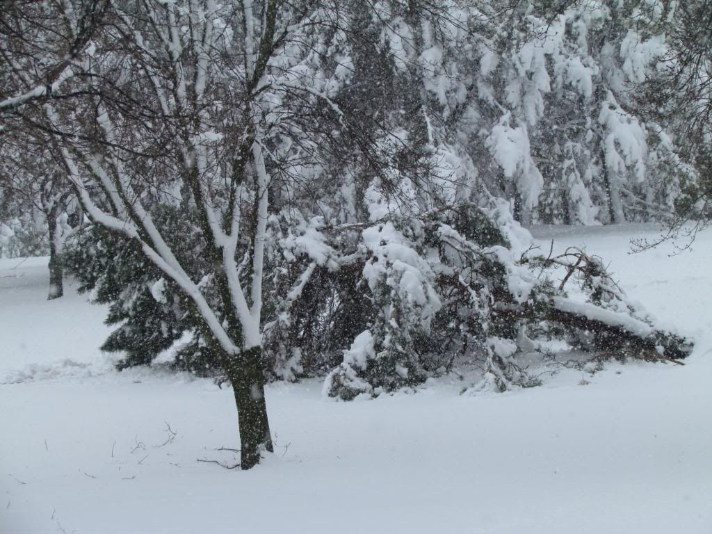
 Downed pine trees May 2nd 2013

Widespread major damage and power outages-Area wide overview

This will be one for the record books for a long time! The storm brought a widespread 12-15" of snow and brought the entire Southern and Eastern part of the state to a complete standstill including parts of Northwest Wisconsin and a section of North Iowa. Another 1-3" of snow was reported on top of this the next morning bringing region total 2 day totals to 13-18" The weight of the snow and sheer amounts seen was the root of the major impacts that were seen with this storm. The snow which the NWS named concrete snow was very wet in nature and because temperatures were in the middle 30s during the snow it easily stuck to tree branches which weighed the branches down and caused them to snap falling on homes, cars and powerlines. Falling branches into powerlines took power out to numbers in the Thousands in all parts of the with the highest concentration seen in Red Wing and the Rochester areas. Tree damage was so substantial that power outages continue to occur even several days after the storm. Snowfall amounts were so extreme that Roads were impassible Thursday morning either from the snow or fallen trees. The Minnesota Department of Transportation declared  no travel at one point and Highway 52 near Zumbrota closed in both directions due to a crash and at one point traffic was backed up so far the traffic jam went back for 20 miles back down towards Rochester.

 photo IMG_5839_zpsbb8eee09.jpg

Tree damage May 2nd 2013

Rochester Area Overview

I was first aware of the upcoming storm days before it happened but I had generally thought it was over hyped because I thought stuff like this could never happen in May. I was definitely proved way wrong. I shouldn't even need to state to local viewers of  how I myself never seen anything like it, I asked many local residents and they have said the same thing "never before in the month of May" I first went to bed Wednesday night and it was raining steady, but the time I woke up Thursday morning it was very heavy snow and it had already accumulated to 6" The storm even brought a the modern progressive city of Rochester to a halt as 13.90" fell officially at the airport while my location received 13.0" of snow during the snowstorm and another 2.50" Friday morning for a 2 day total of 15.50" Many business were schools were closed including Rochester Community and Technical college which is known for rarely ever closing. Significant widespread tree damage was seen, Bus services were hindered or were stopped and snow and fallen tree branches made most roads impassible. At one point 12,000 people with without power in the Rochester area alone from fallen tree limbs into power lines. During my walk through around my area I was surprised to see just how bad some of the tree damage was. The photos included in this post are some of the worse I've seen, but I also entire sections of trees limbs down on homes and many blocking sidewalks. Tree crews were overloaded by the amount of worked that is needed to be done.
 photo IMG_5817_zpsa9e476f1.jpg

Birch tree bending under the weight of heavy snow May 2nd 2013

Trees damage across the area is major. City crews in Rochester alone said they will be working for weeks to clean up the damage. All across the area trees really took a hard hit from this snowstorm, and it is not just localized it is widespread over a huge area. The damage was so widespread it was difficult to find yards that didn't have at least some sort tree damage. It wasn't just Pine species that were hit hard but was also deciduous trees because of the wet nature of the snow sticking to the branches.  It made things were that some trees had begun flowering or had buds swelling which made them more prone to breaking. Ask and Red Maple trees seemed to to be especially hard hit. The following 3 photos are of various damage I've seen around the city.

 photo IMG_5854_zps2abab7a3.jpg
 Landscape damage to Aborviate the day after the historic May snowstorm May 3rd 2013

Damage to landscapes like these was devastating. Evergreens and especially Arborvitae shrubs are damaged beyond repair many have bent and broken branches that can not be fixed on its own.

 photo IMG_5822_zps90a854a7.jpg

Service berry May 2nd 2013

 photo IMG_5824_zpsf3c8ba48.jpg

Fallen Branches blocking my street May 2nd 2013
 photo IMG_5827_zps4f78f90f.jpg

Hyacinth in the Historic May snowstorm May 2nd 2013

All time May snow records smashed

I think this photo of a Hyacinth sets the mood for this storm because we need to be reminded it is May! Snowstorms of this magnitude have NEVER before occurred this late in the season in recorded history in our area, so when people talk about how extreme this is, there is nothing to compare it too! At our areas official climate location at the Rochester Airport we have set the records for the worst snowstorm in May history. Our local NWS office is calling this unprecedented because the airport has received an uncalled for 13.90" of snow shattering all May historic records that date back to the 1800s. our old May record before this was 2.0" The NWS said before this year there have only been 10 times since 1886 that is has snowed in Rochester and they in the past they all totaled under 1" until today.

The NWS has stated that a new all time state of Minnesota record may be set from this storm in Dodge Center where 15" was reported. This could replace the old state record of 6" which used to be in Northern Minnesota
 photo IMG_5813_zpsddc7f5ce.jpg

Greening Alpine Current under a foot of snow May 2nd 2013

Snowfall and damage reports

 Dodge Center 15.40: ( possible new state record)
Red Wing 13.50" tree damage, widespread power outages
Rochester Airport 14.0"
 West Downtown Rochester 13.0" widespread tree damage, power outages, city buses stalled, roads impassible
Kasson 13.50" power outages, trees down
Claremont 13.0" 
Austin 10.00" Thundersnow
Zumbrota 8.40" Highway 52 close
Cannon Falls 8.20" 
Spring Valley 8.0"
Kenyon 7.50" 
Lake City 6.0"
Preston 6.0" 
Wabasha 5.60"
Winona 3.50"
Harmony 2.50"

May 3rd additional accumulations 

 photo IMG_5851_zps794286fa.jpg
 Backyard May 3nd 2013

To add insult to an already record storm another system brought an additional 1-3" of snow to the area Friday Morning before turning to rain as temperatures warmed into the middle 30s. This put 2 day snowfall totals up nearing the 20" mark for several areas. To end off this post on this very historic month for snow I wanted to include the photo of the backyard after the 2nd snowfall. It is hard to believe 2 days ago you could see Daffodils, the lawn had just been mowed and the temperature was in the upper 70s! A significant warm up back into the 70s is expected by next week which should set us up for an very fast snowmelt, we will have to see how many days it takes to melt the snow.


Wednesday, May 1, 2013

Huge pattern change turning cold! Next storm system could produce 2-4" of wet snow Thursday, possibly breaking historic May snowfall totals. Not warming up early next week.

 photo 301_zpse5c9e27e.png
Regional weather view

Winter is just not wanting to stay away from the Midwest! A sharp cold front moved across the region and has brought cold air back to the region, to make matters worse the next storm system which will be a cool cut off low type will likely produce accumulating snowfall to parts of North Iowa, Minnesota and Wisconsin which could break May snowfall records in this region. This low will continue to circulate across the region over the next several days bringing extended cloudiness, cool weather and widespread showers. Temperatures will go through a warming trend over the weekend with 60s and 70s moving back in by Monday.
 photo 302_zpsb93d6b50.png


Local weather view

Accumulations expected and timing-Rare May snow system possibly breaking records

A cut off low cool pressure system will backtrack into the region bringing rain then turning to a heavy wet snow tonight into Thursday and will continue through the day as drizzle and snow. The snow will be heavy at times. Temperatures will be cool in the lower to middle 30s both at day and night and with the snow will be heavy at times this will lead to accumulations on grassy surfaces and trees. At this time the highest accumulations will be in he northwest part of the area, Red Wing Cannon Falls to Dodge Center could see 3-4" with 1-3" across a large part of the central part of the area. There will be a sharp cut off in the snow totals with the Southeast part of the area only seeing a half inch to 1" of accumulation. 

Impacts expected: Temperatures will be in the low to mid 30s the entire time of the snowfall this will make it very wet and heavy in nature, because of this there will could be problems with trees branches breaking and isolated power outages from falling branches. Pine species are the most at risk of breakage. Main roads should remain fairly decent for travel as warm pavement temps melt snow. Side roads may have some accumulation. People should be aware that snow of this magnitude are very rare for this late in the season and has only happened a few times in our history. This will likely be a record breaking event.

Freeze potienal statement

At this time temperatures are expected to be near 32.F but clouds will protect us from temperatures dropping much below freezing and at this point I to not anticipate damage to plants/flowers from the cold temperatures. However the heavy weight of the snow could damage some spring blooming perennials.

Cool and rainy weather will last through the weekend.

As the low continues to sit over the area it will spread continual widespread showers and drizzle. Any snow should be done by Friday Morning and we should expect rain, drizzle and cloudiness for the rest of Friday. Clouds, light rain and drizzle will last through Sunday and it will be off and on type in nature. Over the next 4 days we have the potienal to pick up 1-2" of precipitation. Temperatures will go onto a warming trend after Thursday even with clouds and rain. Temperatures warm up the the 40s Friday, upper 40s by Saturday and into the 50s by Sunday.

Warm up by Monday/beyond

Monday we turn around once again. This is the next day in which we can expect descent weather. Clouds will finally break up and it will be dry during the day with highs into the middle to upper 60s. Following Monday, Tuesday rain and even thunderstorm chances do come back into the picture, but it will be the scattered type and we will still see some sunshine. Highs warm up to near 70.F again by the point with lows in the 50s. 

Thursday, Cold! Snow and rain likely, Snow could be heavy at times. Wet slushy accumulations ranging from 2-4" north to 0.50-1" south. Highs in the mid 30s. Thursday Night, Snow, accumulations around 1-2" temperatures in the low 30s

Friday, A change of snow, then changing to light rain and drizzle. Highs in the lower 40s. Friday Night, Light rain and drizzle, lows in the upper 30s.

Saturday, Cloudy with Light rain and drizzle, highs in the mid to upper 40s. Saturday Night, Cloudy with light rain and drizzle, lows in the lower 40s.

Sunday, Cloudy with scattered showers and drizzle. Highs in the low to mid 50s. Sunday Night, Cloudy skies, lows in the low 40s.

Monday, Nice, Clearing skies, light winds, highs in the mid to upper 60s. Monday Night, Cloudy with lows in the mid 40s.

Tuesday/Wednesday, Partly cloudy with a chance of scattered showers or thunderstorms. Highs in the upper 60s to lower 70s.

Looking Ahead

This looks to possibly be the last of the cold and snow but the pattern remains fairly active with one dry day Thursday looks to be dry before another cold front bringing a chances for showers and thunderstorms next Friday. Next weekend looks un settled with a chance for rain and thunderstorms. Early the week of Monday and Tuesday the 13th and 14th a parade of storms systems brings a chance of showers and thunderstorms every other day. Temperatures during this time will be warmer then they have been generally in the 50s and 60s through this entire time frame, with occasionally 70s at times.