Map Image Legend Image

Iowa Weather Network Warnings Map

Iowa Weather Network Warnings Map

Winter Weather Advisory

Saturday, September 28, 2013

Fall Color Report 2013 # 1

 photo 303-Copy-Copy_zpse62adcec.png
Regional Fall Color Report

Fall colors are beginning to appear across the area and it is now time to begin annual fall color reports. Being from Northwestern Wisconsin it is a new experience to me that I have not had to start yet since when I lived there it was near the 1st of September that I would start that rather then the 1st of October. Across the region, low color is being observed across a large portion of the area including most of Minnesota, Wisconsin and Iowa. Northern parts of Minnesota and Wisconsin are already reporting moderate areas of color.

 photo IMG_6556_zpse9bf33c3.jpg
Fall color starting to show on Green Ash September 28th Hiawatha,IA

This summer most of Iowa saw 100 degree temperatures along with drought that developed. It will be interesting to see how the fall color season progresses, rains over the past week may have very well could have saved our season. Currently Here in Eastern Iowa fall color literally starting popping over the past 5 days or so. All areas are reporting low color, and many State DNR sites and locals say this is slightly earlier then normal and could possibly be from drought stress. Trees that are showing color are strictly among earlier changing species including most Ash trees are turning, Sumac and Prairie Dogwoods. A few Red and Sugar Maples are showing some color, but most remain green. We certainly have a long ways to go in our fall color season , however we have gotten a good start so far.

Local Fall Color Reports

Waterloo Low Color
Iowa City Low Color
Cedar Rapids Low Color
Marengo Low Color
Anamosa Low Color
Independence Low Color   

Tuesday, September 24, 2013

Dry for the rest of the week, warming up to the 80s. Next chance of rain Saturday/Sunday with a strong cold front.

 photo 303-Copy_zps31980700.png
Weather Map

A high pressure system that has been taking its time crossing the country has been responsible for the beautiful weather we have been receiving lately and it will continue to provide 3 more beautiful days that have been much like the past 5 accept that it will be warming up quite a bit to the lower to mid 80s for highs and 60s for lows with dewpoints increasing through Friday. All this will come ahead of a cold front set to arrive to Iowa on Saturday when a strong fall cold front will produce rain which should push across the state giving everyone a chance of storms. For Eastern Iowa, Saturday night into Sunday is the best chance for rain, we have one shot to see thunderstorms, some of which could be strong. Then after the cold fronts passage it will bring the return of dry and cooler weather for the rest of the weekend into next week. Highs will cool to the lower to middle 70s and lows will cool into the 40s and 50s.

Wednesday, Sunny skies with light winds. Highs in the upper 70s. Wednesday Night,  Clear skies, lows in the mid 50s.

Thursday, Sunny skies, light southerly breezes with highs in the low 80s. Thursday night, Clear skies Clear skies with lows in the upper 50s

Friday, Sunny and warm with a touch of humidity. Highs in the low to mid 80s with southerly breezes. Friday Night, Clear Skies and humid. Lows in the low to mid 60s.

Saturday, Sunny skies and humid with southerly breezes. Showers and Thunderstorms moving in late. Highs in the lower 80s. Saturday Night, Showers and Thunderstorms moving through, some could be strong. Lows in the mid 50s.

Sunday, Clearing skies with northerly breezes. Highs in the low to mid 70s. Sunday Night, Clear skies with lows in the upper 40s.

Monday through Wednesday, Sunny skies each day with light breezes. highs in the mid to upper 70s each day with lows in the low to mid 50s each night.

Ahead

During the end of next week a cold front does bring the chance of showers come Friday the 4th of October. The system is a quick moving one as sunny skies and cool fall-like temperatures arrive for the weekend of the 5th. Monday October 7th a strong warm front pushes through the state bring very warm temperatures for October standards. A fast approaching very strong cold front around Tuesday the 8th could cause our next good chance of thunderstorms, which would have to be watched for severe potienal. Wednesday the 9th looks significantly colder with the Northern Areas having their 1st chance of patchy frost possibilities. Warmer temperatures and drier conditions return for the middle of the month.

Thursday, September 19, 2013

Severe Storms Rake Eastern Iowa with numerous reports of tree damage throughout many communities as well as structural damage in the North Liberty Area

 photo IMG_6499_zps4b60627e.jpg
Front edge of a roll cloud/shelf cloud in front of a severe thunderstorm September 19th Hiawatha,Iowa

A hot muggy day with record breaking high temperatures in the lower to middle 90s made fuel for severe thunderstorms as a strong fall cold front sliced into this hot humid airmass. During the afternoon hours an outflow boundary was enough to already enough to spark the areas 1st round of severe storms around 1-3pm, wind damage was reported in Anamosa an Scotch Grove. Later in the afternoon the main show was moving in as the strong cold front sparked thunderstorms over Central Iowa near Des Monies where numerous reports of significant tree damage was reported across the Northwest side of the Des Monies metro. This line of storms turned into a long-range bow echo as it raced down the I-80 corridor towards Cedar Rapids and Iowa City and surrounding towns. 50 to 60MPH, tree damage and power lines down were reported in several communities including both in the Cedar Rapids and Iowa City metros. The worst damage report I've come across so far is out of North Liberty where one home at a garage roof torn off, windows broken and a flag pole snapped and blown over a house into the back yard. On the upside there was beneficial rains reported with widespread rainfall of at least 0.50" reported, and amounts as high as 1-3" over the last 24 hour period.


Video of the storm from Hiawatha,Iowa

At my location there the strongest winds was in two parts of the storm, the 1st initial blow as the roll cloud went over then even strong gusty winds as the heaviest rain moved in. It almost appeared to have a wet microburst look to it as heavy rain was blowing of roofs. Numerous large branches at least 5 inches in diameter broke off trees just down the street from where I live. I estimated the wind gusts at 50 to 60MPH. 0.81" of rain fell at my location.

Damage Reports

Belle Plain, Large tree down blocking road
Newhall,   60MPH wind gust
Vinton, 63MPH wind gust
Shellsburg, 5-6" diameter branch down
Hiawatha, estimated 50-60MPH winds 5" diameter branch down
SW Cedar Rapids, estimated 60MPH winds
Iowa City, Tree down, powerlines down
North Liberty, Garage roof blown off, Windows broke, Flag pole snapped and thrown over house
Anamosa, Section of a tree snapped off and fell onto a car
Scotch Grove, Section of tree snapped
Olin,1.00" hail
Tipton, Cattle shed blown down 8-12" branch broken


Tuesday, September 17, 2013

Prairie- The Lost Landscape.

 photo 303-Copy-Copy_zpsd1ab74a2.png

Map depicting what could have been the original prairie of the Midwest.

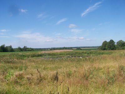
Prairieland- the lost landscape. A prairie describes a diverse plant community of mostly grasses but also forbs ( flowers) This post is dedicated to induce interest in the landscape that once covered most of the Midwest. According to Campsilos.org, At one time prairie used to cover 40% of the U.S with the largest areas of prairie in the Midwestern states. 85% of Iowa was once prairie with the exception of the Northeast Driffless area and river valleys. Now 99.9% of the original prairie is gone in Iowa with the majority of it over time being plowed for farming or urban development. The most abundant plant type in Iowas Prairie was Big Bluestem Grass, which is now rarely seen in the wild. Original remnant prairie is completely different then most common roadside/ditch grass that can been seen along roads and corridors. A remnant prairie is an original prairie that has never been plowed over or disturbed. I visited Hayden Prairie an original while living in Northeast Iowa and original prairie consists of much diversity and there is a mixture of beautiful grasses and flowers alike that bloom in all seasons. Unfortunately there isn't a way to bring those back once destroyed.


 photo Picture1548013728_zps23884057.jpg
 Western Wisconsin Prairie Clayton,WI June 2008

I have always been interested in prairies growing up back on my hometown farm we had prairie behind our house as seen above in an earlier post from me when I lived there. I recently had began doing research on it again and have renewed interested in prairies. Its also quite interesting to note that most of our common prized garden perennial flowers and grasses come from native prairie. Some of these perennials include Beebalm, Little Blue Stem, Switch Grass, Big Blue Stem, Rudbeckia, Coneflower, Butterflyweed, Goldenrod, Joe Pye Weed, Aster, Liatris, Spiderwort and Ladyslipper.
 photo IMG_6449_zpsaa0442e2.jpg
Prairie grasses and Goldenrod Hiawatha,IA September 8th 2013

 photo IMG_6470_zpsc3cd78b1.jpg
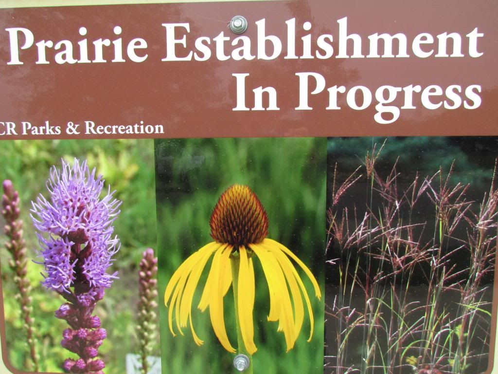
Over the past 10 years or so there are multiple groups, organizations and programs dedicated to the preserving or re establishment of land back to prairies. There is now prairie seed for sale and even governmental breaks for landowners who are interested in turning their land back to prairie. One of the main ideas for people interesting in prairies is to understand that degraded soil conditions and lack of knowledge it is very difficult to get the full plant diversities of original prairie land. Do research on plant selection and your site and visit local original prairie to get ideas of what types of plants to choose. Be prepared for the maintenance that they require which is most significant in the first 1-3 years of establishment before care drops substantially also, if your going native watch out for non native grasses and flowers that are sold for other great purposes.
 photo IMG_6477_zps7f60e2ba.jpg

Prairie Garden filled with Switch Grass and little Blue Stem Downtown Cedar Rapids September 17th

You also do not necessarily need a large area to have a prairie! I believe Prairies and Cities can co exists easily and you can even have a spot in your front or backyard become a "Micro Prairie" like the one seen above I like the idea of having just a garden or landscape planted with prairie grasses and flowers. In fact grasses have been getting extremely popular over the years and are now on the top of many gardens list being put along side many other garden perennials and they accent them quite well, and what even better many of the ornamental grasses available are prairie grasses!
 photo IMG_6475_zps5e3d2c05.jpg


Prairie Dropseed, Switch Grass, Big Bluestem and Little Bluestem Grass Planting City of 5 seasons sculpture Downtown Cedar Rapids September 17th

Some of the most common native grasses found in prairies are: Big Blue Stem, Little Blue Stem, Indaingrass, Switchgrass and prairie dropseed. With just a fraction of the forbs found in above photos. Please consider planting a prairie or

There are many articles on Prairies, here are several I found on the subject while doing the research to do this article. Some of the information is post on my own input and experiences. 

Camp silos.org-Quick Facts About Prairies

Iowa Extension-Iowa reserch information on Prairies

University of Texas-Prairie Restoration

Iowa Prairie Network

Saturday, September 14, 2013

Much needed drought relief will be seen across the area as showers and thunderstorms move in tonight. Breif break Monday and Tuesday before turning quite active again for the middle of the week.

 photo 303_zpsc4b597ac.png
Regional Weather View

For the first time in over a month, a weather system in the form of a low pressure will move East across the Region from Northwest Iowa to Wisconsin, this will spread widespread beneficial rains across most of the region, but especially across Minnesota, Wisconsin, Iowa, Missouri and Illinois. This will bring drought relief to the region.

Locally, a stationary front is draped across Northern Iowa and widespread steady rain along with the possibility of thunderstorms will develop in the vicinity of this front as it moves southeast through the area. The rain will be starting tonight and will last through much of the day Sunday. Rainfall totals will range from 0.50" to 1.00" with locally higher amounts, which will bring much needed drought relief in ways that we really need. The rain and clouds will hold temperatures into the 60s for the first time this season. Sunday will be a cool and wet day as a co Monday on the backside of the front will feature sunshine as well as most of Tuesday, temperatures will warm to the lower 70s with lows ranging. Tuesday night the cold front pushes back north as a warm front and thunderstorm chances will begin to increase once again especially Tuesday night through Thursday. Beneficial rains of another 0.50" to 1.00" look likely and the has the chance to see heavy rainfall and possibly strong storms any one of those 3 days. Temperatures will be in the upper 70s in between storms with a touch of humidity. and lows will be in the middle 60s. The rainfall will clear out Friday through next weekend with pleasant temperatures humidity and sunshine moving back into the picture.

Sunday, Scattered Showers and possibly a thunderstorm. Cool and wet with highs in the middle 60s. Sunday night, Scattered Showers, otherwise cloudy with lows in the upper 40s to lower 50s.

Monday, Clearing skies, sunny and pleasant. Highs in the upper 60s to lower 70s. Monday Night, Clear skies, lows in the lower 50s

Tuesday, Sunny skies with increasing afternoon clouds. Highs in the lower to middle 70s. Tuesday Night, Showers and Thunderstorms developing, lows in the lower 60s.

Wednesday, Partly Cloudy with developing showers and thunderstorms redeveloping. Humid with highs in the upper 70s to lower 80s. Wednesday Night, Showers and thunderstorms around otherwise partly cloudy skies with lows in the middle 60s.

Thursday, Partly Cloudy skies and slightly humid with showers and thunderstorms redeveloping. Thursday night, Leftover showers and thunderstorms, otherwise cloudy skies with lows in the upper 50s.

Friday, Sunny skies and pleasant humidity, highs in the middle 70s. Friday Night, Clear skies, lows in the upper 40s.

Weekend: Sunny skies with highs in the upper 60s and lows in the upper 40s to lower 50s. 

Month Ahead:

Dry conditions and mild temperatures will last through Tuesday the 24th of next week. However our next significant weather system along with a cold front will spread a good chance of showers and thunderstorms coming in Wednesday the 25th. Quiet weather will follow this weather system which appears to last through the rest of this month. At this point I do not see any major warm ups or cool downs through the end of the month.

Wednesday, September 11, 2013

Another heat wave brings September triple digit heat. Record highs broken and drought continuing to worsen.

 photo IMG_6463_zpsc5b2a2fc.jpg
Brown grass Downtown Cedar Rapids September 10th 2013

Another late season September heat wave has brought triple digit heat once again to the corn state, with the highest local temperature of 102.F at Vinton. A developing area of high pressure commonly called a heat bubble developed over the southwestern states on the heels of our 1st heat wave late last month. The heat bubble centered its self over Iowa and brought triple digit highs along with dry strong southwest winds. The most extreme heat in which highs were near or at 100 lasted 2 days. Vinton had highs in the 100s Monday and Tuesday and a record high temperature of 99 was set at Cedar Rapids Eastern Iowa Airport. Dry soil and vegetation  aided in the heat as dry soil heats up more regular then moist soil, and green grasses and crops would normally have a cooling effect, however much of the grass and crops around Eastern Iowa have died back or are brown. Most of the area has received 0.25" of less of rain for the month. Here in Hiawatha only 0.02" have fallen for September after a dry and hot end to August.

 photo curtemps_600x405_zpsdeab5b17.jpg
Here is a look of how the temperatures looked across the country during the heat wave. Map from Weather.com Notice again like last time the warmed temperatures in the Midwest are found over Iowa and not the typical states of Oklahoma and Texas

Heat waves Highest temperatures Monday-Tuesday September 9-10th

Vinton 102.F
Downtown Cedar Rapids 102.F
Marion 102.F
Hiawatha-(My Station) 101.F
Iowa City 101.F
Mount Vernon 100.F
Eastern Iowa Airport 99.F
Waterloo 99.F
Monticello 99.F
Central City 99.F
Belle Plain 98.F


Thursday, September 5, 2013

Heat and dry weather is back on track/continuing- Low to mid 90s next 5 days. Next descent chance of rain Tuesday-Wednesday next week with a cold front that will cool us down late week.

 photo 303_zpsb44c12d1.png
Regional Weather map

Across the region a hot and humid airmass is back in place. A stationary front meandering northward and southward around the Minnesota/Iowa boarder will produce a broken up amount of days in the 90s north of that front, however south of the front will have a continues 4-5 day streak of 90s. This will include Eastern Iowa. There will be a chance of hitting 100 mainly for large metropolitan areas. Our areas hottest day which will be Saturday will probably see highs in the middle 90s. Heat index values will approach 100 a few of those days. Lows will range from the upper 60s to lower 70s. Each day will be sunny through Tuesday of next week, with Eastern Iowas only chance of rain-meaning a stray shower or storm though that time bring Saturday Night and it wont be a night to count on very many people seeing rain. Tuesday however after seeing around low to mid 90 degree day will bring our areas 1st chance of rain in some time. A cold front moving in from the north should produce thunderstorms along it as it moves through the area.  Right now the timing looks good for us, Tuesday night into Wednesday for seeing storms. I do believe there would be a chance of severe weather with the storms. The cold front will bring much cooler pleasant weather with temperatures in the upper 70s and much lower humidity for Thursday

Eastern Iowa Forecast

Friday Sunny, hot and humid. Light winds with highs in the lower 90s. Friday Night, Clear, Humid, lows in the middle 60s.

Saturday, Sunny, Very Hot! and humid. Highs in the middle to upper 90s. Heat index values approaching 100. Saturday Night, Partly Cloudy Humid. A small chance of a stray shower or storm. Lows in the mid 60s

Sunday, Warm and humid. Highs in the middle to upper 80s. Sunday Night, Partly Cloudy, lows in the middle 60s.

Monday, Sunny, Very Hot! and humid. Highs in the lower to middle 90s. Heat index values near 100 Monday Night, Clear skies, Warm with lows in the low to mid 70s.

Tuesday,  Sunny, Very Hot! and humid. Highs in the lower to middle 90s. Heat index values near 100. Tuesday night, Developing showers and thunderstorms, Increasing clouds with lows in the middle 60s.

Wednesday, Cooler, Showers and thunderstorms in the morning. Then partly cloudy. Highs in the lower 80s. Wednesday Night, Cooler, Partly Cloudy, lows in the lower 60s.

Thursday, Sunny and nice! Highs in the upper 70s. Thursday Night, Partly Cloudy Skies, lows in the lower 60s.

Looking Ahead

Next weekend will be cooler with skies ranging from mostly sunny to partly cloudy. Clouds will increase late Sunday. Temperatures will be in the 70s with lows in the 50s and 60s. Monday September 16th will bring another chance of rain to Eastern Iowa in the form of showers and thunderstorms. Tuesday and Wednesday, a warm up, it will be sunny with warm to hot temperatures back up into the 90s. Then the models show a chance of a strong storm system Friday September 20th through Saturday the 21st bringing widespread showers and thunderstorms and abundant rains. This storm at this point through is very far out so it is hard to consider it fact or just another glimpse of hope for rain for Iowa.