Map Image Legend Image

Iowa Weather Network Warnings Map

Iowa Weather Network Warnings Map

Winter Weather Advisory

Friday, April 29, 2011

April 29th Spring Growth Update.

1st Daffodil & Hyacinth of the season in my Main Garden blooming April 25th

There has not been too much to report in the spring green-up process because cool temperatures have really slowed things down significant, but our first warm day in the last few really spiked everything. I had my first daffodil of the season open in my main garden, away from the protection of the warm side of the house. Surprisingly it wasn't from ones I thought would be first. The daffodil above was planted from my last fridge project ever a 2010 fridge project daffodil before it was no longer required to have them fridge to survive in my gardens. Also interesting the Hyacinths from last year are returning this year, which is interesting because they are not well known to come back in Wisconsin garden zone 4, but it is certainly welcomed! I also had several pink Hyacinths starting to bloom as well!

This first daffodils is quite a bit later then the 1st one last year, as much as 1 weeks later. Last year I had 1st blooms in my main garden on April 10th.


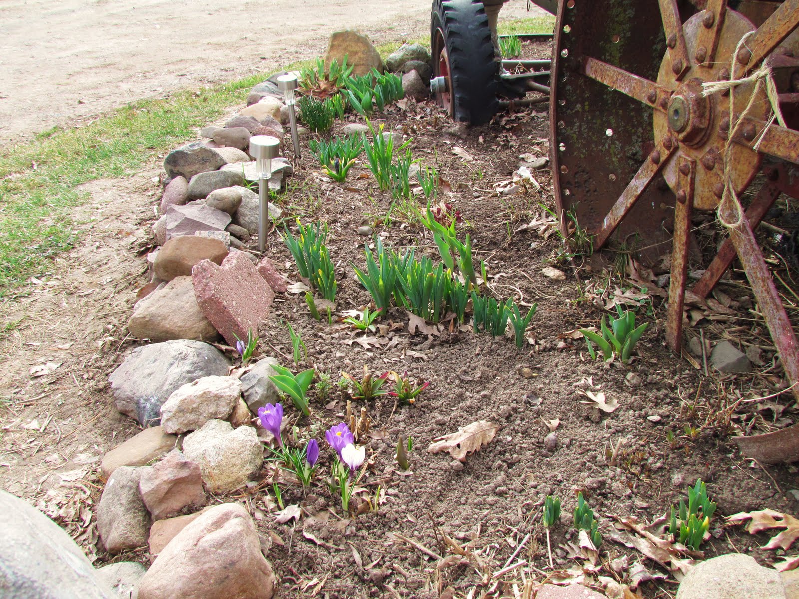
Full main garden spring view.

This is a full view of the spring bulb garden, here Tulips, Daffodils, Chives and Iris can be seen. Most of the green in the far right end of the garden is the former original 2009 surviving fridge project, They look to soon provide a very pretty show for the 3rd year in a row! The tulips which were planted the same year also will put on a good show.


Royal Star Magnolia

New to my yard, This Royal Star Magnolia is started to bud! I've heard these trees are very beautiful in person, having huge white flowers that are fragrant. I planted this one late last October, which I thought was a bit late, but the tree does not seem to be phased! I will post pictures when some of the flowers fully open.


Full bloom south side daffodils April 29th

Happy to report the daffodils along the southern wall are in full bloom now, They have been fairing pretty well in the snow and cold temps we've had, they continue to bloom away, but some stabling warm weather would do both people and plants some good! I will post more pictures and Spring progresses.

Thursday, April 28, 2011

Finally a nice day ahead! Sunshine and much warmer temps Friday, Then cooler with a chance of showers and storms Saturday before clearing Sunday.

Regional weather view.

Finally more descent looking weather for the Upper Midwest will arrive on Friday. temperatures will be much warmer in the 60s to 70, region wide, as warm air surges ahead of the next system which will bring showers and thunderstorms marching across the entire region on Saturday with it's cold front. The thunderstorms should not be severe, It will be cooler and breezy as a result of the cold front, Things will dry out again for Friday.

Local View.

Locally we will finally get a long awaited descent day. Friday will bring us much sunnier and significantly warmer conditions. Under mostly sunny skies ans breezy conditions, highs will be about 20 degrees warmer they were Thursday, with highs that I'm expected to be in the mid to upper 60s. Winds could gust over 30MPH at times from the south. Lows Friday night will be in the mid 40s. Friday night a cold front will start to approach and showers and thunderstorms will form in the very early morning hours Saturday, but should reach here by around dawn, They will not be severe, but they could bring heavy downpours. The showers with thunder could last to around noon before it mainly becomes light rain or drizzle, skies may actually even lighten up some in the afternoon, Highs should still manage lower to middle 50s for highs, mid 30s for lows. Sunday will bring clearing skies, we may actually see a fair amount of sunshine, highs will be in the low to possible mid 50s, especially if we get more sun.

Friday, Windy and much warmer, Mostly sunny skies with highs in the mid to upper 60s. Winds could gust over 30MPH Friday Night, Partly cloudy, showers and thunderstorms develop late, lows in the middle to upper 40s.

Saturday, Windy, Showers and thunderstorms in the morning before ending, then partly sunny skies, with possible drizzle the rest of the day. Highs in the low to mid 50s. Winds gusting to near 25MPH Saturday Night, Partly cloudy lows in the low to mid 30s.

Sunday, Partly cloudy skies and breezy, highs in the low to mid 50s. Sunday Night, Clear skies, lows in the low to mid 30s.

Looking Ahead

The looking ahead forecast continues to show me up lifting news, it continues to trend warmer in each run i see, even trending warmer with the cool airmass coming for Monday May 2nd. It still looks cool, but there is a chance we may not see below freezing temperatures like earlier thought. There is still slight chance of seeing some snow again though on May 2nd, but it looks very light. By Tuesday May 3rd it dries out and becomes much warmer once again. It stays dry and warm through Wednesday the 4th, before a cool front brings a chance of showers and thunderstorms along with cooler temperatures arriving just in time for Friday. Then a significant warm up, possibly a pattern changing warm up insures us much warmer temps on Saturday May 7th, showers follow ahead of the warm airmass. It dries out Sunday through Wednesday 8-11, and even shows signs and becoming very warm. A system brings a chance of thunderstorms on the Thursday the 12th before it drys out and remains mild as we approach the 14th. Because the models are showing a potentially trend to a warmer but wet pattern, we will have to watch closely as we are in our severe weather season.

Wednesday, April 27, 2011

April 26th-27th System & Cold temp report.

A strong low pressure system brought heavy rain, strong winds, snow and cold temperatures to the area over the past couple days. as it slowly marches from Iowa to Central Wisconsin. It started off very windy and very wet on Tuesday, the area had off and on light to moderate steady rain all day long, Most areas revived over half inch of rain from this system, but some places like River Falls got as much as nearly 1.50"! Winds during this time were gusting over 40MPH at times at my location, I tied my 2nd strongest wind gust with this system wit ha gust peaking at 43MPH from the Northeast. This is the 3rd time this month, all from strong low pressure systems that I've had winds near this strength from this direction.

Brief moderate snow/sleet shower during the evening hours on April 27th

Behind the low pressure system after it stalled out near Green Bay,WI rain changed to snow during the overnight hours as cold air got sucked down into the area from Northern Minnesota and north into Canada, accumulations were minor to none. My area did not even accumulate enough to count as a trace, but some areas briefly had an inch to and inch an a half in the northern areas before it quickly melted.


High temps reported on Wednesday.

Wednesday, brief popcorn snow showers formed as the low pressure system continues to pivot precip around. The cloudiness along with the snow showers held temperatures into levels more common for March then late April, some places did not even had highs in the 40s today, Which is 20 degrees below the normal high of around 60.F if what we should be experiencing this time of year. I've only recorded highs in the 30s this late in April 1 other time in the 4 years I've been recording and that was in 2008. Last year 2010 there was no 30 degrees highs in April.

The good news is the worst of this cold snap is behind us, we can expect temps at least 10 degrees warmer tomorrow then they were today, and there should be more sun as well.

Monday, April 25, 2011

Turning cold wet and windy once again, snow on Wednesday with accumulations possible. Dries out Thursday, but stays cloudy.

Regional weather view.

Winterish cold weather continues to well overstay it's welcome in the Upper Midwest after two days of pleasant conditions. Wednesday will be cold wet and windy as a fairly strong storm system moves from Iowa into Wisconsin, As cold air gets sucked into the system it will mix with snow and could turn things white again in Northeastern Minnesota and Northern Wisconsin. Temperatures will be cool.

Local view.

Locally the weather will be downright awful the next 3 days. The only 3 words that describe it are cold, windy and wet. Tuesday will be raining or drizzling all day, some of this could be heavy and may have thunder in it during the afternoon. To make things worse, not only will it be cold, but it will be windy as well, as winds could gust to 40MPH at times. Highs Tuesday will struggle to reach the mid 40s for highs. Tuesday night, rain will mix with snow especially north, and accumulations of a trace to 1 inch of snow will be possible as lows cool to the mid 30s. Wednesday will be our coldest day, some people could be waking up to white grounds again this spring but it will melt fast and be gone by evening, highs will be around 40, and it will be breezy, some drizzle or rain will be possible. Cloudy conditions should save us from a freeze Wednesday night as lows fall to the mid 30s. Thursday there will be a bit of improvement, it should be dry and highs should warm to the upper 40s. It will be less breezy as well. Lows should be in the upper 30s Thursday Night.

Tuesday, Cold and Windy. steady Rain or drizzle through the day, some rain could be heavy and it could have thunder in the afternoon. Highs in the mid 40s. Winds could gust to near 40MPH at times. Tuesday Night,Windy, Rain mixing with wet snow at times. Lows in the low to mid 30s

Wednesday, Cold and breezy, Snow possible in the morning. Total accumulations a trace to 1 inch. Highs in the lower 40s. Wednesday Night, Cloudy, lows in the mid 30s.

Thursday, Cool Cloudy but dry with highs in the upper 40s. Thursday Night, Mostly cloudy, lows in the upper 30s.

Looking Ahead

The long range forecast is not a pretty site. Finding a descent stretch of warm weather is just not possible in this long range forecast at least through the starting of May. Although Friday should be warm following our cool snap for a short time, highs could be near 70. It will quickly cool off significantly by Saturday, as a strong cold front pushed through. Behind on on Sunday will be cold and windy, The weather pattern remains cold, to very cold through both Monday and Tuesday May 1st-2nd Highs may barely reach 40 and
it is possible we could have a hard freeze. After this the models are hinting at it warming up on Wednesday and Thursday may 5th-6th but it turns wet again weather rain and thunderstorms appear possible. After this warm up the model may finally want to stabilized our weather pattern in a warm and wet one, we may get a nice dry streak with fair May temps from May 8th to
May 12th, before it starts to turn more stormy as we head for the 13th of May.

Thursday, April 21, 2011

Wet with actual rain Friday, Cloudy Saturday and finally a nice day ahead for Easter with sun and 60s

Regional weather view.

The region will still be wet, with barely any break from an already fairly wet April. Rain is possible for the entire region, temperatures as a result of the rain will be a bit on the cool side. Ranging from the mid 40s across the north, upper 40s in central and southern Minnesota/Wisconsin and upper 50s to near 60 in Iowa, where Thunderstorms are possible. Sunday will be much drier and brighter across the region, with 50s and 60s region wide.


Local View

Locally we will finally get wet with the type of precipitation we should be getting wet with this time of year! Rain will be likely and it will be wet as off and on rain will be possible through Friday with a thunderstorm possible in the afternoon, from a system and front skirting to the south.. Temperatures will be in the upper 40s with the rain and lows in the upper 30s. Saturday we will still have cloudy skies, but it should be dry accept for a few sprinkles in the morning. Highs will be a bit warmer in the lower 50s with lows in the mid 30s, I do think that there will be breaks in the cloud cover from time to time. Sunday will bring the area our first bout of mild weather in quite some time, It will be the day to get outside for sure as sunshine and warm temperature is what we should see. Highs with the sun should be in the low 60s, and lows in the low 40s.

Friday, Cloudy and wet with off and on rain showers likely through out the day Maybe some thunder in the afternoon. Highs in the upper 40s. Friday Night, Cloudy with rain showers possible, lows in the upper 30s.

Saturday, A sprinkle possible in the morning, then partly sunny skies. Highs in the low 50s. Saturday Night, Mostly cloudy with lows in the mid to upper 30s.

Easter Sunday, Mostly sunny and nice! Highs in the low 60s. Sunday Night, Partly cloudy with lows in the low 40s.

Looking Ahead

Monday and Tuesday starting next week look much warmer, but wet. Showers and thunderstorms with heavy rain could be possible for Tuesday with a cold front and system. Wednesday looks slightly cooler but drier. Then Thursday and Friday the 28th and 29th looks dry with fair spring temperatures. More rain moves back in for Saturday with a weak system and strong cold front. Sunday the 1st of May looks cool but sunny, with Monday and Tuesday the 2/3rd quickly warming back up before yet another system spreads rain and storm chances our way for Wednesday the 4th, that system looks to have the potential for severe weather. Towards the end of the model run on May 7th it turns warm and it continues to be stormy.


Wednesday, April 20, 2011

Another day another snowfall- April 20th snowfall report.

April 20th Snow

Western Wisconsin was plagued by yet another snowfall event on Wednesday, making it continue to feel more like winter then spring. Snow reports have been pretty bleak and few with this system, but Generally 1-2 inches was reported throughout the entire area from north to south. Some areas did not get as much as they could have! (sigh of relief)
Snow accumulation of springs first lilac sprouts of the season.

2 inches of snow fell at my location, It started on Tuesday evening and lasted into Wednesday afternoon. This snowfall was much wetter then the one on Sunday because temperatures were mainly above 32.F. by Sunrise the snow kinda lost it's ability to accumulate, and the snow on the ground was already showing signs of melting by 12PM. The good news is this snowfall was much less damaging to spring bulbs because of the warmer temperatures.

This system brought my total monthly April snowfall total too 5.75" which is 4.25" above the normal amount of 1" for my area, which is typically seen in the first week or two of the month. This also marks the 6th month in a row that I've had above normal snowfall, meaning every month this winter had normal, or above normal snowfall! My seasonal average is now 88.0" which is 42 inches above normal, with the average winter snowfall being 46.0" Many are saying we had one heck of a long, cold and snowy winter, and we are more then ready for some warmer temperatures so spring can continue!


Monday, April 18, 2011

Snow chances still there but decreasing for highest ammounts and strong winds. Sunshine and warmer temps arrive by Thursday.

Regional weather view.

This looks more like a map you would find in Winter rather then in the last two weeks of April. A late significant winter storm will march across the Upper Midwest bringing heavy snows to parts of Southeastern Minnesota Central Wisconsin and Northern Iowa. Minor accumulations will be seen the rest of Wisconsin and the southern 1/2 of Minnesota, while the southern corridor of the minor accumulations will be much smaller. Rain will me the dormant precip type in Iowa.


Local View

Note: This forecast replaces my forecast for Tuesday. The looking ahead forecast remains the same so I will leave the old one valid.

Locally we can expect a late season winter system to impact the area early this week. The good news is it will not impact us quite as hard as originally thought there will be less amounts and less wind, but there will still be accumulations in the local area. Precip will start off as rain Tuesday late afternoon before changing to Snow in the evening. Snow will continue overnight and may be moderate at times especially in the far south. Temperatures will be right near 32.F the entire time of the snow so it will be very wet. Snow will continue into Wednesday but should be done by 1PM Wednesday leaving behind a cool and cloudy rest of the day. Temperatures will not climb out of the 30s. Temperatures overnight Wednesday Night will really drop, well below freezing temperatures are likely possible as cold as the low 20s, which will harm spring flowers that happened to be blooming. Thursday we will finally see some descent sunshine, temperatures will be highly dependable on how much snow melts from the day before, but I have a feeling upper 40s would be possible, melting most of the snow in areas that revive less accumulations. Lows on Thursday night should be near 30s.

Accumulations

The highest accumulations will be just southeast of the area, so naturally the highest totals in our area will be the further south you go. Around Downsville as much as 5 inches are possible. That amount will drastically cut off as you head north, 2-4" are possible around New Richmond, Hudson and Colfax, and continue to cut off Amery, Barron, Rice Lake and Cumberland will see 1-2" and Siren and Spooner areas will see an inch or less. This snow will be very wet so in areas with higher accumulations breakage of tree branches will be possible. Winds will be breezy around 30MPH at times, which could cause some drifting, but snow should be wet enough not to cause problems.

Tuesday, Chilly Cloudy with rain or drizzle developing in the late afternoon. Highs in the low 40s. Tuesday Night, Rain changing to snow. It could be Moderate at times for southern areas, Lows in the low 30s.

Wednesday, Cold and breezy, Snow in the morning then cloudy. Total accumulations 2-4" up to 5" for southern areas, 1-5 for central areas and an inch or less for northern areas. Highs in the mid 30s Wednesday Night, Cold, Partly cloudy skies. Lows in the low to mid 20s.

Thursday, Warmer and less breezy, Sunny skies with highs in the upper 40s. Thursday Night, Partly Cloudy with lows in the low 30s.

Sunday, April 17, 2011

Chilly and mainly cloudy next few days. Also watching closely for potienal Wednesday sigificant snow and wind- Early release forecast.

Regional View Monday & Tuesday. Were looking for a rather chilly and cloudy forecast for what you would expect in the Upper Midwest this time of year. warmest temps that can be found will only be in the low 50s. with highs as cool as the upper 30s in snow covered Northern Minnesota, expect to be precip free.

Local View


Note: Normally I would make a 3 day forecast but Wednesdays forecast will not be included because of significant uncertainty with the next storm system.


Locally we will have a few cool days but they should be so bad that it will keep people front going outside. it will be fairly cloudy both Monday and Tuesday, but there should be some sun as well. Expect highs in the mid to upper 40s both days with lows at either side of 32.F Winds will be light Monday but they will really start increasing on Tuesday gusting to 25MPH at times.


Monday, Chilly, Partly sunny skies with highs in the upper 40s with Light winds. Monday Night, Cloudy lows in the low 30s.


Tuesday, Partly sunny, chilly and windy, winds gusting to 25MPH at times. Highs in the upper 40s. Tuesday night, Cloudy and windy rain possible late, lows in the low 30s


Looking Ahead


Wednesday early release forecast map.


Snowstorm and strong wind potential


I am discouraged to even be forecasting the chance of weather like this nearly to May, but Wednesday the models have been hinting at a potential snowstorm hitting the local area. Nothing is set in stone at this time because with being so late in the season, any shifts could mean the difference from heavy snow, and mainly heavy rain. At this time the models are pointing at mostly snow, if that pans out someone near or over us could see significant double digit snowfall totals higher then 10 inches. One thing that is certain though is the very strong winds, this storm continues to show to be a significantly windy one winds over 4o to 45MPH could be possible. Please continue to monitor watches, warnings and near term forecasts concerning this potential significant storm system, as this could changed significantly.


Longer Term.


Following this snowstorm potential looks cold and dry. Highs may barely struggle to reach freezing for a couple days afterwards. Then the models keep it cool and wet from the 22 through Sunday April 24th. Then finally the models are hinting at a much warmer and more typical pattern for this time of year arriving by the 26th of April, on Thursday the 28th a strong system brings heavy rain potential. Then it drys out and becomes warm following this storm. Towards the end of the model on May 3rd, it looks to potentially turn very warm and rainy.

Saturday, April 16, 2011

From Daffodils to Drifts!- April 16th snowfall report & April 15th strong winds

April 16th-A snowy scene not typically seen in Western Wisconsin this time of year

Some people may remember by Drifts to Daffodils post in February, well now we've done to opposite! If I posted the picture above in December, most people would likely have trouble believe it was actually taken in mid April! A strong low pressure system first brought very windy conditions to the area Friday, then brought all snow on Friday night into Saturday without any rain at all, most places seen around a half inch to and inch, but some areas were dumped on by more then 4 inches of snow, Reminding everyone of the extra long winter that we just gone through, and making everyone forget the near 80.F degree temperatures 6 days ago! I know I remember I have already begun early spring planting shrubs in one of my front gardens. Snowfall reports can be found at the bottom of this post.

Snowy Daffodils April 16th

I've got to say when I first woke up and saw how much snow we had gotten it made me wonder if the Spring we had was a dream and I had to look at the calender to remind me it was April. I measured 3.0" inches of new snow at my location while I was looking how sad My daffodils looked this morning in the image above. I found them drooping, snowcover in partly frozen. It has me wondering if they will be able to pull through this one, as I've never had this much snow when Daffodils in parts of my yard were in full bloom.

Here is a look how the main garden Daffodils and Tulips are doing, they were luckily not blooming, so the snow and cold will have a hard time harming these hardy flowers!

An all to familiar front yard scene April 16th 2011

One more look at a view that reminded me of what I've been looking at for the last 6 months! This snow even had a wintry-like feel to it because the temperature was below 32.F most of the time it was falling.

Small tree down near Lake Magnor near Clayton,WI April 15th

Another thing worth mentioned is the strong Northeast winds that arose from this system on Friday. The same very strong low pressure system that brought us the snow also brought the area very strong winds. winds were sustained over 25MPH at times, and it brought my 3rd highest wind gust ever recorded my station reported a gust of 42MPH around 3PM. The winds did cause issues and even downed some weakened trees around my area.

Large tree down 1 mile south of Clayton April 15th

This tree that fell while I was at my aunts was actually fairly large, at least a foot in diameter at the bottom. My guess was for the reason this fell is that the saturated ground weakened the root system and it fell, crushing a farmers barbed wire fence.


The highest reports was an almost gut wrenching 4.50" in River Falls there seemed to be a fairly narrow corridor of higher reports in the central and southwest parts of the area. The least snow reported overall was seen in southern Dunn county.

Thursday, April 14, 2011

Cool weekend with Late season snowfall accoumulation possible, Slightly warmer condtions return by Sunday.


Regional weather view.

Across the region will be a cool spring picture coming together, with even the chance for snowfall accumulations in Minnesota/Wisconsin, With a chilly rain expected in Iowa, It will be quite windy across the region as well.

Local view.

Locally we not have the best spring weather for the weekend instead we are looking to a cool weekend with snow chances. Friday it will be pretty windy and cloudy with winds gusting to near 40MPH to go with these winds, There could be a chilly off and on rain or drizzle late in the afternoon. Then late Friday this rain/drizzle changing will change to snow as temps round down to the low 30s, How much accumulation will all greatly depend on how fast it falls because the ground is thawed out currently. If it falls hard long enough we could see a trace to 1 inch of snow when you wake up Saturday morning. Some models even point out at the chance for 2 to maybe 3" so people should unfortunately expect to see the chance for a white ground waking time Saturday, it will be a very wet snow since temps will be near of above 32.F. New snowcover and clouds overhead will make way for a cold Saturday, highs will struggle to reach the low 40s for highs and it will be breezy as well, the good news us most of the snow we get Friday night will melt off quickly. Saturday night after this snowfall will likely be the coolest night we've had in awhile, lows in the upper 20s are likely, This could result in damage to early spring flowers that are blooming. Sunday will be the much better of the 2 days, it will be partly sunny and much warmer, temperatures should top out near 50.F for highs, with lows in the low 30s.

Friday, Windy, Cloudy and cold, winds gusting to near 40MPH at times. Light rain or drizzle developing in the afternoon, highs in the upper 40s. Friday Night, Drizzle and rain changing to snow, some could be moderate at times, lows falling to the low 30s.

Saturday, Cold and breezy, light snow coming to an end in the morning. Total snowfall accumulations around a trace to 1 inch. Saturday Night, Cold partly cloudy with lows in the upper 20s

Sunday, Warmer, partly sunny and less breezy with highs in the upper 40s. Sunday night partly cloudy with lows in the low 30s

Looking Ahead

Going into Monday we warm things up nicely, but it looks to turn fairly wet with off and on chances for light rain from Monday through Wednesday, Then Thursday finally looks like a dry, and fair day. Then Friday a system will skirt to our south bringing with it cooler and and the chance for light rain or light snow. Temperatures behind that system look to cool down again just in time for that weekend, but it looks dry. Finally after that system the weather looks to straiten out and become warm and mild in time for Monday April 25th, It stays dry through most of that week until Thursday April 28th when a strong system could give us thunderstorms and heavy rain. Slightly Cooler but weather tries to make a come back by the 30s of April, but this is so far out we can expect changes on this for sure along with most of the rest of this long range forecast.

Wednesday, April 13, 2011

Severe Weather Awareness Week- Tornado drill day Thursday

This is Severe Weather Awareness week in Wisconsin and Thursday is focused on awareness on tornados. The Wisconsin statewide tornado drill will also be held tomorrow starting with a mock tornado watch at 1PM then a mock tornado warning, during this time most cities and villages around the local area will test their tornado warning systems. People should expect there towns system to be tested during the following times

In Polk, Barron, St Croix and Dunn Counties.

Mock tornado warning at 1:40-1:45PM, most communities will sound their sirens for a test 3-5 minute long.

In Washburn and Burnett counties.

Mock tornado warning at 1:50-1:55PM, most communities will sound there sirens for a test lasing 3-5 minutes long.

For more information regarding the drill please visit here

April 13th Spring Growth Update

Lilac sprouts April 13th

We've had a beautiful week of weather here in Western Wisconsin. Everyday in the last 7 has brought us highs at least in the upper 50s to low 60s, an as I've mentioned in my post below, one day was even near 80.F! Lows everyday this week has also been well above freezing in the upper 30s to low 40s, with the warmest night time low on Saturday April 9th with a low of 45.F It was a perfect week to get to work in the yard which I have kept myself very busy cleaning up and raking.

Weeping Willow April 13th

All this warm weather has resulted in a fast-rate early part of out green up. Early trees and bushes including Weeping Willows and Lilacs that I love following each spring have broke bud this week. From far away it doesn't look like much is going on but if you look closer ( picture above) you can clearly see the young leaves pushing out of the winter weary buds!

Royal Star Magnolia

Adding this new tree to the list of early trees to follow if my new Royal Star Magnolia that I planted last fall. These flower buds have begun to break open, and if everything goes right, I should be getting large beautiful white start shaped flowers in a couple weeks!

Van Sion Daffodils on the south side of the house April 13th

These daffodils which are now in full bloom have done so great since I transplanted 2 years ago them from my moms old house in lower Michigan. These are the original curse breaking daffodils I posted about last year in 2010, Last year this patch produced 2 flowers, this year they nearly tripled that!

Main Garden spring bulbs

The bulbs in my main garden have really grown very fast the past week. The Tulips in this garden already have buds showing, and it seems like just last week they were barely sprouting 1st leaf. One interesting thing about the Tulips in this garden is I was not expecting such a good turn out for sprouts, It appears like many of them will bloom for the 3rd year in a row!

Lonely single Crocus blooming in long time faded garden April 13th

I did get this very interesting surprise above today, I was walking around the yard and in the middle of a large patch of long grass I saw this single Crocus beautifully blooming by it's self in the corner just outside of my yard. I wondered how it got there since I never planted crocus there. Then I remembered a very long time ago, My mom planted a garden here that had this color Crocus in it. This crocus must have been sitting there for years and finally mustered up the strength to bloom this year. I moved it to my main garden shortly after taking this pictures. In fact it can be see as the lighter colored flower in the photo above this one.

Monday, April 11, 2011

One more very nice day ahead before cooler, wetter times ahead.

Regional Weather View.

A mild and quiet weather will continue Tuesday with sunshine through out the entire region, but that will quickly end Wednesday as a cold front pushed through bringing cooler wet conditions. These showers will bring the way for a much cooler and drier day Tuesday.
Local weather view.

Note: This week is Severe Weather Awareness week in Wisconsin, each day the NWS reminds us that we are in our severe weather active season covering many events that can hit during the next few months. Tornado drill day is Thursday, with tornado siren testings at 1:40 to 1:45pm for the local area. More information can be found HERE

Locally we will get one more picture perfect day with sunshine and light winds with highs in the middle to upper 60s with lows in the mid 40s Tuesday & Tuesday night. Then a cool front will bring cooler and wetter weather for our area Wednesday, rainshowers and drizzle will develop along a cold front and will likely be on and off much of Wednesday afternoon, but the rain will not be heavy. Temperatures will be near 50.F with the clouds lows will be in the upper 30s. Tuesday will feel actually quite chilly to us over the week we just had, it will dry again with partly sunny skies and highs in the upper 40s, with lows falling to the low 30s, potentially even below freezing.

Tuesday, Mild and Nice! Sunny skies with highs in the upper 60s. Tuesday night, Partly cloudy with lows in the mid 40s.

Wednesday, Much cooler, A chance of light rain or drizzle, otherwise cloudy with highs in the low 50s. Wednesday night, A chance of drizzle, otherwise cloudy with lows in the upper 30s.

Thursday, Chilly, Partly sunny skies with highs in the upper 40s. Tuesday Night, Partly Cloudy lows falling to the low to mid 30s.

Looking Ahead

The looking ahead forecast shows the cool down continuing through the rest of the week even into the weekend, It keeps us fairly dry accept for a few showers, possibly even some light snow on Friday, then Saturday to look chilly and breezy, but drier. A warm up starts back by Sunday, The model wants to keep us dry with a lot of clouds through most of that week through Thursday the 21st. Then a big systems moves up through central part of the U.S and gives us a heavy rain chance on Friday the 22nd, behind it a brief shot of cooler temps, before the models start picking up on a nice warm up with chances for rain as we head towards the end of April. This is a stormy time of year and with severe weather season here, chances could always pop up at any time, please continue to monitor the forecasts.

Sunday, April 10, 2011

Severe Thunderstorm Report-large hail across some areas, & Warm temp report, some places reaches near 80-Spring flower pictures included!

Edge of a developing thunderstorm over my house in Clayton,WI April 10th 2011

The area had it's first severe weather outbreak of the season today as thunderstorms formed along a very sharp warm front/cold front system. Thunderstorms formed ahead of a cold front right over the local area and just southwest. One in particular developed just south of Dunn County and and produced very large hail larger then the size of golf balls was reported in a hail core just southeast Downsville and in Elk Mound. The storms moved north-north east and also produced Golf ball sized hail in extreme southeastern Barron county just northwest of New Auburn. More thunderstorms formed and impacted the Chetek where I happened to be for a small local area chase with a friend from Minnesota. A storm with radar detected rotation east of Chetek prompt a tornado warning for southeast Barron county, and sirens were sounded in Chetek, but it luckily did not produce a tornado, or damage.

Local area Severe Reports

2 miles SE Downsville 1.75" hail

Elk Mound 2 inch hail

2 miles NW Elk Mound 1 inch hail

NW of New Auburn 1.75" hail


Crocus in front lawn opening to warm sunny conditions April 10th 2011

Today was a very mild day here in Western Wisconsin, Shorts and short sleeves were common as Temperatures quickly shot up to the middle up upper 70s for the first time this year before thunderstorms broke out and the cold front went through. The warmest temperature on my station was a very mild 77.F, it came with very conditions as dewpoints were in the lower 60s. However these temps didn't last long by the evening hours it turned much colder and windy at temps were already down to the mid 40s by 11pm. My station has it's second highest wind gust ever with this front with a wind gust from the SW at 43MPH

1st South side Daffodil bloom opened on April 9th 2011

The Daffodils on the south side I've been following have progressed almost extra fast this year! They really colored in very nicely in the sun and 70s we had. I also noticed the frogs in the back pond were really getting loud today, Spring is certainly in full swing in my area I also noticed early trees just binging to break bud! This years 1st daffodil bloom on my property was a little over a week later then last year.

Highs Sunday

The above is a list of high temperatures reported on Sunday, the warmest reports were Roberts and Menomonie which both reached just shy of 80 at 79.F the coolest was Spooner with a high of 73, either way 70s were reached through out the entire area! A sharp cut off in the temps was noted just north of the area though, while we had mid to upper 70s, far northern WI had low 40s for highs where lake superior cooled air kept that area chilly!

Saturday, April 9, 2011

Increasing moderate risk of severe thunderstorms Sunday including highend risk for large hail, damaging winds and tornados

Image from SPC

The Storm Prediction Center in Norman,Oklahoma has issued a Moderate Risk! of severe thunderstorms for the entire local area. this includes the cities of Siren, Spooner, Osceola, Amery, Rice Lake, Barron, New Richmond, Hudson and Menomonie. Thunderstorms from the early morning hours should clear out and partly cloudy skies will develop by mid morning to afternoon allowing for heating to take place. During the afternoon hours thunderstorms will quickly develop in Minnesota and become severe, pushing east south east raking across the entire area. Large hail, Very heavy rain, Damaging strait line winds, and even tornado's are a possibility for tomorrow. This is one of the higher risks we've been under in quite some time and should be taken with some seriousness.

My forecast can be found here

Severe Weather Threat tomorrow!

Image from SPC

The Storm Prediction Center in Norman,OK has issued a Moderate Risk! for far southwestern parts of the local area south of Interstate 94 in southern Dunn counties, This includes the cities of Hudson and Menomonie, and a Slight Risk for all north of this area, which includes the entire 6 county area. Thunderstorms are expected to develop late Saturday in southern Minnesota area and move northeast, pushing into the local area. The highest threats will be large hail and damaging winds, with the outside chance of tornados. This is the first threat of severe weather for the local area, and people should be aware severe storms may be around Saturday evening and night.

A detailed forecast for the local area can be found below!

Area under the gun for severe thunderstorms tonight and tomorrow with very warm condtions, then much cooler for Monday with rain showers


Regional View


Attention is turned towards a significant weather system moving across the Upper Midwest that has the potential to bring a large scale severe weather outbreak across most of the region. Most of Iowa Eastern Minnesota, and most of Wisconsin will under the gun for severe thunderstorms Saturday and especially Sunday. Meanwhile temperatures will be very warm with mid 70-degree readings as far north as Minnesota and Wisconsin! Monday will be much cooler with showers behind a strong cold front.

Local View

Note: There will be no looking ahead forecast due too significant severe weather chances for my local coverage area.

Locally, The top story will be the areas first severe weather threat of spring, which will happen for our area late tonight and Sunday in two waves, which I will go into detail below this common information. A strong warm front will surge through the area boasting Temperatures ahead of it Saturday night lows will be very mild, not even falling out of the 50s! Sunday they will be at their highest levels of the season so far in the lower to middle 70s on Sunday, with upper 60s North of the warm front. After a wave of thunderstorms Saturday night, Skies Sunday will become partly cloudy in the afternoon, more storms will fire Sunday mid afternoon to evening ahead of a cold front. Monday will be much cooler and windy with light rain showers early then eventual clearing will take place, Highs will be in the lower 50s, with lows in the mid 30s

Significant Severe Weather Potential for our area

This storm system will bring with it a significant severe weather potential with it. It will come in two waves for the area, one late Saturday night-into the early morning hours Sunday likely between 2AM Sunday to 7AM, The main threat for these storms will be large hail and strong wind gusts. The more significant severe weather threat will be on Sunday in the mid afternoon hours to even hours, If skies clear from early morning storms Sunday, an outbreak of severe weather would develop over Eastern Minnesota and push east into Western Wisconsin. This would bring the threat of very large hail, damaging strait line winds and even tornado's. People in the local area should remember their severe weather precaution plans, Saturday night an Sunday could potentially be dangerous right around the local area.

Saturday, Cloudy with drizzle in the afternoon. Highs in the lower 60s. Saturday Night, Thunderstorms developing late some storms could be severe, with heavy rainfall possible. Lows in the mid 50s

Sunday, Warm! Partly Cloudy with highs in the low 70s. Thunderstorms developing in the afternoon, some storms could be severe, With heavy rainfall likely. Sunday night, Turning windy and cooler with a chance of showers. Lows in the low 40s.

Monday, Much cooler and windy, Showers in the morning otherwise cloudy, winds could gust to near 35MPH. Monday Night, Partly Cloudy with lows in the upper 30s.

Thursday, April 7, 2011

First 60s of the season across the area today!

Fields East of the house April 7th 2011

It was a very warm pleasant day across the area today, I knew when I woke up to clear sun lit skies and temperatures in the mid 40s already at 9AM it was going to be a beatiful day much warmer then I originally thought. Highs topped 60s for the 1st time this season at all reporting station accept for 1, some places even had mid 60 degree readings! A warm front ahead of a low pressure system brought us the much welcome warmth! Even though I officially went snowless on April 6th the tiny snow patches that are left in deep shaded areas really took a hit in the 60 degree weather and sun.

Highs Thursday

The warmest temperatures reported was 64 at My station, Osceola and Grantsburg. The coolest was Spooer with a high of 57.F!


Tuesday, April 5, 2011

A few showers Wednesday, then sunny and mild on Thursday before turning wet with showers and thunderstorms possible Friday.


Regional weather view.


A wet spring pattern is setting up for the Upper Midwest this week. light rain showers will push through Minnesota and Wisconsin on Wednesday, leaving Iowa dry. Thursday will be a dry and mild day across the entire region, upper 50 degree temperatures will be possible as far north as Minnesota and Wisconsin with 60s and 70s in Iowa. Thursday night Friday will be a bit more active around the region as a frontal system brings a chance of rain and storms to Minnesota, Wisconsin and Iowa.


Local view


Locally we will have partly sunny skies Wednesday with a chance for a few light rain showers on and off through the day. This rain will not amount to much and will not cause issues, temperatures should mild in the middle 50s, especially if we get more sunshine, lows will not even fall below freezing at most places! expect mid 30 degree lows. Thursday will be very nice! I expect mostly sunny skies with high temperatures making it to their highest levels of the season so far into the upper 50s! In the afternoon, there will be increasing clouds will developing showers late in the evening and overnight with the chance of a thunderstorm, lows will be in the upper 30s. Friday will have showers and thunderstorms in the morning hours, some of this rain could be moderate and times, and we could end out with a quarter to a half inch of rain. Temperatures on Friday will be in the low 50s, with lows in the upper 30s With temperatures this mild expect most areas to have no snow on the ground by Friday.


Wednesday, Partly sunny with the chance for a few light rain showers, highs in the mid 50s. Wednesday Night


Thursday, Nice! mostly sunny skies with highs in the upper 50s increasing clouds in the afternoon. Thursday night, showers and possible thunderstorms developing lows in the upper 30s


Friday, Showers and thunderstorms possible in the morning otherwise mostly cloudy to partly sunny, highs in the low 50s Friday night, partly cloud with lows in the upper 30s.


Looking ahead


Immediate attention is focused on the upcoming weekend for the potential of a stronger storm system moving in. It has the potential to bring heavy rain, but ahead of it this storm system will come in quite mild in fact this storm will bring in a significant warm up it has the potential to bring our first 60+ degree highs on Sunday 70s may even be not out of question! but this day will be one to watch because with this warm air around there may be a potential of strong, maybe severe thunderstorms close if not in our local area. It cools off behind this system on Monday but it does not get cold. On Tuesday April 12th a smaller system may bring a few light showers with a cold front, It does cool off briefly behind this system for the 14th before warmer and surges in ahead another strong system that could come in on the 17th, storms and heavy rain would be likely. Towards the very end of the model, they are hinting at maybe a cool down behind that system.

Spring is here! - Spring growth update & snowcover update.


Purple & White Crocus on the southern foundation April 5th 2011

Spring has most certainly sprung here in Western Wisconsin! I've noticed multiple signs of Spring this week including the first croaking frogs in the pond, and first butterflies of the season! Temperatures today across the region were typical for this time of year in the upper 40s to low 50s. Some places did have there warmest reading of the season so far including at my location with a high of 53.F!
Main garden Daffodil sprouts April 5th ( Original 2009 Daffodil Project )

The spring in my main garden also sprouted this week, These are the same daffodils that were one of my original fridge project daffodils on 2009 returning for their 2nd spring. These were quite a bit later then last year by as much as 3 weeks later, last year they sprouted on March 7th. The Crocus bulbs I separated in the front yard are also sprouting and developing many flower buds, which is very surprising because I just had separated the bulbs last year. Their show may be impressive this year so I may have to post pictures.

Southern foundation spring bulbs have really progressed this week, the crocus are in full bloom and the daffodil flower buds are becoming plump and are tilting towards the warm sunshine, It shouldn't be long before they burst into bloom!

Nearly snowless fields April 5th

Snowcover across my area is nearly completely gone, I consider this less then an inch of snow on the ground, and I'm just about ready to go to the 0 inch mark, which could not have come sooner! We've had snow on the ground since November, which is nearly 6 months! With the warm temperatures ahead for this week It is sure they the entire area should have a snowless ground by the end of the week!

Front yard April 5th

The only snow that can be found in my yard now are in the severe drifted spots of the 2010 Dec Blizzard, and piles that were made from plowing over the winter, I sure missed the yard!