
Iowa Weather Network Warnings Map

Winter Weather Advisory
Monday, June 30, 2014
June 30th severe weather outbreak- central Iowa report. Wind damage Des Moines Metro with sigificant damage in Madison, Warren, Story and Marshall Counties. Confirmed tornado NE of Winterset
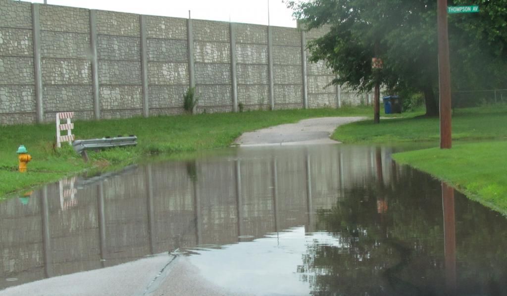
Flash flooding on Des Moines streets June 30th 2014
This is the severe weather report for June 30th, showing how central Iowa was impacted. The severe weather that occurred locally today was a part of a much bigger line that started in Nebraska around 8am this morning. Severe storms have been on going in Northern central Iowa all night long, and there were two areas of major storms. One went near Story City to Marshalltown and the other went from Western Iowa near I-80 into our area. The main line of storms that effected our area tracked all the way across west Iowa arriving in the local area between 10am and 1:30pm. When the storms entered the area there were two cells with in the line which produced significant damage. One which tracked from Story City to north of Marshalltown, and another which went from near Stuart through Northern Madison and Warren counties. On the southern cell, Impressive rotation was being detected and a reported tornado near Stuart. This rotating cell was on the very southern edge of a line that at that time stretched from Warren county on the south side of the line northward to the Story City area. These storms continued east all the way through the state producing widespread wind hail damage on its way through the central and eastern part of the state.
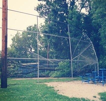
Tree damage at Martinsdale
In the southern cell The rotation and enhanced winds past through Northern Madison county and produced a tornado 5 miles Northeast of Winterset before entering Warren county. This storm turned southeast just before entering metro Des Moines. Significant to major damage was done Northeast of Winterset when a tornado crosse Cumming road There was also significant damage in Martensdale including several barns, buildings and even homes partially or totally damaged. In this area damage is significant with many roads closed and blocked off. A NWS survey team was sent to this area today to survey the damage and it was determined that it was enhanced strait line winds. This storm continued east with the core of the worst of the storm moving to Indianola and Sandyville where windows were broken from large hail in Sandyville. 2.75" hail was reported in Beech. These storms went on to produce damage through Southeastern Iowa. The other strong cell produced significant tree damage in Story City which continued north of Marshalltown. In this area numerous trees were reported down along with 70 to 80MPH measured wind gusts. This cell went on to produce major damage in Traer and significant damage in Cedar Rapids.
video as the line of storms went through Des Moines
This line also impacted all of Des Moines Metro area with high winds, smaller hail to a lesser extent, hail and torrential rain. I stayed at home for this event where this video was taken. The worst of the video is about 36 seconds in. The storms moved in a little after 12pm and it came with no defined cloud line at all. It was more of a meso cyclone for Des Moines as the high winds were embedded with in the rain. I would estimate that we had gusts to 55MPH in my neighborhood. Des Moines international reported 51MPH gusts and Ankeny reported 43MPH gusts. Towards the back side of the cell I did have some small pea to dime sized hail that fell. South suburbs reported 1.00" hail. Damage in the metro was mostly in the form of large tree limbs and Flooding with the worst of the damage to the south of the metro. Many streets had standing water and were flooding, especially in the Northern suburbs. Grimes and Ankeny both had reports of flash flooding. I had over 1" of rain in a short time and I did come across some street flooding in my neighborhood. 1.23" of rain fell at my location.
Confirmed tornado 5 miles NW of Winterset rated EF1
Adel 1.00" hail
Urbandale medium sized tree limbs down
1 mile W Cumming 70MPH wind gust.
Norwalk 1.00" hail
Martensdale, Structural damage, Barn destroyed, powerlines down, major trees damage ( NWS to be sent out )
Indianola 60MPH wind gust
Beech 2.75" hail
Sandyville 60MPH wind gust, windows broken out of north side of homes from hail damage
Ankeny, Flash flooding water over curbs
Grimes, Flash flooding, 6" of water in areas where it is not normal. Beaver creek overflowing
Des Moines, Tree limbs down
2 miles W Ogden 1.50: hail
N Story City Trees snapped off at base
Zearing Numerous 40-50ft tall trees down, several major branches snapped
Northern Marshall County, Shed blown down, widespread tree damage.
Marshalltown, Water of unknown depth flowing down entire street.
West Des Moines, Large tree limbs down
Rainfall reports Des Moines Fairmount Park 1.26"
Ankeny 1.44"
Marshalltown 2.29"
Ames 2.07"
Knoxville 1.19
Pella 1.56"
Perry 2.04"
Boone 1.52"
Des Moines international Airport 1.32"
Tuesday, June 17, 2014
June 17th North Iowa storm chase & Severe weather report: Bow echo hits Des Moines Metro
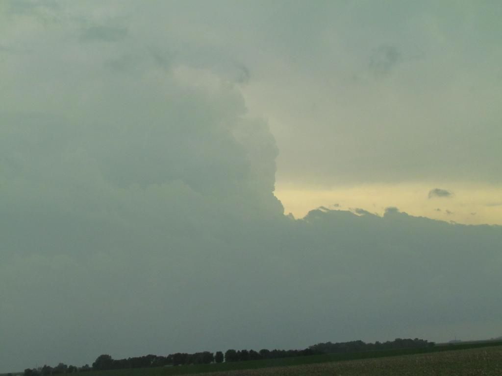
Storm structure as things starting to fire June 17th 2014
Yesterday there was a significant severe weather outbreak most of Iowa and Nebraska where the town of Pilger was heavily damaged by a strong tornado. In Iowa it started in the far northern part of the state, then progressed southward as storms broke away from the stationary front. Several tornadoes were reported and many areas have extensive tree damage from high winds. Major flooding was also an issue for some towns. I went storm chasing yesterday and met up with my friend Dave W in Clarion. I could tell it was going to be a good day because I could tell a boundary had just lifted through this area and we had very strong southeasterly winds and clearing skies to the south of Clarion. Temperatures were in the lower 80s where we were and just under 90 to the south in Des Moines. We left Clarion at around 1pm, where I left my car which made for a fun night later. We heading West down 18 to Spencer towards some storms that were just developing on radar ( as seen above ) We caught up with the more southerly storm which we watched blow up on radar near Cherokee and quickly become warned. We caught it at Greenfield when it was warning for a tornado. A funnel cloud was reported of which I did not see because we were near Webb, but we did see hail, and some very fast moving clouds and high winds as that storm and another storm from the south merged with it. At the same time storms that were ongoing in along the boarder were moving/backbuliding southward and eventually turned into a huge line with tornadic segments.
High winds June 16th north of Sioux Rapids, Iowa
As the storms formed more into a line it became a very high wind event. The image above was taking north of Sioux Rapids where we ran into strong northerly winds from storms that were passing though. We also saw hail in this area that was the size of quarters.
Storm footage from north of Sioux Rapids, IA
These are the strong winds which were taken in the same areas as the image above. Later on I did notice a hail stone in the bottom of the image appears to be a fairly good size that bounced off the ground. Down the road numerous trees were down in Sioux Rapids.
Tornado sirens sounding in Pocahontas, Iowa June 16th
As we drove south away from the on coming line we staid around the south side of the back building storms, several storms produced funnel clouds and tornadoes which we did not see. Above, sirens were sounding in the town of Pocahontas for a storm capable of producing a tornado that was north of town. This was the 1st cell. After we had left another cell did produce a tornado north of the city. We continued down highway 3 through Humbolt and then we heading towards my car back in Clarion. There was significant storm damage around Clarion, power was out to most of the city as power lines were blown down and trees were down widespread across the city. This is where a problem began for me. I had more then enough gas to make to the gas station across the street from where I was parked but there was no power to pump. I drove to another gas station 12 miles down the road, on the way we noticed an RV camper was flipped with no one inside. Got to the next gas station off 35 Near Lamiter and it was also without power, by this point my empty light came on, but I decided to give it one last shot and drive to Dows to get gas, but it like many other North Iowa towns, it was also without power, so I became stuck there for 5 hours before family, 78 miles from Des Moines came up with some gas so I could go to the next store and fill up. Next time I better fill up before storms arrive. While being stuck there I heard of many stores of major damage in many communities, including Mason City airport being without power, and high tension wires down around Dows, and driving down the freeway lots of blown downs signs could be seen and tree damage. Theses storms went on to hit Waterloo and Cedar Rapids. So in total for the trip we saw was, high winds, lots of storm damage and hail.
Reports from storms we were on
Peterson, Golf ball sized hail
Sioux Rapids, Numerous trees down 70MPH wind gust
Gilmore City,Tree limbs down
Greenville, Funnel clouds
Storm damage in Des Moines June 16th 2014
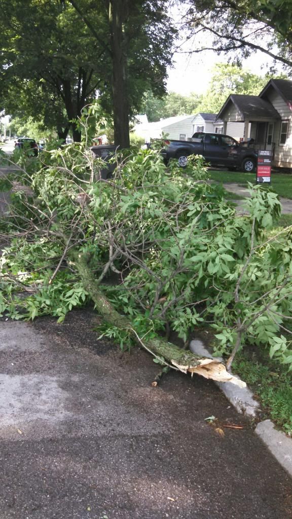
Meanwhile back in Southern Iowa, the local area also had severe thunderstorms as another segment of storms formed into a bow echo that hit the Des Moines metropolitan area. The bow echo went across the entire state of Iowa, but an enhanced area of High winds from 60 to 65MPH hit from near Boone and move southeastward through all of the Des Moines Metro. Widespread damage mainly in the form of tree branches were reported down. A 74MPH wind gust was reported at Ankeny Golf course. Tree Damage was reported in West Des Moines, Des Moines, Ankeny, Urbandale and Altoona and 14,000 were without power across Des Moines at one point. 27,000 across the state. While driving into the city late Monday Night after the storms, I did notice the Euclid Ave area was without power. In my neighborhood there were lots of large branches and 1 tree fell at the top of the block. 0.74" of rain fell with the storm. Clean up will continue widespread across the state over the next few days as many areas were impacted.
Local Reports:
Ankeny Golf Course 74MPH wind gust along with dime sized hail.
Dallas Center 10 to 12" diameter tree down along with 2 telephone poles
Altoona, 12.50" tree down
Des Moines, large tree limbs and trees down, 14,000 without power
West Des Moines, Tree limbs down
Prairie City, Trees and large tree limbs down
Urbandale 62MPH wind gust
South Des Moines, 8" tree down, several large limbs down
Pleasent Hill 8" tree limb down, power flashes reported
Monroe 58 to 65MPH wind gust, moved heavy patio furniture
Lake Red Rock area, 62MPH
Friday, June 13, 2014
A pallet of color! Incorporating annuals into your garden
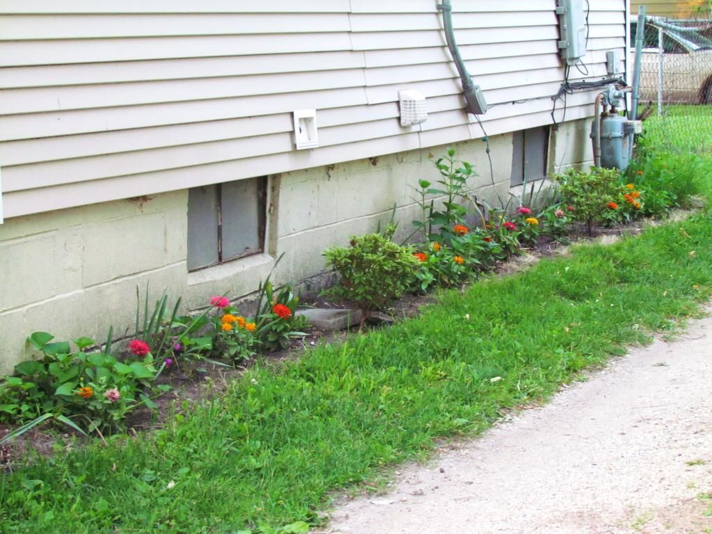
Zinna's incorporated into the Southside flower bed June 13th
Many of gardeners have seen annuals in beautiful pots and hanging baskets that grace our yards an cities streets, but what about adding them into our perennial flower beds? Today I'm going to talk about how you can use annuals in perennial flower beds as well, if fact some flower beds are nothing but annuals and are replanted year after year. When describing an annuals, it can be multiple things which includes tropical and flowering bedding plants, in the case of my beds I have both. In the photo above are Zinnas and Balsam flowers.
Wide section of annuals in my front yard bed.
There are multiple ways annuals can be added into flower beds as well. A couple reasons could be is for a fill in plant that can be planted over the top of where spring bulbs use to be. Annuals can be planted right over the top of where spring bulbs are and they will fill in those holes with flowers that will last all season. In my flower bed where I have many spring bulbs its a welcome sight to see the green and flowering annuals take over the spot where tulips and daffodils are fading. In this photo, To the left is a purple leafed elephant ear, followed by Zinnas and wax begonias
Border Marigolds June 13th 2014
Annuals can be used as a boarder plant as well and what I find I like about the addition of annuals into my flowerbeds is that they add color that fills in between the perennial cycles so there is always something blooming. Annuals with proper care will bloom from planting time to frost and will add a constant pallet of color. The marigolds above were seeded by me earlier in the spring and then added to the garden
Annuals and perennials blooming together June 13th 2014
Annuals and perennials complement each other. Above lilies can be seen blooming along side marigolds and petunias. My plan here was to allow the marigolds to take over the areas where large clusters of tulips used to be. So what kind of annuals can be used inside of a perennial bed? Anything that can be in a container will be great used in a flower beds. You can use any color and style you want, Petunia's, Marigolds, Zinnias, Wax begonias, Saliva, Impatiens, Coleus are just a few selections that would do great. When choosing annuals make sure you pick site appropriate plants. In conclusion annuals are great for multiple reasons including fill ins for spring bulbs, added color in between perennial blooms and as border plants. Take a look at multiple plantings around Des Moines and Central Iowa and you can see just how useful adding annuals into flower beds can be.
Wednesday, June 4, 2014
June 3rd storm chase South Iowa storm chase
Tail end of inflow clouds north of Lamoni, Iowa
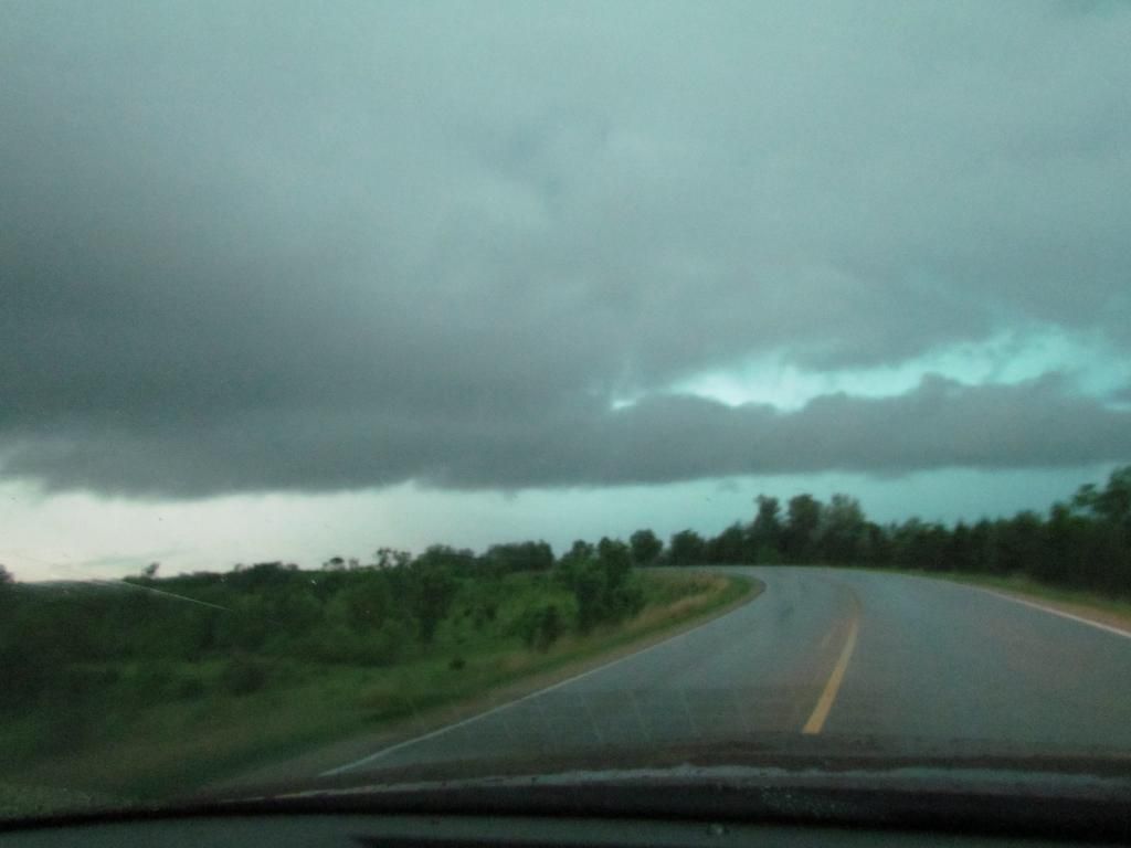
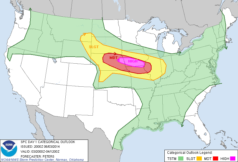
This started off as a significant potential day for a high end hail and wind event as the SPC issued a high risk for part of Iowa. My storm chase partner from Minnesota Alex W. picked me in Des Moines at 5pm by this point storms were already ongoing and had just did significant damage in the Omaha, Nebraska metro and were moving ESE south of Osceola. We caught up with the storm West of 35 near Leon where we watched it approach, Tornado warnings were issued, but features were hard to see due to rain. We continued to stay on this cell and we followed in ESE to Lamoni where it finally impacted us and we saw impressive high winds and hail larger then quarters.
Video of strong winds near Lamoni, Iowa
This is a video of some of the highs winds that were seen as the storm moved into the Lamoni area. Hail larger then quarters fell there as well.
Photo of a wall cloud South of Ellston, Iowa
After the 1st storm above finally turned into a complete bow echo and moved SE towards Missouri we deiced to go to Leon and wait and see if more storms coming in from the west were going to be worth staying down for. When a tornado warning was issued for the storm near Mt Ayer we began heading west. South of the small town of Ellston we saw this lowering and high winds as it approached. We got stuck at some dead end roads so we let the storm pass and we called the storm chase over at this point.
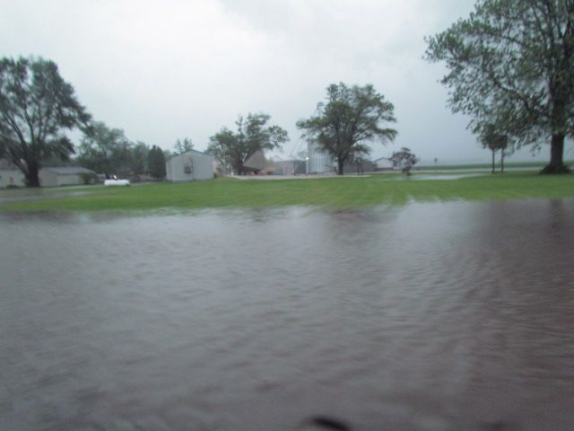
High water Davis City, Iowa
There was sigificant amounts of rain over far southern Iowa 3- 5" of rain fell over this area resulting in the flooding seen here. Severe Storms trained over the same one after another area on a warm front that was draped over Southern Iowa.
Here is a list of reports from the areas were were in
1 mile E Lamoni 1.00" hail
2 miles S Lamoni 2.50" hail
This started off as a significant potential day for a high end hail and wind event as the SPC issued a high risk for part of Iowa. My storm chase partner from Minnesota Alex W. picked me in Des Moines at 5pm by this point storms were already ongoing and had just did significant damage in the Omaha, Nebraska metro and were moving ESE south of Osceola. We caught up with the storm West of 35 near Leon where we watched it approach, Tornado warnings were issued, but features were hard to see due to rain. We continued to stay on this cell and we followed in ESE to Lamoni where it finally impacted us and we saw impressive high winds and hail larger then quarters.
Video of strong winds near Lamoni, Iowa
This is a video of some of the highs winds that were seen as the storm moved into the Lamoni area. Hail larger then quarters fell there as well.
Photo of a wall cloud South of Ellston, Iowa
After the 1st storm above finally turned into a complete bow echo and moved SE towards Missouri we deiced to go to Leon and wait and see if more storms coming in from the west were going to be worth staying down for. When a tornado warning was issued for the storm near Mt Ayer we began heading west. South of the small town of Ellston we saw this lowering and high winds as it approached. We got stuck at some dead end roads so we let the storm pass and we called the storm chase over at this point.

High water Davis City, Iowa
There was sigificant amounts of rain over far southern Iowa 3- 5" of rain fell over this area resulting in the flooding seen here. Severe Storms trained over the same one after another area on a warm front that was draped over Southern Iowa.
Here is a list of reports from the areas were were in
1 mile E Lamoni 1.00" hail
2 miles S Lamoni 2.50" hail
Sunday, June 1, 2014
Severe Weather Tuesday- HIGH risk now in place. Flooding possible
The SPC has issued a High Risk for severe weather on Tuesday which includes much of Iowa and Des Moines. This is a situation that should be taken seriously as high risks are rarely issued. The main risks for severe weather will be very high damaging winds, hail and tornadoes. Storms will develop in Nebraska and move east across Iowa likely in the form of a bow echo, which will likely arrive at night for most of the state. Along with a severe weather threat flooding will be a concern as dewpoints and rich moisture will be in place, outputs are showing 2-3" rainfall amounts are possible across a large area of Iowa over the next day. Please stay tuned to your favorite weather outlooks as this systems begins to unfold as it looks more significant at this time then it did earlier
Subscribe to:
Posts (Atom)
