Map Image Legend Image

Iowa Weather Network Warnings Map

Iowa Weather Network Warnings Map

Winter Weather Advisory

Friday, September 30, 2011

September 29th sigificant wind event-widespread 45-50MPH winds reported! Minor damage reported as well.

Image from Twin Cities NWS

A strong low pressure system produced widespread 45 to 50MPH winds which caused minor tree damage in what ended out to be a pretty significant wind event. A strong, tight low pressure over Michigan brought these very strong winds to much of the Upper Midwest. The low in this image was center near Duluth,MN, the NWS says the purple and blue colors indicated stronger low pressure and stronger winds. The strongest winds appeared to be on the southern and western side, as well as the Northeastern side of the low.
Strong winds on front yard tree September 29th 2011

For the local area, the winds started out in the morning hours, but really got very strong around 1PM in the afternoon, which is also when showers started to develop, by the 1pm hour, gusts were well over 45MPH on multiple stations across the area. One very strong gust in particular measured 56MPH from Rochester. Widespread minor damage in forms of breaking tree limbs and blown around objects occurred area wide, The good news is there was no significant damage reported. The winds were highest across Southern and western parts of the local area, in places like Rochester, Dodge Center, Austin and Preston which was more on the edge of the shower activity.

Effects from Rochester


Strong wind video from Front yard.

The NWS had wind advisories and warnings for many states across the region in preparation for this event, Much of Minnesota, all of Wisconsin and Michigan, and some of Illinois were included in these advisories or warnings, so naturally it was known there was going to be alot of wind. The winds was pretty gusty early, but it was when class was over around 1pm that the winds really picked up. During my drive home drive home winds were howling across the city, I witnessed one impressive gust of wind which sent a shower of small dead branches and leaves at the street and my car, none were of concerning size to cause damage.

2 inch Ash branch along 4th Downtown Rochester

The city will have alot of branches to clean up this weekend, especially from ash tree species, which really took beating in these winds, I seen multiple branches from ash down across the city, Trees that were especially hard hit were right along 4th street in Downtown, one block between stoplights had 5 branches of the size above laying in the boulevard. Not only was there ,many branches but there were lots of of leaves piled 3 feet deep in some of the alleys between high rise buildings!

Tree branch laying on boulevard along 4th street SW


Large 4 inch diameter ash branch snapped

This was the largest of the branches I found in Downtown, it was large enough that it made an indentation in the grass where it fell. My thinking on why the Downtown trees were some of the hardest hit is because the wind blowing between the high rise buildings, acted like wind tunnels that were aimed right at these trees.
Very large 10 inch diameter tree top snapped St Marys Park-West Downtown

This was the largest branch I found that broke off the top of a tree in St Marys Park in West Downtown. This damage occurred again from the Ash tree species. There was a large hole in the ground where the base of the branch struck the ground.

Damage from my neighborhood.

This was a fair sized Maple branch that broke off and landed in the sidewalk on my street, just up the hill slightly. These types of trees are stronger and do not typically loose branches as easily, which really showed how strong the winds were.


Damage from our yard September 29th 2011

I spent much of the time when the winds were strongest at home. They were probably some of the strongest I've seen, it reminded me of the October 2010 storm system in Wisconsin accept the winds were not as sustained. Some effects I saw was the tree in the front seemed to sway surprisingly vigorous back in forth, I was surprised in how flexible that tree is. At one point, I also watched as a huge box and pieces trash blow like tumbleweeds across the industrial lot west our house, the garbage then scattered into my neighborhood. it was quite an interesting experience to see, but not so much to clean up after! There was also lots of leaves flying through the air constantly all day long. There was some minor damage around the yard which included the 2 inch Silver Maple branch above, there was also lots dead branches varying in size from pretty large to small, I spent much of the afternoon Saturday picking up these branches. Wind reports from the closest wind gauge to our neighborhood said winds were 56MPH, this was from St Marys hospital 2 blocks from the house, but this gauge is located on top of the hospital where it is high above the tree line, free of obstacles. Closer to the ground around my neighborhood it was probably closer to 45MPH. The Rochester International Airport 7 miles to my south recorded a 48MPH gust!

Highest wind gusts reported.

Wind gusts were over 45MPH at most stations, The highest wind gust area wide was from a station 2 miles Southwest of Downtown Rochester a very strong 56MPH and the least windiest conditions were found in Northeastern areas.


Tuesday, September 27, 2011

Strong cold front pasing through, Cooler sunny with strong winds possibly gusting to 45MPH Thursday, Cool but sunny weekend. Updated #1


Regional Weather View.


Attention in the Upper Midwest is turned to a strong low pressure system and cold front which will cause strong winds to blow through Thursday. Winds could gust to 50MPH in parts of Northeast Iowa, Eastern Minnesota, Wisconsin and Upper Michigan, behind the front that will also bring in much cooler air for Thursday and Friday. Weather conditions will be calmer, and dry weather looking likely for the weekend.
Local weather view with fall color projections


Locally, Our weather will also focus attention onto the strong low pressure and cold front for Thursday which will cause windy conditions of 30 to 40MPH possibly gusting as high as 45MPH here in the local area. Behinds the winds, it also will be much cooler and dry with partly cloudy skies. Highs will in the low to mid 60s. lows Thursday night will be in the mid 40s. Friday should be sunny but cool, with highs in the upper 50s to low 60s, it will also still be breezy as well. With clear skies Friday Night, temperatures have the potential to reach light frosting range in the upper 30s in areas outside of larger cities of Austin, Winona, Rochester and Red Wing, in these areas lows should remain in the low 40s. The weekend should feature sunshine both Saturday and Sunday with highs in the mid 60s both days, and lows in the low to mid 40s, which will be perfect for fall color viewing! Based on current trends if leaves can hold up in Thursdays winds, it is likely that much of the central and northern part of the area will have moderate, or near moderate color by the weekend, and southern areas should at least be in the low color range.


Strong wind threat.


It looks likely that strong winds will occur tomorrow from this system. The primary wind direction will be Northwest 30 to 40MPH, with some gusts at times reaching 45MPH, It is possible there may be a few gusts over 45MPH outside of large the communities. The timing of the strongest winds will be in the afternoon. Winds this strong can cause issues, some possibly even being on the more significant side depending on the situation. Weakened Trees or branches may break, especially in the large communities and in woods where trees are closer together, loose objects will blow around if not secured. People in the local area should take time to secure loose objects before 10AM tomorrow.

Metro view.

For the Rochester Metro we can expect the windy conditions tomorrow as described above, winds have the chance to reach 45MPH even here in the city. See the wind threat section for possible impacts. besides these winds, Thursday will be, sunny and much cooler. Highs will be in the mid 60s with lows in the mid 40s, and Friday will also be much of the same for weather accept highs will be in the low 60s instead. Friday night will be chilly and has a chance to frost with lows in the upper 30s in outer city areas, inner city and Downtown will probably remain in the 40s and frost free. The weekend will be nice with lots of sunshine and highs in the mid 60s, and lows in the mid 40s both days. Fall color will likely increasing alot and should be approaching moderate levels in the metro by the weekend.

Thursday, Windy! Cooler, Sunny, Northwest winds of 30 to 40MPH, gusting to 45MPH at times. Highs in the low to mid 60s. Thursday Night, clear skies, lows in the low to mid 40s.

Friday, Cool and breezy, winds up to 30MPH possible, Sunny skies with highs in the upper 50s to low 60s. Friday Night, Frost possible, Clear skies, with lows falling into the upper 30s to low 40s.

Saturday/Sunday, Sunshine, highs in the mid 60s, lows in the low to mid 40s.

Looking Ahead

Monday of the upcoming week looks sunny with much more mild temperatures. The mild temperatures with off and on cloudiness and sun lasts through Thursday the 6th, before a strong system passes through and looks to bring heavy rainfall potential to the area on Friday the 7th, behind it, it dries out and cools off, before another strong system pushes southeastward from Canada. The models have been particularly interesting with this one, saying that enough cold air may come down with in to bring rain, and even snow chances into Minnesota, even as far south as the local area on the the 13th of October. This is nothing to get worried or concerned about at this time because the models has not been consistent with this outcome, it could show a completely different scenario even tomorrow, so check back later.

Rainfall totals September 26th. Very beneficial 1+ values reported in some areas, others areas got far less.

Soggy conditions September 26th 2011

Monday was a soggy, blustery and cool day for much of the area, as a low pressure system was passing through. What is interesting about this system is that it is a cut off low pressure system, so it is actually moving in an usually Westerly direction, instead of the typical east direction seen most of the time. This is why we've been stuck under clouds for a long period of time. The system sent wave steady moderate showers west out of Wisconsin, eventually passing through the entire area. There was a fairly sharp cutoff in the heaviest totals from the lesser totals because the bands remained over these areas longest, and they dried up in drier air that was over Cannon Falls and Dodge Center. Southeasterly areas, which was in need of the moisture got commonly around 1 inch of rain, while westerly and northerly areas saw a quarter inch or less, even further north barely say anything but some drizzle!

Rainfall totals across the area

Winona 1.15"
Dakota 1.03"
West Downtown Rochester (my sta.) 1.00"
Lanesbro 0.84"
Preston 0.79"
Rochester Airport 0.68"
Spring Valley 0.65"
Austin 0.26"
Red Wing 0.25"
Lake City 0.25"
Dodge Center 0.19"
Cannon Falls 0.03"

Saturday, September 24, 2011

Fall Color Report #3 Much more color being seen across the area, "low color now" being reported- Photos included

Fall color report #3 September 24th 2011

Fall color is really starting to increase across the area this week with the cool and cloudy days we've had. All areas accept for Austin are reporting "low color" with at least 20% to 35% color. Austin it's self is still reporting slight less then 19% color. Most color across the area at this time is in earlier changing trees like Maple, Ash and roadside Sumac in colors of Red, Orange and Yellowish. Slight drought conditions along with a lime pierod of cloudy days are helping to speed up the coloring process. Peak colors for the area should occur in about 3 weeks if weather corporates.
Downtown-Orange Red Maple September 24th 2011

I've noticed significantly more fall color here in Rochester just in the past week. I raise color this week to Low Color-20% because it is now getting hard to find places that don't have at least a little tinge of color. I've noticed Red Maples, Sugar Maples, Sumac, and Ash all starting to turn colors of Yellow, Orange and red and in areas with lots of these trees, color is picking up and starting to get impressive.


St Marys Park color

Here we see Ash (left) starting to turn yellow, and a Sugar Maple (right) starting to turn a very pretty red. Color in this spot has picked up just in the last week.
St Marys Park-West Downtown, Darf Burning Bush color.


Another thing I've noticed is many of the old houses around my neighborhood, as well as St Marys Hospital have mass plantings of these darf burning bushes around them, and it's easy to see why! The color on these are astoundingly fiery red, and are a real eye catcher!

West Downtown Sugar Maples.

These young Sugar Maples in my neighborhood are really starting to get nice color, but they are some of the only Maples turning in the nieghborhood so far.


Entire tree view Sept 24th 2011-Looking Northeast towards Emerald Hills

I wanted to show an entire tree view to show that even though color is really picking up, it is still not very impressive when looking at a broad view.

Front yard view Sept 24th 2011

Here is a look at the very summer-looking Front yard view as of September 24th. The ash in the front is still appears to be starting to hint at color, but as one can see here it is lacking any sigificant color. Which is interesting becuase looking back in my old posts, ash trees in my hometown yard always had very good color by this time of year. Even the darf burning bush we have near the middle of the garden is still green.

Friday, September 23, 2011

A bit sunnier for Saturday, the long lasting showery & cool condtions from backtracking low for Sun through Tues.

Regional Weather View.

A cool wet fall like pattern will be setting up for the 1st week of the fall season. A backtracking low pressure system will edge back towards the region and cool, cloudy and showery conditions to parts of Minnesota Iowa, and most of Wisconsin and Illinois. Western Minnesota and Iowa as well as South and North Dakota and Missouri should be dry.

Local Weather View.

Locally we will have at least 1 day break from cloudy conditions. Saturday should be a pretty good amount of sunshine for the most part. Highs will be in the mid to upper 60s as a result of the sunshine with lows in the mid 40s. As the day goes on clouds will increase, and towards the overnight hours, there may be a sprinkle. Sunday through Tuesday there will be increasing showers and drizzle from the east it will likely be a prolonged period of clouds, coolness and drizzle. Sunday will be cooler and much more cloudy with a chance of isolated sprinkles or drizzle at any point in the day. Highs will be in the low 60s with lows in the mid 40s. Monday as the system strengthens slightly there will be a better chance of scattered showers and drizzle, it will be a chilly day with highs in the upper 50s. The drizzle may last through the night time hours. Tuesday, there will still be a chance of drizzle or a shower, but the shower chances will slowly decrease as the day goes on, and there may be a few peaks of sunshine. Highs will be in the low 60s, with lows in the mid 40s. The rain and clouds will finally clear out Tuesday into Wednesday.


Metro view.

For the Rochester Metro we can also expect Saturday to be our nice day, it will be partly cloudy with highs in the upper 60s for the metro. Sunday through Tuesday will have a chance of isolated showers or drizzle all 3 days, but Monday will be the wettest and coolest. Highs will be in the 60s Sunday with lows in the mid 40s. Monday highs will be in the upper 50s with lows in the mid 40s, and finally Tuesday will have highs in the low 60s with lows in the mid 40s. Clouds will clear Tuesday Night into Wednesday.

Saturday, Partly cloudy then increasing clouds. Highs in the mid to upper 60s. Saturday Night. isolated drizzle developing. Lows in the mid 40s

Sunday, Mostly Cloudy with the chance of isolated drizzle, highs in the low 60s. Sunday Night, Isolated drizzle possibly, Mostly cloudy with lows in the mid 40s.

Monday, Cool, Cloudy with scatted showers and drizzle, highs in the upper 50s. Monday Night, Drizzle or light rain, otherwise cloudy with lows in the mid 40s.

Tuesday, Isolated drizzle or shower still possibly, otherwise mostly cloudy with highs in the low 60s. Tuesday Night, Clearing skies, lows in the low to mid 40s.

Looking Ahead


The system which will plague Southeastern Minnesota through Midweek will finally clear out for Wednesday, Sunshine and warmer temps will come back into the picture. The sunshine and seasonable temps should last into the 1st half of next weekend. Sunday the 2nd of October will have a small chance of showers with a cold front, before it dries out and becomes sunny with seasonable temps by Monday the 3rd, lasting through the 6th. Towards the 7th a strong cold front passes bringing a shower and thunderstorm chances. along with much colder air behind it, but that doesn't last long because warmer air and drier conditions comes right back at us towards the end of the model at October 9th.

Monday, September 19, 2011

Very Strong cold front plus system for Tuesday, chance of strong storms, then turning very cool wet and windy Tues. night and Wednesday.

Regional Weather View.


A potent system will plow through the Upper Midwest on Tuesday bringing with it a huge transition in the weather. There will be a chance of severe weather on one side, and windy very cool weather on the other. Conditions will clear up and becoming nicer come Thursday.


Local Weather View.


Locally we can expect a nice start to Tuesday, it will be partly cloudy with highs in the low 70s. Then thunderstorms could develop along the front in the afternoon, and if they do some could become Strong, possibly severe. But the chance of this happening is quite slim. What is likely to be the bigger story for Southeastern Minnesota will be the much cooler and windy conditions near, and behind the front. As the front approaches Tuesday Evening winds from the West will kick up very quickly, and could gust 25 to 30MPH, possible 40MPH, which could cause some minor issues. The wind will spill into Wednesday, when it will be much cooler, mostly cloudy with off and on drizzle or light rain, if enough instability builds up there could be a few cells with some grapple or enhanced gusts. Highs will not warm much at all, and will be lucky if we reach the upper 50s. Wednesday Night, we can expect a chilly breezy night with lows dropping in the low 40s. Thursday will be the much better day, we should get some sunshine with a drier airmass, and with the added sun, highs will warm to near 60, but with the drier air it will cool off Thursday Night, lows may dip into the upper 30s, with possibly some patchy frost.
Metro View.


For the Rochester Metro we can expect mid 70s Tuesday, with the storm chances mainly early in the day. It is slim that Rochester will see one of these storms, but if we do, it could be on the stronger side. Windy conditions near the front will reach the metro by evening, and could cause some minor issues. Gusts to near 35MPH are possible Tuesday, lasting through Wednesday making it feel raw. Highs will likely not reach 60, with as mentioned above the off and on drizzle or light rain. Thursday will be much brighter, with partly cloudy skies and highs in the low 60s. Under the current forecasts, lows Thursday Night should not drop cool enough to see frost in Inner city and Downtown locations, but outer cities may see patchy frost.


Tuesday, Partly Cloudy with a slim chance of a thunderstorm, some could be strong possibly severe. Highs in the lot to mid 70s. Then increasing cloudiness and wind. Tuesday Night, Windy, winds could gust to near 35MPH, possibly 40MPH at times. Otherwise partly cloudy with lows in the mid 40s.


Wednesday, Windy, Cold, Mostly cloudy with off and on drizzle. Highs in the mid to upper 50s Winds could gust to 30MPH. Wednesday Night, Cloudy, lows in the mid 40s.


Thursday, Clearing skies. Partly cloudy with highs in the upper 50s to low 60s. Thursday Night, chilly, clear skies with lows in the upper 30s to low 40s.


No looking ahead forecast.

Fall Color Report #2 colors are just starting to show across most of Southeastern Minnesota.


Fall color report #2


Fall colors are now just starting to show across much of Southeastern Minnesota with the longer nights and very chilly days we've been having. All areas along and North of Interstate 90 are now reporting slight color in earlier changing trees. While the far southern part of the area, including Austin and Harmony remains primarily green, with no color yet being reported. Average peak time is only about 3 to 4 weeks away so I suspect color really begin to show faster in the next few weeks!


Sugar maple starting to turn orange September 19th 2011 West Downtown Rochester.

Here in Rochester I give the area about 10% color chance so far, I've started to noticed a few spotty earlier changing trees starting to turn color along city streets. I've seen Sugar Maple, and some Ash starting to turn orange and yellow. Burning bushes in yards are also starting to turn reddish-pink. another thing I noticed is quite a few trees are just dropping leaves with little to no color, likely due to stress from dry conditions.


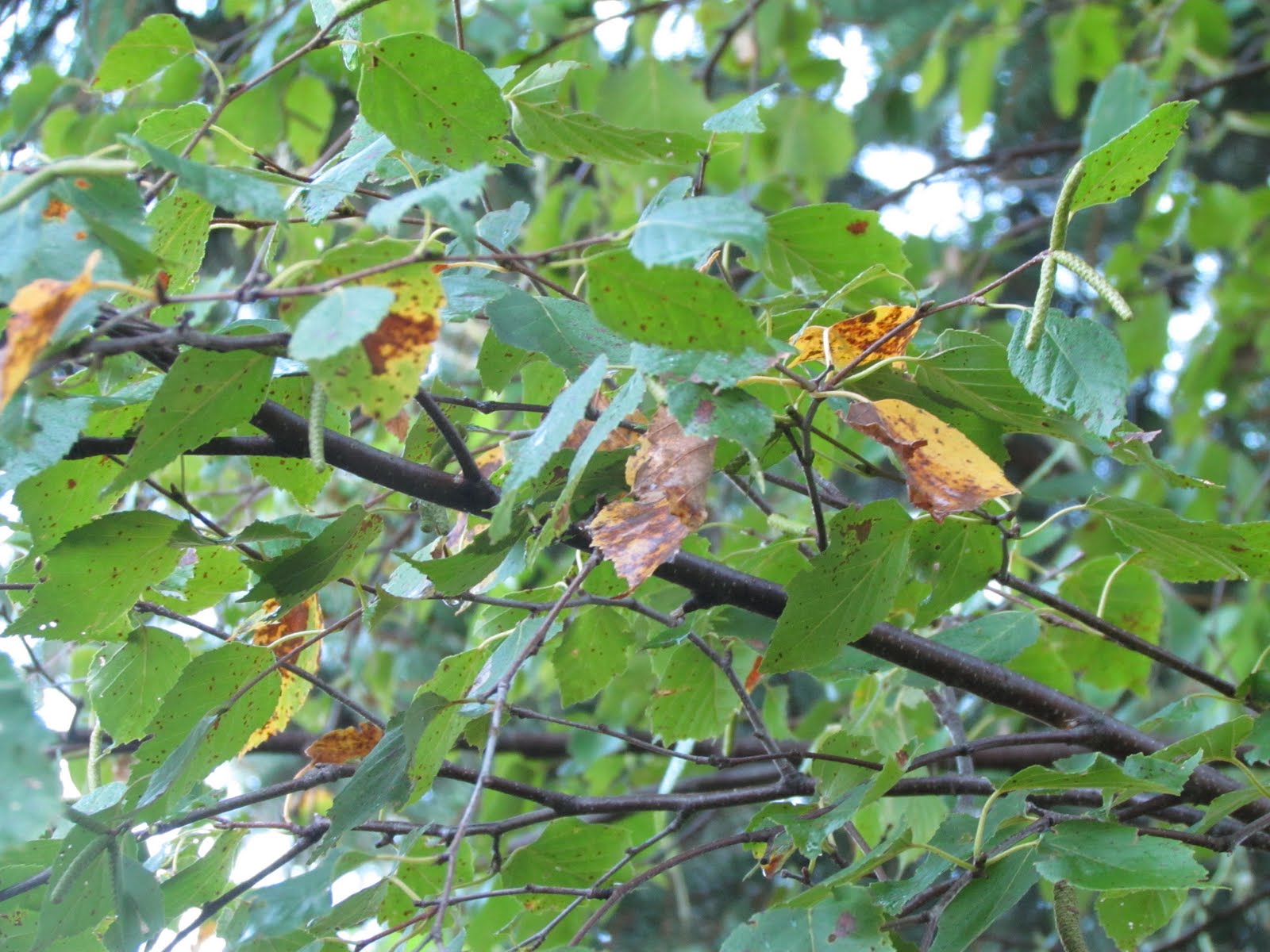
Green trees September 19th 2011


As one can see we will have a very long ways to go, there is still lots of green around. In the yard, trees remain very green at this time. The only color I have noticed is the Ash in the front yard starting to hint at possible color change soon by some slight yellowing and dropping of a few leaves, otherwise it is still mostly green and not impressive at this time.

Saturday, September 17, 2011

Much Needed Rainfall arrives Sunday, then brief nice weather Monday, before more rain chances Tuesday.

Regional Weather View.

A weather system will spread showers and thunderstorms across much of the Upper Midwest. These will fall across an area that could really use the rainfall, and these storms will not be severe. As a result of the rain, it will be cool region-wide before clearing and warmer temperatures move in from the west for Monday, then our next weather system arrives, bring more rain chances Tuesday.
Local weather view.


Locally we can expect a cloudy, wet, cool and dreary Sunday with showers and possibly some thunderstorms in the morning. This rainfall is much needed, and the good news is some spots may see some heavier downpours with rainfall amounts over a quarter inch Highs will only be in the mid 60s and lows in the low 50s with the rainfall. Monday will be a much better day across the area. We can expect clearing skies, and much warmer temperatures in the low 70s. With lows in the low 50s. Tuesday our next weather system already arrives with a cold front, it will be partly cloudy with a chance of showers and thunderstorms. It is too early to tell if they will be severe, but some could be strong, temps will be a bit warmer in the upper 60s with this rainfall, lows will be in the low 50s.


Metro View.

For the Rochester Metro we can expect the same wet & cool Sunday conditions. Monday will be brighter, with highs in the mid 70s for Rochester, and lows in the low 50s. Tuesday will be partly cloudy, with shower and thunderstorm chances, with highs in near 70, and lows in the low 50s.

Sunday, Widespread Showers and thunderstorms, heavier downpours possible. Highs in the low to mid 60s. Sunday Night, a chance of a shower early, otherwise clearing skies, lows in the low 50s.

Monday, Much nicer, partly cloudy, highs in the low to mid 70s. Monday Night, Increasing clouds, lows in the lower 50s.

Tuesday, Partly Cloudy with a chance of showers and thunderstorms in the afternoon. Highs in the upper 60s to 70.F Tuesday Night, A chance of a shower, otherwise mostly cloudy with lows in the low 50s.

Looking Ahead

Weather looks to dry out nicely behind Tuesdays system. Dry weather with seasonal temps looks to last from Thursday, all the way into next weekend, and even into the following week. Its not until October that we will see more rain chances coming in. The model is very un trust worthy this time of year, so check back often.

Thursday, September 15, 2011

9/15/2011 Record Low Temps last night-Growing season has ended in some areas-Upper 20s reported!

Frost in our backyard in West Downtown Rochester September 15th 2011

Record Low Temperatures with the first frost of the season was reported across all of Southeast Minnesota area last night, and in some localized cases freezing conditions were reported, causing an end to the growing season. A very strong cold front, followed by a strong high pressure with dry air allowed clear skies which contributed to the frost/freeze overnight. A hard damaging frost was seen in most cases North of I-90 away from the Mississippi River and outside the Rochester Metro where low 30s and upper 20s were common. South of I-90 and along the Mississippi, frost was more patchy and less damaging. In these areas mid 30s were seen and the growing season continues.


Photo of tender annuals that were not effect by frosts.


At my location in West Downtown we also had our frist frost with a low 35.F, but the frost was extremely patchy/light, from a distance the yard barely had any white appearance at all. Flowers and tender plants along the deck were not effected and are still beautiful and in full bloom, but on my daily commute to the college on the Eastern outskirts of the city I saw plants that were hit and the corn crops appeared to be very brown. To go along with this, The Rochester Airport away from the city 9 miles to my south had a record breaking low of 31.F, with a hard frost. My theory behind the lack of frost an warmer conditions at my location is that there was some heating effect going on from all the nearby homes and large buildings, as the yard is located in a inner city residential neighborhood.

Low temps recorded September 15th 2011

Several locations broke record low temperatures last night, one including the Rochester International Airport which had a low of 31.F breaking the old record for Sept 15th which was 32.F The coldest area-wide reading came from a un official station in Kenyon which fell to 28.F and the warmest area was Washaba at 36.F For the Rochester Metro, the coldest in the area was Oronoco, where a freeze was reported and the warmest was My station in West Downtown which fell to 35.F.


Tuesday, September 13, 2011

Very Chilly Air setteling in. 50s for highs Wed then Widespread hard frost or freeze likely Wednesday night. -updated X1

Regional weather view.

Attention is on a very chilly airmass settling into the Upper Midwest which came in on a cold front that slid through Tuesday. It will feel very like fall across the entire region, some places may not even get out of the 50s on Wednesday in Minnesota and Wisconsin. A early widespread freeze or frost is likely across South Dakota, Minnesota, Most of Wisconsin and Iowa..

Local View.


Note: This forecast has been updated due to more cold air looking to entrench into the local area, because of this low temps Wednesday have been lowered.


Locally we can expect very chilly conditions as we get into Wednesday. It will feel fall like, and will feel chilly to even "coldish" Under chilly but sunny conditions. Highs will not even get out of the 50s. This will set the stage for the areas 1st frost and possibly freeze of the season, which is discussed below. The cool, sunny conditions will last through Thursday with highs a bit warmer in the low 60s, and lows near frosting potential again in the upper 30s to 40.F on Thursday Night.


Widespread Wednesday Night hard Frost/Freeze likely.


Wednesday after highs are reached, clear skies and light winds overnight will allow for significantly dropping temperatures after sunset, lows will fall to the low to mid 30s across many areas. This will likely cause widespread killing frost for much of the area. it now looks to end the growing season for some parts of Southeast Minnesota as some places may reach the upper 20s, The best chance for this and a freeze will be north of Rochester and Winona. South of there are hard frost is still likely with lows in the mid 30s. This is very early for frosts this hard in Southern Minnesota. Temperatures in the upper 20s to low 30s this early will kill tender annuals and veggies, and can cause damage to landscape trees and shrubs. People should take time to bring in tender annuals or veggies, as well as over summering houseplants Wednesday Night, and keep them in Thursday Night as well lows once again will dip to the once again into the mid to upper 30s

Metro view.


For the Rochester Metro, we can also expect Wednesday to be our coldest day, it will be very chilly even with sunshine. Highs may briefly reach 60, then after sunset temps will quickly fall off dipping into the 30s. Thursday will bring slightly warmer conditions with highs in the mid 60s, and lows in the low 40s.


Rochester Frost Chances.


Frost is also a likelyhood for the Rochester Metro, the worst frost or growing season ending freeze with low 30s will be in outlying residential areas such as around the airport and surrounding communities. I still feel the Inner residential and Downtown areas will likely see lighter patchy frosts with lows in the middle 30s. In these areas garden plants may be less damaged.


Wednesday, Very Chilly! Lots of sunshine with highs in the upper 50s to near 60. Wednesday Night, Clear Skies, Cold! Widespread frost or freeze likely. lows falling to the low to middle 30s. with upper 20s possible in cooler spots north.


Thursday, Chilly, Sunny with highs in the low to mid 60s. Thursday Night, Very Chilly, Clear skies with lows in the mid to upper 30s.


Looking Ahead


After this nosedive in temps, it stabilizes into the first part of the weekend with more milder and dry conditions. The models are trying to hint and a slightly wetter pattern trying to set up for the second half of next weekend. Then it dries out with fair temps for Monday and Tuesday the 19th and 20th. The models then show a much warmer, but dry air mass pulling into the region around the 23rd. Then a very cold low pressure system passes Northeast around the 29th, not looking to effect our weather at this time.

Monday September 12th Warm Temp Report- 90s reported.

View of cooling street trees in my neighborhood September 12th 2011


Monday was the peak of a string of very warm days across Southeastern Minnesota. Everyday the past week/weekend has brought us sunshine and increasingly warm conditions. by Thursday of last week it was already reaching the mid 80s at my location, from then, each day built up in heat until Monday when highs topped out in the upper 80s to low 90s. The difference with this airmass is there was really hardly any humidity to deal with so it was bearable in the shade. Temperatures in the 90s certainly not record breakers for southeastern Minnesota in September either, but it is fairly unusual. Skies leading up to Monday were very sunny, with no precip to be seen. Which is continuing the very dry condtions across the area.


Highs Monday.


The warmest reading area wide was from Red Wing and Lake City both with highs of 91.F The lowest readings were from the Rochester Airport and Kenyon with a high of 87.F both areas. For the Rochester Metro, the warmest high was at several inner city stations including mine, with a high of 90.F and the lowest reading was from Hallmark Terrace, which is a outlying residential area north of the city.

Saturday, September 10, 2011

Fall Color Report 2011 #1

Fall Color Report #1


We are now approaching the middle part of September and following up on last weekends post, I now feel it is time to begin fall color reports for my new coverage area. So starting now I will have a fall color report issued weekly, or sooner as color intensity picks up, Fall color reports are based from the Minnesota Department of Natural Resources as well as from others, according to them fall color across Southeastern Minnesota is non-existent, all areas are reporting little to no color. It is still a bit early for colors to show up, Average peak color for Southeastern Minnesota is in Mid-October. For state coverage on fall color, go to the Minnesota Department of Natural Resources page, found HERE


Picture in Rochester looking north at Assissi Heights grounds towards the Elton Hills area


Looking around around Rochester it is still very much like summer, both looking at the trees and weather wise. Temperatures the last couple of days have been very summer like in the low to mid 80s with strong sunshine. Color is hard to find at this time because most trees still have that "summer green" color, I have seen the drought stressed tree or two losing leaves, but looking across the landscape there is really no color to be seen at this time. In our city lot, everything is still looking a lot like summer, the green ash in the front yard is still very green and full of leaves. Locals news outlets are saying that we are in for a beautiful fall color season, hopefully they are right, because with the abundance of maples and ashes around Rochester it should make for a very beautiful scene later this month into Oct!

Wednesday, September 7, 2011

Dry sunny weather continuing!

Regional Weather View.

A stretch of mild sunny weather continues as a high pressures sits over the Upper Midwest. We can expect these conditions to continue through the weekend for the entire region. Highs will by in the upper 70s to 80.F Region wide, with very little chances at precip.


Local weather view.


What does all this mean for Southeastern Minnesota? A continuing stretch of sunny, dry days with light winds. We should expect plenty of sunshine for the end of the week through next weekend. Temperatures all the way through Sunday will be fairly uniform in the upper 70s to 80.F area wide, with night lows in the middle to upper 50s. Humidity will increase, but will remain well into the comfortable range.


Rochester Metro view.


Note: This map has had changes, Surrounding "bedroom communities" directly linked to Rochester have been added to better reflect the metro area as a hole.


For weather, it will be the same for the Rochester area through Sunday, accept there may be a better chance at 80.F especially Friday, Saturday and Sunday. Lows in the city may also be a few degrees warmer then surrounding areas.


Thursday, Sunny, pleasant, highs in the upper 70s to 80.F. Thursday Night, Clear Skies, lows in the mid 50s.


Friday, Sunny, plea sent, highs in the upper 70s to 80.F. Friday Night, Clear Skies, lows in the mid to upper 50s.


Saturday, Sunny and Nice, Highs in the upper 70s to 80.F. Saturday Night, Clear skies, lows in the mid tp upper 50s.


Sunday, Sunny, Warm, highs in the low 80s. Sunday Night, Clear skies, lows in the upper 50s.


Looking Ahead


Monday or Tuesday we may have a slim chance at very light rain with a strong cold front, which will bring in much cooler air by Wednesday the 14th, showing that it would be quite chilly and breezy on Wednesday, with overnight lots so cool, Some spots overnight Wednesday may have chances at frost, especially Northern parts of southeastern Minnesota. This will have to be watched. Following that more sunshine and nice weather moves for the end of the week, with some better chances at rainfall with the next system/cold front which will be here according to the models by Sunday the 18th. It dries out and remains cool behind this front. After this it shows yet another cold front bringing in cool temperatures again for around the 23rd of the month.

Monday, September 5, 2011

Premature coloring-The difference between harmless fall color and possible tree stresses or disease.

Green ashes exhibiting perfect fall color. Photo taken September 2009 in Clayton,Wis

A resent argument that came up persuaded me to make a post discussing the different between fall color and pre mature color of leaves caused by stress or disease. This information which could prove to be helpful to area residents. First it is a good idea to know what causes leave to turn in fall. Many know that the chlorophyll reducing and the colors of the leaves appearing are the initial way colors show up in leaves, the effect is caused by the shortening days and cooling nights of late summer/early fall, as the suns angle changes trees "know" when it is time to shut down and hibernate for winter.

Premature coloring on a ash tree branch in Clayton,WI September 5th 2011

Sometimes a tree can exhibit coloring with out anything to do with the shortening days of summer. This is called premature coloring, Insects or disease can be a main factor the premature coloring. It can effect any tree at any given season, but it is most often seen with in about 3-7 weeks before normal fall colors arrives. To name some, Verticillium wilt which is a fungal vascular disease is a major producer of premature fall color in Sugar Maples and Silver Maples, it can cause entire trees or some branches to change color weeks before they normally would. To name another Dutch Elms Disease is a insect born disease that infects elm trees, which can cause elm trees to develop premature color on certain branches or spotty branches throughout the tree. To know that a disease is effecting your tree you would often the premature coloring of certain trees in most years.

Disease is not always the contributor of premature color, it can also be caused by damage to trunk or branches. Damage can occur either in several cases but weed whacking too close to trees trunks is a major cause. Severe damage to the trunk can cause a girdling effect on the tree, causing entire trees to turn color prematurely. To discuss one more issue that causes entire trees to color prematurely, root or drought stress is another why some trees show fall color early, in dry years many stressed trees will change colors and drop their leaves to conserve energy. Root stress or damage can cause the same effect can to be seen, in larger cities, the wrong kind of tree planted in a tiny boulevard space can also cause root stress because the area is not large enough for the tree to pick up enough moisture and nutrients, some times resulting in premature coloring and some dead branches, some trees are effected more then other but this is especially seen in Sugar Maples.
Birch tree shedding of the oldest leaves September 5th Clayton,WI

Sometimes trees will exhibit some color when the shedding of the oldest leaves take place. Some species of trees shed some of their oldest leaves about 2-3 weeks before the initial color change. Although this is seen more often in drier years the same effect normally takes place each time, some color can be seen on the oldest leaves, before they drop. This normally only lasts for 1-3 weeks before the tree sheds the oldest leaves and it's back to green.

So how to you know if your tree has fall color or disease/insect issues? People should know that with most trees, coloring takes place fairly fast and normally starts at the end of most branches on the tree and moves inward, for the most part causing the entire tree to have color at one time. Trees turning in fall do not normally have fall color on just one or two branches or sections of the tree. For premature coloring causes by insects or disease, Look for dead branches, lots of dead branches on a trees that seem to turn early can be a sure sign of diseases. Also look for trunk damage, on weed whipped damaged trees the damage would be most prevalent near the ground level. In cities if you see trees that turn early with lots of pavement around the roots with very little room, this can be a sign of root stress that may cause trees to turn early. Finally for trees that are just shedding look for spotty leaves all over the tree that may be turning that may appear to be the leaves closest to the inner branches.

Saturday, September 3, 2011

Cloudy chilly and windy condtions Sunday then sunny but remaining chilly through Labor Day, with gradual warming Tuesday.


Regional weather view.


A chilly high pressure settles in for the rest of this weekend allowing for much cooler, fall like conditions region wide. This cooler air will be ushered in a strong northwest winds. Highs will not warm out of the 60s in parts of Minnesota, Wisconsin and Iowa, which may lead to some light frost in Northern Wisconsin and Minnesota away from Lake Superior. A gradual warming and dry trend will start Tuesday allowing for 70s to come back into the region.


Local weather view.


More Locally we can expect a blustery and chilly day across the area. It may start off fairly sunny but clouds will build in the afternoon, an a sprinkle or two could also develop. Winds will be gusting from the Northwest 25 to 30MPH at times, many places will not get out of the upper 60s on Sunday due to the cloudiness. Sunday Night will be chilly partly cloudy with lows dipping into the mid 40s Monday we can expect much sunnier and less windy conditions, but it will continue to be chilly. We can expect highs in the upper 60s again Monday with lows dipping into the mid 40s once again. A couple cool spots here or there may drop into the lower 40s. Tuesday gradual warming will take place. It will be sunny with highs rebounding into the low 70s, and lows into the upper 40s.

Metro View

For the Rochester area we can also expect it to be quite chilly, cloudy and blustery Sunday, highs will also not get out of the 60s even in the city. Some of the sprinkles in the area could effect Rochester as well. Partly cloudy skies Sunday Night will allow lows to fall into the middle to upper 40s. Monday will be much sunnier, dry, and less windy, and as a result, highs may manage to reach 70 or just below. Monday night will be chilly once again with lows in the upper 40s in the city. Tuesday will be much warmer with sunny skies and highs in the mid 70s, and lows in the lower 50s.

Sunday, Chilly and windy, Mostly Cloudy with isolated sprinkles. Winds gusting 25 to 30MPH Highs in the upper 60s. Sunday Night, Chilly, Partly cloudy with lows in the mid to upper 40s

Monday, Chilly, Sunny and less windy, Highs in the upper 60s to low 70s. Monday Night, Mostly Clear Chilly, with lows in the middle to upper 40s.

Tuesday, Warmer, Sunny and pleasant, highs in the low to mid 70s. Tuesday Night, Partly cloudy with lows in the upper 40s to low 50s.

Looking Ahead


The models have this high pressure keeping us dry the entire week ahead all the way through next weekend. It appears that we will likely have a long stretch of beautiful sunny weather once again with variable high temperatures around average for this time of year. According to the models, Our next rain chance does not come until around September 16th with a cool front. There does not appear to be any big cool downs or warm ups at this time but stay tuned because this could change.