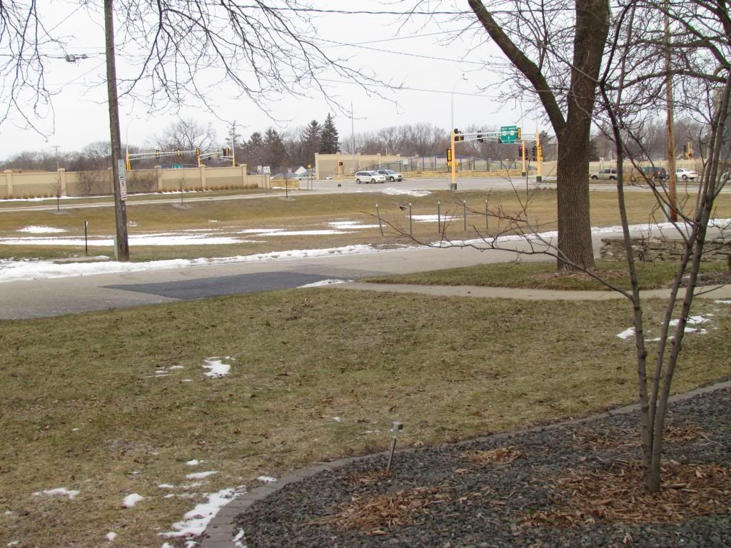
Snowcover as of January 12th 2013
A center of a low pressure system tracked north over South Dakota into Northwest Minnesota. This placement brought warmth and the 1st rain of the year surging northward out of Iowa into most of Minnesota over the past couple days. A completely different story was taking place on the cold side of the storm as snows and blizzard conditions were seen in Northwestern Minnesota and North Dakota. In Southeastern Minnesota, as the system began moving in rain pushed northward and it was raining in most areas after 5pm Thursday, Luckily by this time temperatures were already well above 32.F so icy roads were not a problem. Even though rain ended by 10pm Thursday, a warm airmass over a cool snowpack lead to the development of dense fog and drizzle that lasted all of Friday. By Fridays end rainfall amounts seen were around 0.25" in all areas. Interestingly enough the highest temperatures of the day did not occuar during the daylight hours Friday, as south winds continued and temperatures warmed into the middle 50s in Iowa, it pumped this air into our area all evening long. By 12am Friday Night, temperatures topped out in the lower to middle 40s over the prairie plains to even upper 40s in valley bluff regions near the Mississippi River. Snowcovered suffered significantly during this event. 2-4" of snow covered the ground before the warm up, and now afterwords most areas now only have little snowcover to around 1" of snowcover. This is the 2nd time this year we've lost our snowcover.
Passing of the cold front.
Shortly after midnight as the low moved eastward a very strong cold front swept through the area bringing northwest winds gusting near to over 40MPH, light snow and a significant temperature drop. Temperatures went from the low to upper 40s to the 10s and 20s just over a 5 hour time frame. Light snows accompanied the front as well but little to no snow accumulations were seen.
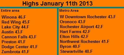
The highest temperatures spotted was Winona which warmed to 46.F at around 12am. The coolest temperatures was Stewartville at 40.F
Wind Gusts
W Downtown Rochester 41MPH
Dodge Center 39MPH
Rochester Airport 39MPH
Red Wing 38MPH
Preston 37MPH
Austin 33MPH
Winona 30MPH
Rainfall Amounts Thursday-Friday January 10-11th 2013
Dodge Center 0.38"
Red Wing 0.31"
Austin 0.28"
Winona 0.26"
Preston 0.22"
W Downtown Rochester-(My Sta) 0.21"
Rochester Airport 0.16"
Snow Crocus Sprouts January 12th 2013
I am starting to come to a conclusion that it now will take alot to surprise me about how these plants can sprout so early. It's not even February and here they are, all it took is the melting of the snowcover. The variety of Crocus above is Snow Crocus I planted this past fall so there known for being early. It is likely these sprouted under the snowcover, and they are now exposed now that the snow melted. I am not concerned that these will not make it through the rest of winter. As long as we can get some snowcover on them to protect them from extreme temperatures, they will make it through just fine.


No comments:
Post a Comment