Map Image Legend Image

Iowa Weather Network Warnings Map

Iowa Weather Network Warnings Map

Winter Weather Advisory

Sunday, February 23, 2014

Relocation to Des Moines,Iowa

Relocation to Des Moines

It has finally come time to let everyone know of the changes I mentioned last week, changes which will come as a surprise to many. I am very excited to announce that I have relocated to Des Moines, Iowa. I want to say I really enjoyed my time in the Cedar Rapids area and Eastern Iowa, and the reason for the move is that I am moving to peruse a new job opportunity which was offered to me there. I will be living in the City of Des Moines proper about 3 miles east of Downtown, just east of the capital building. The move its self has already taken place and there will be a change to the area I cover. I will immediately switch my blog over to Central & Southern Iowa effective immediately and changes are already seen. Below is my introductionary post to Des Moines- Central and Southern Iowa.

 photo IMG_20140221_134917_389_zpsa80525a4.jpg
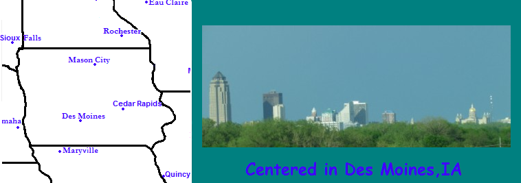
Downtown Des Moines February 23rd 2014

Welcome to the Des Moines Metropolitan Area!  I have spent the last few months preparing for and making the move from Cedar Rapids to Des Moines. What brought this move was a new job at a garden center with in the metro where I will be working retail and customer service. This move was more calculated and not as fast as my last move was. I have actually always wanted to live in Des Moines and looked at it as a place I wanted to live when I was going to college.

Introduction to Des Moines: Des Moines is in the southern 1/3rd of Iowa on interstates 35 and 80, about 254 miles South of Minneapolis,MN and about 164 miles North of Kansas City,MO It is the capital city of Iowa and its Iowas largest city. Des Moines proper has a population of 203,000, with a metro residential population of about 480,000  Des Moines is one the fastest growing metropolitan area in Iowa and is home to the tallest building in the state.

I am looking foreword to my new adventure in Central and Southern Iowa! My blog will be focused on covering weather events as well as some forecasting as well. As the name implies there will be lots of gardening information, and photos documenting seasonal changes posted as well along with photos of the city an landscaping. My blog will focus on a very localized area which will over coverages to some of Iowas largest cities and smallest towns in South Central Iowa, which is what makes my blog stand out. My coverage area will include Des Moines, Ames, Pella, Marshalltown, Newton and Indianola as well as the small towns in between. Over the next few weeks I will begin publishing forecasts and horticultural posts will begin soon after.

 photo 120207_winter_zpscfa36d47.png
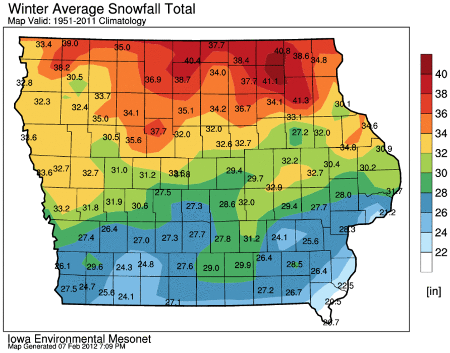
 Winter snowfall average map.

Like Cedar Rapids, Des Moines has hot very humid winters and snow, cold winters. However the Des Moines averages less snow and significantly more 90 degree days then Eastern Iowa. It should also be noted that there is well documented urban heating in Des Moines, and most times the 2 weather stations with in the metro, 1, the Des Moines International Airport located on the south side and the Ankney Airport on the north side always being warmer then surrounding stations. Snowfall average, according to the map above which excludes the Des Moines Airport average, Ankeny Airport Winter snowfall average is around  27" The snowiest month is February at 7.5" The average rainfall 35.61" with the wettest month being June at 5.25" For temperatures Des Moines hottest month is July with an average high of 86.F typically, on average has 1 100.F per year and 21 days above 90. The coldest month is January with an average high of 31.F Typically there area 12 days below zero.

I hope to be welcomed into the area by new viewers of Central Southern Iowa and to my faithful viewers from Eastern Iowa, thanks for visiting my blog over the past year.
Thursday, February 13, 2014

Changes coming soon.

This is an announcement to current viewers. It may have been noticed that there has been a slow down in posts, this is all in anticipation of a significant change that will result in big changes to my blog including a link change. The change will be announced at the end of next week and I will explain everything at that time.


Thank you


Blog owner


Derek McKay 

Sunday, February 9, 2014

February 8th Clipper System, Highest Snow depth of the winter so far & adding the seasonal snowfall totals

 photo ResizedImage_1392002879905_zpse7dfe3ee.jpg
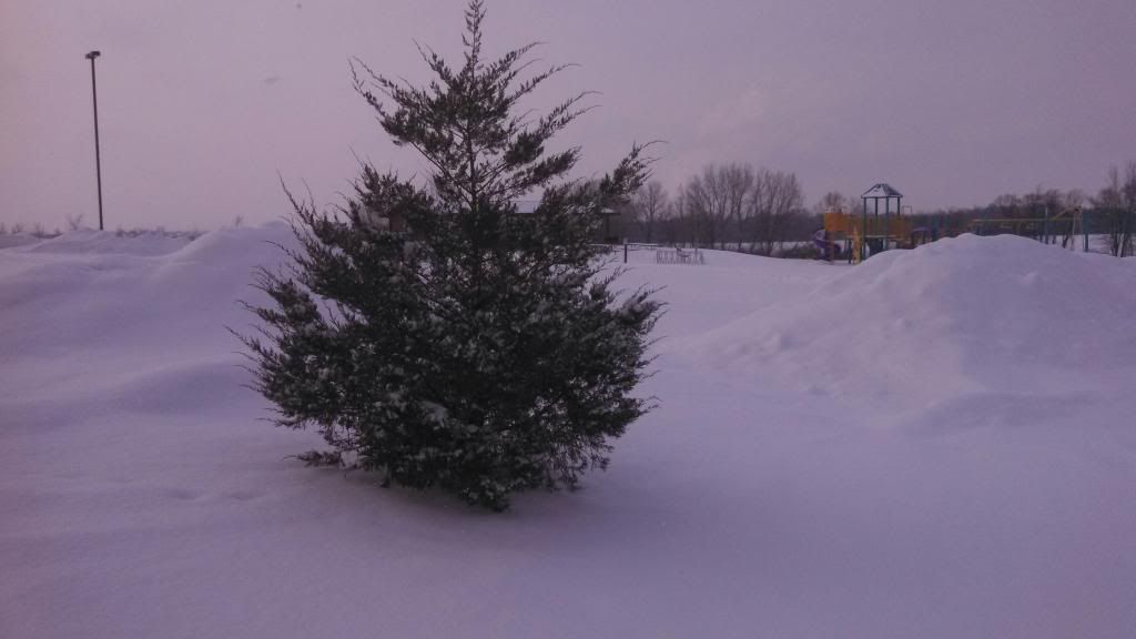
Snowy Juniper during clipper system February 8th 2014

This Saturday brought another clipper system to Eastern Iowa, which in turn brought another wave of Snow, some of which came down very heavy at times, especially in the morning hours. During the afternoon the snow tapered but lasted though the rest of the day. The cause of Saturdays snow was all to a strong little system moving across the state. A strong snow band developed as it moved cross Central and Eastern Iowa during the early morning to mid afternoon hours producing 1-2" per hour amounts as it quickly moved across Iowa. Most of the accumulation in the reports below occurred in only an hours time. Here in Hiawatha I recorded 2.50" with 0.09" of water content, which is a dry snow. The snow was very light and fluffy and so fluffy I seen people using brooms to clear the snow off their cars. It also made for a beautiful Morning on Sunday when the large flakes glistened against the sun. The snow for the most part did not cause much in the way of issues accept for travel on Interstate 80 where an accident caused a 3 hour closer of the interstate near Iowa City.

So where are we in terms of snowfall/snowcover and such?

Adding the numbers: Hiawatha,Iowa

Seasons Total Snowfall 27.70" ( -2.30" from seasonal norm )

Snow this month 7.75" ( +1.25" and month just started )

Snow Depth 6.50" ( 0.98"  water content ) Highest snow depth of the season so far

February 9th Snowfall Reports

 Atkins 3.20"
 Cedar Rapids 3.00"
 Independence 3.0"
 Marion 3.00"
Northwest Cedar Rapids 2.70"
 Iowa City 2.60"
Waterloo 2.50"
Hiawatha 2.50"
 Mt Vernon 2.50"
Monticello 2.40"
 Springville 2.10"
Washington 1.0"


Wednesday, February 5, 2014

February 5th Snowfall Report- Northern edge of a winter storm drops 2-5" of snow causing dangerous travel

 photo ResizedImage_1391643685211_zps1ab49fd9.jpg
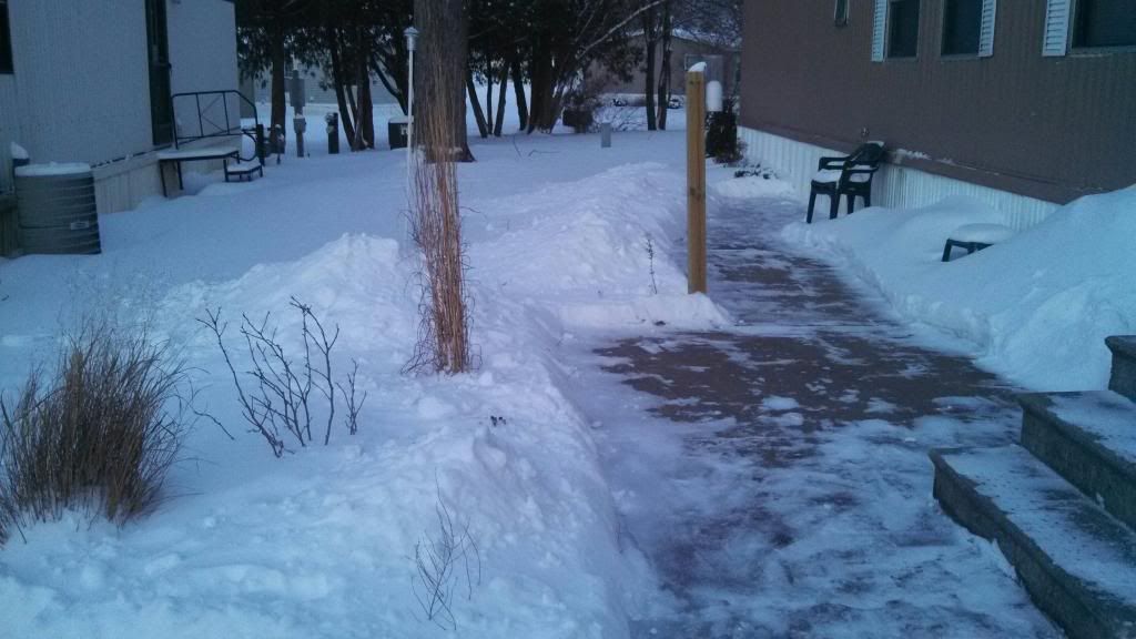
Increasing snow piles February 5th 2014

A snowstorm just got done hitting our area and it was a long lasting one by far. The snow started around noon Tuesday and continues through Wednesday. Heaviest snow occurred Wednesday morning. The fine texture to the snow made the roads extra dangerous and numerous accidents were reported throughout the area, Especially on 380 and interstate 80 the south side of Cedar Rapids, where I happened to be trying to get to Des Moines but had to turn around due to very dangerous conditions on interstate 80. Our snow here in Eastern Iowa was a part of a much larger storm system that effected 2 3rds of Iowa as well as a much larger part of the region that spread snow and ice across a huge part of the country from Kansas City southward to areas as far south as Northern Arkansas and Oklahoma. Amounts ranged from 1-2" in the highway 20 corridor to 5-6" in the south around Iowa City southward. Taking measurements was very difficult due to the fine textures nature of the snow and wind. Listed below is the reports for the area.

Snowfall reports

Wellman 5.0"
Victor 4.0"
 Marion 4.0"
 Olin 3.80"
Hiawatha 3.75"
Cedar Rapids 3.50"
Coralville 3.50"
 Bertram 3.50"
 Anamosa 3.20"
North English 3.00"
 Solon 3.0"
Jesup 1.50"
Independence 1.50"
Waterloo 1.50"