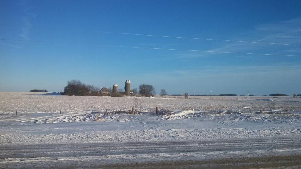
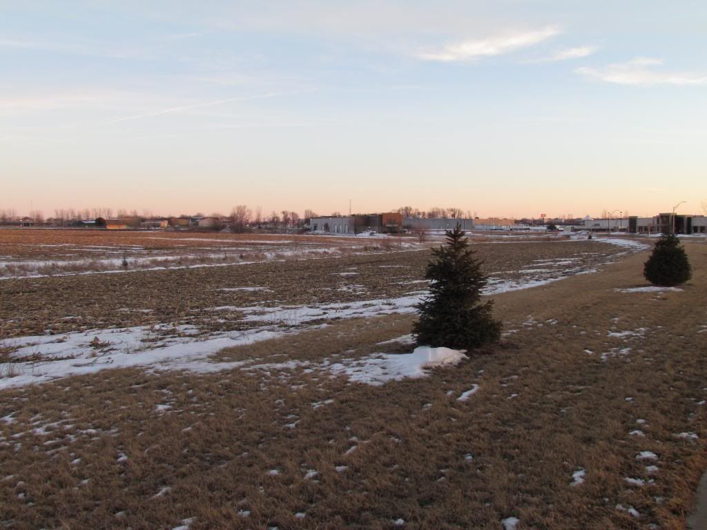
Aftermath of the January 26th blizzard. Wind whipped fields of Northern Iowa near New Hampton,IA
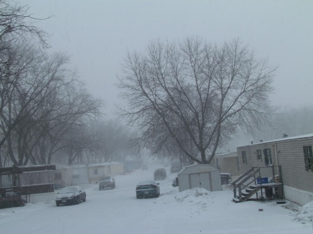
I am now back from my final winter trip to Northern Wisconsin and I need to revisit the topic and do a report of last weeks blizzard here in Eastern Iowa. Looking back at reports from that day now looks as though the blizzard last weekend was very significant. I unfortunately don't have as much information as I would have liked to have shown for such a major event, I will go with what I can pull together for this report. Sunday January 26th a potent Clipper/winter storm and the leading edge of a very cold Arctic Airmass came together to create a powerful blizzard that caused parts of the state to shut down last weekend, including many communities in our area. Between 1 and 4" of snow fell across the area, then winds gusted from 50 to over 60MPH causing blizzard conditions and even causing damage. I would consider this evening to be major. NWS reports even mentioned zero visibility and cars being stranded in Western Joens county near Springville. Highway 20 was shut down between Dubuque and Waterloo as well. In Independence reports of cars being pushed off the road in icy areas was reported. I was not around to witness the blizzard but upon my return I noticed significant drifting even days after the event. Temperatures plummeted behind the storm as well to the middle 10s below zero as the arctic air settled over the area Tuesday morning wind chills as low as -40.F were seen on Sunday and Monday morning. This storm had a true Arctic Blast to it. Below is a list of reports from that day as well as the coldest temperatures seen during this arctic outbreak
Reports
Marion 60MPH wind gust 3 foot long branches down
Independence 59MPH gust
Monticello 56MPH wind gust, Blizzard conditions
Iowa City 56MPH wind gust, Blizzard conditions
Van Horne 52MPH wind gust
Washington 53MPH wind gust
Eastern Iowa Airport-Cedar Rapids 54MPH wind gust
Waterloo-Cedar Falls Airport 52MPH wind gust
Vinton 50MPH wind gust
Olin & Springville, Blizzard- Pure white out conditions stranded motorist in Western parts of Jones county.
Manchester, Blizzard Highwah 20 closed between Dubuque and Waterloo
Independence, massive drifting on side roads
Mechanicsville, Whiteout conditions reported between Mechanicsville and Mount Vernon
Williamsburg, Blizzard conditions, Shingles reported to have blown off of residence.
January 28th lows
Manchester -18.F
Waterloo-Cedar Falls Airport -18.F
Monticello -18.F
Independence -16.F
Mount Vernon -15.F
Cedar Rapids Eastern Iowa Airport -13.F
Hiawatha, My Sta. -12.F
Williamsburg -10.F
Czech Village-Cedar Rapids -10.F
Iowa City -10.F
Washington -7.F


Iowa Weather Network Warnings Map

Winter Weather Advisory
Friday, January 31, 2014
Friday, January 24, 2014
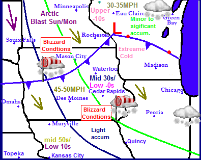
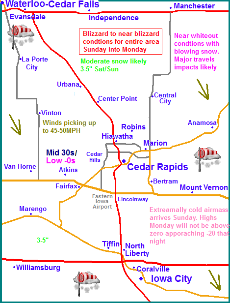
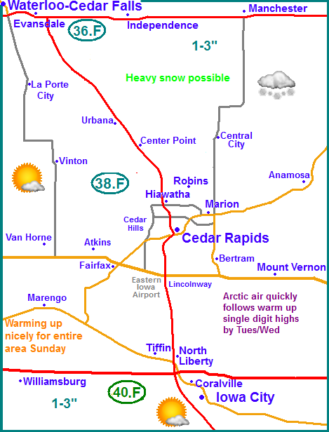
Sigificant weather system arriving Sunday will bring snow accumulations 3-5" then winds pick up 45-50MPH creating blizzard to near blizzard conditions. Extreamelly cold air follows on the heals of this with well below zero highs and near -20 below lows.
Regional Weather View
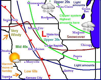
A system quick to gain all the attention will be impacting the Upper Midwest Sunday into Monday. Snowfall will not be the major issue, but high winds gusting to 50MPH will create widespread blizzard conditions across a huge area of the Midwest late Sunday into Monday. Also bitter cold extreme arctic air will be brought down by the arctic front behind this system and highs will be below zero across a large part of the region as well. This airmass will through the region into Winters Chill for a large part of next week.
Local Weather View
Locally Saturday will be colder and windy with gusts up to 35MPH as we see a brief shot of arctic air behind Friday night snow. Highs will start in the 10s and fall to the lower single digits by the evening hours.
Storms Impact Sunday: The major topic at hand Sunday will be the potienal for blizzard conditions later in the day into Monday. We can expect 3 real issues with this system, Extreme cold, blizzard conditions and high winds, but not high snowfall amounts. The NWS already has Winter Storm Watches in place, but locals should realize this is in place for more about the significant blowing snow that is expected, not the snowfall accumulations which will generally be 3-5". I have feelings the watch may be upgraded to a Blizzard Watch later on Saturday. Sunday will actually start off mild with highs in the mid 30s but then the arctic cold front will approach, snow showers will develop and the temperatures will fall throughout the day as winds pick up out the Northwest, by Sunday evening we could be having gusts of 45MPH + picking up the new 3-5" of snow that falls on Saturday. This will create blizzard to near blizzard conditions especially in open areas outside of the larger cites. Blowing and drifting will be an issued and travel impacts are likely. People should consider postponing or cancelling plans. The worst of the blowing will be Sunday into early parts of Monday, however Monday will be very cold in the wake of the passing of the arctic front. Highs will not get above zero and wind chills will be extreamlly cold. Wind Chill Warning statements may be issued as wind chills of -40.F are possible, we can expect actual air temperatures to be around -5.F on Monday. Monday Nights cold will rival or surpass the cold at the start of the month and could approach -20.F in all areas, with of course areas of the north having the best shot.Tuesday through Wednesday we will calm things down as we will be in the middle of the arctic airmass. It will be cold and dry both days with highs barely above zero Tuesday and moderating to thew upper single digits Wednesday. Thursday we increase the clouds some and we will finally crack the 20s for a high.
Saturday, Cold! Falling temperatures with gusty and cold northwest winds. Highs in the single digits by the evening hours. Saturday Night, Snow developing, some could be moderate at times. Lows rising to the upper 20s
Sunday, Snow likely, some could be moderate at times, Temperatures Start off in the 30s then falling to the single digits late. Strong Northwest winds developing later in the day and gusting to 45MPH + at times. Significant drifting and blowing snow likely with blizzard conditions possible at times. Sunday Night, Windy with significant blowing and drifting snow. Gusts up to 45MPH, blizzard conditions possible. Lows below zero with extreme wind chills.
Monday, Very Cold! and blustery with extreme wind chills. Sunny skies with highs around the mid single digits below zero. Monday Night, Very Cold! Lows in the upper 10s to lower 20s below zero.
Tuesday, Cold! and sunny. Not as blustery with sunny skies. Highs in the lower single digits above zero. Tuesday Night, Cold and clear with lows in the lower to middle 10s below zero.
Wednesday, Moderating temperatures. Sunny with highs in the middle 10s. Wednesday Night Clear skies with lows in the upper single digits.
Thursday, Warmer with increasing clouds. Highs in the mid 20s. Thursday Night Cloudy skies with lows in the upper 10s.
Friday, Snow developing. Minor accumulations possible. Highs in the upper 20s.
Looking Ahead
As you saw above Friday appears to be our next chance of snow. At this point i looks like a few inches are a possibility, this could last into Saturday of next weekend. Sunday the 2nd looks fair for cloudiness with highs in the upper 20s. Monday through Wednesday 3rd through the 5th looks dry, sunny with temperatures around to just below normal. Thursday the model does get a little interesting. Possible a little to interesting to be taken seriously at this time. The model shows a winter storm system quickly developing over Kansas and then moving east spreading heavy snows and highs winds, possible blizzard conditions over a huge swath of the Midwest including all of Iowa and most of Kansas, Missouri, Nebraska, Minnesota, Wisconsin and Illinois. In the wake of this storm, yet another bitterly cold arctic airmass settles down from the north Friday through Sunday the 9th. Temperatures could again rival this and early January lows/highs. This is certainly becoming a very long and harsh winter for much of the region.
Tuesday, January 21, 2014
January 20th snowfall
Snowfall January 20th 2014
Yesterday a strong arctic cold front made its way slowly through Iowa. The day started off with sunshine and highs ranging from about 32 to as warm as 37.F in the south. Temperatures cooled slowly through the day and then in the afternoon a fast moving storm system ahead of the arctic cold front and produced snowfall in Central and Eastern Iowa. The snowfall actually blossomed over Central Iowa near Marshalltown and came down quite heavy at times. Interesting to note that at the same time we had one full mild day in the 30s to our North up in Minnesota and Wisconsin had temperatures in the single digits at this same time. However it didn't take long to reach us. After about 9pm Temperatures nosedived to below zero levels in all areas by Morning Tuesday. Strong gusty winds of nearly 40MPH. The highest gust in the area was from Waterloo-Cedar Falls with a gust of 37MPH, this blew in these cold temperatures from the north and did cause some significant blowing snow in certain areas. This new snow that now covers the area brought the return of full snowcover to the entire area. Snowdepths of 4-8" of areas of the far north to as little as 2" in the south, all of which is from the last snowfall. The snowfall total of 1.70" here in Hiawatha brings the seasons total to 18.95" which is only 11.05" away from the seasonal average of 30" Below is a list of snowfall totals seen from this event.
Coggon 2.70"
Independence 2.50"
Iowa City 2.50"
Marion 2.30"
Atkins 2.20"
Swisher 2.10"
Monticello 2.0"
Anamosa 2.0"
Waterloo-Cedar Falls Airport 2.0"
Washington 2.0"
Wellman 2.0"
North English 2.0"
Cedar Rapids 1.80"
Hiawatha 1.75"
Bertram 1.50"
Sunday, January 19, 2014
Snow yesterday, Sunny & upper 30 to mid 40+ degree temperatures today.
Hiawatha,IA January 2014
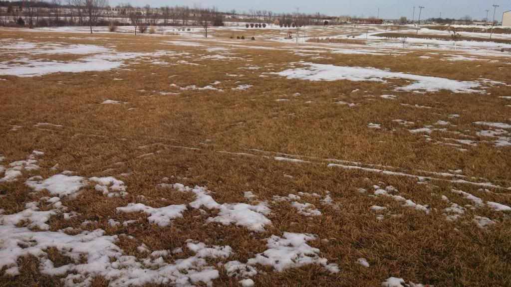
We had a bit of varitiy in weather the past 2 days in our area. Saturday was relatively cold and snowy and Sunday was sunny and beautiful. A a clipper system rode along the edge of the jet stream on Saturday pushing snow into our area from the northeast. Generally 1-3 inches were reported with the highest amounts in Buchanan and Delaware counties. Snow did come down heavy at times and there was some traffic troubles reported in the Iowa City area, but other then that it was a typical January clipper Some of the amounts were as follows, Independence, 4.0" Hiawatha 1.0", Bertram 1.50", Iowa City 1.30" Sunday the jet stream completely pushed through Iowa sending a warm front through the state making way for clear skies and warm temperatures. Here in Hiawatha we got 1" of snow Saturday all of which melted completely and we even lost a little of the old snowcover as well. Snowcover across the areas is now generally ranges from 3-4" of snow depth in areas of Buchanan and Delaware counties very patchy in areas southwest of there, Waterloo to Cedar Rapids to officially no snowcover in areas near Iowa City and South. Open areas and fields have really melted off nicely and lows of grass is showing, shaded areas, woods and northern exposed hills still has a fair amount of snowcover. This is the least amount of snow I've had on the ground here in Hiawatha since Mid December. In total with yesterdays snow I'm up to 17.25" of snow for the season which is over half of the seasons average. Below is a list of highs seen across Eastern Iowa today. Note that the warmer temperatures were in areas that lost snowcover as the day went on, and cooler temperatures were seen where higher snow depths were.
Washington 48.F
Williamsburg 46.F
Downtown Cedar Rapids 45.F
Downtown Iowa City 45.F
Iowa City 44.F
Waterloo-Cedar Falls Airport 44.F
Marion 43.F
Hiawatha 43.F
Cedar Rapids Eastern Iowa Airport 42.F
Vinton 42.F
Independence 41.F
Shellsburg 42.F
Central City 40.F
Monticello 39.F
Manchester 39.F
Thursday, January 16, 2014
Roller coast continues in tearms of our temperatures. Snow Saturday, models show a westward shift 1-3" in all area, then sunny and warming to the 30s and 40s by Sunday. Arctic air arrives once again Tuesday of next week. Turning more active long tearm?
Regional Weather View
Regionally there will be a clipper system moving through areas of Iowa, Minnesota and Wisconsin where several inches and heavy snow will be seen on Saturday. It will be a quick mover that will follow the jet stream and there will be a very sharp cut off from higher to lower amounts. South and west of the blue line above will see no snow.. Sunday the jet stream will move northeast sending a breif shot of warm front across the rest of Iowa and into Southern Minnesota. In areas with no snowcover 50s and 60s will be seen, with 40s in most of the rest of Iowa. Temperatures will not rise above freezing in many areas of Minnesota and northern Wisconsin. The warm up will be short lived because by Tuesday an arctic cold front will slide across the region bringing much colder temperatures. This front will come through most of the region dry.
Local Weather View
Locally this clipper system is causing a little bit of a problem in forecasting the weather because it will be such a close cut off line. The models have shown a westward shift, which means increased snowfall for all areas. At this point now the models depict all areas seeing 1-3" of snow on Friday night into Saturday Morning, this will mainly include all areas. Temperatures will slowly rise Saturday into the lower 30s in response to a slowly approaching warm front. Sunday will be nice across Eastern Iowa, under sunny skies and southerly breezes, highs in the lower to middle 40s can be expected, especially areas with little to no snowcover. Monday, an arctic cold front sweeps through the state, it will be sunny but the high which will be in the lower 30s will likely be reached in the morning, with temperatures steady or falling through the day and falling to the single digits for lows. Tuesday will be sunny and cold, but winds should be lighter. Highs will only be in the lower 10s, and in the upper single digits in areas with more snowcover. Lows will be on either side of zero. Wednesday will be sunny with highs in the lower to middle 10s and lows in the mid single digits. Thursday into Friday next week it will be increasingly cloudy ahead of our next shot at snow, but at this point amounts look light.
Friday, Clearing skies, cold and blustery with cold wind chills. Highs in the upper single digits to lower 10s. Friday night. Snow possible late Partly cloudy with lows in the mid single digits.
Saturday, Cloudy skies with snow developing, possibly moderate at times. 1-3" all area. Highs warming to the upper 20s to lower 30s.. Saturday night, lows in the mid 10s.
Sunday, Sunny and pleasant with southerly breezes, highs in the upper 30s to mid 40s. Sunday Night, Clear skies with lows in the lower 20s to upper 10s.
Monday, Sunny skies with winds turning north and becoming blustery. Highs in upper 20s to mid 30s. Monday night, increasing clouds with lows in the mid single digits.
Tuesday, Sunny and cold, highs in the lower 10s to upper single digits. Tuesday Night, Cold, Clear skies with lows on either side of zero.
Wednesday, Sunny skies with increasing clouds late. Highs in the mid 10s. Wednesday Night, Cloudy with lows in the mid single digits.
Thursday, Cloudy with a chance of snow developing in the afternoon. Amounts 1-2" into Friday morning mainly northeast. Highs in the mid to upper 20s. Thursday Night. A chance of snow, lows in the mid 10s.
Looking Ahead, After Thursday and Fridays snow, Saturday looks cold and sunny with highs somewhere in the single digits, and Sunday the 26th looks to warm into the 10s. After this a pattern change is likely and it gets more interesting as the jet stream sets it self up to produce multiple clippers. Monday the 27th is the 1st of many possible clippers according to the model. Another one follows right on its heals for Tuesday, this one looks a bit heavier especially to our Northeast. Wednesday looks cloudy and warmer likely somewhere around the 20s. Then Thursday the 30th the models are starting to show a possible developing snowstorm over the middle of the country bringing much of Iowa heavy snowfall and possibly some strong winds. This storm will need to be watched as it looks significant. Arctic air follows this storm drying our weather our as we head into the month of February.
Tuesday, January 14, 2014
Potent-fast moving weather system produces rain, strong winds and snow across Eastern Iowa, Widespread 45-50+ MPH gusts reported.
Today brought a variety of weather to Eastern Iowa. We started out the morning with moderate downpours and temperatures in the upper 30s then ended with moderate snow and very strong winds. Today's weather was all from a small but very potent low pressure system that passed through Minnesota where it produced significant snows in Minnesota as well as Wisconsin. As the low moved to our north it first sent its warm front which brought us the rain and downpours around 6am, amounts were less then 0.25" at most area, then its cold front quickly passed through and behind it very gust winds of 45 to 50+ MPH were seen after the fronts passed and these winds continued to gust up to 45MPH through out the day. All stations across the area reported over 44MPH, winds later in the afternoon wrap around snow showers developed on the back side of the low produced some rather moderate to even heavy snow shows in some areas. Some snow did blow as well, but the winds did subside some by that point. amounts were very light around half inch to a trace. We are not done with wind either, Thursday could be a repeat of todays wind gusts. High wind watches are already being put into place to our west. Below is a list of highest wind gusts seen today.
Cedar Rapids Eastern Iowa Airport 53MPH
Vinton 52MPH
Independence 49MPH
Iowa City 46MPH
Monticello 47MPH
Waterloo-Cedar Falls Airport 44MPH
Cedar Rapids Eastern Iowa Airport 53MPH
Vinton 52MPH
Independence 49MPH
Iowa City 46MPH
Monticello 47MPH
Waterloo-Cedar Falls Airport 44MPH
Sunday, January 12, 2014
Mid January Warmth- January 12th warm temperature report.
Clark Park in Hiawatha during a warm sunny January 12th day.
Today was a beautiful Mid January day with highs that were in the 40s and neared 50.F degrees in some places in Eastern Iowa. The cause of the warmth was a thanks you a powerful warm front which moved through this morning on those gusty south winds that gusted over 30MPH at times around 11am Sunday, which oddly enough was nearly calm by the late afternoon hours. Afternoon highs soared into the 40s across the area with the only expecting being areas of the North such as Independence which did not hit 40 today. The snowcover area wide did take a hit and in fact some areas of the south and west have very little snow on the ground left. This is the 4th or 5th time since we had our 1st sticking snow that the snowcover has mostly melted here in the Cedar Rapids area, but this is by far the least amount of snow we've had on the ground since Mid December. Some other numbers across the state include 51.F at Des Moines and 55.F at Keokuk. Below is a list of high temperatures reached today and morning wind gusts across Eastern Iowa
Williamsburg 47.F
Kalona 47.F
Downtown Cedar Rapids 46.F
Marion 45.F
Iowa City 44.F 30MPH
Hiawatha 44.F
Mount Vernon 43.F
Cedar Rapids-Eastern Iowa Airport 42.F 35MPH
Vinton 41.F 30MPH
Monticello 41.F 28MPH
Central City 41.F
Waterloo-Cedar Falls Airport 40.F 35MPH
Manchester 40.F
Independence 37.F
Thursday, January 9, 2014
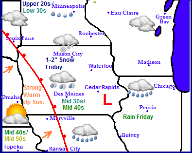
From Arctic Air to warmth. Storm system to bring Rain to the south and sleet and snow to the north towards Waterloo, up to 1" possible. Then everyone feels the warmth Sunday as highs rise to the upper 30s to middle 40s, then temperatures going up and down after this day.
Regional Weather view
Weather across the region will be warming up significantly after our outbreak of arctic air last week. Some places will even gone from below zero weather last week to rain this week. A weak weather system moving across Southeast Iowa will bring rain to the 1/3rd of Southeast Iowa, and sleet and snow along a corridor roughly from Des Moines to Waterloo. Northwest of there, Northern Iowa, Southeast Minnesota and parts of Wisconsin, Mason City to Rochester will see snow with minor accumulations. This feature will be fast to move out as a strong warm front from the southwest brings a push of very mild air into the area. Highs listed above are Fridays highs compared to Sundays highs. Come Sunday temperatures as warm as the 50s could be felt as far north as far southern Iowa. With highs near 60 as one nears Central Missouri. It will be a dry week after the said storm system above passes with temperatures swinging up and down but generally in the 20s to middle 30s.
Local Weather View
Saturday we will get a brief cool down to the 20s and 30s being this storm, before the big warm up Sunday. I have raised forecasted highs for tomorrow due to the fact that areas to our southwest have little snowcover and the warm up appears stronger then first anticipated. Under sunny skies I believe highs will be as listed above, in the upper 30s to middle 40s in the south. If more snowcover can melt Friday it will help us even have a higher shot at warmer temperatures. Most of our snowcover will be melting away this week regardless of Fridays highs/rain as skies will remain sunny with several days with highs around the 32.F mark, accept for Wednesday when we get a brief shot of cooler air before it warms back up, Weather will be dry from Saturday through Thursday next week.
Friday, Sleet/snow across the North, Rain to the south. Highs in the low 30s north to mid to upper 30s south. Snow accumulation across the north around 1" Friday Night, Snow possible with light accumulations. Lows cooling in the middle 20s
Saturday, Partly Cloudy skies with light winds. Highs in the upper 20s to lower 30s. Saturday night, Partly Cloudy with lows in the upper 10s.
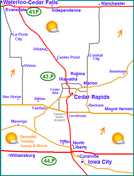
Sunday, Sunny and warm with southerly breezes. Highs in the upper 30s north to lower to middle 40s south. Sunday Night, Increasing clouds with lows in the mid 20s
Monday, Cooler with northerly breezes. Cloudy skies with Highs in the upper 20s to lower 30s. Monday night, Cloudy with lows in the low to mid 20s.
Tuesday, Breezy, Partly Sunny skies with highs in the lower to mid 30s. Tuesday Night, Mostly Cloudy and breezy with lows in the mid 10s
Wednesday, Colder with cool wind chills. Windy with highs in the low to mid 20s. Wednesday Night, Cloudy skies with lows in the mid 10s.
Thursday, Sunny skies and warmer. Southerly breezes. Highs in the middle to upper 30s. Thursday Night. Turning colder and blustery with lows cooling to the in the lower 10s.
Looking Ahead
Friday the 17th an chunk of an arctic airmass will moved southeast through the Midwest and deliver us another spell of cold temperatures. It comes in dry, however a clipper system could produce some snow in our area Saturday the 18th, but most of this will be confined to Northern Iowa. Sunday the 19th we begin a warming trend, which really comes into play between the 20th and 21st. High temperatures could have a run and the lower to middle 40s category. Wednesday the 22nd a storm system spreads rain to our south to areas of Missouri, Southern Illinois and Kentucky. This leaves us dry but brings in a brief shot of slightly cooler air. After this time frame the jet stream then sits directly over Iowa leaving us more prone to storms. January 24th shows a chance of some wet snows over Iowa, but it does not look significant.At the very end of the run, the 25th model shows a better organized storm moving towards Iowa. It has the potienal to be rain across the southern half and snow across the northern half, but it is far to early to determine where this storm will go at this time.
Tuesday, January 7, 2014
Cold Temperature Report- bitter cold temperatures of -20.F reported with wind chills of near -50. Coldest in recent history
Cold Evening January 7th
We are now on the upward trend side of an arctic outbreak that hit the region and our area starting on Saturday. According to multiple weather agencies the cause of the arctic outbreak was literally a piece of the polar vortex from the Arctic Circle broke off and moves south as a large area of high pressure that settled over the middle of the country. The full blast of this arctic outbreak arrived Sunday into Monday when temperatures fell into the middle to upper teens below zero and highs remained well below zero through Monday. Once it fell below zero Sunday temperatures remained below zero through Tuesday afternoon generally ranging from -10 to -5.F for highs. The cold was ridden down on very strong winds Sunday the 5th when winds gusted over 40MPH at time also causing blowing and drifting. The worst of the wind chills were 40 to 50 below zero. Most area schools and even some businesses closed as a result of the cold and people with old car batteries were stranded. This cold snap was well advertised and well warned, however it was a little on the lighter then forecasted side here in Eastern Iowa. The majority of the extensive advertising for this cold snap was for the forecasted wind chills as well as because it has been quite a few years since its been that cold. I happened to have spent the entire cold snap up in Northwest Wisconsin where the air temperatures fell to the coldest level I've seen physically with a low of -28.F below at the nearest official station in Rice Lake,WI. Wind chills there were near -50.F at times. I did do the hot water thrown into cold air test and not much of that 3 cups of water I threw made it to the ground! The good news is we can expect a significant warm up for the area this week with highs nearing 40 by Sunday. Below is a list of coldest lows seen / along with coldest wind chills and gusts associated with this airmass.
Manchester -20.F
Waterloo Airport -19.F/-45.F 37MPH
Monticello -18.F/-46.F 38MPH
Vinton -18.F/-46.F 33MPH
Independence -18.F 39MPH
South Waterloo -18.F
Mt Vernon -18.F
Marion -18.F
Cedar Falls -17.F
Cedar Rapids Eastern Iowa Airport -17.F/-40.F 40MPH
Hiawatha -16.F
Williamsburg -16.F
Downtown Cedar Rapids -16.F
Coralville -16.F
Iowa City -15.F/-41.F 38MPH
Friday, January 3, 2014
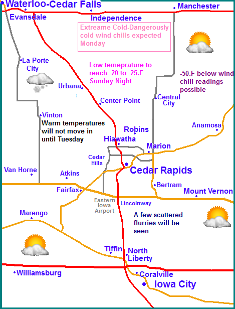
Extreme Cold to ascend on the region late tomorrow. Coldest temperatures in 20s could be seen. Dangerouly cold wind chills likely appoaching -45 to -50.F some areas
Regional Weather View
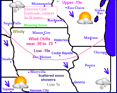
There is only one thing making headlines in the Midwest and that is the extreme cold that is about to ascend onto the region. A bitter cold Arctic Airmass will soon be pledging into the U.S strait from Northern Canada, and a deep snowpack and the extent southward of the arctic high will allow for Very cold to extremely cold temperatures to be seen across all of the Midwest. The core of the coldest extreme air will be seen in all or most of South and North Dakota, Iowa, Minnesota, Illinois and Wisconsin. Temperatures in this area will be the coldest seen in nearly 20 years and have the chance at night will fall into the -20s to -30s be zero range and high temperatures will remain well below zero in this area. Wind chills could be -50 to -70 below zero. This has already lead to the closing of all schools in the State of Minnesota. Elsewhere in the Midwest will also be extremely cold for their respective areas, but generally lower single digits for highs and just above or below zero lows will be seen elsewhere. There will really be not much in the way for precipitation accept for a few scattered arctic flurries. Wednesday warmer temperatures will move into the area putting an end to the extreme cold.
Local Weather View
Locally attention will be completely on the extremely cold airmass mentioned above. The arctic front will reach our area tomorrow afternoon as temperatures will drop through the day and will be in the single digits, then eventually below zero. Once we fall below zero Sunday Night it is very likely we will remain below zero until Tuesday and locations towards Waterloo will not rise above zero until Wednesday. The worst of the extreme cold will be Monday Morning and Monday its self. Low temperatures will range from -18.F towards Iowa City to -25. F towards Waterloo, Cedar Rapids will probably be near -20.F. There is a chance some locations of the north could see temps near -30. This level of cold has significance as according to the local NWS it will be the coldest Eastern Iowa has seen since 1996, and in fact it even challenges our 20 year average plant hardiness zones which states that Cedar
Rapids south does not typically see temperatures lower then -20.F This could be a challenge to shrubs and trees on the lower end of the hardiness scale. Monday high temperatures will not rise above -9.F for many Eastern Iowa Citys, and to make things worse winds could gust near 20MPH, which means wind chill values will near -45 to -50.F. It is likely the Watch will need to be upgraded to a Wind Chill Warning. Monday night will not be much of an improvement as lows will still be in the middle to upper 10s below zero. People should take this cold on a more serious level as it does have a life treating nature to it if not taken seriously. Temperatures will finally warm up on Tuesday when Cedar Rapids southward will rise above zero. By Wednesday, all locations should be in the middle to upper 10s as light snow moves in with an approaching warm front. There is hope however...Thursday and Friday temperautres will rise to the upper 20s to near 30.
Saturday, Cold. Strong Northwest winds and low wind chills. Dropping temperatures through the day with highs near 30 early. Saturday night, Blustery with cold will chills Partly cloudy with lows in the single digits below zero
Sunday, Cold! Partly Sunny with Blustery NW Winds and extremely cold wind chills nearing -30.F Highs in the single digits below zero. Sunday Night, Very Cold! Lows in the lower to middle 20s below zero. Wind chills nearing -45.F
Monday, Very Cold! Blustery NW Winds and extremely cold wind chills nearing -45.F or colder at times. Highs in the teens to lower dingle digits below zero. Monday night, Very Cold! Lows in the upper single digits to lower 20s below zero. Wind chills near -45.F or colder
Tuesday, Cold! Not as blustery, Sunny skies with highs on either side of zero. Tuesday Night, Increasing clouds with lows in the middle to upper single digits below zero.
Wednesday, Warmer and cloudy with a chance of light snow. Highs in the mid to upper 10s Wednesday night, A chance of light snow with lows in the low 10s
Thursday, Partly Sunny skies with lows in the low to middle 20s. Thursday night Partly Cloudy with lows in the mid 10s.
Looking Ahead
The long range charts do show good news. Next weekend into the week of the 13th the models have been continuing to hint warmer temperatures finally coming into the area. I don't want to do out too far on the limb, but it does appear we have the chance for several days between the 12th and 14th that could be near 40.F. However, the model shows this warm up is followed by a significant snowstorm on the 15th which brings Eastern Iowa and neighboring Missouri, Minnesota and Wisconsin significance snow. This is of course followed by another arctic airmass. The models show do show it warming back up into the 30s, maybe 40 again towards the end of the run on the 18th and 19th, but that is too far to say we will actually experience that by the time those dates get here. Overall the long range charts show variable weather with snowstorms and cold and warm ups in between. Which is normal for Eastern Iowa.
Subscribe to:
Posts (Atom)
