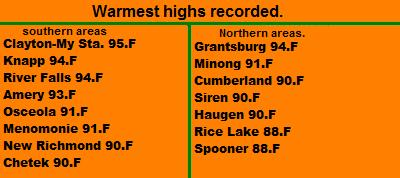
August 12th Storm CoverageSevere Weather again hit part of the area the 12
th, and 13
th as multiple lines of storms hit. during the 12
th, very strong damaging thunderstorms hit Burnett and
Washburn counties. This was part of a large bowing storm complex that hit parts of Minnesota, and move Northeast. Trees and power lines were reported down in the
Danbury,
Grantsburg area. The southern part of this line effected Polk County, My brother was staying
Centuria during this storm and mentioned the winds were very strong, so strong they blew doors open inside the house. When the storm was over he photographed two large trees that had been snapped off in
Centuria. This storm also had torrential flooding rains, and did cause some flooding near
Grantsburg. The southern extent of this storm hit my location and brought brief NW wind of 23MPH and moderate rain.
August 13th Storm Coverage

Backside of the final Thunderstorm August 13
th.
During the 13
th, the area was hit by 3 waves of rain. One came in the early morning hours, the other in the evening. These storms produced heavy rains, especially in the Polk, Barron, St
Croix and Dunn Counties. The storms that hit during the evening did cause some wind damage in Western and Northern Polk County in the Dresser,
Mikinley areas.
August 13th at my location.
Torrential Rains August 13th.
August 13th was very sleepless night for me as the NWS issued 2 watches and multiple warnings and flood warnings through out the night!
Torrential, Heavy rain hit during the the 13th. Earlier in the day around the 3AM hour I had received thunderstorms that produced a half inch of rain. so the ground was already saturated especially from last Tuesdays over an inch of rainfall. During the evening of the 13th, I was hit by two storms that brought heavy rain, both were severe warned and came one after another. The first one came with very heavy rain, breezy north winds behind the storm, and deadly lightning, I had one cloud to ground bolt that hit a mile or less away, and produced very loud piecing thunder. The second one which hit about 20 minutes after the first one brought heavy rain again, but this time gusty southwest winds. I had a reading of 23MPH on my newly raised wind gauge on the roof. by the time the day was over, I had 1.27" of rainfall, making the total for just this week at an outstanding 3.54"Which is well over half of August's normal rainfall!
Between Tuesday August 10th rain and Fridays rain, our driveway has some significant wash outs from rushing water. Some of the worst I've seen as we continue to have one of the wettest seasons we've had in a long time.

I even had standing water in the vegetable garden after the storms were over, a sign the the ground really is very saturated.
Storm Reports from August 12th
Siren, Multiple tree reported down throughout Burnett County
Danbury, Power lines down.
Minong, Trees Down in community
Centuria, two large trees down.
Storm Reports from the 13th
Hammond, Heavy Rain, Water overflowing the road
Dresser, Trees and power lines down in and around town
Mikinley, Numerous Trees Down


 Image from SPC
 Local View
 Soft Maple
 Shoreline Trees with lake


 I end my post with a beautiful photo of the sunset in Little Sand Bay, It was an awesome sunset, The island in the picture is Sand Island!


 Local View
 Local Weather View.


 Local View.
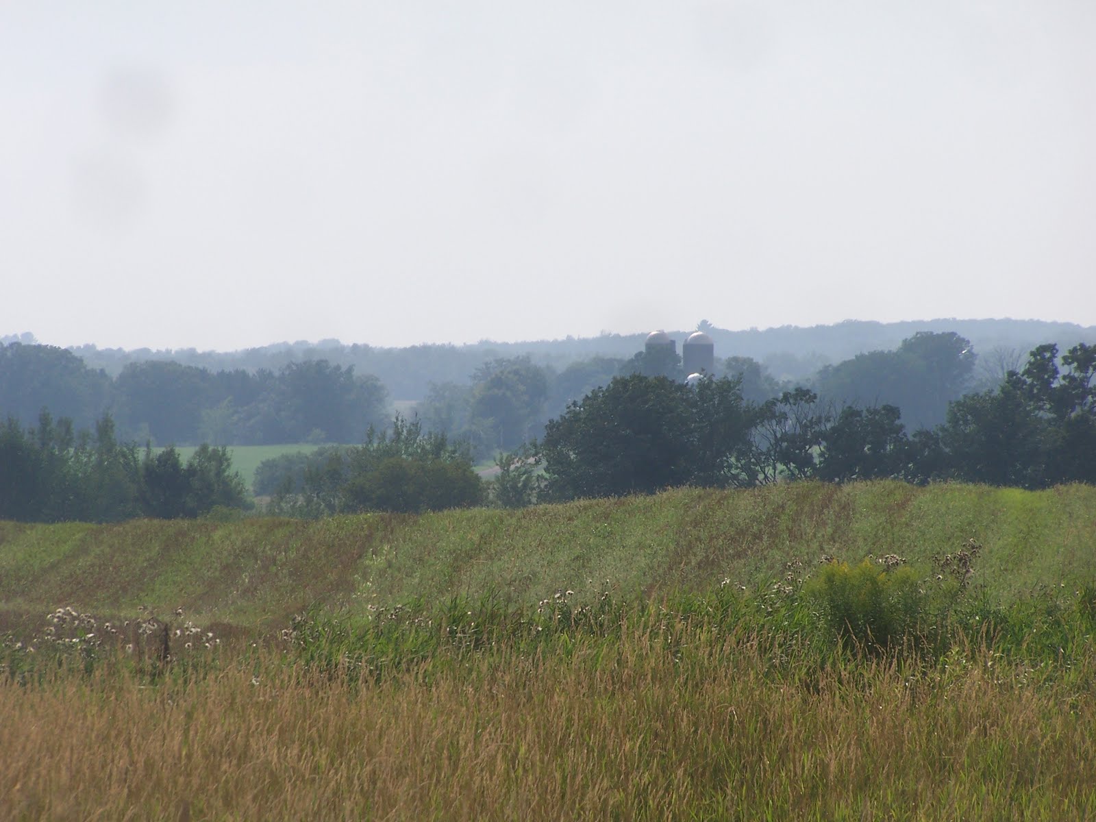


 Local View.
 The front of the Strong Storm that hit before it gave way to a heavy rain producing event.
 Standing water in fields on our land well after the heavy rains August 11

 Local View.


 Local View.
 Local View.