Map Image Legend Image

Iowa Weather Network Warnings Map

Iowa Weather Network Warnings Map

Winter Weather Advisory

Wednesday, March 30, 2011

Turning wetter for the end of the week, Rain/Snow, little or no accumulation. then much warmer for Saturday.

Regional weather view

After enjoying a week of sunshine, A wetter pattern is about to move into the central part of the Upper Midwest. A warm front and weak weather system will bring the threat of rain and snow to Minnesota and Wisconsin along with northern Iowa. Temperatures will be at least in the 40s across the region with 50s in Iowa. It will become considerably warmer and drier on Saturday.
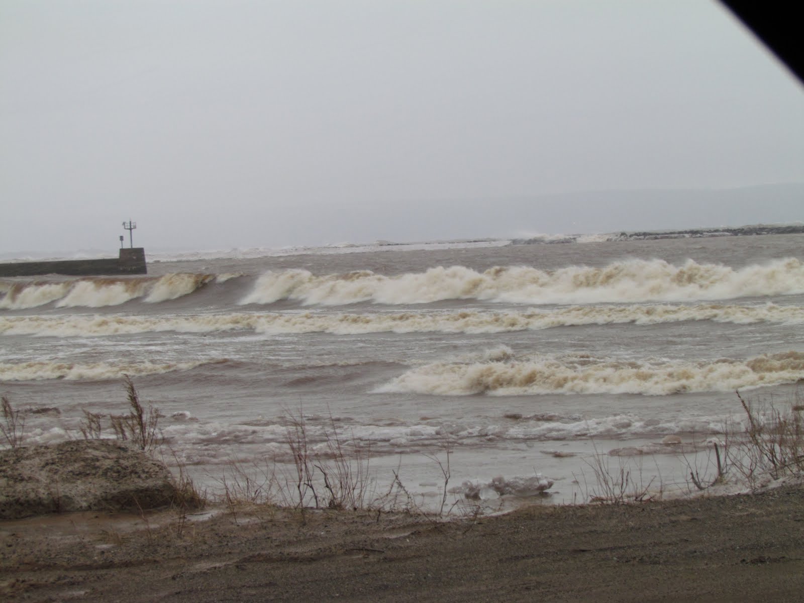

Local view

Locally, the dry pattern we've enjoyed will come to an end as a weather system brings the threat of rain and snow. Thursday could actually bring sunshine early, with Increasing clouds in the morning, then light rain or drizzle will develop. It will not be an all day or steady rain, just off an on type of rainfall. Highs on Thursday will be in the low 40s with the rain and drizzle. If the precip sticks around long enough into the evening hours it may turn to a few snow flurries as temps fall to near freezing. There will be little to no accumulation for snow, Lows on Thursday night will only fall off to the lower 30s. Friday will be cloudy and wet, there could still be some flurries or drizzle in the morning otherwise it will be cloudy, precip should end by 3pm, highs will be in the upper 30s, Friday night skies will begin to clear, lows will fall into the mid 20s. Saturday will be pleasant, and it will be our nicest day of the weekend! it will be partly cloudy with highs in the mid 40s, places that have snow less ground in southern St Croix county could even manage 50, lows Saturday night will be not to bad in the low 30s once again.

Thursday, Sunny early with increasing clouds then Mostly cloudy with light rain or drizzle likely, highs in the low 40s. Thursday Night, light drizzle or snow flurries, little snow accumulation expected. Lows in the low 30s.

Friday, Cool, Light flurries or drizzle in the morning otherwise cloudy. Highs in the upper 30s. Friday Night, Clearing skies with lows in the mid 20s.

Saturday, Nice and dry, Partly Cloudy with highs in the mid 40s Saturday night, Partly cloudy with lows in the low 30s.

Looking ahead

The main story in the looking ahead forecast is a strong storms system that will move across the Upper Midwest on Sunday and Monday, It has a low of potential to bring everything from heavy rain to sleet and heavy snow. It is far to early to tell what our area would get but it appears right now we are very close to the borderline of rain, sleet and snow. Behind this storm system on Tuesday it drys out, but really doesn't get cold behind it at all like our last system. In fact it warms up nicely by Friday April 8th. On April 9th it shows a large rain system passing us to the south leaving us dry. Then the models are pointing at a potential pattern shift to a warmer pattern for us, it shows a warm up by April the 11th, then a significant warm up on the 14th, This run keeps us fairly dry, with rain and storm chances moving in by the 15th. These models have been changing and this has been a very odd Winter and Spring so please check back often


Sunday, March 27, 2011

Warmer and dry weather finally on the way, 40s again by Tuesday or Wednesday.

Regional weather view.

It will be a quiet next 3 days in the Upper Midwest which is good news. There should be dry conditions across all areas accept maybe Iowa. The only issues that will be found are flood warnings in Minnesota and South and North Dakota. Warmer air will start to push east Monday.
Local View

Locally some much well deserved warmer conditions will be moving into our area. This will be the big story as we warm up more and more each day. A high pressure will keep away systems and keeps us dry, which is good news. Monday will still be chilly, but we should start to feel the effects of the warming trend we should have mostly sunny skies with highs reaching the middle to upper 30s and lows in the mid teens, with light Winds. Tuesday will be even warmer with partly cloudy skies and highs in the upper 30s to low 40s Tuesday night as a result of the warmer temps should only fall to the low 20s. Wednesday will be the warmest day out of the next 3, with highs in the low 40s, maybe even middle 40s if we can stay in the full sunshine long enough, it wont be a bad day to be outside at all! Wednesday night lows will fall to the mid 20s.

Monday, Chilly but warmer, Mostly sunny skies with high in the mid 30s, light winds. Monday Night partly cloudy lows in the mid teens.

Tuesday, Warmer, partly cloudy, light winds highs in the upper 30s to low 40s. Tuesday Night, Not as chilly, Partly cloudy with lows in the low 20s.

Wednesday, Partly cloudy to partly sunny, highs in the low to mid 40s. Wednesday Night, partly cloudy lows in the mid 20s

Looking Ahead

We have warmer weather to look foreword to in the long term forecast, Highs will represent more to what should be experienced this time of year and we should have at least a couple shots at 50 degrees on the weekend!Before we get that, On the leading edge of the warmest air, we could have a shot at some snow on Friday April 1st. Then the models are pointing at a potential significant system on Monday April 4th it puts a low pressures system through Minnesota, but we appear to be on the warm side, which means good rain chances, potentially heavy rain changing to snow- But this storm will have to be watched because it will be like the one last Tuesday, any slight track will mean the difference between little snow, or a lot. Snow accumulations right now look light. Behind that system cold air pours into the region, but only lasts a day or two. on April 7th we have a chance of rain or wet snow showers with warmer temperatures, then the models wants to keep cooler and wet as we approach Mid April. This will be changing be check back for updates. One thing that can be fore sure is the warm weather that is approaching for this weekend.

1st Spring flower of 2011! + southern foundation Daffodil update...Spring has still sprung dispite cold!

1st Spring flower of 2011 A Yellow Crocus

The 1st spring flower of 2011 has opened up in the bright sunshine along the southern side of the house foundation today, despite low temperatures in the single digits and low teens the past few nights. The only protection I've been providing are some old blankets laid gently over the top at night. My flowers did not come out unscathed from this cold snap. On March 22nd 23rd they were buried under 8 inches of snow without protection and a low of 8.F, I thought for sure they were done in for the year, but the sun quickly melted away the snow away from the house, and they looked well, so I began putting cover over them at night. This is not the earliest Crocus bloom I have even had on my property, last year I had Crocus blooming by March 24th, and the only reason for the early bloom this year is because I planted earlier blooming crocus. I also have white colored crocus and purple crocus which is near blooming on the same side of the house. It is just Yellow is known for being the earliest.

Daffodils March 27th

These daffodils have been progressing very nicely even with the cool sunshine we've had the past few days the south side of the house can warm up much warmer then anywhere else in my yard. To show an idea how much later they are this year. Last year this time, this same patch of daffodils was 2 days away from blooming, and this year they are only 2 inches tall and are not even close!

Another view of some daffodils down the line slightly.

I will admit it is odd having daffodils this tall with 8 inches of snow on the ground everywhere, but it is a nice reminder that Spring is still on the way! With a warm up expected in the next few days I'm sure these will be progressing even more. I say bring on spring and warmth, I am more then ready!

Saturday, March 26, 2011

Earth hour a sucess in Clayton, First earth hour city in the local area!


Video of images around Clayton,WI

Photos Above include: (1st- Clayton welcome/business sign, 2- Bergmann's greenhouse billboard 3- my backyard)

Earth hour was a success across the area the U.S as well as the local area! Many local area residents turned of there lights for one hour across the entire area to celebrate this global event for a cleaner more resourceful world. My community Clayton, became the first earth hour city in the area to join officially making the list on Friday March 25th Our community successfully completes turning off the lights. The welcome sign, a well known local landmark went dark, as well as the Bergmann's greenhouse billboard. My house, like for the past 3 years also went dark for the hour and I did everything by candlelight. I spent the evening talking with my family how in the old days, all they had were candles for light!

I really want to thank the Village of Clayton and it's city members for working with me to make this event possible in our town, I'd also like to thank a friend of mine Alan G. for helping me out with communication and I consider this event a huge success for our community, and it shows you do not have to be a large city to show you are thinking of a cleaner future!

Friday, March 25, 2011

Earth Hour is Tomorrow Saturday the 26th 8:30pm to 9:30pm!

Image from Earth hour.com

This is a post reminding everyone that Earth hour is tomorrow night at 8:30pm to 9:30pm. Supporters will turn off there lights to show support for earth and a cleaner more resourceful world, making there light switch there voting poll! I am not sure on actual numbers, but hundreds of people nation wide and will partake in this event, and thousands world wide. Many landmarks and large cities world wide will also be included.

Locally, at least 8 individuals will take part in this event, including 1 municipality. I am very happy to announce that after a year of talking to the village officials through emails, The village president and I have brought earth hour to the village of Clayton. Clayton will participate by turning off the Welcome sign flood lighting on the south side of town for the evening. Burgmanns greenhouse will also take part in this event by turning off it's billboard.

Please consider partaking in this ever growing event by turning off your lights Tomorrow night from 8:30pm to 9:30PM!

More on earth hour can be found below

Earth Hour home page

A list of national landmarks and cities and villages that will take part in this event can be found at

Earth Hour cities/landmarks list

Thursday, March 24, 2011

Lots of Sunshine next 3 days but chilly, No rain or snow. Clear and dry for Earth Hour!

Regional Weather View.

It will be cool and dry and quite for once region wide for most the Upper Midwest, with the only chance at precip being in Iowa where rain/snow is possible. Temperatures will be quite a bit cooler then last week with highs only making it into the mid 30s in MN/WI to the low 40s in Iowa.


Local view with Earth Hour Theme

Locally we can expect lots of clear skies and sunshine, but it will be chilly for this time of year because of the new snow cover. Although temperatures really wont feel bad with the strong sun and light winds and temps will be slowly moderating higher and higher each day. We can expect highs to make it to the low to mid 30s on Friday, with abundant sunshine all day. Lows Friday night will be very cool in the upper single digits. Saturday will be alot like Friday with lots of Sunshine to be found, highs will be in the mid 30s. Saturday Night FOR EARTH HOUR: There will be clear skies and chilly temperatures for earth hour and all of Saturday night, There will be no weather issues, expect lows in the upper single digits. Sunday will be warmer, highs will reach the mid to upper 30s under sunny skies and light winds. Lows Sunday Night will be in the low 10s. All in all not a bad weekend coming up!

Don't forget to sign up and turn off your lights for earth hour 2011 Saturday Night!

Friday, Chilly with Sunny Skies, highs in the low 30s. Friday Night, Cold, Clear skies with lows in the upper single digits.

Saturday, Chilly, Sunny skies and highs in the mid 30s. Saturday Night, Chilly with Clear skies for Earth Hour, and the rest of Saturday Night lows in the upper single digits.

Sunday, Warmer, Sunny skies with highs in the mid to upper 30s. Sunday Night, Clear skies, lows in the low 10s.

Looking ahead

Monday and Tuesday following the weekend look to continue to be a bit chilly and dry. It will be warmer then this week though. Then on Wednesday the models are picking on a potential snowstorm hitting Iowa and southern Minnesota, It does show it passing to the south of the local area, but with it being so close it will be something we will have to keep our eye on. I was well as many others are hoping it does not happen in our area. Behind that system it does not really get too cold, but it does get drier. Then it shows a warmer pattern with a chance at snow ahead of it on April 1st. Then warm air surges into the region we have a brief shot at 50s and 60s especially on April 5th! Then a very strong cold front moves down from Canada on April 6th and brings with a chance of rain turning to snow, with much colder temperatures, Then we remain in a chilly and wet pattern through the 9th of April.

Wednesday, March 23, 2011

March 23rd Spring Snowstorm- Superior,WI trip

March 24th 2011 storm-Superior Lighthouse on Wisconsin Point.

My and a friend of mine Dirk Miller of Dirks Forecasting Center, decided to take up a rare opportunity to see Lake Superior waves from a strong storms system that was expected to hit the area with strong winds and snow. I departed from Clayton Tuesday Morning when heavy sleet was falling, I reached Dirks house and left Rice Lake by noon, sleet was falling there as well, weather Conditions in terms of precip actually improved when we reached Superior, but the winds really picked up.

Lake Superior Waves

When we reached the lake, the winds were howling in the trees at Wisconsin point, and the waves were very large and crashing over the ice mounds! The winds I felt at the point were the strongest I've ever felt, It was very hard to stand up strait, and difficult to hear anyone talking! I had my hand held gauge and the wind was constantly over 30MPH, it was never under 30. The highest wind gust I measured was 42MPH, but I was not out very long before I had to go back to the truck to warm up because the wind was so cold I was numb with in a few minutes!


The most significant weather up in Superior the entire time was mostly the major wind that was going on, When I got home I found out the Sky Harbor Airport on the Minnesota side was reporting 56MPH gusts near the time we were at the point! Dirk, as well as many other people who visited Lake Superior that day said that they were the largest waves they had seen in many years, some said it was the largest waves then have ever seen, They were certainly the biggest I've ever seen!

I did attempt to get wind readings as best as I could, anytime we got near the water, the waves would crash up against the ice and it would sent pieces of ice way onto the shore, which in 30-40MPH winds feels quite painful, like someone throwing a snowball at you in full force!


This is a video of some of the waves at the shoreline, lots of water and ice can be seen splashing up, it was very difficult to hold the camera at a half we descent angle with out be pushed by the force of the wind!


Heavy Snow in Solon Springs,WI

There was nothing by flurries around the lake, and it did not really start snowing until we got just south of Superior, however when we got toward Solon Springs, the snow became heavy. The drive as we got through Minong and Spooner towards Rice Lake brought a snow that continued to slowly get more wet the further south we drive. By the time we left for Dirks house around 10pm it was snowing heavily with thunder and lightning, I attempted to get home to Clayton shortly after I arrived, but I only made it to his neighbors driveway before I knew I could not make it the 30 mile drive south. All in all it was an awesome trip and we made it safely home, and we were very care and knew safety was always first. I'm glad we took the risk, before it was quite a site to see!

Major spring snowstorm with high snowfall accumulations hits the area. Area wide bright lightning seen! Many car accidents, with lots of cancellations

A view from Wednesdays spring snowstorm March 24th 2011

Yet another strong storm system brought another major snow storm to parts of the local area in what seemed to be a never ending winter in Western Wisconsin! The storm brought with it everything from strong winds to blinding heavy snow and high snowfall accumulations, to sleet and heavy rain as the low pressure center tracked just to the areas south. The storm was strong enough that frequent thunder and lightning was seen area wide with the heavy snow and sleet bands. High impact travel issues were seen across the area especially early in the storm system when heavy sleet covered the roads. Many car accidents/slide offs were reported, I seen more then one significant car accident on Highway 63 between Clayton and Cumberland where the cops responded. One major accident that was reported was a large semi slide off the road and tipped over spilling it's contents onto the roadway on Highway 8 near Barron. Later in the storm system, many roads became impassible for the 3rd time this winter from heavy snow and blowing snow.
Heavy Sleet which accumulated on the lawn early in the storm system March 22nd

Before I left for Superior,WI with Dirk Miller from Rice Lake, the precip type was sleet at my location with the first band that rolled through during the morning hours. By late morning my dad reported it actually had turned to light rain/drizzle that lasted much of the day before the second wave, and the brunt of the storm hit during the late evening hours. Rain quickly turned back to sleet then eventually heavy snow with large flakes by 10PM. By this time a intense heavy band of snow was setting up right over much of the area, In this band there was very heavy snow falling and I saw more then one bright flash of lightning where I was stranded to ride out the storm in Rice Lake at Dirks Millers house. Shortly after I seen the lightning, my dad reported that at home there was lightning bright enough to light up the entire night sky, I have to say that was some of the most intense and frequent lightning I've ever seen in a snowstorm! At the same time that we were getting heavy snow with lightning, my brother was reporting just a plain old thunderstorms in River Falls!

Fallen pine branches from ice, snow and strong winds.

The wind is this storm was strong, gusting to near 40MPH at times, this with ice and heavy snow accumulation cause considerable pine tree branch damage. I came home to multiple branches large and small covering the lawn, some were 1 to 2 inches in diameter and were thrown quite a ways. Wind whipped heavy sleet, shredded pine needles, and I could see needles covering the snow all across the lawn from all our pine trees, even in spots far from any trees.

Locally Reported snowfall totals

By Wednesday evening my area received way more then I expected. After being nearly snow free with daffodils budding and crocus showing signs of color on Monday, I was blanketed by 8.50" of fresh, very wet and heavy snow, on top of a partly thawed ground.

The areas highest snowfall accumulation was 12 inches in Spooner and Sarona in Washburn counties. There was a sharp cut off in snowfall totals where more sleet and rain mixed in at St Croix county, most of this area only revived 2-5 inches!

Monday, March 21, 2011

Strong snowstorm expected to impact the area Tuesday and Wednesday, thunderstorms, heavy rain Tuesday changing to sleet and heavy snow is Wednesday.

Regional Weather View.

Attention is turned to a A very strong storm system will bring a huge variety of weather across the Upper Midwest Tuesday and Wednesday everything from snow, to thunderstorms will be seen. in Northern Minnesota and Wisconsin, A major snowstorm looks to potentially shape up, heavy snow, with highs snow accumulations appears likely, with Blizzard Conditions in the Duluth/Superior area, In Central Minnesota and Western Wisconsin, Everything from Thunderstorms and Rain to Sleet and snow will be possible for Minneapolis,MN to Eau Claire and Oshkosh,WI with Rain and Severe Thunderstorms likely in Iowa, where a fairly large severe weather outbreak is likely, for areas around Des Monies to Waterloo,IA Temperatures will be in the Low 70s in Iowa to the low 30s in Northern Minnesota.

Local View

Note- This storm is will be a very hard storm to forecast for, with all types of weather likely including significant snow. Any slight changes in the storms, even my 10 miles will significantly altered the weather.

The local in this snowstorm will be in a very messy spot, We have the paternal to receive everything from Thunderstorms to Heavy snow. A strong low pressure system will move from Nebraska into Iowa, as this happens, because we will be a the warm side of the system, the first part of this storm could come has heavy rain, even thunderstorms on Tuesday Morning through Tuesday afternoon High temperatures will be near 40 Some of the thunderstorms early Tuesday and in the afternoon Tuesday could be strong with pea sized hail. Tuesday Night cooler air will begin coming in, temperatures will be close to 32.F, Sleet and Snow should begin in Northern areas like Burnett and Washburn counties, eventually by Early Wednesday Morning temps should be in the upper 20s to 30.F and it will chance to Sleet, freezing, to snow, and some could be heavy. Thundersnow is possible, Winds will also be blowing near 30MPH at times on Wednesday, causing some drifting.

Strong Thunderstorms & Heavy Rain

As the system first started getting together early Tuesday Morning, a wave of Thunderstorms will heavy rain are possible, some of these storms could be strong and could have pea sized hail, maybe potentially larger, The best area to see strong thunderstorms and heavy rain will be South of Highway 8.

Major Snowfall Accumulations

Significant snowfall accumulations are likely, and it could be quite localized, with even traveling 10 miles will making a huge different in totals at your location. The highest accumulations will occur over Northern Burnett and Washburn counties communities such as Danbury and Minong will see major snowfall accumulations of 12+ inches are likely. The further south you go the more of the chance you will run into sleet and freezing rain. In Southern Burnett and Washburn counties places like Grantsburg, Siren and Spooner will get 8-10". Central and Southern areas will be the area most at question for snowfall totals, depending on how much warm air is still in place. 4-6" is possible in Rice Lake, Cumberland and Frederic, With significantly less in southern Polk/Barron and Northern St Croix/Dunn counties, here 2-3" is likely, with around 1" in St Croix and Dunn counties, where mostly rain will fall. All the snow with will fall will be very wet, as temperatures will be hovering right around 30.F, Trees and power lines could come down, especially in Burnett and Washburn counties. People in the local area should prepare for everything from strong thunderstorms and heavy rain, to a significant winter storm.

Tuesday, Thunderstorms with heavy rain early, then rain and possible thunderstorms in the afternoon. Some storms could be strong. Highs in the upper 30s. Tuesday Night, Cooler, Rain changing to sleet, freezing rain and snow, some snow could be heavy at times in the North. Lows in the low 30s.

Wednesday, Cold and breezy with snow or sleet in all areas, some snow will be heavy at times. Winds gusting to near 30MPH causing drifting. Highs in the low 30s Wednesday Night, Cold, Mostly Cloudy with lows in the upper 10s

Thursday, Cool, Clearing Skies, Sunny with highs in the mid 30s. Thursday Night, Cold, Clear Skies with lows in the low 10s.

Looking Ahead

The weekend following the storm looks like a cool one for Late March, and a system could bring us more wet snow on Saturday. Monday the 28th looks cold, highs may struggle to reach freezing. Then following into midweek looks slightly warmer, with a few chances at wet snow. Going into the first part of April it looks warmer, with a chance at rain or snow. Then I see a significant warm up by April 1st with a strong low pressure system that could bring heavy rain and thunderstorms. This week the models are showing a much cooler and snowier pattern for the rest of March, Which has been the trend the last few days, but anything could happen, This time of year weather is very changeable

Sunday, March 20, 2011

Dangerous lightning seen from 1st Thunderstorm of the season , Several fires reported from lightning, along with heavy downpours and small hail.


Video of some thunder from this afternoons storm.

The area was rocked by it's first thunderstorm of the season this afternoon, and it was a very loud one for the first. It brought with it very dangerous and frequent lightning with heavy downpours and small hail. Around 2:30PM showers developed around New Richmond and quickly developed into thunderstorms that moved northeast and followed just south of Highway 63 and weny from New Richmond to Clear Lake and Clayton to Rice Lake. I was quite surprised when I saw the small showers develop into storms, but what was most surprising was the amount of thunder and lightning it brought with it. I had several bright flashes of lightning with very loud thunder that happened at least 5 times. One bolt was strong enough that it rung our land line phone on it's hook, which was followed by a window rattling thunder. After the storm passed I heard fire sirens not too far away, and later my friend from the Turtle Lake fire department reported that there were 2 different lighting related fires, one in Turtle Lake an the other in Almena. The storm also dropped some heavy rain and pea sized hail at many locations in it's path, I picked up a quick 0.20" of rain in the storm that lasted about 15 minutes, bringing my total for the day to 0.37" of rain

Picture during the Thunderstorm March 20th

Some of what was interesting about this storm is it arrived while there was still substantial snowcover on the ground and the temperature at my location was in the upper 30s! It is actually quite rare to see thunderstorms with that frequent of lightning with still snow covering the ground. It would seem like this type of storm is more coming for the warm days of May rather then March! The heavy rain that came with it briefly lifted the fog, then after it ended, I could see fog billowing out of the woods and shaded areas.

Comparing this years 1st thunderstorm to last year

Comparing the first Thunderstorm date to 2010 you will not find that it is much later. Last year the first thunderstorm was seen at my location on March 12th, so this years first thunderstorm was about a week later then last year. March thunderstorms are not rare for the area, but they are more typical for our area in April.


Reports

Clayton, Pea sized hail with frequent dangerous lightning.

Turtle Lake, Lightning related fire.

Almena, Lightning related house fire

Rice Lake, pea sized hail frequent lightning

Saturday, March 19, 2011

Mild weather continuing rain showers and possible thunderstorms Sunday, and drier and warm for Monday then much cooler weather arrives by Tuesday.

Regional View.

A mild Spring-Like pattern continues, with warm temps, the threat for rain and even thunderstorms in Iowa. 70s will occur in Iowa, with upper 40s in most of Minnesota and Wisconsin. Flood issues from rising rivers in Minnesota and Wisconsin will continue as a result of significant snow pack melting.


Local view.

Locally we can expect a rainy wet Sunday, as a low pressure system moves Northeast. Rain showers and drizzle will be possible much of the day, and some of the showers could be moderate maybe even heavy at times, and I would not be surprised at all if a few thunderstorms developed. Rainfall amounts will be quite fair with this system up to quarter of an inch are possible in the heavier showers or storms. Temperatures with the rain will be in the upper 40s on Sunday. Monday will be mild and nice! We will end the chance of rain and instead bring in and warm dry conditions, highs should reach the low 50s under partly sunny skies. Clouds will increase late Monday ahead of our next cold front. Lows Monday night will be in the middle 30s. Tuesday will bring us a cool down. There will be a chance of light rain or snow showers with the passing of the cold front early otherwise it will be cloudy and breezy. There will be no snow accumulation, Highs will be in the upper 30s. Tuesday night will be our first night in awhile that will fall below freezing, be cloudy with lows in the upper 20s.

Flooding Issues.

Temperatures from Sunday Morning through Monday Night will be well above freezing even at night, these temps with up to a quarter inch of rain Sunday will melt whats left of the snow pack, especially in southern parts of the area. Minor flooding issues including, lowland flooding, field flooding and ditch flooding will continue to be possible. Also areas creeks and rivers will be high this week. if to live along area rivers and creeks watch for rising waters which may indicate a ice jam.

Sunday, Mild, Cloudy with scattered rain showers or thunderstorms, Rainfall amounts up to a quarter inch. Highs in the upper 40s. Sunday Night, Light drizzle, otherwise cloudy with lows in the upper 30s.

Monday, Nice, Mild! Partly Sunny with highs in the low 50s. Monday Night, Increasing clouds, lows in the mid 30s.

Tuesday, Much cooler, Cloudy and breezy with a chance of light rain or snow showers in the morning. No new snowfall accumulations. Highs in the upper 30s. Tuesday night, Mostly Cloudy with lows in the upper 20s.

Looking Ahead

The models appear to take a slightly more wintry turn. I am closely watching a storm system Wednesday, which has the potently to bring down enough cool air to bring significant wet snowfall accumulations to the local area. A lot can change but it is Worth keeping a close eye on. Behind it comes a cold push of air on Thursday, highs would struggle to reach above freezing. Friday looks slightly warmer, but still quite cool for March. Another chance at some snow arrives around the 28th of March, but with milder air. Then towards Thursday the very last day of March, I see continued cool weather with another chance at light snow. The good news for Spring-lovers, This cooler down is followed by a significant warm up by April 1st, which brings in much warmer temperatures and rain chances. We will have to see if we can avoid the last few snow chance before we go into a more stable spring pattern.

Friday, March 18, 2011

Forecast for Saturday Clayton vs State game!

Clayton basketball team has made it to state and is planning on playing in Madison this Saturday, many Clayton residents will be leaving town for the big play off, This is a forecast for this big event, and I wish all the best of luck for Clayton!


Clayton vs State game forecast

Go Clayton!

For Madison:

For fans driving or busing from Clayton, there will be no weather issues and it will be a very nice day. From here all the way to the State capital, driving conditions will be excellent with sunny skies! Highs in Madison for the game will be in the mid to upper 50s with sunshine lasting through the day, Increasing clouds will follow anyone driving home late with lows in the low 30s.

For Clayton:

Back and the teams hometown it will be Sunny and very nice as well, highs will reach the low to mid 50s. Increasing clouds Saturday night will follow this nice day, with lows also in the low 30s.

Thursdays temperature report, and late winter Daffodil progress.

Snowcover that has gone patchy in the

We had a very mild day yesterday across the area, 50s were reached at every reporting station, some places in the north had there first 50s of the year, and some places were lucky enough to see middle 50s! These temperatures were reached from a strong warm front that passed thought the night before, which allowed temperatures at night to have their first above 32.F readings of the season! My location had a low temp of 36.F. This took a huge bite out of the areas snowcover, most areas lost at least 3 inches on Thursday alone, The snowcover still counts as continuous in my book, meaning that it's still a relatively strong snowpack but it has gone down significantly. Fields have brown patches starting to show, and yards in the area have lots of grass spots. I believe with the warm days continuing it wont be long until the rest will be gone.

Here is another pictures of the front yard with my dog seen in the back round! The Grass can actually be seen here instead of being buried under 2 feet of snow. This is the most I've seen in the yard since November, and I sure have missed it!

Yesterdays high temperatures

Here is a list of high temperatures reached yesterday, the warmest reading was Baldwin at 56.F and the lowest, which was still very mild was 50.F which was reached at several locations.

This is a picture of the Daffodils and Crocus as of March 18th, they have really started greening up and growing, especially in the last 3 days. Both the Daffodils and Crocus have now reached the stage where they are showing flower buds! If it stays warm long enough, I may break my old 1st flower date, but only time will tell this happens or not!

Wednesday, March 16, 2011

Rain showers & warm end of the week into the weekend, multipal chances at 50.F

Regional Weather View

A very mild end to the week is on tap for the Upper Midwest. Very warm conditions will bring temperatures as warm as 70s are possible in Iowa. Further north Middle 50s could be reached for the first time in Southern Minnesota and southern 2 3rds of Wisconsin with low 40s more likely well off to the north. Flood Watches have been posted in Minnesota due to a significantly ripening deep snowpack over the region. The snowpack-line is expected to move well into Minnesota and Wisconsin the next few days. A weak system will bring a threat of rain showers to the region on Thursday, this mainly looks light, Setting up for a dry and mild weather will continue right through the weekend.


Local View.

Locally we can expect a very mild end to the week right into the weekend! I am continuing to believe that most of the areas 8 plus inch snow cover will be gone by weeks end, especially now that it is very ripe, Minor flood issues could occur with this, ditch and lowland field/swamp flooding could all occur this weekend. Thursday will bring to us partly sunny skies, with a chance of light rain showers in the afternoon, but none of this will be much to worry about with amounts coming up to a 10th of an inch or less. Before the showers Thursday afternoon I believe temperatures will make it to the middle 50s. This would be especially possible if we get more sun then clouds. Friday will be partly sunny and dry with highs in the low 50s, and lows in the low 30s. Saturday will be very nice, It will be a day everyone should get outside! We will have mostly sunny skies with dry conditions and, and I believe highs will again have the chance to reach the low to middle 50s once again, setting up for a very mild night in the upper 30s Saturday Night!

Thursday, Very Mild Partly sunny with a chance of light rain showers in the afternoon. Highs in the low mid 50s. Thursday Night, Mostly cloudy with lows in the low 30s.

Friday, Very Mild, Partly sunny, highs in the low 50s. Friday Night, Partly Cloudy with lows in the low 30s.

Saturday, Very Mild & Nice! Mostly Sunny with light winds and highs in the low to mid 50s Saturday Night, Mild lows in the mid 30s.


Looking Ahead

I am still watching Sunday as being the potential for a more significant rainfall event, Which is why I held from making a 4 day forecast. The models show a system bring rain showers to the area with maybe the treat for up to 3 quarters of an inch this will be something to watch as we progress through the week. The modems continue to show very mild temperatures lasting through the start of next week. With a another chances at a heavier rainfall even on Tuesday the 22nd. This comes with a cold front. It cools down slightly on Wednesday March 23rd but it shows us being dry by then limiting us any chances on snowfall. then towards the 26th of March the models a hinting at a very strong push of warm air from the west moving east, bringing a chance of light rain Saturday the 26th, then heavy rain on the 27th with warm temperatures, Following this system brings us a couple more chances at rain with cooler conditions, Overall the models are showing a more warm Spring-like rainy pattern through the rest of the month rather then a cool snowy one.

Sunday, March 13, 2011

Warmth here we come! very mild spring-like days ahead. Chance of rain showers Tuesday, then clearing and 50s by Wednesday.

Regional View

A huge turn around is in the cards for the Upper Midwest. Instead of dodging snowstorms, a very mild air mass is heading towards the Upper Midwest this week. Starting Monday highs will be in the 40s and 50s region wide, with highs approaching the 50s as far north as Minnesota and Wisconsin by Wednesday. The only precip that will be found will be on Tuesday with a chance of rain showers south and snow showers here or there. River flooding is expected to increase region wide this week from a melting snow pack brought on by the warmth.


Local View.

Locally the big story is the very mild and long lasting spring-like air mass that is about to move in. This warm up with start with highs in the 40s on Monday, but as early as Wednesday highs topping the 50s will be possible. Our big warm up starts Monday, I expect sunny skies, and with the sun, highs it will reach the low 40s. With lows only falling into the upper 20s. Tuesday will be even warmer as a warm front approaches, Highs will be in the mid 40s. It will be partly sunny at first, with a chance of light rain showers increasing in the afternoon. Lows Tuesday Night will not even fall below 30.F. Then Wednesday comes the warmest of the next 3, dry conditions with clearing skies will allow for a very nice day. Under sunny skies, I expect highs in the lower 50s Wednesday, with even the chance of a few middle 50s if we can get full sun all day! This will set the stage for very mild nights in the upper 30s to low 40s, This will likely be our first night above 32.F of the year.

Snow melt Expected.

I expect a significant decrease in the area snowpack with this warm up. I believe over half of the the snowpack covering the area will melt with this warm up, because most of the areas snowpack has at least 3 inches of water content, a few minor flooding issues may arise over the next 3 days. Minor issues such as ditch flooding and yard flooding will occur. Ice clogged storm drains may also cause temporary street flooding. River flooding may become an issue in the days/weeks following this, For the latest information of River flood forecast please visit the NWS link here.

Monday, Sunshine with light winds. Highs in the low 40s. Monday Night, Increasing clouds, lows in the upper 20s.

Tuesday, Partly sunny with a chance of a few light rain showers in the afternoon. Highs in the mid 40s Tuesday Night, a chance of rain showers early, then clearing. Lows in the low 30s.

Wednesday, Very Nice! Sunny with light winds and highs in the low to mid 50s. Wednesday night, very mild, increasing clouds with lows in the low 40s to upper 30s.

Looking Ahead

The long range models show the very mild airmass continuing right into Thursday, 50s for highs may happen once again. Then early Friday morning a cold front goes through bringing rain showers, with cooler, but not cold air behind it. A system brings mild air back with it by Sunday 20th, It shows that rain is possible, potentially heavy rain by the looks of this model. Thunderstorms also look possible, with a cold front on the back side of the system bringing cooler air with snow showers by Monday the 21st. Then it appears like we stay in a bit and drier cooler pattern for the rest of that week through Friday. Then by Saturday the models try to put the treat of a snowstorm just to the local areas south. While at the same time mild air builds back out west and appears like it could move east.

Thursday, March 10, 2011

Mild Friday highs in the mid 40s with sun, then much cooler and windy with wind driven snow for Saturday.

Regional weather view

Most of the area will be getting a healthy dose of Spring-like weather Friday as a system moves over northern Minnesota. Under mostly sunny skies highs will reach the low 60s in snow less areas of Iowa, to the middle 40s over Central MN/Wisconsin. Upper 30s will be more common across Northern Minnesota. These temperatures wont last long as the cold front behind this system brings in much cooler and very windy conditions. Wind driven snow showers are likely as well especially across Northern Minnesota where minor accumulations are possible. There may actually be some rain showers in southern Minnesota and Wisconsin before it chances to snow
Local View.


Locally we can expect a nice Friday ahead. Depending on morning fog, we have to potential to reach to near 50.F tomorrow, but only if morning fog/clouds clears off early enough. I have a feeling we will have sun at least most of the day so I'm going with middle 40s. If clouds no now clear otherwise low 40s is likely. Either way it will be mild and breezy, then towards evening we will get increasing clouds with the treat of developing light rain showers late. Rain would be totals light if any. Then early Saturday morning, Behind the front winds will switch northwest and become strong gusting to 40MPH at times, Temperature will drop and light snow will develop making for wind driven light snow early in the day, accumulations will be light but will be blowing around. Highs on Saturday will only be in the low 30s and it will feel even colder with cold wind chills. Then Saturday night will be quite cool with partly cloudy skies, lows will fall to the low teens, with a few upper single digits possible. Sunday should redound a bit in tempetures ahead of our next warm up and it will be much less windy. Highs should make the low to mid 30s with partly sunny skies, lows will be in the upper teens.


Friday, Mild, Cloudy with fog early then becoming sunny. Highs in the mid 40s. Friday Night, Increasing clouds with light rain developing late. Lows in the low 30s.


Saturday, Much cooler and windy with wind driven light snow and chilly wind chills. Winds gusting to 40MPH at times, light accumulation aronnd 1 inch or less, highs in the low 30s. Saturday Night partly cloudy with lows in the low 10s.


Sunday, Partly sunny, and less windy, highs in the mid 30s. Sunday Night, Cloudy with lows in the upper teens.


Looking ahead


Forecast attention is still focus towards a significant warm up which now looks likely in our cards for next week. We will be getting a very good dose of Spring-Like weather Starting Monday and lasting much of next week. We have the potential to reach 50.F more then 1 time, and we may even has a small outside chance chance at seeing 60.F. Not only do I see this significant warm up I see a good chance at rain by Wednesday the 16th. This significant warm up will likely allow for a very large decrease in the areas, very hefty snow pack, some flooding issues may begin to occur by Friday, depending upon how much snow we loose. I see a brief cool down Friday the 18th with a chance at light snow, then another chance of snow the 21st, temperatures appear fair during that time. Then towards the very end of the model it shows a very strong storm system passing well to our northwest, bringing in a even stronger warm up with it. This storm almost has a spring-time look to it in our area with the threat of heavy rain and even Thunderstorms appear possible in that system. I also notice the winds look fairly strong on the low, Behind it cooler conditions follow. The models have made

Late winter- south side of the house Daffodil growth. Later or earlier then last year?

South side of house grass.

Today the Daffodils which sprouted on the south side of my house in the February 50.F warm-up got to enjoy there first March sun after being under snow for weeks. As per usual the famous south sunny side of my house is proving to be warm spot, the snow has already long melted from the house exposing grass. Even when we got 1 inch of snow yesterday it had no problem melting off quickly there.


Daffodil sprouts March 10th 2011

The strong March sun proved it's self today. Grass patches in areas that were very wind whipped in the late February snowstorm are getting larger each day, but we have a long ways to go before we see any significant grass because there are spots in the yard with 3 feet deep drifts, but still with the grass patches and warm sun, the feeling of Spring was in the air!
Underground warmth taller daffodils March 10th 2011

This new addition patch of daffodils I added last year at the very end of the garden are oddly twice as tall as the rest of the ones sprouting on the same side of the house. I couldn't figure out why until I stuck my shovel into the ground, when I did there was no frost in the ground at all, which was odd to me because the rest of the south side had at least a thin layer of frost to about 1 inch. What I believe caused this is something warm, like the hot water pipes to our wood stove must go near this spot, because it is the only spot that had no frost. The spotter was literally only about a foot or two wide with an abrupt end on all sides, one way to see this difference is the sprouting daffodils on the right side of the picture are smaller because that's where there was frost in the soil the longest, the daffodils continue to get smaller as you continue to go even more to the right of those ones. If these will flower this year, I would suspect I should see a flower bud fairly soon!


Everyone should remember this patch from last year! This is the same bunch of daffodils that I found sitting in a pot party buried in the ground last February. I was happy to see these sprouting again, hopefully to provide a nice show in the next couple months!

Comparing these daffodils to last year I found that in height they are much further behind this year, which was expected, but in the date they sprouted was actually 2 days earlier then last year due to our February thaw. I will be watching closely to the Souths side this year because with the planting of new even earlier kinds flowering bulbs last fall, any significant warm ups could break my earliest date for a spring flower bloom, especially those daffodils that are twice as tall as the others!

Tuesday, March 8, 2011

Birthday Post and annoucement.

Myself on my 20th Birthday March 8th 2011

Well the big two zero, I just turned 20 and I'm to the age where I don't want to go back but I wouldn't mind it if the age clock stopped either! Every year on my birthday I always take the time to write a little about my past and how my interests came to be. This year instead of writing about my past, I would like to write about what I'm planning on in the future.

I've always had a huge interest in both meteorology and horticulture my entire life, but just recently I had to make a choice in what I wanted to peruse in for a career. I've decided that meteorology would be a bit too difficult for me to study because it takes quite a lot of knowledge to pass. So I've decided I want to take my interest in plants and further my education on them, as everyone knows I've been interested in horticulture for a long time and I remember planting my first plant outside when I was half as tall as the shovel! My many years of interest and knowledge this subject is why I've been looking to further my education in it.

I'm still working very hard on my HS-GED, and after more then a year of work I am getting very close to passing. After looking at potential collages for horticulture from as close right here in Wisconsin to as far away as Alabama. I've decided after I get my diploma, I will for sure be going to Rochester community collage in Rochester,Minnesota. There they have a 2 year degree class which offers studies to get careers in landscaping, tree care, greenhouse management, and golf course management. I've wanted to work in a greenhouse for as long as I can remember, and I would love to become a professional in tree care. So I've decided this class will be perfect for me!

During the time I take this class I will be moving to a family members house in Rochester Minnesota for a few years, the only question is when. The class starts in August, but recently I've been given the idea that I could move down there for summer work, and begin working before classes start. So if I can not find any greenhouse work anywhere around where I live now, I may go down and try to find it down there. I've already begun calling local greenhouses for jobs, and if I find a job there, I would likely be moving to Rochester shortly after I finish my HS-GED, which will be in the next month or two. After I get my diploma from Rochester Community collage I am hoping to get a long term career in greenhouse work, landscaping, tree care, or even all three!

I would like to mention, even though I plan on perusing an education and a career in horticulture, I will never loose interest in following the weather, it will always be close to me, and It will be something I can never stop loving, as mother nature can be sometimes predicable to extremely un forgiving and just awesome, and I really think keeping a high interest in weather will actually really help the other, since weather can greatly effect plants! When I move, I plan to take a new spotter class down there so I can continue to be an official spotter for the NWS and report severe weather and snowfall reports. I will also be sure to have a weather station set up and I will be keeping all the weather records I do here currently at home, I even hope to do a little storm chasing in the summer while I'm there!

Announcement

I'm sure many people have been awaiting my decision on what I will be doing with my blog. Although I'm still open to ideas and changes in my plan, I think I've decided I will likely be transferring this blog to cover weather in a few counties in southeastern Minnesota, I would do exactly what I do now with reports and pictures, I will also do the same as I do now with taking pictures from my new location and writing stories from my point of view in weather, and depending on how much time I have, I may even do some forecasting! Also with the changes would also likely be a blog name change.

It's also important for me to mention I will be providing full coverage to Western Wisconsin like I have been the past years, until right before I move. I will make an official announcement letting everyone know when I make the change and move to Rochester.

Thanks to anyone who took the time to learn about my future, I know I am very excited to get started in collage and to try living in a new community, but at the same time I will never forget my hometown and where I came from!

Blog owner,
Derek McKay

Monday, March 7, 2011

Modeate snow with significant accumulations possible in parts of the area Tuesday Night/Wednesday. The looking sunny and warmer for Thurs.

Regional View

A Winter Storm is set to impact much of the Upper Midwest this week as a low pressure system moves northeast from Kansas into Iowa, then Wisconsin. This looks to set the heaviest snow of at least 6 inches in Northern and Western Iowa, Southeastern Minnesota, Central Wisconsin and the Eastern Upper Peninsula of Michigan. Rain and more sleet will be found south, and minor accumulations will be found north of that area. The good news is there wont be much cold air to be found behind it, in fact temperatures will be above freezing after the passing of the storm.

Local View

Note: This storm has been extremely tricky to forecast for, it has going over 50 miles swings in the potential track over the past week, It is showing more stability but I don't want to rule out the treat of a change in the track at last minute. Which would significantly effect totals. A slight trend north would bring more snow, and a trend south, much less, either way right now it appears the heaviest snow and the highest totals will remain mostly south east of the my blog coverage area.

Tomorrow ahead of the storm will actually seasonal temperatures in the middle to upper 30s with cloudy skies. It will actually feel warm to many people. There could be some light snow or drizzle through out parts of the day, but the heavier snow should not develop until Tuesday Night. Tuesday Night winds will increase out of the Northeast, and light snow should develop, quickly becoming moderate, and could become heavy in far southeastern parts of the area, in places like Menomonie or Elk Mound. some blowing and drifting will be possible as winds gust to 30MPH. Light snow will likely last much of the first half on Wednesday before tapering, but Temperatures will not cool off like originally thought, instead it will stay in the low 30s on Wednesday which is still a bit cool for this time of year. Thursday will likely bring us a much better day, with increasing sunshine and highs in the mid to upper 30s, and lows in the 20s.

Snowfall Accumulations

With the current track of this storm, it looks likely that the highest accumulations will be in far southern parts of the area in or near southern Dunn county. 3-5" looks like the the bet so far for communities such as Menomonie Downsville and Elk Mound. Farther north and west 2-3" will be more common for cities such as Rice Lake, Amery, New Richmond and Hudson. Northwest of here even less 1-3" for Northwest Polk and Burnett counties, It is very possible there will be a sharp cut off in the highest amounts some places in Burnett County may see nothing but a few flurries.

Tuesday, Cloudy, light snow or drizzle at times with highs in the upper 30s Tuesday Night, turning breezy, with light snow developing quickly becoming moderate to possibly heavy at times in southern areas. lows in the low 20s

Wednesday, Windy and cooler with light to moderate snow and blowing and drifting snow. Snow will taper in the afternoon, highs in the low 30s Total accumulations 3-5" Southeastern areas to 1-3" Central and northern areas. Wednesday Night, cloudy and breezy with lows in the low 20s to upper 10s

Thursday, Warmer with clearing skies and highs in the middle to upper 30s Thursday Night, Partly cloudy with lows in the lower 20s

Looking ahead

This week the long range forecasts are actually looking a bit better with temperatures, This model says we may even be flirting with our first March 40.F temp by Friday, but then on Saturday a system wants to trys to develop which could give us of appears to be rain turning to snow, cooler air follows the system. Then by Monday the 14th through Wednesday the 16th, the models are picking up on what could be our first more significant spring-like warm ups, I don't want to get anyone excited but a stretch of 40s would surely be possible, at the same time towards the later end of the warm up on the 15th a system gets it's act together, but in time for us to be on the warm side, Rain changing to snow would be likely with this turn out. A brief cool down and drier conditions follow on the 17th. Then on the 18th warmer air moves back in, followed by colder air and snow chances once again by the 19th. The 20th the first day of Calender Spring the models show us being dry and cool as a large snowstorm passes just to the south. At the very end of the model run it shows warmth building in the Western U.S while we remain a bit cool. All in all this long range is looking a bit better for anyone looking towards a more Spring-Like pattern although this one still shows us quite active through the 20th