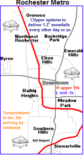
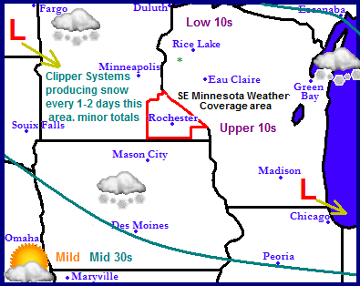
Continued active pattern at least for the northern part of the Upper Midwest as several clipper systems move in from the northwest each bringing minor accumulations to the areas in blue above. The clipper systems track looks to shift northward with the passing of each one so the southern portion of the areas highlighted above will see less snow. Temperatures will slowly become mild as warmer temperatures move in from the southwest. Highs will be in the 20s north 30s central and 40s south region wide.
 Local and Metro views
Note: Forecast has been updated for tonight's system. Only the local view map has been updated.
Clipper System Parade for Southern Minnesota.
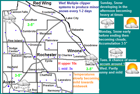
System Tonight: next storm arrives one Sunday Night and will be our biggest system of this "clipper system parade" Snow will begin late this afternoon and into night and will be heavy at times, but little wind is expected with it. Accumulations will be 3-5" throughout the entire area. Snow will end Monday Morning. The next clipper arrives Monday night and Tuesday, As mentioned above the stormtrack will shift northward slowly through the week so the northeastern part of the area will have the potienal for the most accumulation and the snowfall amounts with each passing system will become less and less as each one moves through. The models indicate we have the potienal to pick up 2" in the southwestern part of the area over then next 5 days to 5" over the northeastern part of the area over the next 5 days. These snowfalls should not cause too much in the way of delays. Temperatures will be on a warming trend and will start off cold with highs in the upper 10s on Saturday then warm to the upper 20s to lower 30s come Wednesday. Lows will start off in the single digits then warm to the 10s
Sunday, Gusty winds and colder with snow developing late with cold wind chills. Highs in the mid 10s. Winds gusting to 25MPH early Sunday Night, snow, moderate heavy at times. Lows in the low 10s
Monday, A chance of snow early then ending, system total accumulation 3-5" Warmer Mostly cloudy in the afternoon Highs in the low to mid 20s. Monday Night, A chance of snow, cloudy with lows in the mid 10s.
Tuesday, A chance of snow. Accumulations 1-2" Highs in the upper 20s Tuesday Night, Mostly Cloudy with lows in the middle 10s
Wednesday, Partly sunny skies, highs in the lower 30s. Wednesday Night, Cloudy skies, lows in the upper 10s to lower 20s
Looking Ahead-Not updated
The end of the week looks dry and seasonable to maybe slightly mild. Saturday and Sunday the 9/10th is our next chance of precipitation as a system to our south moves in. Right now it looks to start off as maybe freezing rain or sleet then move then change over to snow. Might be enough to call it a winter storm but the bulk of the accumulations at this point to to be south and east of our area. It does bring in much colder temperatures behind it for the start of the work week the 11th, but it doesn't stay cold for long temperatures warm up to seasonable levels as we enter a drier pattern for the middle part of that week which lasts through to the end. The models are hinting at a big warm up on Saturday the 16th with dry conditions and pleasant temperatures that last through Sunday the 17th but it is so far away it might as well be consider a figment of the models imagination.


No comments:
Post a Comment