Map Image Legend Image

Iowa Weather Network Warnings Map

Iowa Weather Network Warnings Map

Winter Weather Advisory

Sunday, August 31, 2014

Severe weather threats today

 photo day1probotlk_1200_wind_zpsa57ddf7e.gif
Image from SPC

The SPC has issued a Slight Risk for severe storms for parts of Wisconsin, Minnesota, Iowa, Nebraska, Missouri, Kansas and South Dakota. This includes our area. There is an enhanced risk centers over Iowa, Nebraska and Kansas as well as southwest Minnesota. Depending on what happens with the current showers in Nebraska and Kansas, The storms this evening will fire over eastern Nebraska and Kansas and moved east this evening. As the storms fire there will be a risk for tornadoes. Storms will move east and transition into a line and move towards the local area likely around dusk or after dark. In our area in poses the highest risk for high winds and large hail, as well as very heavy rain and flooding. Isolated tornadoes will also be possible. Many of the local forecast models I looked at point towards Northern parts of the areas such as Ames have a higher risk for seeing severe weather. Please be aware today that there will be the risk for severe weather.

Friday, August 29, 2014

August 28th heavy rainfall event, flash flooding and river flooding reported. August now more then double the average rainfall

 photo IMG_20140828_101836_744_zps20f4cdb0.jpg
Low hanging fog covers Downtown Des Moines August 28th 2014

What a wet month this is turning out to be, more bouts of heavy rain impacted central Iowa yesterday, first in the morning, and then again in the evening hours. The morning storms brought half inch to an inch. The photo above was taken in Downtown Des Moines as a low cloud deck was set in. The tops of the 801 grand building and the wells Fargo building was not visible. Both bouts of rain are thanks to a frontal boundary that has been draped over Iowa for the past week. The night time storms brought the heaviest amounts of rain. Flash flooding was reported in Ames and Des Moines metro area. Lightning was also very intense and frequent. Amounts were widespread and ranged from 2-3" to as much as just under 4" in Dallas and Polk Counties. Des Moines international airport broke a record daily rainfall record for August 28th.

For Des Moines at my station say 3.07" bringing the monthly total to 8.14" which is nearly double the normal rain.

Rainfall totals for August 28th

 Adel 3.96"
 West Des Moines 3.60"
 Polk City 3.57"
Windsor Heights 3.49"
 Ames 3.29"
Norwalk 3.19"
Fairmount Park Des Moines 3.07"
 Earlham 3.06"
 Urbandale 3.00"
 Winterset 3.00"
Ankeny 2.89"
Newton 2.83"
 Bondurant 2.68"
Madrid 2.35"
Johnston 2.35"
Clive 2.27"

Monday, August 25, 2014

August 25th High temperaure report. Lower to mid 90s seen, Highest temps so far this season

 photo IMG_20140824_160822_148_zps73298bae.jpg
Clear skies in a hot day, August 25th 2014

Yesterday and today brought very hot weather and high humidity to southern Iowa as a warm front lingered and eventually passed north of our area drawing in the heat. Highs were in the lower to middle 90s for about 4-5 days and dewpoints were in the middle to upper 70s each day producing heat index values over 100. The highest dewpoint for Des Moines was 79.F, which is normal for Florida. The highest temperatures were found in the Des Moines metro area where urban heat island brought the temperature up. These type of warm ups are not anything new to our area, in fact it is normal for this region and actually we have seen a below average number of these days. Des Moines averages one 100.F a year which we have not yet seen.  Our heat wave was a part of a much larger heat wave that brought upper 90s and 100s to places like Nebraska and Kansas. Nearby Kansas City hit 99.F during this heat wave.


Highs Sunday

Fairmount Park neighborhood ( My Station) 95.F
 Urbandale 95.F
Des Moines international 93.F
 Pella 93.F
 Indianola 93.F
Ankeny 91.F
Ames 91.F
Marshalltown 90.F
Newton 90.F
Knoxville 90.F
 Boone 90.F
Perry 89.F

Thursday, August 21, 2014

August 20th storms cause flooding and dangerous lightning


Video of some of the lightning seen August 20th 2014 Yesterday during the early morning hours, several thunderstorms developed along a stationary front that was trying to push through the area. The first storms formed around 5am and then after that, waves of thunderstorms developed on this front through the mid morning hours. flooding was seen especially in the Southewest metro area where 3-5" of rain was seen in parts of West Des Moines, Cumming and Norwalk. Lightning was vivid and extreamlly dangerous and close where thunderstorms developed, and heavy rain lead to flash flooding in some areas. The most intense band of rain was centered in a very isolated area from near Dexter to Cumming and Norwalk in the SW side of the Des Moines metro. Traffic was backed up for miles on 235, 35 and even the Highway 5 bypass as the heavy storms pushed through during morning rushhour. So far at least 1 report has over 5" that fell in Cumming and other report of 3.20" that fell in Earlham. 1.47" was reported at Des Moines international airport. In my raingauge about 2 miles ENE of Downtown Des Moines in the Fairmount Park neighborhood. 0.41" fell.

Monday, August 18, 2014

Slight risk today


Slight risk

The SPC has issued a slight risk for severe weather today across much of central and northern Iowa. This risk mainly includes the risk for hail and high winds, however like yesterday a slight risk of a weak tornado is possible. Stroms will develop this afternoon and evening. 


Wednesday, August 6, 2014

Much needed rain across Southern Iowa. Rainfall totals topped 2" in some areas

 photo IMG_7566_zps61be1a3f.jpg
Raindrops on a Elephant ear plant August 6th 2014

A stationary front is to thank for bringing the resent rainfall across southern Iowa late last night and this afternoon. The rain was needed to continue to add moisture to lawns and crops after a warm and fairly dry end to July and start to August. Even more added news is the rain was not extensively heavy and much of it soaked into the ground. It's been over a month since the parts of the area have seen 1+ rainfall totals. Below is a list of what was seen last night up until this evening at 8:00pm.

 Waukee 2.51"
 Windsor Heights 2.43"
Perry 2.17"
 West Des Moines 1.88"
 Des Moines, Fairmount Park- My Station. 1.83"
Des Moines international 1.61"
Johnston 1.44"
Ankeny 1.29"
Boone 1.16"
 Ames 1.08"
 Spring Hill 1.05"
Polk City 1.04"
 Story City 1.00"
 Prairie City 0.85"
Winterset 0.81"
Knoxville 0.68"
Newton 0.59"
Pella 0.42"
Marshalltown 0.39"

Friday, August 1, 2014

Dry weather setting in- is it really time to start watering?

 photo IMG_20140731_194209_374_zpse37cc8b9.jpg
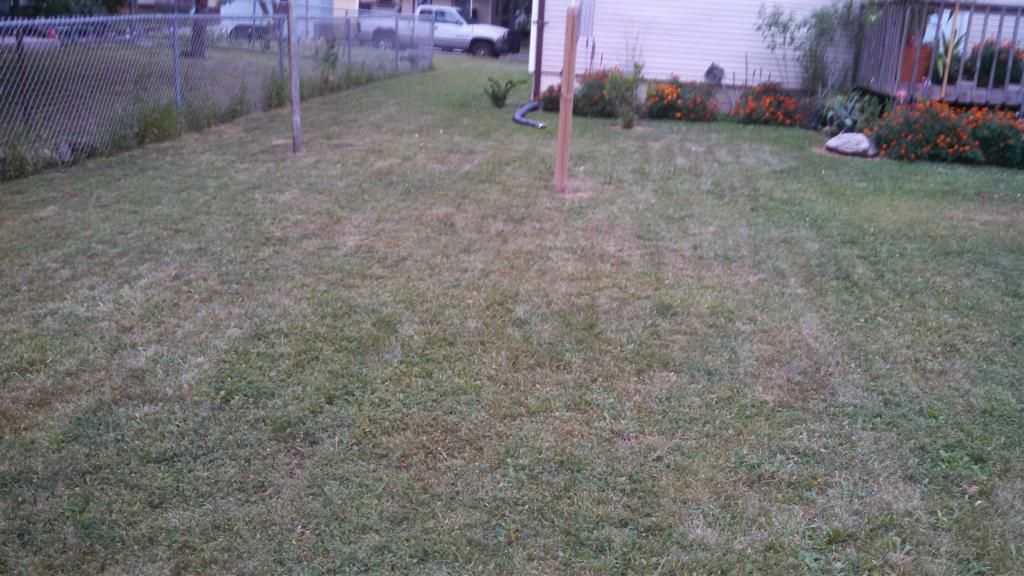
Grass turning dormant August 1st 2014

 June was very wet with 9.16" of rain falling in Des Moines, 4.22" above normal. Flooding was an issue at that time, but now, the weather has turned warm in the 80s and its been dry, gardens are really starting to dry out. Looking at precipitation July ended the month 2.58" of rain below normal. I've noticed grass in sunny areas is turning brown fast. So I know with this people will soon be wondering, when is it REALLY time to water the landscaping? Water is a precious resource wither we know it or not.  It may not always be so readily avaible, so we need to think of ways to conserve water. So at what point does the landscaping dry out that it really threatens the condition of the plants? Follow these steps of conserve water and care for plants.

 Lawns:
I'd like to start with grass. Grass is an amazing plant, it withstands everything from wet, dry, to being drove and stepped on and it will still thrive!  When grass starts to dry out, it naturally turns brown, but it is very important to note this does not mean its dead! That is grasses natural mechanism that it uses when conditions are not right for growth. It will turn green again once rains have returned. This is why when my lawn turns brown, I let it go dormant and save the water for veggies and flowers.

Established plants & trees

Landscaping such as perennials,  shrubs and trees that have been in place for years do not yet need to be watered. These plants are established and are accumulated to periods of drought. Watering these plants will actually cause them to loose this tolerance and its ability to withstand drought and dry weather, so leave these dry for now.

Newly planted plants & trees

Landscaping thats has just been installed this year or late last year will need to be watered in order to stay healthy. These plants need about 1" of water per week. Or about 1 to 1/2 gallons per plants. 3-4 gallons for trees per week. Of course this watering scheduled depends on temperatures and level of clouds and even if the plants are mulched or not. Mulched gardens and trees need water less often. If you are un sure, stick your finger way down into the soil and if it feels wet, leave it dry out and check in the next day or so.

Pots and containers

Potted flowers MUST have water or they will not survive. Plants which have root bound roots  and have small pots will need water every day or every other day when its warm, less which its cloudy or cooler. Check the moisture level using your finger.