I am very excited to announce I will be moving to Eastern Iowa and I will be moving to the Cedar Rapids area. After visiting the city twice I've come to really like this area. I will be living in a Cedar Rapids Suburb
called Hiawatha. I have been offered a job at the areas largest
garden center, which is my primary reason for moving. I will be working on the
landscape crew there for the rest of the growing season this
year, then next year to learn that side then I would be put into my
ideal position in their retail garden center next year full time, where I will be offering consultation and customer service. I did learn that there is the potienal for a long term career at this company.
Now that I have plans to move and have finally landed what will very likely eventually will become my ideal job ( or at least the right path), I will make preparations to re open the blog covering weather and garden for the Cedar Rapids area I will do this once I have settled into my new home and my new job.
Thankyou for all your long awaited patience
Blog owner
Derek McKay


Iowa Weather Network Warnings Map

Winter Weather Advisory
Wednesday, July 31, 2013
Thursday, July 18, 2013
Blog closed until further notice.
I am announcing that I am am officially shutting down my blog until further notice. Sudden life changes have required me to move out of Cresco and I will be moving to a new area. After everything in my life gets settled in a new area once again I will begin posting. My blog will likely begin to reflect more my horticultural side in the long term future.
Please bare with me during this difficult time
Thanks,
Blog owner
Derek McKay
Please bare with me during this difficult time
Thanks,
Blog owner
Derek McKay
Thursday, July 4, 2013
4th of July weekend forecast. Sunny and pleasent through Saturday, next chance of storms Sunday

Regional weather view
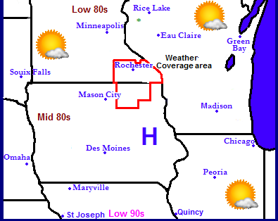
For the 4th of July weekend we can expect a continuation of the pleasant weather we have been having over the past week. High pressure seen in the map above has been in control of our weather and will continue to be in control. For Southeastern Minnesota and Northeast Iowa we can expect Thursday through Saturday to be sunny with highs in the low to middle 80s. Expect Humidity will be increasing through the weekend. Sunday, later in the day is the next chance for thunderstorms as a stationary frontal boundary begins to make its way eastward bringing with it more humidity as well.
Independence Day: Sunny skies, light winds, highs in the lower to middle 80s. Thursday Night, Clear skies, lows in the middle 60s.
Friday, Sunny skies, breezy south winds gusting to 25MPH, highs in the middle 80s. Friday Night, Clear skies, lows in the upper 60s.
Saturday, Warm and humid, Sunny with breezy south winds to 25MPH, Highs in the mid to upper 80s. Saturday Night, Increasing clouds, lows in the lower 70s.
Sunday, Warm and humid, scattered thunderstorms developing, some could be strong, highs in the middle to upper 80s. Sunday Night, A chance of scattered thunderstorms early, otherwise cloudy skies, lows in the lower 70s.
Wet start to next week.
Monday and Tuesday the chances for thunderstorms will increase with the frontal boundaries track eastward. Monday and Tuesday scattered storms will be abundant and cloudcover and high humidties will be the rule though day. Thunderstorms will develop and some could be strong to severe. Highs will quickly warm to the low to middle 80s with any sun that we see during the day.
More on this expected weather in future posts.

City of Cresco Fireworks display July 3rd 2013
Have a great and Happy 4th of July!
Tuesday, July 2, 2013
Beautiful Summer-like weather
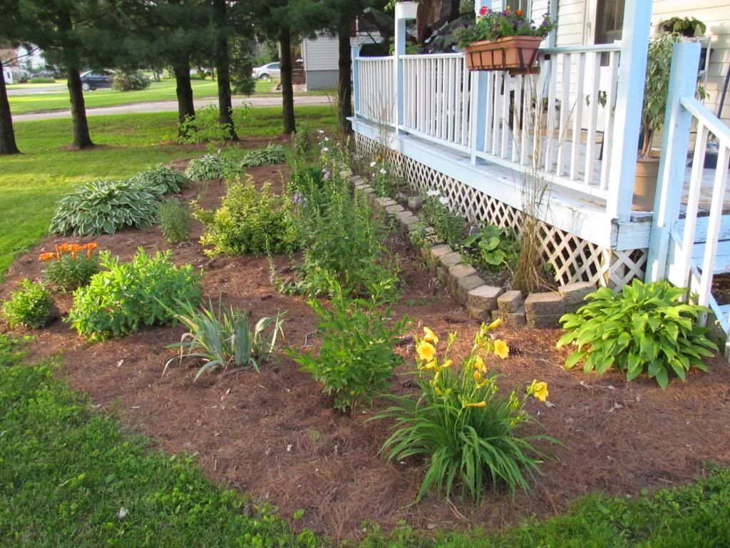
Front yard gardens July 2nd 2013
The past couple of days have been beautiful across Northeast Iowa and Southeast Minnesota as high pressure from the north has taken over the weather. We've had sunshine, low humidity and high temperatures in the lower 80s. This dry steak will significant help out water logged soils, Unfortunately it came too late for most farmers to get corn crops planted, and estimated 40% of farmlands remains un planted. The currently dry streak will last through the Holiday week and even into the weekend. The only chance for rain will be coming from an isolated storm that map develop during the afternoon across the area.
Todays Almanac: Sunny skies prevailed throughout the day across the area. No rain was reported.
Cresco,Iowa High 81.F Low: 60.F
Charles City,Iowa High 81.F Low 61.F
Rochester,Minnesota High 80.F Low 60.F
Note to viewers:
I have been thinking about how I can make my blog more self sufficient and better while at the same time being different then most blogs out there. Now that I am graduated from college and working full time, I need to make the blog more able to update it's self and I will change the way I do things to more adapt to the more limited time I now have. Over the next few days I will continue to think of ideas for my blog.
Thanks,
Derek McKay
Subscribe to:
Posts (Atom)

