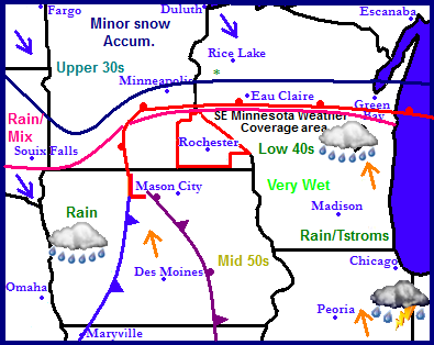
The next storm system is pushing into the Upper Midwest from Nebraska this evening. The center of this storm will move across Iowa into Minnesota, The one will have a lot of warm air with it which means most of the precipitation will fall as rain over a large chuck of the region. It will also drag in very warm air as warm as the middle 50s as far north as Des Monies. Sunday as the storm moves away some areas will see wet snow mixing in as colder air moves southward. All the the accumulation though will be confined to Northern Minnesota and Wisconsin. Things will clear out region wide for the start of next week through the middle of next week. Snowless areas will be rather mild due to a lack of snowcover and cold air. It will remain dry through at least Wednesday until our next potential weather system moves in. See the extended forecast for this one.
Local and Metro Weather Views
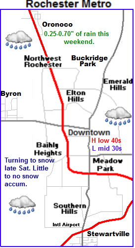
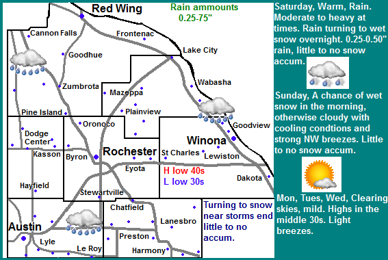
 For our area the storms path will mean a mostly plain old warm rain event. Temperatures through most of the storm will be well above freezing and in fact may warm to near 40, so freezing rain will not be an issue. Saturday will be very wet with waves of moderate rain and drizzle throughout the day. Highs will be near 40, with lows in the middle 30s. Rainfall amounts will be near 0.25-0.50" to as much as 0.75" in localized areas. It is likely this rain and warmth will melt all of our current snowcover. As the storm pulls away from our area on Sunday the rain will turn to a few wet snowflakes, but by they most of the precipitation will end and there will be little to no snow accumulation. Snow will come to an end Sunday Morning. Sunday will be warm early in the morning, but turn cooler and blustery by the afternoon. It really wont turn too unreasonably cold after the storm passage for at least December standards anyway. Highs will still be in the upper 20s on Monday, with lows in the upper 10s. It will be dry, with clearing skies. Tuesday and even Wednesday temperatures will actually rebound to the middle 30s with more sunshine coming back into the picture. It might even approach 40.F with the lack of snowcover we will likely have by that time. Lows will be in the lower 20s each night.
Saturday, Very Mild, Rain, Could be moderate at times. Highs in the lower 40s. Saturday Night, Rain, Turning to wet snow late. Lows in the middle 30s. Little or no snow accumulation.
Sunday, Rain/Snow ending as wet snowflakes. Warm early, Turning cooler and blustery. Highs in the middle 30s early. Sunday Night, Cloudy, lows in the lower 20s.
Monday, Clearing skies. Highs in the upper 20s to lower 30s. Monday Night, Clear skies. Lows in the upper 10s to lower 20s.
Tuesday, Warm, Partly Cloudy skies with highs in the lower to middle 30s. Tuesday Night, Partly Cloudy, Lows in the upper 10s to lower 20s.
Wednesday, Warm, Partly Cloudy, increasing clouds with highs in the middle to upper 30s. Wednesday Night, A chance of snow developing, Lows in the middle 20s.
Looking Ahead
The next storm gaining intimidate attention impacts the area as early as next Thursday, it looks like it could be a bigger storm and it really needs to be watched. Right now the model takes the central of the storm through central Iowa, which means our area would be on the all snow side and it would not turn to rain. This storm does hold snow storm potential to it with pretty hefty accumulations. Question is will the models hold it in our area. It will continued to be watched through the week. It turns quite cold for Friday December 21st and remains cold through next weekend and into Christmas. If we get that projected snowstorm next week we would likely have a very good chance at a white Christmas. Cold dry air continues to funnel over Southeastern Minnesota towards the end of December before a warmup as we approach the very end of the month.


No comments:
Post a Comment