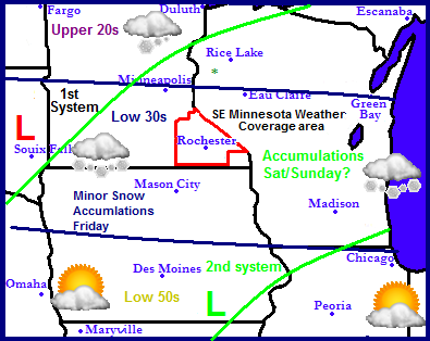
Regional Weather early release forecast.
Thursdays System This is an early release forecast concerning the precipitation for Friday, Saturday and Sunday. Multiple weather systems are going to move through over the course of the next 4 days. One will move through tomorrow bringing rain and drizzle, along with a quick shot of warm air with temperatures rising into the 50s. A cold front will move through later tomorrow dropping temperatures back into the 30s.
Fridays System Friday a weak weather system will move through Southern Minnesota and Northern Iowa. Right now it looks to bring light snows to our area. Maybe a dusting to an inch for Southern Minnesota
Sat Nights/Sundays Weather System. Another 3rd weather system will pass through Saturday Night into Sunday. The models have been kinda all over the place with this storms location and amounts. Right now I will stay on the safe side an say 2-3" are definitely a possibility for this system. I will have more updates as they become available.


No comments:
Post a Comment