Regional Weather View.
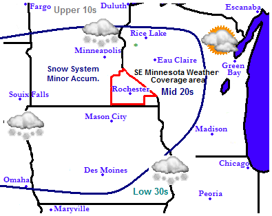
After last weeks snowstorm we have cold arctic air in place for the Christmas Holiday with a high pressure system in place. The stormtrack is located to the south of the region bringing severe weather and significant snow to southern states. This will leave the Upper Midwest cold and sunny. Friday a clipper system will move across Southern Minnesota and Northern Iowa which could deliver snow across parts of Iowa, Minnesota and Wisconsin, but it will not cause too much problems. Temperatures will start off below normal and rise to near normal.
Local and Metro weather views.
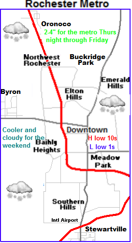
 Snow developing Thursday Night into Friday
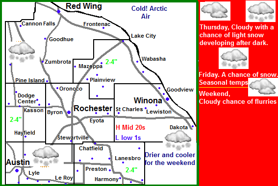
Expect Thursday to be warmer with highs in the 20s and lows near 0, but we will also have increasing clouds. Thursday night into Friday light snow will begin developing ahead of the next storm which will be a clipper. Snow will begin developing Thursday night and last into the 1st part of Friday. It will be moderate to heavy at times, with accumulations ranging from 2-4" This will cause some minor travel inconveniences but nothing major. Highs will otherwise be in the 20s Thursday and Friday with lows in the mid 10s Saturday will be mostly cloudy with highs in the 20s lows in the single digits and Sunday will be mostly sunny and cooler with highs in the mid 10s and lows nearing 0.
Thursday, Cloudy and warmer. Highs in the lower 20s, Thursday Night, Snow developing, some could be heavy at times. Lows in the mid 10s
Friday, Snow in the morning, some could be heavy at times, otherwise cloudy with highs in the mid 20s. Snow accumulations 2-4" Friday Night, Cloudy, lows in the middle 10s
Saturday, Cloudy with highs in the upper 10s to lower 20s. Saturday Night, Cloudy with lows in the single digits.
Sunday, Cooler, Sunny skies, Chilly highs in the mid to upper 10s. Sunday Night, Clear skies with lows in the single digits to near zero
Looking Ahead
Expect dry cool weather to end out December and to start of the first part of 2013. A brief warm up arrives by the 3rd to give us a break from the cold, but its short lived because a storm system passing to the north gives a shot of cold air again on the 5th of January bringing dry cool weather once again. Around January 9th it actually begins to turn on the mild, cloudy side with a chance for some light snows every few days. There are no big snowstorms in the long term.


No comments:
Post a Comment