A very strong weather system effected the area late this weekend and brought a wide range of snowfall totals here in Southeastern Minnesota ranging from minor to major. Going to the beginning of this storms history, it originated in the Western U.S where it then moved into South Dakota and strengthened into a Winter Storm. The low pressure system tracked right along I-90 and over Southeastern Minnesota. Snow, heavy at times began filtering into Minnesota by late Saturday, and by early Sunday it was in Eastern Minnesota and our area. Snow lasted off an on in intensity through Sunday into early Monday morning. because of this the track of the low there was a well defined line in snowfall amounts that separated the major snowfall amounts which fell in Central Minnesota to the less significant totals that fell in our area, the southern part of our state. Winter Storm warnings were posted for much of Minnesota, with Blizzard Warnings in Southwestern Minnesota. In our area Goodhue and Wabasha counties were initially the only counties under Winter Storm Warnings until the NWS sent Dodge, Olmstead and Winona counties under warnings. This was mostly due to winter storm conditions being met in the far northern parts of these counties. The rest of the area was put under an Advisory.
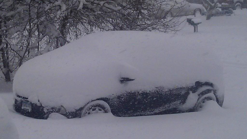
This photo explains the true power of this storm to our north in Central Minnesota.The Minneapolis/St Paul metropolitan area and areas north and south and east into Western Wisconsin which were in the worst of this storm were burried under 12-16" of new snow, enough to shut down area business and schools even well after the storm ended. Record snowfalls were seen at Minneapolis International Airport with this one.The photo above is from a friend of mine from the City of Isanti,Minnesota about 60 miles north of Minneapolis where 15.50" of snow fell. This was initially much more snow they they were expecting for that area, but the storm slowed down which allowed for longer timed accumulations. In Western Minnesota high snowfall amounts were blown by 50MPH winds creating blizzard conditions near the South Dakota boarder, many roads closed in this area because of blowing snow. The cut off from the very heavy snow amounts in central Minnesota to lighter amounts here seems to be Red Wing to Cannon Falls in our area northward. My hometown area received 13.0" of snow from this storm. He said he had 1.30" of water from this incredible snowpack amount!
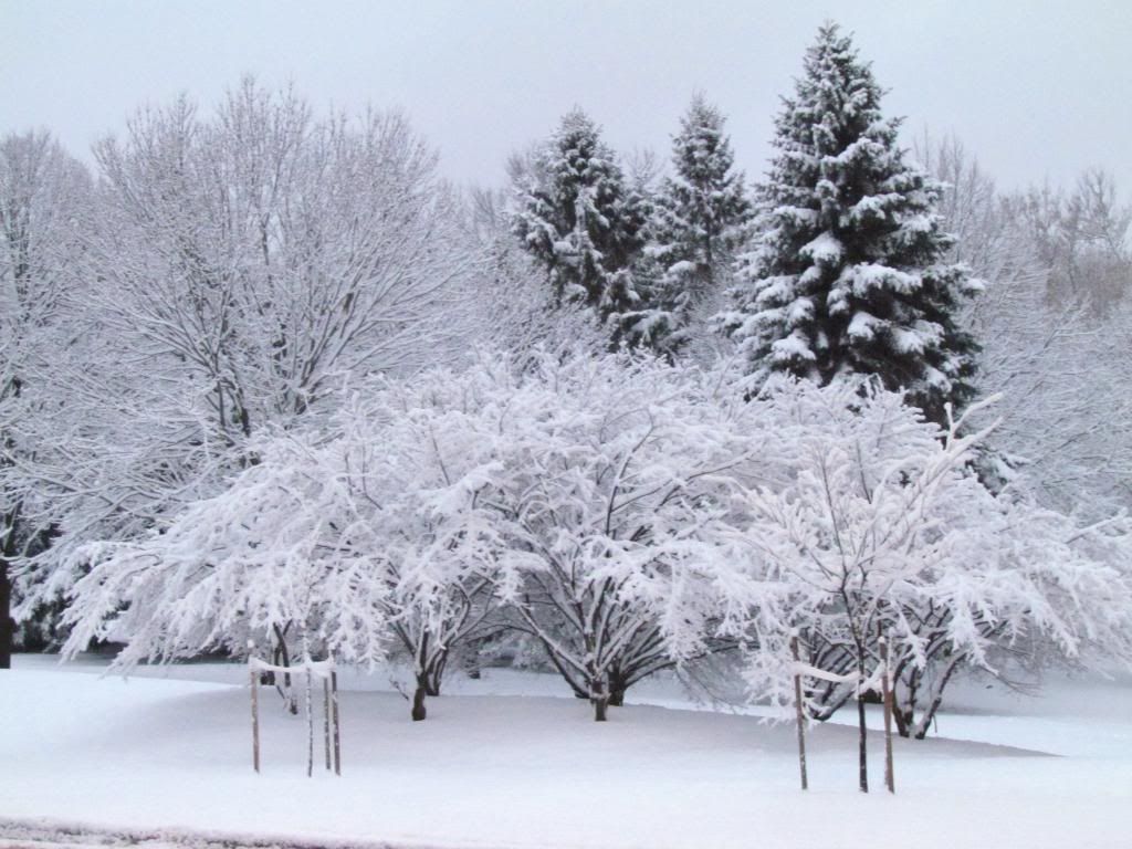
St Marys Park Rochester,MN December 9th
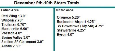
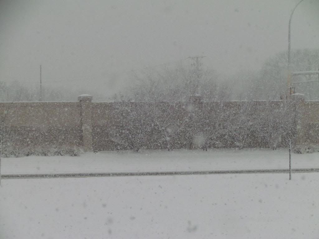
Here in Southeastern Minnesota we dealt with amounts ranging 13.0" inches in Red Wing to 2.30" in Austin. The cut off line in areas that saw major amounts like this was pretty much North of Zumbrota northward. The farther north you were in the area, the more snow you saw, even 10 miles made a big difference in how much snow you saw. There were multiple impassible side roads in Goodhue County during the storm, but luckily this snow came with no wind so road closers of major were minimal to none. It was also helped the storm hit on a weekend. In Rochester the storm was much more minimal, we had moderate snow off and on with one band of heavy snow pictured at the top of this post. My snowfall accumulation was 4.25" tieing the highest accumulating snowfall last year which also means this is the still the highest accumulating snowfall I've seen since I moved to Rochester. We are continuing our snowstorm-free streak though, we have yet to see an official Winter Storm here in Rochester which is considered 6.00" of snowfall in one event or more. With this snow, I will admit after going through a record streak of snow free days I kinda missed the look of a true Minnesota winter, and the moisture is very much needed.
The NWS in Channhassen released a really neat map showing snowfall totals across the state. That map can be seen HERE

Interesting Notes from this event:
Red Wing had the highest reported snowfall amount of 13.0"
4th longest snow free streak on record in Rochester, 293 days without accumulating snow between February last year and yesterday.
1st accumulating snow of the season for Rochester and much of the area.
This system tied the highest accumulating snowfall event from last year in Rochester.
Austin had the lowest reported amount of 2.30"
Rochester continuing streak of snowstorm free days ( 6.00" or more) 2 years since one hit.


No comments:
Post a Comment