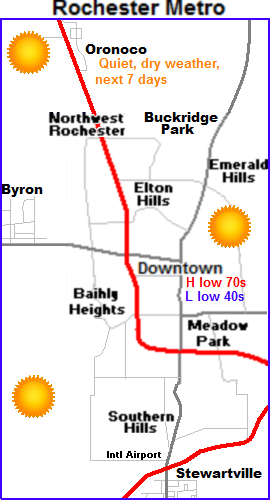
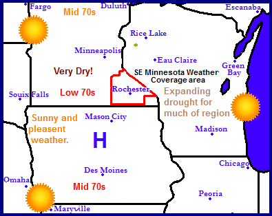
An area of blocking high pressure will bring a long string of sunny calm days to all of the Upper Midwest for the next week. This is unfortunately bad news because it is worsening drought conditions across this region which really needs widespread good rainfall. Look for every day to repete its self with highs in the 70s region wide.
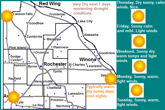
 Local and Metro views.
It is very easy to be a forecaster this week becasue the weather will be quite boring for the area. Every day will repeat it's self one after another. The only slight difference will be temperatures, which will be very mild and pleasant for this time of year. We can expect highs starting in the lower 70s on Thursday, warming to the mid to upper 70s for Friday and through the weekend. Lows will generally be in the lower to middle 40s, warming to the 50s each day. We can expect this type of pattern through at least Tuesday of next week as an area of high pressure remains situated over the area. This pattern will lead to expanding drought. I don't see any chance of rain until the end of next week.
Thursday, Sunny nice and mild. Highs in the upper 60s to lower 70s. Thursday Night, Clear skies, lows in the lower to middle 40s.
Friday, Sunny, nice, Warm! Highs in the mid to upper 70s. Light winds. Friday Night, Clear skies, lows in the mid to upper 40s
Saturday, Sunny skies, nice, warm! Highs in the low to mid 70s. Saturday Night, Clear skies, lows in the mid to upper 40s.
Sunday, Sunny skies, nice and warm! Highs in the low to mid 70s. Sunday Night, Clear skies, lows in the mid to upper 40s.
Monday, Sunny, Warm! Highs in the mid to upper 70s. Monday Night, Clear skies, lows in the upper 40s to low 50s.
Tuesday, Sunny and warm! Highs in the upper 70s. Tuesday Night, Clear skies, lows in the upper 40s to lower 50s.
Looking Ahead
Wednesday and Thursday the 3/4th looks like another warm sunny day for the area. Highs may be in or around the 80s. Friday the 5th our next chance at seeing rain, and things look a little interesting with this system but only to a point because models have been very un reliable at predicting rain this year. The model shows widespread rain across all of Minnesota Friday the 5th into Saturday the 6th. A cold front swings through Saturday bringing significantly colder air into Minnesota. There might be some snow in Northern Minnesota with that system as it exits. Dries out, and remains on the cooler side for Monday the 8th, and remains cool, dry and sunny through the 11th of October.


No comments:
Post a Comment