
Iowa Weather Network Warnings Map

Winter Weather Advisory
Monday, June 30, 2014
June 30th severe weather outbreak- central Iowa report. Wind damage Des Moines Metro with sigificant damage in Madison, Warren, Story and Marshall Counties. Confirmed tornado NE of Winterset
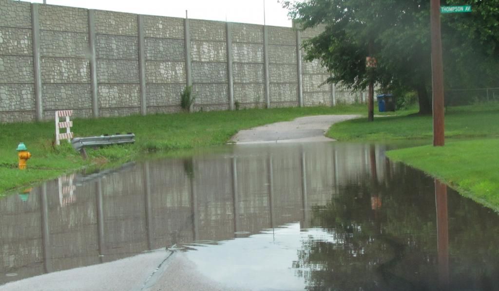
Flash flooding on Des Moines streets June 30th 2014
This is the severe weather report for June 30th, showing how central Iowa was impacted. The severe weather that occurred locally today was a part of a much bigger line that started in Nebraska around 8am this morning. Severe storms have been on going in Northern central Iowa all night long, and there were two areas of major storms. One went near Story City to Marshalltown and the other went from Western Iowa near I-80 into our area. The main line of storms that effected our area tracked all the way across west Iowa arriving in the local area between 10am and 1:30pm. When the storms entered the area there were two cells with in the line which produced significant damage. One which tracked from Story City to north of Marshalltown, and another which went from near Stuart through Northern Madison and Warren counties. On the southern cell, Impressive rotation was being detected and a reported tornado near Stuart. This rotating cell was on the very southern edge of a line that at that time stretched from Warren county on the south side of the line northward to the Story City area. These storms continued east all the way through the state producing widespread wind hail damage on its way through the central and eastern part of the state.
Tree damage at Martinsdale
In the southern cell The rotation and enhanced winds past through Northern Madison county and produced a tornado 5 miles Northeast of Winterset before entering Warren county. This storm turned southeast just before entering metro Des Moines. Significant to major damage was done Northeast of Winterset when a tornado crosse Cumming road There was also significant damage in Martensdale including several barns, buildings and even homes partially or totally damaged. In this area damage is significant with many roads closed and blocked off. A NWS survey team was sent to this area today to survey the damage and it was determined that it was enhanced strait line winds. This storm continued east with the core of the worst of the storm moving to Indianola and Sandyville where windows were broken from large hail in Sandyville. 2.75" hail was reported in Beech. These storms went on to produce damage through Southeastern Iowa. The other strong cell produced significant tree damage in Story City which continued north of Marshalltown. In this area numerous trees were reported down along with 70 to 80MPH measured wind gusts. This cell went on to produce major damage in Traer and significant damage in Cedar Rapids.
video as the line of storms went through Des Moines
This line also impacted all of Des Moines Metro area with high winds, smaller hail to a lesser extent, hail and torrential rain. I stayed at home for this event where this video was taken. The worst of the video is about 36 seconds in. The storms moved in a little after 12pm and it came with no defined cloud line at all. It was more of a meso cyclone for Des Moines as the high winds were embedded with in the rain. I would estimate that we had gusts to 55MPH in my neighborhood. Des Moines international reported 51MPH gusts and Ankeny reported 43MPH gusts. Towards the back side of the cell I did have some small pea to dime sized hail that fell. South suburbs reported 1.00" hail. Damage in the metro was mostly in the form of large tree limbs and Flooding with the worst of the damage to the south of the metro. Many streets had standing water and were flooding, especially in the Northern suburbs. Grimes and Ankeny both had reports of flash flooding. I had over 1" of rain in a short time and I did come across some street flooding in my neighborhood. 1.23" of rain fell at my location.
Confirmed tornado 5 miles NW of Winterset rated EF1
Adel 1.00" hail
Urbandale medium sized tree limbs down
1 mile W Cumming 70MPH wind gust.
Norwalk 1.00" hail
Martensdale, Structural damage, Barn destroyed, powerlines down, major trees damage ( NWS to be sent out )
Indianola 60MPH wind gust
Beech 2.75" hail
Sandyville 60MPH wind gust, windows broken out of north side of homes from hail damage
Ankeny, Flash flooding water over curbs
Grimes, Flash flooding, 6" of water in areas where it is not normal. Beaver creek overflowing
Des Moines, Tree limbs down
2 miles W Ogden 1.50: hail
N Story City Trees snapped off at base
Zearing Numerous 40-50ft tall trees down, several major branches snapped
Northern Marshall County, Shed blown down, widespread tree damage.
Marshalltown, Water of unknown depth flowing down entire street.
West Des Moines, Large tree limbs down
Rainfall reports Des Moines Fairmount Park 1.26"
Ankeny 1.44"
Marshalltown 2.29"
Ames 2.07"
Knoxville 1.19
Pella 1.56"
Perry 2.04"
Boone 1.52"
Des Moines international Airport 1.32"
Subscribe to:
Post Comments (Atom)


No comments:
Post a Comment