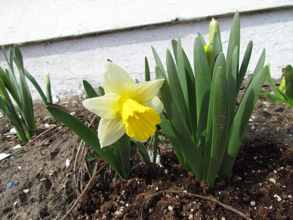
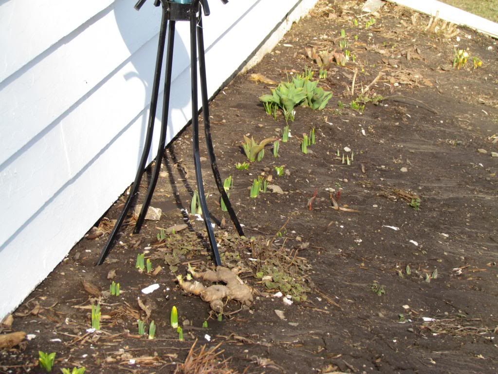
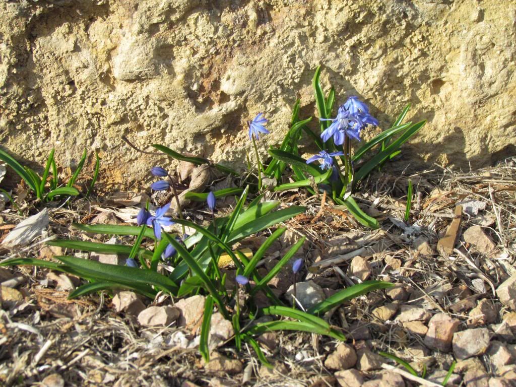
1st standard Daffodil of the season April 27th 2013
Most of this month has been plagued with very wet and well below normal temperatures in the 30s and 40s with multiple, at least 4 or 5 little snowfall events through the entire month. This put a slow down on the growth pattern and even has delayed our spring by 2 weeks later then it should be, and an stunning 1 month later then last year. We have gained significant moisture amounts through the month helping plants get much needed moisture which was lacking with lasts years drought. These conditions along with a recent warm up that brought the areas 1st 60s and 70s over the past 3 days, even some highs near 80 has allowed for an explosion of growth with major differences seen in those 3 days. The 1st Daffodil of the season in my garden can be seen above.
Highs seen Sunday April 28th
Cannon Falls 79.F
West Downtown Rochester ( my station ) 78.F
Austin 77.F
Red Wing 77.F
Dodge Center 75.F
Preston 75.F
Rochester Airport 74.F
Winona 73.F
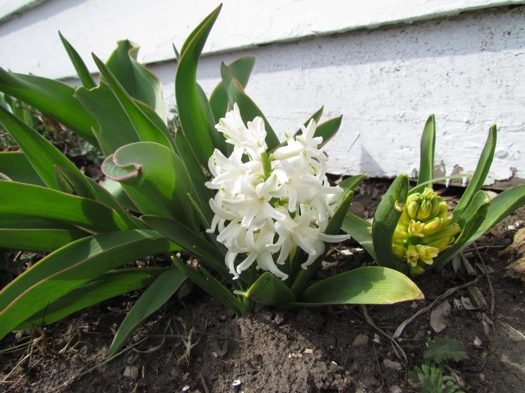
White Hyacinth April 28th 2013
Also joining the spring garden, Hyacinths have just started to bloom and they are already perfuming the entire yard, more will be popping in the coming days! These are one of the more fragrant flowers you can grow. Tulips are starting to show signs of budding and Glory-of-the-snow have also started to bloom. There are also multiple perennials beginning to grow.
Greening up grass and landscape April 28th 2013
The grass has greened up significantly over the past 3 days, all that was needed was a little warmth!
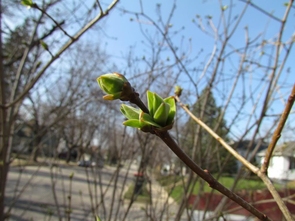
Young Lilac leaves April 28th 2013
Woody plants are also taking on significant progress now that it has finally warmed up,I have seen Magnolias, Forsythias, starting to develop flower buds and will be blooming shortly. Lilacs, Crab Apples, starting to get leaves, and in trees earlier trees such as Redbud, Serviceberry, Maples, Elms, and Aspen are in the flowering and budding stages. It is quite exciting to see such significant changes over a very short period.


Iowa Weather Network Warnings Map

Winter Weather Advisory
Sunday, April 28, 2013
Sunday, April 21, 2013
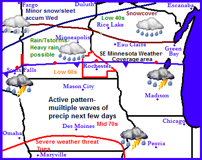
Active weather pattern continues. Rain and snow Monday and early Tuesday, minor snowfall accumulations are a possibility. Breaking news!-Warmth finally arriving this week, Temperatures in the 60s in order by weeks end.
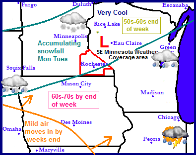
Regional weather view.
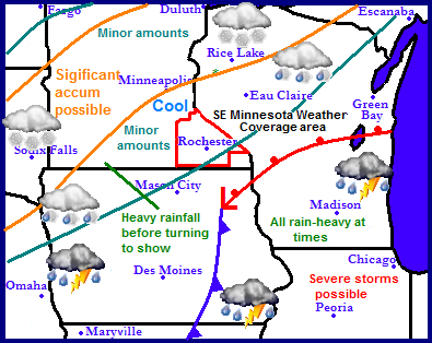
The wet cool pattern that has been in place for some time now will continue for at least a few more days... Another snow event is expected to happen in Minnesota and Wisconsin as accumulating snowfall is possible, but an end of this pattern is in sight, but weeks end the cold air will begin to break down as warmth floods into the region bringing spring-like temperatures and drier weather conditions.
Local weather view.
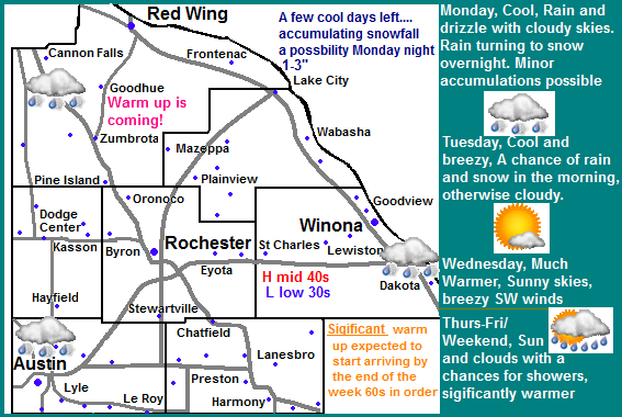
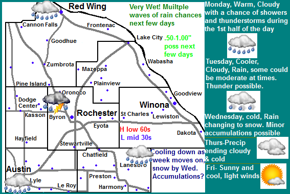
We've got a few more days of this crummy wet pattern-to be honest we even have the threat for accumulating snowfall Monday night into the 1st part of Tuesday as a system slides across the area. Rain will develop tomorrow with amounts around quarter to three quarters of an inch, the rain will be changing to snow will occur tomorrow night. 1-3" of wet sloppy snow could accumulate and like in the past few days it will melt very quickly. Monday highs will be in the upper 40s early then remain in the middle to low 40s the rest of the day. Tuesday will be cold with cold strong north winds. Highs will be in the upper 30s to lower 40s, with lows falling into the upper 20s, this will be the last of the coolest air and wet weather for awhile.
HERE comes the warm up! Wednesday-through end of the week
The weather everyone has been waiting for will show us a taste Wednesday and Thursday it will be sunny and much warmer as high pressure moves into the area. This will be the start of a long term warm up across the region. With sunny skies expected and southwest winds developing, we can expect 50s for highs both days with lows around the low to mid 30s both nights. We are on the verge of experiencing beautiful weather! Friday, Saturday and Sunday significant warmth will flood into the region on southwest winds, highs as warm as the low to mid 60s for the 1st time this season can be expected. There is a chance some areas may flirt near 70.F degrees, with lows in the 40s. all 3 days look to be partly cloudy and will feature pleasant amounts of sun. There is a small threat for showers possibly a thunderstorm Sunday, but it looks fairly light at this time.
Monday, Cool, Cloudy, Rain, highs in the upper 40s before cooling down. Breezy Northwest winds. Monday Night, Cold, Rain and snow likely. Snowfall accumulation 1-3" Lows in the lower 30s.
Tuesday, Cold and breezy. Northwest winds 25-30MPH Rain/Snow in the morning otherwise cloudy with highs in the lower 40s. Tuesday Night, Cold! Clearing skies with lows in the upper 20s.
Wednesday, Much warmer. Sunny skies, breezy southwest winds to 30MPH. Highs in the low 50s. Wednesday Night, A chance of light rain and snow, cloudy with lows in the low 30s.
Thursday, Sunny skies, light winds, highs in the lower 50s. Thursday Night, Clear skies, lows in the upper 30s.
Friday, Nice! Breezy south winds with Sunny skies, highs in the lower to mid 60s. Friday Night, Partly Cloudy with lows in the mid 40s.
Saturday, Nice! Partly cloudy with highs in the lower to middle 60s. Saturday Night, Partly Cloudy with lows in the upper 40s.
Sunday, Nice! Partly cloudy with a chance of a shower or thunderstorm. Highs in the upper 60s to lower 70s, breezy south winds. Sunday Night, Partly Cloudy with lows in the upper 40s to low 50s.
Warm up progression continues in long term
The long range charts continue to favor this current pattern finally ending. Monday the 29th a cold front pushes through bringing a chance for showers and thunderstorms, then cooler temperatures and a dry sunny day back down into the 50s for Tuesday the 30th. The middle of next week which will be the 1st part of May looks dry and sunny with many days with highs in the 60s, possibly 70 degrees. Friday the 3rd unsettled weather brings the chances for showers and thunderstorms which lasts into Saturday. There is no cold air following this system. Following this into the 2nd full week of May, the weather looks to continue to warm up an remain relatively dry. I see the threat for more 60s possibly an 80 not far off, but that may be going too far. A return to a more stormy, possibly slightly cooler pattern back be in store for us during the middle part of May according to this model
Thursday, April 18, 2013
Relocating to Iowa!
Soon moving to Iowa
Some of you may already know, but for ones that have not yet heard the good news news this is a message to viewers letting them know that I will soon be relocating to Iowa. I am nearing the end of my college education in which I will obtain a horticulture degree this upcoming May, I've worked very hard through my college career and I learned many great things which continue to add to my passion for horticulture. Throughout my education I have maintained a high honors grade and I made the deans list each semester, I am very proud to say that one semester I had even had a 4.0" grade point average. I will finish out my college career as an high honor roll student. Now that college is nearing to a close I have begun to search for a career to peruse. In my job search for a year round full time job I have landed a job at a large growing greenhouse operation in North Iowa in the town of Cresco. This will be a 62 mile move south of where I live currently. I consider that this will be my next adventure I will be taking. I am not really complete sure how it will work out but I look forword to this challenge and my next step in life.
During this move and as finals and graduation approaches forecast posts may be a bit sparse because of how busy things are becoming so please bare with me. There will definitely be changes in the area I cover and will decide over the next few weeks what my final plan will be. At this point I will definitely be added several North Iowa counties to my coverage area, and I still plan to cover the Rochester area and several Southern Minnesota counties. I will have announcements of these changes as they occur.
Thank to veiwers for sticking with me all this time.
Derek M.
Wednesday, April 17, 2013
A very cool and wet pattern remains in place for the area. 1-2" of rain expected tonight, some of which could be heavy and could cause river flooding. Thunder is possible tonight. Storm ending as snow Friday 1-2" of slushy snow are possible. Saturday is our next chance for a dry day.
Regional weather view
A fairly active pattern continues as a couple waves of storms will be pushing through the region. The reason for the active pattern is that the jet stream continues to be located right over the area, this feature is continuing the winter that doesn't end for some across the region as yet another winter storm is expected for parts of Minnesota, South Dakota and Northern Wisconsin. Accumulation snowfall is possible as far south as Northwest Iowa. Significant amounts of moisture will also be seen with this storm as heavy rains develop across Southeast Minnesota, most of Iowa, Wisconsin and Illinois. Flooding is possible as 1-3" of rain is expected. Some area will get some of both worlds seeing both heavy rain and accumulating snowfall.
Local and Metro views.
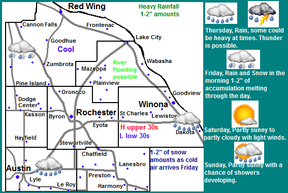
Cool and wet are the words that can be used to describe our weather for the next few days as we continue to be stuck in this same pattern that wont be changing for at least the next several days. A significant storm system will be effecting our area over the next couple days. First we will see rain, some of which could be heavy at times. Rain amounts from this will be around 1-2" which could cause problems with river flooding of which will mostly be the minor type. Colder air will begin to move into the area Thursday night which will turn the rain to snow Thursday Night into Friday Morning and will likely accumulate to 1-2" if the wet ground can allow for this much accumulation. All of the slushy type snow will melt during the day Friday or Saturday. Temperatures will continue to be well below normal only from where they should be in the mid to upper 50s, we can expect highs in the upper 30s through Friday, with lows anywhere from the lower 30s to as cold as the lower 20s Friday Night. Saturday is the next chance for a dry day. At this time it looks to be sunny with highs in the upper 40s, but its difficult to say if the chances for sun can hold, it should be a good bet that it will be dry though. This try streak is unfortunately looking to be short lived as the chances rain possible mixing with snow again begin to increase again Sunday, rain amounts will be closer to the 0.25-0.50" range with little to no accumulation from the snow.
Thursday, Rain, heavy at times. Thunder is possible. Rainfall amounts from Wednesday-Thursday Night 1-2" Thursday Night, Rain, mixing with and changing for sleet and snow. Lows in the lower 30s
Friday, Cold and breezy! Snow and sleet in the morning before ending, snow accumulations 1-2" drizzle possible in the afternoon. Highs in the upper 30s. Friday Night, Cold! Partly cloudy skies with lows in the low to mid 20s.
Saturday, Partly Cloudy skies, light winds with highs in the mid to upper 40s. Saturday Night, Partly Cloudy with lows in the low 30s
Sunday, Partly Cloudy with the threat for showers increasing. Highs in the upper 40s. Sunday Night, A chance of rain mixing with snow. Little to no snow accumulation, lows in mid 30s.
Will it ever warm up? Drier warmer weather expected in coming weeks.
The models continue to show a break down of this pattern in the coming weeks and the both models seem to agree, it will just take some time to break this pattern, at some point however it will break and the models do try to show this. Monday we will keep the threat for rain with warmer temperatures at least in the 40s. Rainfall amounts look fairly light. Tuesday and Wednesday look cool for April standards, but warmer then it has been it also appears it will be sunny and highs. Thursday through Sunday the 28th the models continue to keep a drier pattern over our area with good chances for sun. As warmer air pushes in from the west we will have a chance for our highs possibly up to near as high as 60.F as early as the late part of next week. Monday the 29th through the 1st part of May the models show the weather becoming more disturbed with chances for showers and thunderstorms between the date listed above and the 3rd of May. a cool chilly drier air follows behind this storm system, and that is what the extended forecast shows.
Saturday, April 13, 2013
Extremely active weather over the past few days, Severe Weather, heavy rain and snow- Storm system Tuesday the 9th through Thursday the 11th
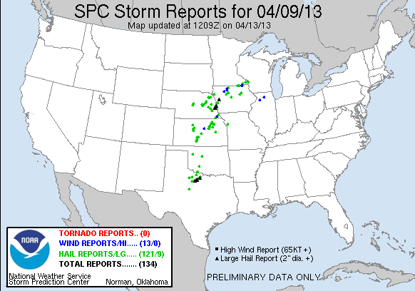
Image from SPC
Extremely active weather pattern over the Midwest over the past few days all from a slow moving storm system that spread a variety of changeable weather conditions from heavy rain and severe storms to the south and snow and ice to areas the north, some areas even had all of these conditions met!
Tuesday April 9th Severe Storms and Heavy Rain
A stationery front along with a vigorous storm moving through the region sparked an area of thunderstorms in central Iowa Tuesday afternoon. This area of storms move north to the Minnesota/Iowa boarder before turning east. Boarder communities such as Le Roy and and Harmony were impacted with severe weather in the form of wind and large from these storms, heavy rain lightning and thunder from this complex of storms was seen Farther north throughout the rest of the area which brought significant 1-2+ inch rainfall amounts. Here in Rochester 2.23" of rain fell over Tuesday and Wednesday with a system total of In total including snow water was 2.83" and was the most precipitation we've seen since we entered a drought pattern. The rainfall lead to flooding of some creeks and rivers.
Area Severe Storm Reports
Le Roy 0.75" ( Penny ) size hail
2 miles N Harmony 1.50" ( Ping pong ball) sized hail
Harmony 0.75 ( Penny ) sized hail
Wednesday/Thursday snowfall
Snowcovered lawns April 11th 2013
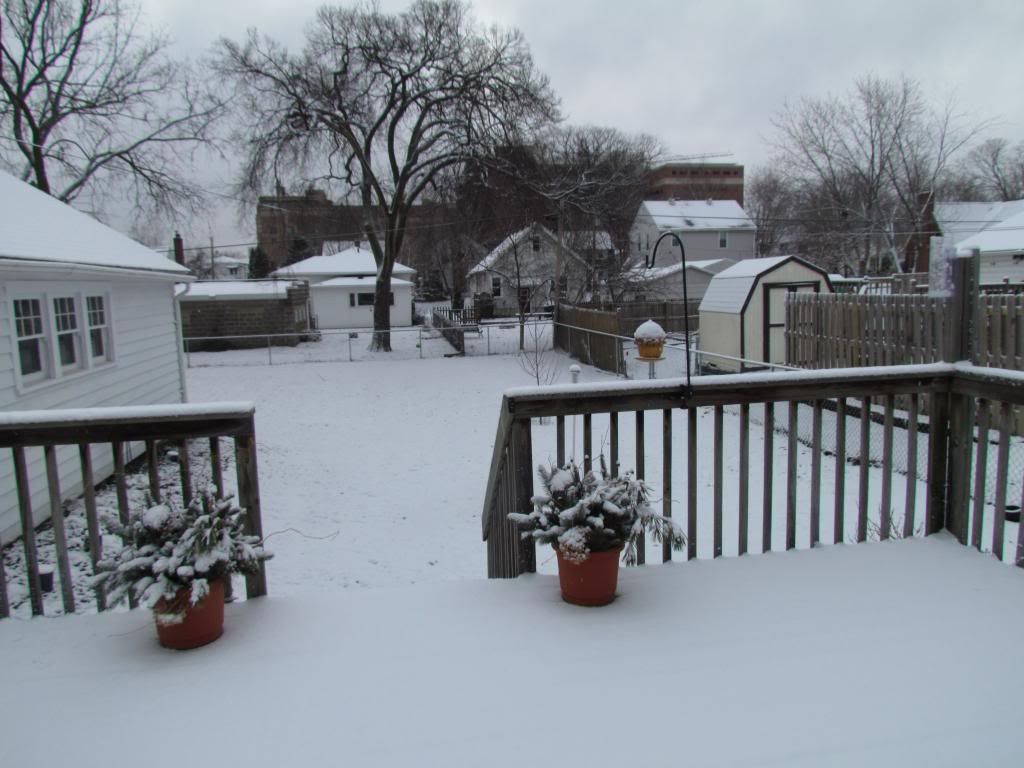
The areas was thrown back into a late season batch of Winter Wednesday night into Thursday the rain turned to snow in which some accumulated several times, to various amounts across the area ranging from 3" to 0.50 to 1.0" during the mornings of Thursday, Friday and a 3rd time Saturday. The snow was melted by the end of each of the days it accumulated. Here in Rochester 2.50" of snow accumulated over the past 3 days.
Sunday, April 7, 2013
Very active and changible weather pattern setting up for the next week. 60s with showers and thunderstorms Monday then cooler with rain Tuesday changing to very cool with snow Wednesday-slushy minor amounts possible. 1.00+ precip amount highly likely next few days
Regional weather view
A very active weather pattern is setting up across the Upper Midwest this week with quite a contrast in terms of weather to start off the week. Monday and Tuesday, the regions 1st threat for severe weather exits across southern Iowa, further north the stationary front/warm front will bring the warm airmass associated with this storm systems as far north as far Southern Minnesota. Waves of showers and thunderstorms with rain changing to a wet snow across the far is expected to move through the region the next few days. Accumulating snows are a possibility across Northern Minnesota, elsewhere heavy rain is a likelihood. Wednesday another system will move through bringing cold air southward and bringing the threat for snow farther south into Minnesota and Iowa. Friday the entire region will be quiet and cool.
Local and metro views.
Monday-warm with showers and thunderstorms early
For us here in Southern Minnesota expect that our weather over the next few days will be anything but consistent. Monday will be warm and stormy with highs in the 60s, by Wednesday temps will cool to the low 40s. It will be very wet the next few days with precipitation amounts exceeding 1-2" amounts a high possibility. Here is a breakdown of the weather for the next few days. Monday the stationery front mentioned above will be sitting right over the area bringing mild air up into the 60s from regions to our south. Showers and thunderstorms will be likely during the morning hours,m some of which could bring heavy downpours. Rain will come to an end in the afternoon with a partly sunny sky during the afternoon with highs rising to the low to middle 60s.
Cooler Tuesday with more rain-possibly heavy at times
Tuesday, The day will start off cloudy with more rain pushing into the area in the afternoon. Moderate rain is a possibility with the off chance for thunder. Highs will rise to the upper 40s before cooling off.
Wednesday-much colder rain/snow
Wednesday will be much colder with the chance for rain changing to snow. Highs will be in the upper 30s to low 40s. The snow may accumulate to a slushy inch or two before quickly melting away due to warm temps.
Thursday/Friday drying out
Thursday and Friday our precip chances come to an end and we begin to dry out. Thursday will be cloudy and cold with temperatures in the upper 30s and lows falling way below freezing into the middle 20s. Friday we will get to see the sun again, but it will be a fairly cool day with highs in the low to mid 40s.
Monday, Showers and thunderstorms in the morning, then party sunny in the afternoon, warm with highs in the lower to mid 60s. Monday night, Cloudy with a chance of drizzle late. Lows in the low 40s.
Tuesday, Rain, moderate downpours are possible with the chance for thunder. Cloudy skies, highs in the upper 40s. Tuesday night, Light rain, Cloudy with lows in the middle 30s
Wednesday, Much colder, Cloudy with rain developing possibly mixing with snow. Precip changing to all snow late. Wednesday night. Precip changing to all snow late. Slushy minor accumulations possible, lows in the upper 20s.
Thursday, A small chance of rain or flurries early, other wise cloudy and cold with highs in the upper 30s to lower 40s. Thursday Night, Cloudy and cold, lows in the middle 20s.
Friday, Sunny and cool, light winds with highs in the low to mid 40s. Friday Night, Increasing clouds, lows in the mid 20s.
Weather pattern ahead looks cool through the middle of the month with warm up long term.
Saturday at this point looks warmer and dry with highs again apporaching the 50s. Sunday rain moves back in from the west with heavy snow across the northern part of Minnesota as the jet stream gets pushed south. Monday the 15th it shows something I'd rather not mention, but shows a low pressure system riding the jet stream as it is unusually far south for this time of year, this would spread rain in Iowa with a breif shot of snow across our area. Its really too early to tell if that will materialize but one this is for sure the models are consistent with a cold airmass coming in for the middle of the month around the 17th, which brings several days of cold days way below normal. Most of those days look to be dry and sunny, but a weak systems brings more snows across Northern Minnesota, leaving our area alone. The models have also been consistent with this significant change as well, sometime arouht Sunday the 21st the jet stream is gets kick well to the north into Canada bring our temperatures right from a very cool pattern right into a very warm pattern coming our way for the end of the month.
Thursday, April 4, 2013
April 4th Spring Growth Update

Back yard April 4th 2013
Today was the first day of the season that my station as well as the Rochester airport officially hit a temperature of 50 or higher. The airport recorded 50.F while my station rose to a high of 53.F under a mostly sunny sky. The winter snowcover has finally melted and we've have no snow on the ground since about the 2nd of April. This has kick started the growing season.
Snow Crocus & Dutch Crocus April 4th 2013
I would say we are in the early spring stage of growth at this point based on the flowers that are blooming. I've seen Snowdrops, squill, Crocus and Winter Aconite in bloom. Early flowering Trees have bud swell but most trees, shrubs and the grass show no signs of breaking dormancy at this time. In my yard Dutch Crocus have joined the show just in the past couple days adding striped purple and white blooms to my display.
South garage garden April 4th 2013
All the spring bulbs are now up now that we've been exposed to warmth and sunshine and the ground has thawed at this location. Daffodils and Tulips are about 4-5" tall and the Hyacinths have flower buds showing. Snow Iris which are a new addition to this garden last fall are also showing signs of blooming and should be blooming in about one week.
Siberian Squill April 4th 2013
I have not shown these much in past spring postings. I found these growing in a garden near the sidewalk in the community. These are Siberian Squill. They are rather short plants with strapped foliage and blue flowers. They are old favorites so they are often seen covering the ground in spring with their blooms in old neighborhoods in Rochester. There a great substitute to Crocus if you have a squirrel or rabbit problem because they bloom near the same time.
Tuesday, April 2, 2013
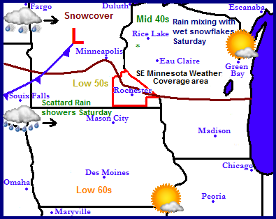
Consistant seasonable temperatures 45-50.F for the rest of the week, 60.F by Saturday with showers and Tstorms, then drier for Sunday into Monday Updated X1
Regional Weather view
The weather pattern lately has been a bit more conducive for Spring-like weather. A high pressure system will bring warmer conditions to the region and produce temperatures more normal of that for this time of year, 60s in Iowa, 50s in snowless areas of Minnesota and middle 40s for the snowcovered areas. This will continue to erode the significant snowcover that still remains across much of North Dakota, Center and Northern Minnesota and and Northern Wisconsin. Saturday a storm system slide across the Dakota into Minnesota and Wisconsin which will spread some light rainshowers, possibly mixing in with snow in areas of the north. Precipitation amounts will be fairly meager. After the passing of the cool front slightly cooler temperatures will be seen with quieter weather returning for the start of next week.
Local and Metro views
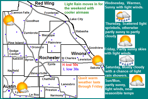
Locally we can one more day of sunny clear weather Wednesday with a significant rise in temperatures expected into the upper 40s to lower 50s. Thursday and Friday will feature more clouds with a chance of some light sprinkles on Thursday. High temperatures both days will be in the upper 40s with lows in the upper 20s to lower 30s. Saturdays Rain Threat: Saturday a low pressure system and cool front sliding across the state will bring light rain back into the picture and it may actually start late Friday night, much like last Saturdays rain in the fact that it will be light in nature. The rain may end as a few wet snowflakes late Saturday, there will be no accumulations. Amounts will only range into the few 10ths of an inch range. Temperatures will be in the upper 40s Saturday with lows in the lower 30s. Drier for the end of the week/start of next week: Sunday and Monday it will be drier but plenty of clouds will remain. Temperatures will not cool off to much behind the front, expect high temperatures will continue to be near that consistent upper 40 degree range with lows in the 30s.
Wednesday, Sunny skies, light winds. Highs in the upper 40s to low 50s. Wednesday Night, Clear skies, lows in the upper 20s.
Thursday, Partly Cloudy to partly sunny. A chance of a passing sprinkle. Highs in the upper 40s to low 50s Thursday Night, Mostly cloudy, lows in the low 30s.
Friday, Partly sunny to partly cloudy. Light winds with highs in the upper 40s to low 50s. Friday night, light rain developing, lows in the upper 30s.
Saturday, Partly Sunny with a chance of showers and thunderstorms in the afternoon. Windy south winds to 35MPH Highs in the low to mid 60s. Saturday Night, a chance of light showers, Lows in the lower 40s.
Sunday, Partly sunny to partly cloudy, highs in the upper 40s to lower 50s. Sunday Night, Mostly Cloudy, lows in the low to mid 30s
Monday, Partly sunny to partly cloudy, highs in the upper 40s to lower 50s. Monday Night, Mostly cloud, lows in the mid 30s.
Looking ahead
Next weeks looks more on the wet side. Wednesday the 10th will be our next more significant system as a low pressure system and cold front brings brings rain to the area and cooler temperatures between Tuesday the 9th and Saturday the 13th of next week. Temperatures in the 40s look common. GFS shows, which has a hard time being able to be trusted at times this year puts out a significant low pressure system moving through the region Sunday April 14th brings heavy showers and thunderstorms to he area and should be watched for the potienal for a severe weather outbreak. This storm would surge very warm air briefly northward into our region before the storms arrive. This storm is so vigorous on its cold side though it drags a significant cold front south which turns some of the precipitation to wet snow bringing late season snow accumulations on its northwest side to the north/west of the Twin Cities. For now we will take what nice weather we can get.
Subscribe to:
Posts (Atom)

