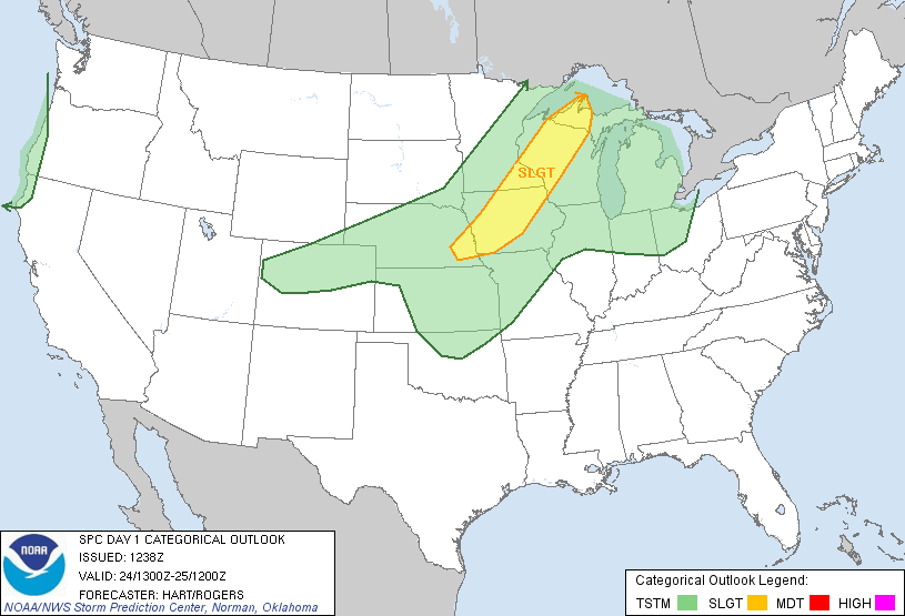
Image from SPC
The SPC continues a Slight Risk for severe thunderstorms in Central Iowa, Southeastern Minnesota and Western Wisconsin for Wednesday. This includes all of the local area. A very strong sigificant cold front will be raking across Minnesota later today, and with very warm moist and unstable air in place ahead of such a strong front, thunderstorms will break out later today most likely after 5pm just west of the area. These storms will quickly form into a line and some will produce some severe weather. The biggest threats will be large hail and damaging winds, but a tornado cannot be ruled out. Be sure to stay tuned to other websites for the most up to state information concerning this threat.


No comments:
Post a Comment