Map Image Legend Image

Iowa Weather Network Warnings Map

Iowa Weather Network Warnings Map

Winter Weather Advisory

Tuesday, September 30, 2014

Fall color report #2 Still low color all areas

 photo IMG_7739_zps3bbfe8d6.jpg
Sugar maples near Kellogg, Iowa September 30th 2014

After a fast start to the fall color season, fall color progression has really slowed this week because of a spell of summer-like temperatures where we had several days in the low to mid 80s. This caused the trees that have turned to start dropping leaves quite fast, but delayed others from really turning. Ash trees are loosing leaves at a fast rate now. About the only change in Des Moines this week from last week is that more ash and some hackberry have turned and I am now seeing a few Sugar maples starting to turn orange, but for the most part I have only see dull yellow to golden yellow in those trees mentioned. In areas where there are an abundance of earlier changing trees it may appear more colorful, but mid to late turning trees are still green.
 photo IMG_7737_zps9ef266b2.jpg
 Entire tree canopy September 30th 2014 at Rocky Creek State Park Kellogg, Iowa

As I look at the entire tree canopy there is a large percentage that has not turned. I would say were up to 20%-Low color in Des Moines and thats about it. This was enough to move us into the low category. Cold weather is expecting to move in this week which should push our fall colors out more.
Fall color report #2

 photo 303-Copy-Copy2-Copy_zps3429b7ef.png


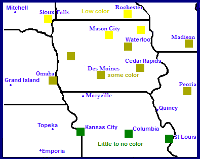
Little has changed in the fall color report. The only difference is that remainder of Iowa was put into the low color category. Much of Iowa is still green at this time. Reading the state fall color report showed little change from last week in terms of color. Hopefully the next weeks colder weather will push the trees to begin turning more. If you want to see stunning fall color head to northern Minnesota and Wisconsin! Their report shows that area is peaking right now.

Monday, September 22, 2014

Iowa fall color report #1

 photo IMG_20140922_104127_632_zpsfc81747a.jpg
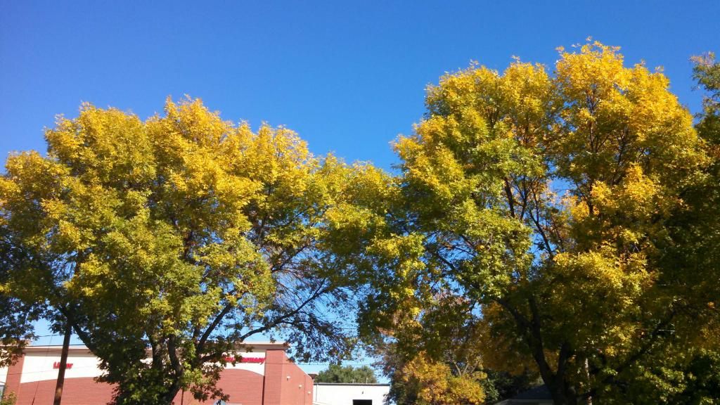
Fall color in green ash September 22nd 2014

Fall color is quickly starting across Iowa and color has become quite abundant in earlier changing trees. This change literally seemed to occur just in the past couple of days here in the Des Moines area. Tree showing color are strictly pretty much the ash species. They are turning colors of golden yellow in many boulevards around shopping centers and along roadsides. White ash has started to turn purple as well. As one looks hard enough you can also seen Maples starting to show a hint of reds especially in silver/red crosses such as Autumn blaze maple. I also saw a few stressed Sugar maples starting to turn orange as well. However as you look across the entire tree canopy it still appears primarily green with a few patches of color here and there. I am going with %15 color change in this area, with our area showing some color and just starting for Des Moines/southern Iowa

 photo 303-Copy-Copy2-Copy_zps337dacf0.png
Fall color report #1

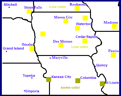
Fall color across  Iowa show the northern and eastern part of the start is about 1 week ahead of the rest of the state. Low color is being reported in Mason City and Decorah. Here colors are more bright and there is more being seen but there is still a long ways to go before peak. The rest of the state, Waterloo, Cedar Rapids, Omaha/Council Bluffs are all reporting 15% with only some color being reported. Normal peak time for northern Iowa is the 1st week of October and the 2nd to 3rd weeks for the rest of Iowa.

Saturday, September 13, 2014

Cold temperature report. Mid to upper 30s reported with frost in northern areas

 photo IMG_20140913_082615_870_zps41caa33e.jpg
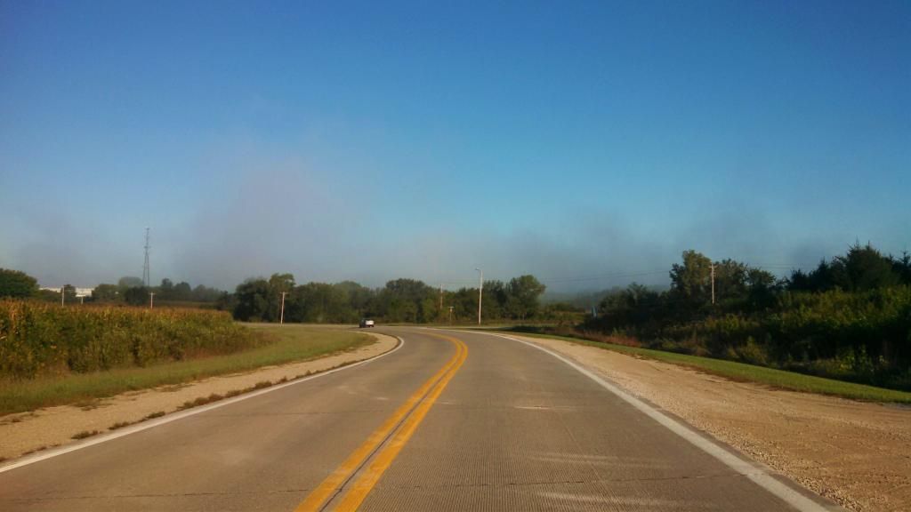
Morning fog September 13th 2014

This morning was a very chilly morning for Iowa and the entire Midwest, thanks to a huge area of high pressure which brought a large chuck of cold air southward across the middle of the country. Lows for the first time this season fell into the middle to upper 30s. Frost was reported in such places as Ames and Cambridge. The frost was light and did not cause any damage. Metro Des Moines did not have frost due to urban heating, but there was reports of some frost on rooftops. This cold snap was very early for Iowa, as 1st frost don't normally occur until into the middle of October. During this cold snap Des Moines only had highs in the middle 50s. Thursday the 11th the high was 54.F which was a new record cold high. Highs of this level are more normal for early to mid November for this area. Other parts of Iowa were colder this morning such as Mason City which had a low of 31.F, a hard frost was reported. The good news is the sun finally came out Saturday unveiling mild day. Temperatures will slowly rise to more normal levels by mid week next week, which will be in the mid 70s. Below is a list of lows reported this morning.

Lows this morning

Ames 34.F
 Marshalltown 34.F
Boone 36.F
Newton 36.F
Ankeny 36.F
 Knoxville 36.F
Winterset 36.F
Pella 38.F 
 Indianola 38.F
Des Moines International 39.F
Des Moines-Fairmount Park neighborhood ( My Station ) 39.F
West Des Moines 40.F

Thursday, September 11, 2014

September 9th 2014 storm report Sigificant flooding local area & storm chase southern Iowa, northern Missouri


 photo IMG_7716_zps6f3c69c8.jpg
Flooding from heavy rains seen in northern Missouri September 9th 2014

Southern Iowa is still dealing with the effects from flooding from our recent rains September 9th when a frontal boundary caused the storms to develop that dropped 3-5" of rain in some areas, but especially in Madison and Warren counties. Flash flooding was reported in Winterset, Norwalk, Spring Hill and Indainaola areas and included the North river flooding over parts of Highway 28 south of Norwalk. Some of the highiest rainfall reports include 5.75" from Bevington. As of 8:41pm September 11th Highway 48 south of Norwalk remains closed due to flooding, and is expected to re open mid day Friday as the river goes below flood stage. The Des Moines airport got 3.00" of rain which broke a daily record for them. My raingauge had 1.69" of rain in it continuing a very wet streak we started in August. Since August 1st we have received 12.67" of rain.  Below is a list of reports and rainfall totals on September 9th.

Norwalk 3-5" deep water on Cherry street. Street barricaded
Norwalk Highway 28 and 23rd closed, covered with water
5 miles N Indainola Summerset road closed due to flooding
4 miles SSW Winterset Pammel pard road closed due to flooding
8 miles SSW Earlham Water rescue at Pitzer Road due to flooding, no injuries
5 miles WSW East Peru 330th street closed due to flooding
 6 miles NW Pella 1" Water over Dubuque drive
Bevington 5.75"
Cumming 4.46"
Spring Hill 4.08"
Indianola 2.65"
Hartford 5.41"
Des Moines Airport 3.00"
Des Moines fairmount park ( my station) 1.69"
Clive 2.11"
Knoxville 4.00"
Pella 2.65"
Prairie City 2.86"
Newton 2.78"
Earlham 3.34"
Johnston 2.14"


Southern Iowa/Northern Missouri storm chase.


Video of inflow winds near Grand River, IA

Storm chase for the day started late and me and Alex W. We left Des Moines around 4pm and were heading for storms SW of Des Moines at Creston. We hit heavy rain and storms by the time we reached Winterset and we continued to drive through the storm down 169 then to 34 towards Murray. We took a small road,  R15 to Grand River where we finally left the rain, and there was a line of storms to our west. The video above was taken near Grand River as the storm approached. 30MPH inflow winds were measured.


Video of extreme lightning near Decatur City Sept 9th 2014

We continued south, then east towards Highway 2 near Decatur City. Here we experienced extremely close cloud to ground lightning. Several bolts struck and 2 of them I got on tape, like the one above.


Video of strong winds behind a storm near Eagleville, MO Sept 9th 2014

After sitting near Decatur City, IA we decided to go south towards the state line, on the way, we saw a tornado warning pop up for a storm over Eagleville. We crossed into Missouri and  saw the back side of the storm at Eagleville and we missed the tornado. Power was going off and on in the town. We did see more dangerous lightning and heavy rain and flash flooding.

Thursday, September 4, 2014

September 4th warm temperature report low to mid 90s tied for the warmest day of the year

 photo IMG_20140904_165446_476_zps292c9216.jpg
New Des Moines botanical gardens September 4th 2014

Today was  a toasty and windy day across Iowa as strong southwesterly winds brought the highs into the lower to middle 90s. Heat index values were over 100.F. The warmth was thanks to a low pressure system to our north causing the warm air to surge in on winds that gusting to 30MPH at times. This  warm up was in front of a much cooler airmass that is about to come down. So this could very well be one of our last real warm days of the summer season. Today tied for the warmest day of 2014 at many locations including Des Moines international with a high of 93.F. My station also tied 95.F again.

Highs and wind gusts

Des Moines Fairmount Park neighborhood 95.F
 Urbandale 95.F
Des Moines international 93.F 31MPH
 Indianola 92.F
Ames 91.F 28MPH
Pella 91.F 24MPH
Knoxville 91.F 30MPH
Ankeny 91.F 30MPH
Windsor Heights 91.F
Marshalltown 90.F 30MPH
Newton 90.F 30MPH
Boone 90.F 26MPH
Perry 90.F 29MPH
Winterset 90.F

Monday, September 1, 2014

August 31st severe weather, heavy rain and flash flooding and Nebraska, SW Iowa storm chase trip

Nebraska storm chasing trip
 

 photo IMG_7587_zpseaefb596.jpg photo IMG_7586_zps47ba1b80.jpg

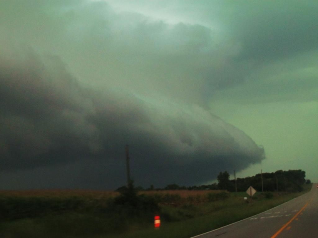
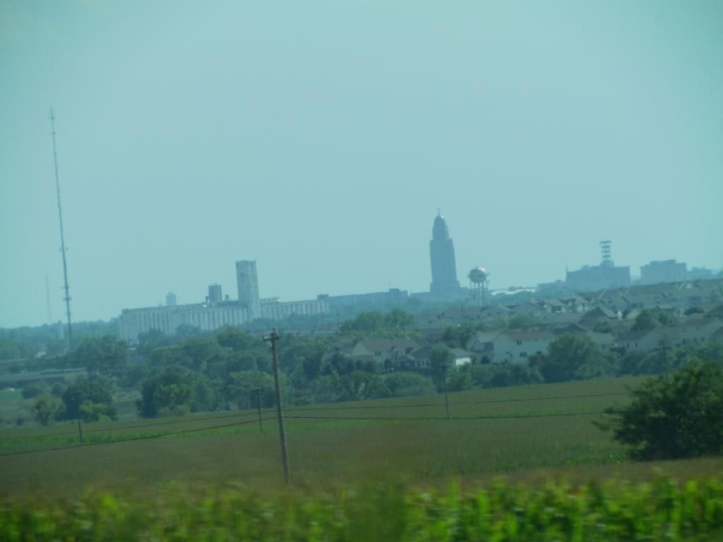
Shelf cloud west of Lincoln, NE August 31st 2014    Lincoln skyline August 31st 2014

Yesterday I had the quick opportunity to go storm chasing. Even though we knew the risk was not extreamlly high, we decided to take the risk to see something in a relatively quiet season we've had. I left West Des Moines around 1 with storm chasing friend Alex W. who drove in all the way from southern Minnesota and we headed for Nebraska and by the time we reached Omaha storms were already breaking out near the Kansas, Nebraska border.
 photo IMG_7612_zps24ea4154.jpg
 Wall clouds near Palmyra, Nebraska

We caught up with those storms about 40 miles southwest of Lincoln where the temperature shot up into the lower 90s with strong southerly winds. We saw elevated material quickly become nice looking shelf clouds near Crete, NE, pictured above We continued to followed these storms through SE Nebraska, we saw quarter sized hail and wall clouds all the way past the Nebraska City area into southwest Iowa. The last bout of severe weather seen was strong winds and very heavy rain in Shenandoah

 photo IMG_7585_zpsc0cf923d.jpg
 Storm clouds ahead near Lincoln, NE

One last photo you can see the edge of our large cluster of storms as we approached them from the northeast. They were looking very impressive.

Severe storm report- Central Iowa Heavy rain & flash flooding

Severe storms tracked all the way from eastern Nebraska and western Iowa before reaching the local area around 9pm last night in the form of a very large line that stretched across the entire state. This line produced wind damage, heavy rain and flash flooding in our areas as in dropped another 2-3" of rain across the area we did not need. The worst of the severe weather and damage was reported over northwest parts of the area. Many reports of 60MPH winds came in from the Dallas Center, Adel area with trees and power lines down. There was one report of minor damage in the Des Moines metro at Urbandale of trees limbs down More wind damage reports came in from Slater of trees down and Story City area of 60MPH winds. There was also 60-70MPH wind reports from Prairie City fo Knoxville areas. Des Moines international airport reported a 52MPH winds gust. There was also a funnel cloud reported southeast of Boone but a tornado did not develop. There storms were also responsible of producing flash flooding. Water was reported flowing over the roads in Minburn and near Granger. In Des Moines 6 inch water was reported over SW 9th street with cars stalling out in the water. Rainfall reports were 2-3"

At my backyard 2.45" of rain was reported bringing the August total all the way to 10.72" and I had water in the basement which I haven't had before.

Reports

Perry 58MPH wind gust
2 miles S Dawson 3" of rain fell in less then an hour
3 miles W Dallas Center 60MPH winds
Numerous reports of water over Highway 44 from Dallas Center to Minburn
10 to 12" branches down in Dallas Center
Adel Trees and powerlines down
4 miles E Minburn 64MPH wind gust
Berkley 60MPH wind gust
3 miles SW Boone Funnel cloud
 Slater, large tree limbs down
Roland 60MPH wind gust
Urbandale, Tree limbs down
2 miles SSW Prairie City 59MPH wind gust
Knoxville 71MPH wind gust

 Rainfall reports

4 miles ENE Dallas Center 2.62"
Mardrid 2.35"
Grimes 2.20"
Polk City 2.24"
Des Moines international 2.19"
Des Moines fairmount part neighborhood ( My station ) 2.45"
Ankeny 1.95"
Ames 2.22"
Nevada 2.26"
Marshalltown 2.40"