Snowfall earlier this morning Hiawatha,Iowa
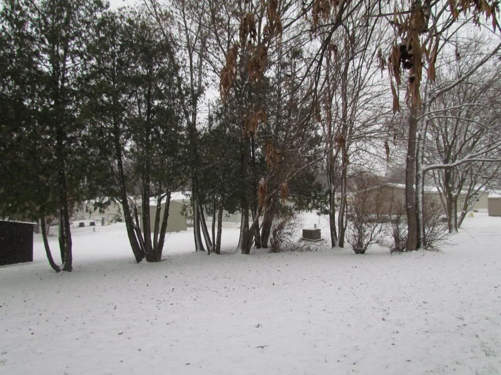
It's starting to look a lot like Winter across Eastern Iowa, as a small but potent weather system left a blanket of 1-3" of new snow across the area. The cause of the snow was a system on the heels of an arctic cold front which is about to move into Iowa. Snow started late last night around 3, 4am and continued through the mid morning hours. The bands were heavy at times before they ended. Temperatures did slowly warm to the lower 30s, but the snowfall is here today at least through Thanksgiving because the ground is now frozen and we are not expecting temperatures above 32 until the end of the week. The highest snowfall reports came from the Northern parts of the area, where 2" were seen. North of the area as much as 5.00" were seen near Olwien
Central City 1.90"
Hiawatha 1.75"
Marion 2.00"
Olin 2.00"
5 miles NW Iowa City 1.0"
Northwest Cedar Rapids 1.90"
Anamosa 2.00"
Vinton 1.00"
Coggon 1.00"


Iowa Weather Network Warnings Map

Winter Weather Advisory
Monday, November 25, 2013
Sunday, November 24, 2013
Snow likely tonight into Monday. a couple inches possible, then 2nd arctic blast ahead Tuesday & Wed. Thanksgiving looks sunny & Chilly with good travel condtions.
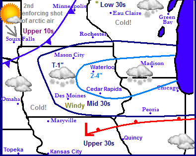
Weather Map for Monday November 25th.
Across the Midwest we have a Wintery-like pattern appearing with our 2nd arctic blast of the season already coming into play. A weak-fast area of low pressure will quickly slide across Iowa producing a quick band of snow which will drop a couple of inches, especially over Eastern Iowa, northern Illinois and Southern Wisconsin. All of this will be ahead of the next arctic blast making its way down from Canada. Highs that will be in the 30s on Monday will only be in the lower 20s again come Tuesday and Wednesday. Travel will be very easy Thanksgiving as high pressure will bring the region quiet cool and sunny weather with slowly rebounding temperatures.
Local Eastern Iowa:
Tonight and Mondays snow
For The Eastern Iowa area the cause of tonight/tomorrows snow will be caused be a warm front. We can expect light snow to begin moving in late tonight around 12am or after. Snow will continue through the 1st part of Monday and could be heavy at times before quickly coming to an end around 11am or after. Southwest winds will gust to 30MPH at times Monday which even though highs will be in the middle 30s, will make it feel colder and could blow around some of the newly fallen snow. Snowfall accumulations are still somewhat uncertain due to not knowing where the exact placement of the band will be, however it appears as of right now most of the area will be in the 2"category, and it appears some spots will have the opportunity to see 3 possibly 4" The best area for this will be the Northeastern part closer to Monticello and Manchester. The Waterloo and Cedar Rapids metro areas will be probably see between 1-3" With Iowa City area seeing a half inch or less. Again this depends on the placement of the band, if it occurs farther north, like some models are showing, most areas will only see a half inch with higher amounts outside of our area. The ground is frozen enough that whatever snow falls will stick likely through Thanksgiving.
Tuesday and Wednesdays cold
Tuesday and Wednesday the full brunt of the next shot of cold air will arrive. Tuesday will have blustery Northwest winds and low wind chills. Wednesday will be sunny with less winds, but both days will have highs in the middle to upper 20s with lows both nights in the lower 10s.
Thanksgiving Day-next weekend
Thanksgiving will bring lights winds with pleasantly moderating temperatures into the lower 30s. Expect easy travel conditions across the region as high pressure has a cold of our weather bring clear conditions for all areas. Lows will be in the upper 10s Next Weekend at 1st will bring warmer temperatures in the middle to upper 30s Friday and Saturday with lows in the 20s, it will be pleasant, but winds will probably be breezy from the south. Sunday a fast moving cold front will push through dropping high temperatures back into the 20s and lows in the 10s. The front appears to go through dry.
Tonight: Snow developing, possibly moderate or heavy at times. Breezy South winds with lows in the upper 10s.
Monday, Snow in the morning, possibly moderate or heavy at times before ending. Total snowfall accumulations 1 to as much as 4" localized areas. Windy, southwest winds to 30MPH causing some blowing snow. Highs in the lower 30s with colder wind chills in the 20s. Monday night, Clear and chilly with lows in the upper 10s
Tuesday-Wednesday, Sunny and cold with blustery NW winds. Highs in the middle 20s. Wednesday not as blustery, Night time lows cold in the lower to mid 10s.
Thanksgiving Day, Sunny and nice! Light winds with highs in the lower 30s. Thursday night, Clear skies with lows in the upper 10s.
Friday-Saturday, Sunny skies with increasing S winds. Warmer with highs in the middle to upper 30s. Lows in the mid 20s
Sunday, Cloudy and colder with blustery NW winds. Highs in the upper 20s. Sunday Night, clearing skies with lows in the mid 10s.
Farther ahead Forecast
Into the 1st part of December, Monday and Tuesday will bring slightly warmer temperatures with chances for clouds coming into the picture, highs in the 30s appear likely. Tuesday the 4th a fast moving clipper system & arctic cold front may brush our area with snow and produce minor accumulations with gusty winds, which could cause a little bit of an issue it at comes true. Most snow appears to fall north of our area. Very cold temperatures with strong NW winds will be in place for Thursday the 5th. Friday the 6th another storm system right on the heels of Wednesdays one will produce another shot of snow, this time more north into Minnesota and Wisconsin. For us it will only bring briefly warmer temperatures Friday before the next cold front plows through. A Winter Storm worth watching then develops on Saturday the 7th which tracks from Arkansas to Ohio bring heavy snows and winds to our south, however it does brush Eastern Iowa and if it tracks more north we could be more effected, This one is worth watching. Very cold temperatures of course follow this winter storm and will be in place for the 1st part of the week of the 9th. Towards the middle of December the models do try to hint at the possibilities of a warm up for our area. December will be active.
Tuesday, November 12, 2013
November 11th snowfall totals, coldest airmas of the season-Arctic Airmass produced the areas 1st teens and single digit lows.
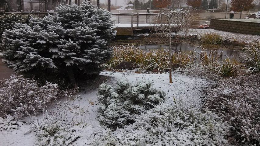
Snowfall at the Culver's Display Garden Marion,IA
An arctic airmass slammed into the region yesterday bring moderate heavy snow, strong northerly winds and dropping temperatures through the day on Monday. Monday morning started out mild and in the lower 40s. The cold front pushed through the the early afternoon hours and by 12pm Heavy Snow bands were moving through the area and temperatures fell into the lower 30s and upper 20s. A quick 0.60 to 1.00" of snow fell in a small but intense band of snow that moved from Minnesota through the state of Iowa. Skies cleared Tuesday night as the coldest night of the season so far was upon us. Lows fell into the into the lower teens and upper single digits, which allowed most of the snow that accumulated Monday to remain on the ground through the night adding to the Winter-Like feel., and now small ponds now have ice on them. This weather reminds me of my Northwest Wisconsin hometown. Below is a list of snowfall reports and lows seen.
Hiawatha, 0.75" 13.F
Cedar Rapids Eastern Iowa Airport, 0.70" 12.F
Solon 1.20" 12.F
Willamsburg 0.60" 12.F
Waterloo-Cedar Falls 0.60" 8.F
Independence 10.F
Iowa City 0.50" 16.F
Monticello 14.F 0.75"
Vinton 12.F 0.75"
Thursday, November 7, 2013
November 5th/6th Sigificant Rainfall Ammounts & Gusty Winds
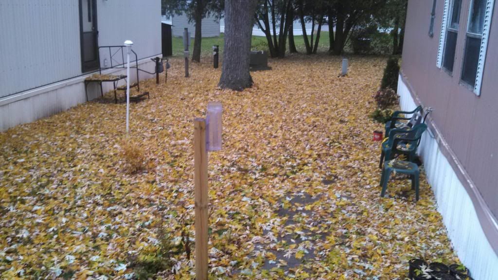
Yard November 5th 2013
Moderate to significant rainfall amounts were seen across Eastern Iowa this week all thanks to a vigorous low pressure system that moved through on Tuesday and Wednesday. The low tracked from Nebraska northwest of Des Monies then into Minnesota, this lead to mild southern air the be forced northward Tuesday. Temperatures actually rose through the day and into the night time hours, peaking around 1am with highs in the upper 50s to near 60. Waves of steady to moderate rain moved northeast through the area. Most places reported at least 0.30" of rain with the highest amounts seen in the central and northwest parts of the area, where some spots reported well over 1.00" amounts. For most communities this was the highest rainfall amounts since Mid Summer. Farther north on the storms northwest side, temperatures were much colder and snow fell, in some cases significant amounts up to 10" in parts of Southwest Minnesota. Snowfall was reported as far south as Northwest parts of Iowa near Estherville and Mars City areas 1-3" snowfall amounts were seen there. Here in Eastern Iowa, it was far to warm for snow during the time the precipitation was falling so it was all rain. It should also be noted that as the low strengthen and spun up stronger, southeasterly winds became quite gusty across our area peaking around 8pm Tuesday Evening. Sustained winds were in the 20MPH range with gusts up to 30MPH. Wind and rainfall amounts can be found below.
Independence 1.62" 28MPH
Waterloo-Cedar Falls 1.21" 28MPH
Easter Iowa Airport-Cedar Rapids 0.72" 29MPH
Hiawatha-My Station 0.64"
Iowa City 0.47" 28MPH
Vinton 0.61" 31MPH
Washington 0.41" 28MPH
Monticello 0.31" 30MPH
Subscribe to:
Posts (Atom)


