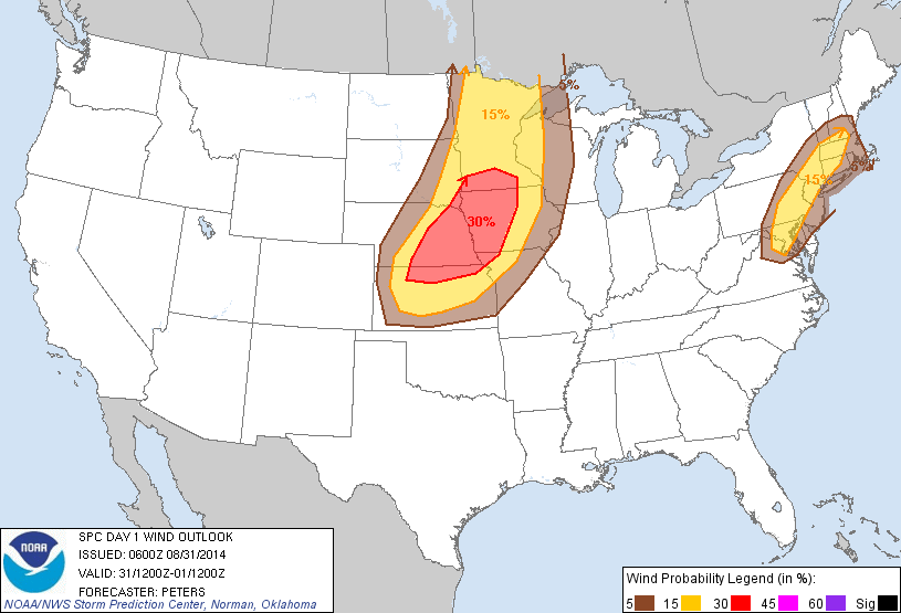
Image from SPC
The SPC has issued a Slight Risk for severe storms for parts of Wisconsin, Minnesota, Iowa, Nebraska, Missouri, Kansas and South Dakota. This includes our area. There is an enhanced risk centers over Iowa, Nebraska and Kansas as well as southwest Minnesota. Depending on what happens with the current showers in Nebraska and Kansas, The storms this evening will fire over eastern Nebraska and Kansas and moved east this evening. As the storms fire there will be a risk for tornadoes. Storms will move east and transition into a line and move towards the local area likely around dusk or after dark. In our area in poses the highest risk for high winds and large hail, as well as very heavy rain and flooding. Isolated tornadoes will also be possible. Many of the local forecast models I looked at point towards Northern parts of the areas such as Ames have a higher risk for seeing severe weather. Please be aware today that there will be the risk for severe weather.


No comments:
Post a Comment