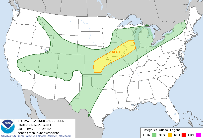
Image from storm prediction center
The Storm Prediction Center has issued a Slight Risk for severe weather for southern and eastern Iowa today and tonight. This includes everywhere southeast of a line roughly from Stuart to Ames, this includes Des Moines. The best chance of severe weather will be after 5pm mainly, and it will move in from the south and west and move east. Large hail, lightning, high winds, and even the chance for a tornado is possible today. Heavy rainfall will also be a threat, but will likely be more of a thing that is needed then that would cause issues. People in the highlighted yellow area should be prepared for the threat of severe storms today.


No comments:
Post a Comment