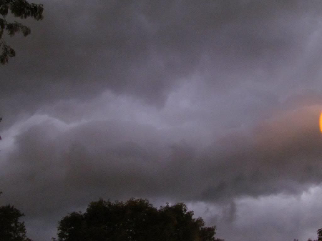
A storm system moved across Iowa over the past 2 days spreading widespread rain and even thunderstorms to the area. The center of low pressure past over Northern Iowa which brought a warm front surging northward through the day Wednesday October 30th. Warm temperatures in the upper 50s and lower 60s and high dewpoints in the 50s brought steady rain which was proceeded by lightning and thunder. The highest temperatures were seen around 12am when warmth was continuing to be pushed into our area. The rain shield from the storm spread all across Eastern Iowa, but the heaviest amounts were seen in Southeastern Iowa, where well over 1.50" even over 3" amounts were seen across the far south part of the area. Across Central and Northern areas, amounts were closer to 0.50 or 0.25 or less. Areas that say the highest amounts were south of I-80. Below is a list of rainfall amounts.
Washington 3.17"
Iowa City 0.98"
Waterloo-Cedar Falls 0.62"
Cedar Rapids-Eastern Iowa Airport 0.51"
Hiawatha-My Station 0.46"
Vinton 0.41"
Monticello 0.32"


Iowa Weather Network Warnings Map

Winter Weather Advisory
Thursday, October 31, 2013
Tuesday, October 29, 2013
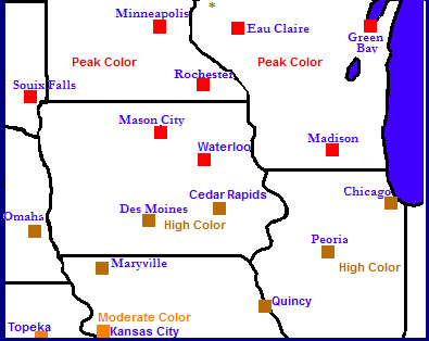
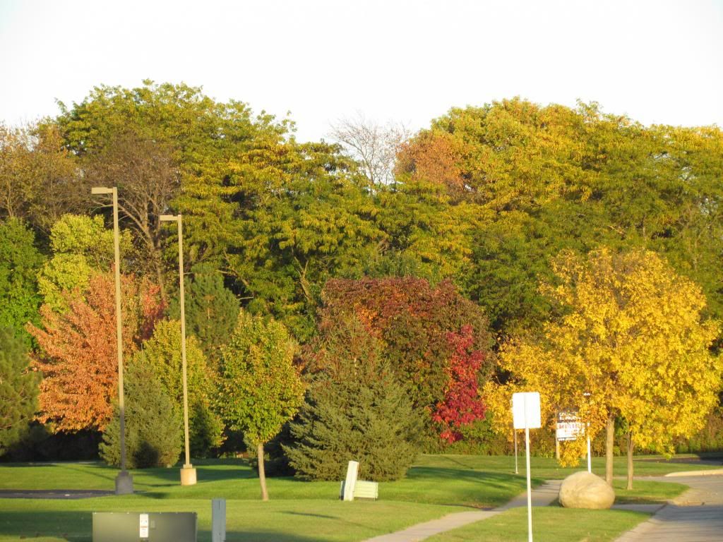
Fall Color Report- all areas peaking or at high color, however, fall color likely to be on the dull side for the area.
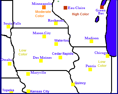
Regional Fall Color Report
Fall color across the region is peaking across Northern Iowa, Wisconsin and South Dakota. The South 1/3rd of Iowa is at high color as well as Illinois, Nebraska and Northern Missouri. Areas in Kansas and the rest of Missouri are only at moderate color at this time. Areas North and West of Minneapolis,MN to Eau Claire,WI have past peak and most trees are now bare.
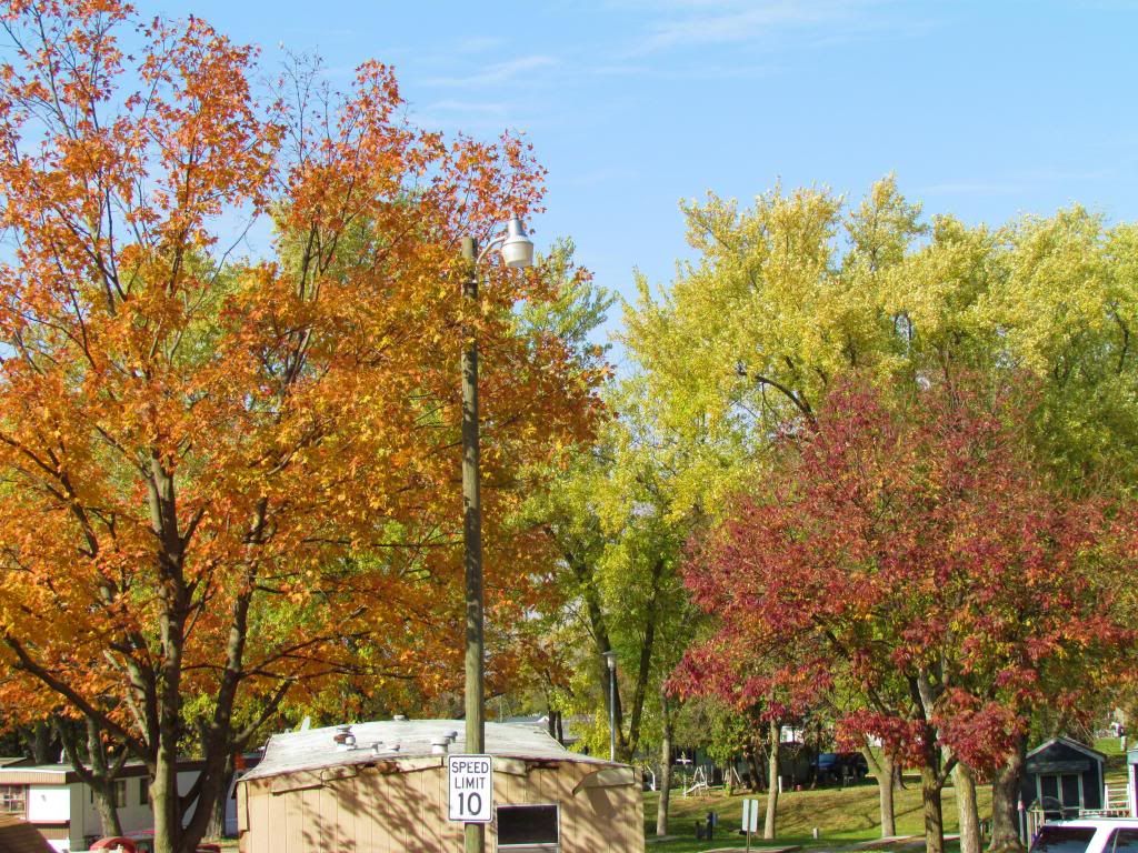
Fall color in Hiawatha,IA
Fall color in most of Eastern Iowa is at peak or is near peak. Areas North of Cedar Rapids around the Highway 20 corridor around Waterloo-Cedar Falls to Independence is reporting peak color, and all other areas such as Cedar Rapids, Iowa City and Williamsburg are reporting high color. Most trees turning, Early trees are passing peak and mid-turning trees are in full color including Silver Maples & Sugar Maples, Ash, Hazelnuts, Hackberry. Late turning trees such as Oaks, Cottonwoods and Aspens are only starting to turn. When I look as the canopy of most woodlands there is still a fair amount of green in many areas, and even colored trees appear to be fairly dull. It is likely that the drought we had in August into September has put a bit of a damper on fall color across the area, however in some areas colors are bright and beautiful especially among Autumn Blaze Maples in new subdivisions in small towns and suburbs in Eastern Iowas Large Cities.
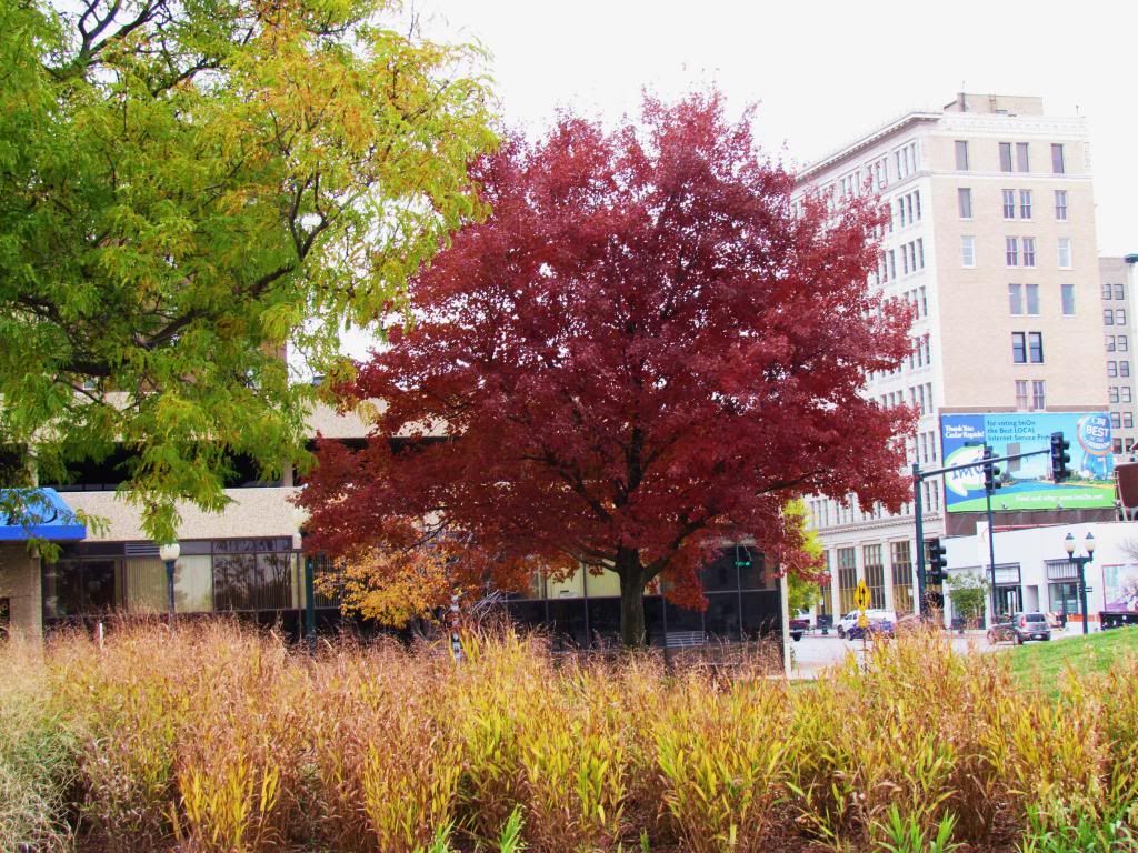
Fall Color Downtown Cedar Rapids
Fall color in Maples are bright and grasses have turned allowing for some addition the the fall color. Honey Locust Trees are turning yellow as well. In the Cedar Rapids area I've noticed the color appears the most beautiful in suburbs such as Robins, Marion and Hiawatha where Autumn Blaze Maples are highly planted, Northwest of Cedar Rapids towards Palo looking southeast at the Cedar River Valley, and the Mound View Area along the northern Cedar River Bluffs area of Cedar Rapids
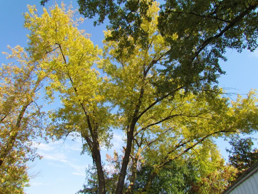
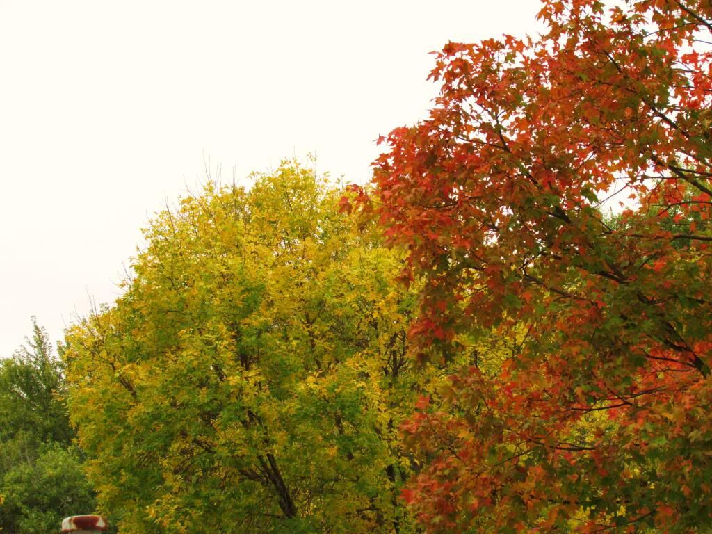
This Silver Maple Maple in our yard has a bright yellow fall color.
Iowa City High Color
Cedar Rapids Metro High Color
Waterloo-Cedar Falls Peak Color
Monticello Peak Color
Williamsburg High Color
Independence Peak Color
Vinton High Color
Friday, October 25, 2013
Areas 1st snow and frost report. Enitre are saw a growing season ending hard freeze, Low 20s reported
Snow accumulation Tuesday October 22nd
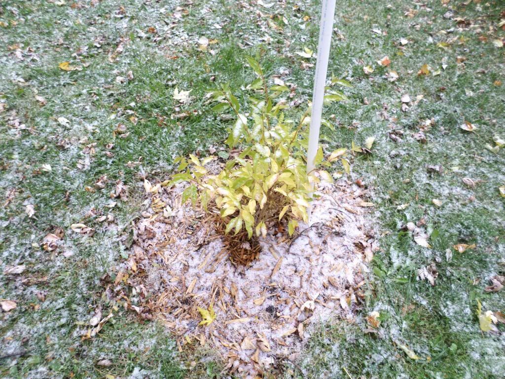
A couple new occurrences happened this week in terms of weather. While I was up nothing for my weekend, the areas 1st snow of the season occurred on Tuesday October 22nd from a band of light snow showers which spread across the central part of the state. Amounts were only around a trace to a quarter inch. This is earlier then snow would normally occur in Eastern Iowa as the average snow for October is 0.00"
Another occurrence in which happened this week was some areas 1st frost and freeze, these were mainly just areas which missed out on frosts earlier in the month. All areas reported a hard freeze when lows behind a cold front and the system the brought the snow dropped into the low to middle 20s during the coldest night which happened on Friday the 25th. Even here in the city the frost was widespread and it ended the growing season. The low was 28.F here in Hiawatha. Outlying areas has lows in the lower to mid 20s.
Eastern Iowa Airport 22.F
Waterloo 22.F
Iowa City 23.F
Mount Vernon 23.F
Vinton 25.F
Monticello 25.F
Central City 25.F
Washington 24.F
Hiawatha 28.F
Friday, October 18, 2013
Fall arriving with force. Chilly air to settle into the area with highs in the 40s and our 1st freeze likely by Monday. Snow flurries are even a possibility on Tuesday!
Regional Weather View.
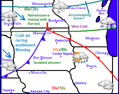
Cool air has been making is way into the Upper Midwest lately and this will be the case coming into next week. This weekend a weak area of low pressure will be moving across Southern Minnesota which will spread rain and snow across that area. There is even a chance for a few inches of snow accumulation across Northern Minnesota and Wisconsin. As the low pressure system passes, there will be a brief push of warmer air across Iowa points south and highs will be in the 60s and 70s for one day ( Sunday ) However come Monday everyone will be on the cold side of the storm. Above the / represents highs Sunday compared to highs Monday.
Across Eastern Iowa Saturday will be cloudy and cool again, much like Friday was. Highs will be in the 50s and there will be breezy southeasterly winds. Saturday Night, skies will be partly cloudy and lows will drop into the low to middle 30s. Sunday we will be on the warm side of the system, and a brief push of warm air will be pushed into our area and highs will make it into the 60s before the storms cold front pushed through in the afternoon Sunday Night, there is a chance of light showers as the front pushes through otherwise it will be cloudy with lows in the upper 30s. Monday will be cold and blustery with highs only in the middle 40s. There will be a cold wind and skies will be mostly cloudy. Monday Night, skies will clear leading the our areas 1st official freeze. Not even city protected areas will be safe as temperatures will fall into the upper 20s to lower 30s so be sure to bring in houseplants for the season and cover and wanted annuals. Tuesday will be cloudy, cold and blustery there will be some wrap around showers on the back side of the low, temperatures could be cold enough that some snowflakes could mix in. Which would be Eastern Iowas 1st snow of the season. Expect lows to once again to be in the upper 20s to lower 30s Tuesday Night. Wednesday through Friday will feature clearing skies with temperatures being slow to rebound to near 50 by next Friday, with lows in the upper 20s to lower 30s.
Saturday, Cloudy & Chilly with strong southeast winds, slight chance for drizzle or sprinkles. Highs in the lower 50s Saturday Night, Clearing skies, lows in the low to middle 30s.
Sunday, Partly Sunny, gusty south winds with highs in the lower 60s. Sunday night, Cloudy skies with a chance for a few showers. Lows in the upper 30s.
Monday, Partly Sunny & Cold with blustery northwest winds. Highs in the middle to upper 40s. Monday Night, Clearing skies, Cold. Frost and freeze likely. Lows in the upper 20s to lower 30s.
Tuesday, Cloudy and Cold, Blustery North winds. A chance for a shower possibly mixing with flurries. Highs in the low to mid 40s. Tuesday Night, Cloudy skies with lows in the lower 30s.
Wednesday, Clearing skies and not as breezy. Highs in the upper 40s Wednesday Night, Partly Cloudy with lows in the lower 30s.
Thursday-Saturday, Partly Cloudy skies with highs rebounding to the upper 40s to lower 50s. Nighttime lows in the upper 20s to lower 30s.
Looking Ahead
The ahead forecast actually continues to look active. By next weekend we will be dealing with a fairly big weather producer rain showers spread across Iowa with snow in Minnesota where accumulations are possible, we could even end up with some flurries in our area. Monday through Tuesday look to be cold but dry as temperatures rebound slowly towards Halloween. Halloween at this point looks dry with seasonal temperatures. The model does show another storm system spreading heavy rains into Iowa in the early part of November.
Wednesday, October 16, 2013
Eastern Iowa Fall Color Photos!
Fall Color Hiawatha,Iowa
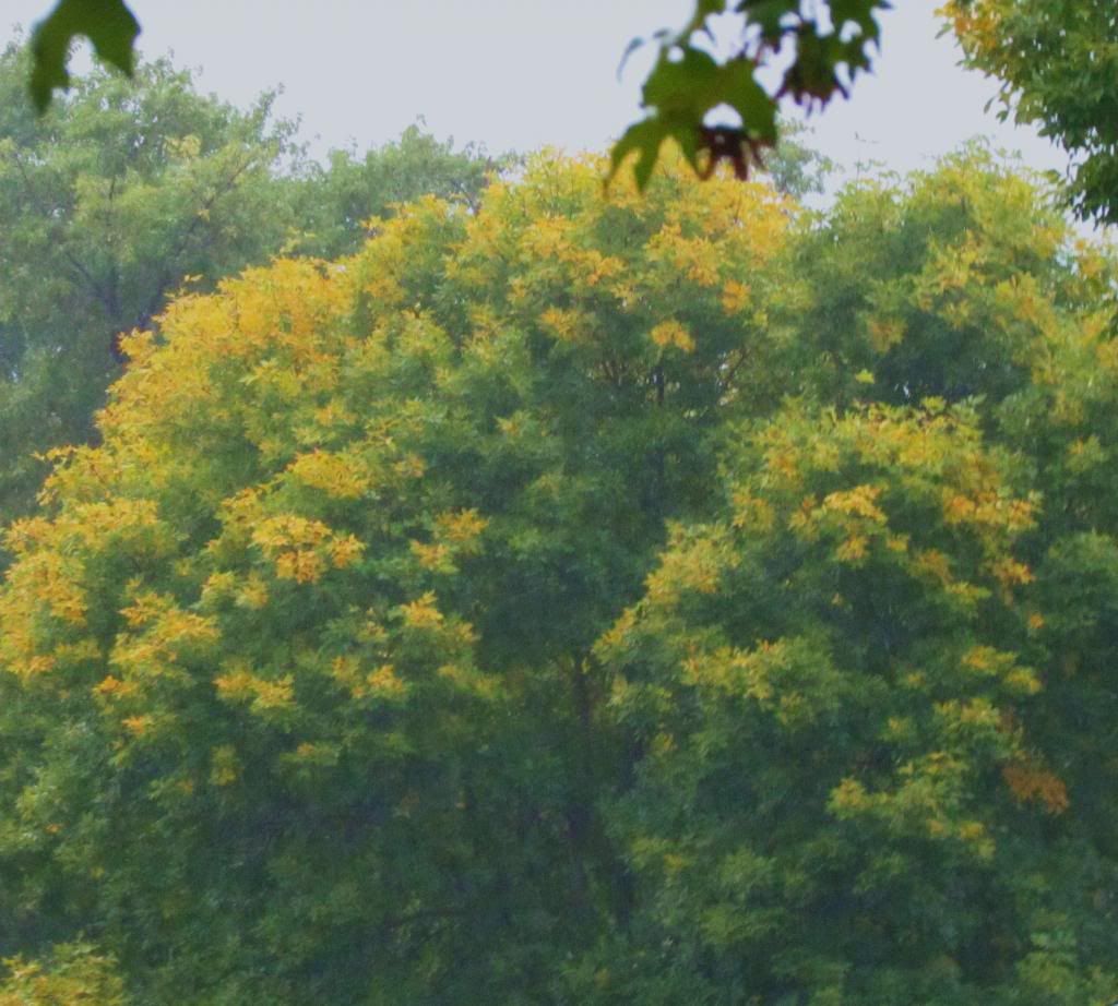
Fall colors are really starting to increase with the cooler weather we have had this week. Early and Late turning trees are peaking in color and many areas have reached moderate color status. Sugar Maples & Ashes are bright and beautiful shades of orange, purple and yellow, Red Maples are red and orange and Hackberry trees are turning light yellow. Evenwhere you go at least some sort of color can be seen. Late turning trees like Aspen, Silver Maples and Oaks are mostly still green, however some are starting to show signs of turning.
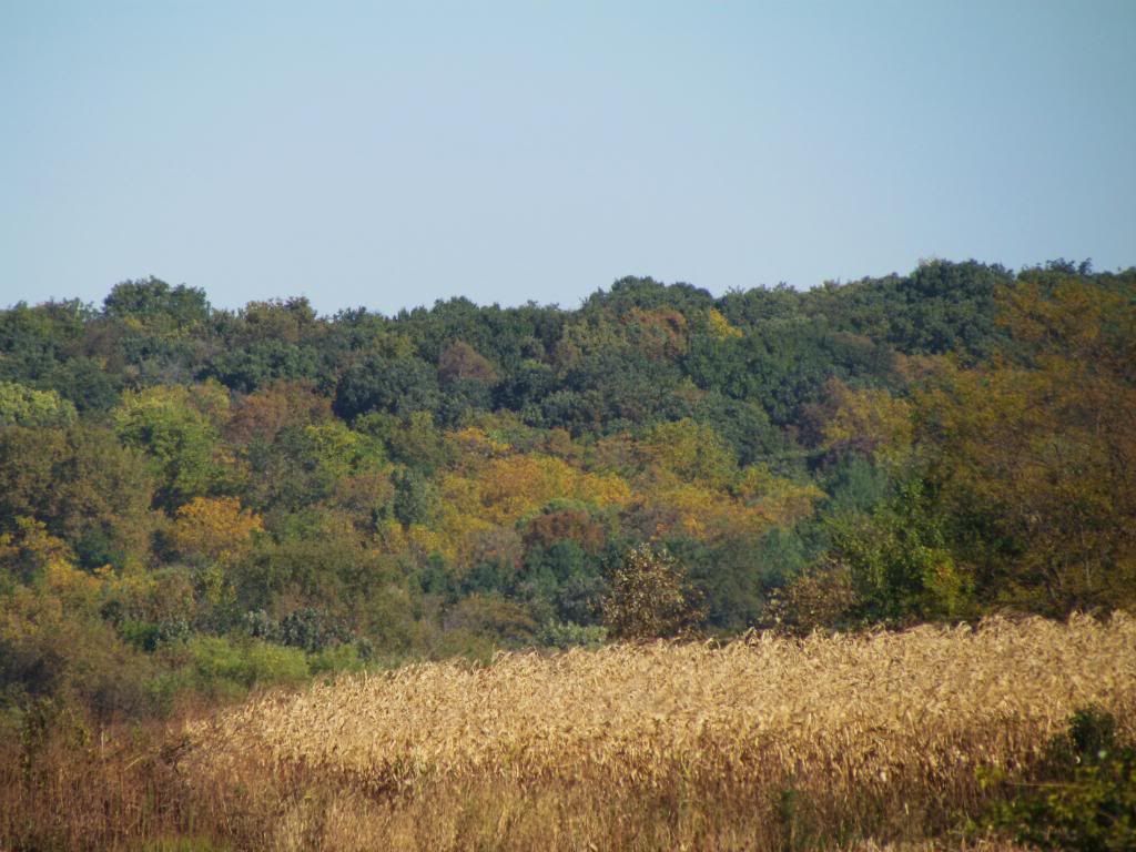
Fall color along Iowa Mississippi River Bluffs Sabula, Iowa
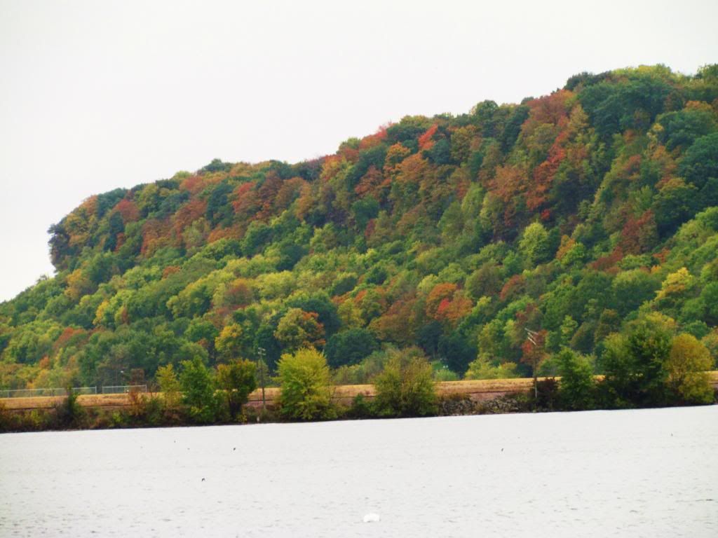
I took a visit of the Mississippi River Bluffs area and fall color is abundant and starting to get bright. I feel that over the next week or two, we will be at near peak color.
Fall Color along Mississippi River Bluff Sabula Iowa
Ashes can be seen here turning yellow and Maples orange.
Sugar Maples turning orange & yellow turning along Illinois Woodland
Sugar Maples are famous for their orange-yellow color some of which can be seen here.
Monday, October 14, 2013
October 13th-14th Cooler Temperature Report Widespread Frost reported outlying areas
Crisp Fall evening October 13th 2013 Hiawatha,Iowa
The areas 1st frost of the season was reported in a 2 consecutive nights this past week as temperatures dipped into the middle to lower 30s with some areas getting a killing frost. The 1st night with frost went virtually un warned by local weather outlets. A cool crisp high pressure system that settled in behind a cold front that past through over the weekend is the cause of the frost. The frost is general was said to be quite heavy in outlying areas and countrysides where temperatures as cool as the lower 30s were reported. However large metropolitan areas away from airport readings did not see frost and temperatures remained in the upper 30s. Inner city areas around Waterloo-Cedar Falls, Cedar Rapids and Iowa City where there are large concentrations of buildings and pavement prevented frost from forming. Here in Hiawatha, I had a low of 38.F both Sunday morning and Monday morning. I did not have frost in the lawn and no plants were effected.
Coldest Morning Lows October 13th-14th
Monticello 30.F
Waterloo Airport 32.F
Williamsburg 33.F
Robins 34.F
Coralville 34.F
Iowa City Airport 36.F
Independence 36.F
South Waterloo 36.F
Marion 36.F
Eastern Iowa Airport 37.F
Central City 37.F
Hiawatha 38.F
Downtown Cedar Rapids 40.F
Sunday, October 13, 2013
Fall Color Report # 3 color is increasing but still consider low for all areas.
The fall color map this week shows an expansion of color across Central Minnesota and Wisconsin. Low color is still all that is being found across Southern Minnesota, Iowa, Illinois, Kansas South Dakota and Nebraska. Moderate color is expected to soon expand across Southern Minnesota, Northern Iowa and Southern Wisconsin in the upcoming weeks.
Fall colors in Eastern Iowa.
Here in Eastern Iowa fall color is continuing to increase. Most areas are still on the low end of the fall color spectrum but are beginning to approach moderate color. Ash trees are at peak and are in colors in yellow and purple. Maples both Red and Sugar Maples are turning orange and red. Burning bushes are turning fire red and Amur maples are turning as well. In areas where there are earlier turning trees concentrated in one area color is good, however when looking at the canopy as whole most of the canopy is still green and the colors that are there are not yet bright. Mid to late turning trees like Oaks, Aspens and Silver Maples are still green as well.
Area fall color report
Cedar Rapids Metro Low Color
Iowa City Low Color
Waterloo Low Color
Anamosa Low Color
Independence Low Color
Sunday, October 6, 2013
Fall Color Report #2- Low color all areas
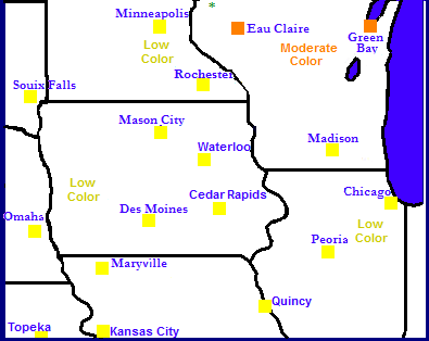
Regional fall color report
Color is increasing across Minnesota and Wisconsin where some areas are reporting Moderate color. Further north, peak color is being observed across Northern Minnesota and Wisconsin.
Fall color among Green Ash Species October 6th 2013
Here in Eastern Iowa, most areas are still reporting low color, however fall colors have been increasing quite a bit across the area. Ash trees are still taking the main show, but most are quite beautiful at this time with Green Ash turning beautiful gold-yellow color, White ashes are purple. Maples, both sugar and red as well as autumn blaze species are just starting to turn red and orange. These are all mostly Early changing trees. Late changing trees such as oaks, aspens, cherries, birches are still green. I suspect that fall colors will really start to increase this next week.
Fall Color Reports
Waterloo/Cedar Falls Low Color
Cedar Rapids Low Color
Iowa City Low Color
Anamosa Low Color
Manchester Low Color
October 4th severe thunderstorm report. Strong winds & Golf ball sized hail reported.
Storm front from early morning storms Friday October 4th
A very strong fall storm system lead to the development of a very late severe weather outbreak across Iowa. A late warm, humid airmass with temperatures in the 80s and dewpoints in the 70s was the fuel for these severe storms. From the storms, several tornadoes were reported in far Northwest Iowa where the worst of the severe weather was seen. Here in Eastern Iowa we dealt with several rounds of storms all of which hit during the morning hours Friday. The first wave 1st developed west of Des Monies and produced significant damage in that area. It pushed across the state following I-80 and weakened to below severe levels by the time it reached Eastern Iowa around 2-3am, still strong winds around 40-50MPH were reported, but no damage was reported. The 2nd wave of storms developed Southeast of Des Monies and these storms were more along the pulse-like nature. These storms moved northeast into Iowa County and pulsed to severe limits in that area and produced golf ball sized hail in the Amana area. This storm moved northeast towards the Cedar Rapids metropolitan area and did cause a scare for the Southeast Cedar Rapids and Marion, but luckily the storm weakened before reaching the metro. This storm was the last one of severe levels to effect Eastern Iowa. Rainfall amounts across the area ranged from 0.08" in Waterloo to 0.79" here in Hiawatha and even 2" plus in the Center Point-Central City area.
Interesting Note- lightning seen over 100 miles from storms in Northeast Iowa:
Late evening around 10pm, there was several reports of lightning flashes as far south as Cedar Rapids and Washington, I myself witnessed the lightning and it was not your typical thunderhead lightning that you can see for 100s of miles from some storms, it was true lightning flashes in the clouds and it was intense and constant. Several residents reported that it was more intense then normal and very strange. All this lightning was centered in storms from storms 118 miles from Cedar Rapids in Northeast Iowa in the Cresco-Decorah areas.
Storm Reports from Eastern Iowa
2 miles W of Amana 1.75" golf ball sized hail
Wednesday, October 2, 2013
Fridays severe weather risk.
The SPC has issued a Moderate Risk For severe thunderstorms for Northern into Central Iowa with a Slight Risk for the majority of Iowa on Friday. The risk area includes Waterloo, Marshalltown, Cedar Rapids and Iowa City as well as surrounding communities. The moderate risk area is showing a heightened risk for Northern & Central Iowa. everyone Northwest of a line from the Davenport Metropolitan area to Centerville,Iowa is with in the risk area. Strong thunderstorms will form along a strong fall cold front in Centeral and Northwestern Iowa in the early afternoon Friday and move east. Arriving here in Eastern Iowa during the evening hours. The biggest threat will be large hail and damaging winds for our area here in the east. But the risk for tornadoes is certainly there especially where storms 1st develop which seems to especially be near the Waterloo-Marshalltown area north and westward where the moderate risk area is located.
By sure to see your favorite internet weather source for more information
SPC outlook links can be found HERE
Tuesday, October 1, 2013
Unusually Warm Summer-Like October warmth next few days, Then a strong fall storm system will bring storms and severe weather threat for Friday followed by very cool Fall-like temperatures for the weekend patchy frost north?
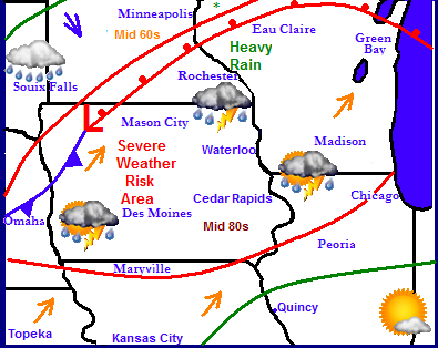
Regional Forecast Map.
A warm summer-like airmass has overtaken much of the Upper Midwest and this will continue for the next few days. However a strong fall storm system will split the region in half keeping the summer-like warmth to the south and keeping cool-rainy conditions to the north. The two airmass colliding will cause the threat for a severe weather outbreak across parts of Nebraska, Southeastern Minnesota, Northern Missourri, Wisconsin and Northwest Illinois on Friday as the cold front pushes through. Heavy Rain appears likely along and north of the warm front across Southern Minnesota and Wisconsin. The storm system will have quite a punch to it un-like other storms we've had and other weather outlooks are saying the severe weather threat may be quite a bit higher then we've seen in awhile. Saturday after the passing of the cold front significantly cooler temperatures will be felt across the entire Upper Midwest.
For the local area expect that we will have one more sunny, dry day Wednesday with sunny skies and highs in the middle 80s and lows in the lower 60s which is some 10-15 degrees warmer then where we should be. Temperatures will be near 80 both Thursday through Friday but rain chances will increase. Thursday the chance for isolated thunderstorms will begin to increase as a warm front lingers near the area and these storms could develop at any time during the day Thursday. Friday will bring the best chance for rain along with the threat for severe thunderstorms developing. It appears that the afternoon and evening a ling of strong to severe thunderstorms will push in from the west. Strong winds and heavy downpours will be the main threats, however there will be other threats as well. Saturday will only have a chance of morning thunderstorms with the afternoon being significantly colder with strong northerly winds. Highs will only be in the upper 50s to lower 60s after being near 80 most of this week. Clearing skies Saturday and Sunday nights could allow for temperatures to fall into the upper 30s, the 1st for most of the area especially North towards the Waterloo area. I will have updates on this frost chance as it approaches. Monday through Tuesday looks beautiful with cool temperatures in the middle 60s and lows in the lower to middle 40s.
Wednesday, Sunny skies and warm, breezy south winds to 25MPH Highs in the lower to mid 80s. Wednesday Night, Partly Cloudy with lows in the middle 60s.
Thursday, warm and humid, A chance of showers and thunderstorms developing during the day. Breezy south winds with highs in the low 80s. Thursday Night, Partly Cloudy with a lingering shower or thunderstorm, lows in the middle 60s
Friday, Warm and humid with breezy south winds. Showers and thunderstorms moving in during the afternoon and evening. Some could be severe. Highs in the lower 80s. Friday Night, Showers and thunderstorms, some could be severe. Lows in the upper 50s.
Saturday, Clearing skies, Much cooler, Cool with strong northwest winds to 25MPH. Highs in the upper 50s to lower 60s. Saturday Night, Clear skies, lows in the upper 30s to lower 40s.
Sunday, Sunny skies and pleasant. Light winds with highs in the middle 60s. Sunday Night, Clear skies, patchy frost possible north areas. Lows in the upper 30s to lower 40s.
Monday through Wednesday, Sunny skies and warming temperatures. Highs in the upper 60s to lower 70s. Lows in the upper 40s to low 50s.
Looking Ahead
We may be able to pull off one more nice day on Thursday before the next storm system arrives for next weekend. Another strong fall storm system brings a cold rain spreading through the Midwest bringing steady rain chances both Friday and Saturday the 11th and 12th. This will be leaving a cool fall like start to the week of Monday the 14th. This will bring another chance of frost which appears to be a much better chance this this weekends. It remains cool and sunny through the 17th of October.
Subscribe to:
Posts (Atom)

