Front yard as of October 8th 2011
The area has been enjoying beautiful sunny and very mild weather for the past week and people have broken out the shorts and short sleeves once again, but lets face it, this type of weather is just not normal for October standards! Everyday for the past 7 days has succeeded 80.F and 3 of those days has been quite hot in the mid to upper 80s at my location. I've seen an odd warm day here or there in October before, but to have such a long stretch of beautiful summer like weather this far into Oct is unheard of to me! Not only have the temperatures been un seasonably mild, but were are lucky enough that everyday has brought abundant sunshine. There was one day this past week that was very windy, Friday strong southerly gusted to 45MPH here in Rochester, taking away many of the leaves of turning trees, and taking down some minor sized branches, but besides this one day winds have been fairly light to just a few breezes. NWS La Crosse says Rochester Airport broke 1 record high this week, Friday at 84.F, They also said that there has never been a stretch of highs in the 80s this long at the airport in October even since records began in 1886!
Bulbs I planted last weekend
Many of my more previous viewers know spring flowering bulbs are one of my favorite plants, I've gone from growing them in the fridge each winter, to eventually finding varieties that worked for me so I was able to leave them in the ground. When I moved into my aunts house for college, I found out there are no spring bulbs in any of the gardens, so we both purchased about 200 bulbs together and becuase I had success in planting them the ground in my home state of Wisconsin, I decided to skip the fridge this year and plant strait into the ground. We got 3 different color Tulips, 4 different color Crocus, mix colored Hyacinths, and two different color Daffodils. If all goes well it should be a very beautiful spring next year right around the time my horticulture studies end for the summer, I planted some along the southern foundation of the house to compare to home sprouting and blooming times, and I plan to follow their growth here next spring just as I did for my gardens in Wisconsin.
Bulbs positioned in a trench along the southern foundation of the garage.
The time to plant bulbs is now! Anyone wanting to plant spring bulbs should get them in the ground in the next 2 weeks, especially if interested in Daffodils. Spring bulbs need time to root in before the ground freezes. Some bulbs like Tulips can be planted up to a week or two before a sticking snowfall, I've had very good results from this planting 1 week before a sticking snow, but the general good rule to follow is to have everything planted by the 20th of October, and for Daffodils is required that they get good roots down or they will be severely damaged and wont bloom. With this time limit, this makes the next couple weeks a great time to plant throughout much of the Upper Midwest! Don't forget to one of the post important steps when planting bulbs and that's watering them down good after planting, otherwise there just dormant bulbs sitting in soil!
Leaf covering for winter protection
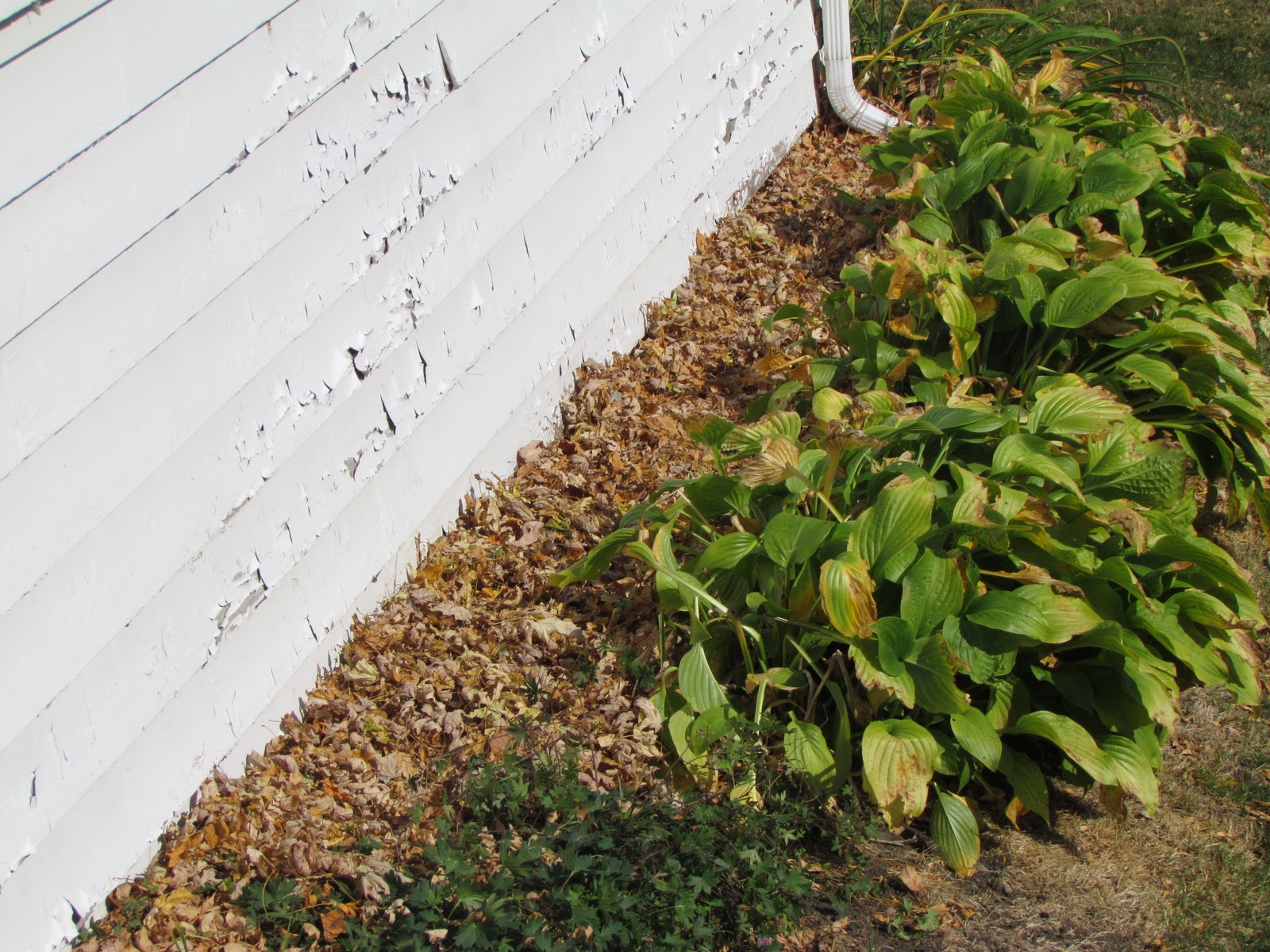
Many homeowners end up with lots of leaves in their yards, and instead of bagging them they can be added to the garden and used as a great winter protection! I've taken this step every fall and I remove the leaves the following spring as bulbs begin to sprout. I leave the leaves near by the plants in most of April in case hard spring freezes threaten.
Iowa Weather Network Warnings Map
Winter Weather Advisory
Sunday, October 9, 2011
Thursday, October 6, 2011
Rain will hold off for for weekend, bringing outstanding warm sunny weather to the area. Updated X1
Regional Weather View.
A very mild, but windy start to the weekend is ahead, A frontal system with tight strengthening low pressure will cause windy, to very windy conditions for parts of the Upper Midwest, winds could gust as high as 50+ MPH in South Dakota and North Dakota as well as Northwest Minnesota, Further east 40MPH winds are possible for the rest of Minnesota and Western Wisconsin. The same frontal system may spark a few showers or thunderstorms over the weekend.

Note The forecast for Saturday and Sunday has been changed, rain chances have been lowered or taken out completely for Saturday and Sunday, and highs have been raised becuase cloud cover will not be as full.
Locally we can also expect the windy conditions as mentioned above, to make for a windy but dry Friday, Winds could gust as high as 40MPH here in the local area, this will likely blow around a lot of the leaves clinging to the trees. Highs will be very mild for Early October and will reach the lower 80s to middle 80s in the Metro with partly cloudy skies. Lows Friday night will be in the low to mid 60s, which is closer to where daytime highs should be! Saturday and Sundays forecast is now looking brighter and warmer as well. Skies will be partly cloudy both days, there is still a small chance at a shower or storms, but it is likely now that it will stay dry. Highs Saturday and Sunday becuase it is now expected to be sunnier will be in the low 80s to mid 80s for Rochester, which is extremely mild. Monday will remain warm, there could still be a light shower, if there isn't showers it will instead be mostly cloudy with highs in the low 80s and lows in the upper 50s.
Metro View
Friday, Partly Cloudy and Windy, winds gusting to 40MPH from the southwest at times. Very mild! with highs in the low to mid 80s. Friday Night, Mild! Partly cloudy with lows in the low to mid 60s.
Saturday, Partly cloudy, Very Mild! with highs in the low to mid 80s. Saturday Night, A chance of showers, otherwise mostly cloudy with lows in the upper 50s.
Sunday, Partly cloudy and very mild, with highs in the low 80s. Sunday Night, mostly cloudy, lows in the low 50s
Monday, Partly Cloudy with a chance of a light morning shower, otherwise mild with highs in the upper 70s. Monday Night, partly cloudy, lows in the mid 50s.
Looking Ahead
Tuesday looks to be more cloudy then sunny with a slight chance of sprinkles. Then Wednesday a system and cold front that will move into Iowa will bring a much better chance of much needed rain to southeastern Minnesota, This will be our next chance at any significant rain. Behind the cold front it is much colder for Thursday the 13th, and the much cooler airmass stays in place through much of that weekend. Then the models get very interesting towards the 17th of October, It shows a clashing of airmasses come together right were a very strong storm system moves over the Upper Midwest which puts most of Minnesota on it's northern edge, with the cool air already in place, This system the models are showing right now has the potential to bring Snow as far south as central Minnesota, with rain for the local area, Lots of wind looks likely as well. It dries out and becomes warmer for the 18th and 19th, before more rain moves in by the 20th of October. The models continue to keep it very active around here through the 23rd, which would bring a system of rain over us every other day it seems. More on this later.
A very mild, but windy start to the weekend is ahead, A frontal system with tight strengthening low pressure will cause windy, to very windy conditions for parts of the Upper Midwest, winds could gust as high as 50+ MPH in South Dakota and North Dakota as well as Northwest Minnesota, Further east 40MPH winds are possible for the rest of Minnesota and Western Wisconsin. The same frontal system may spark a few showers or thunderstorms over the weekend.

Local view
Note The forecast for Saturday and Sunday has been changed, rain chances have been lowered or taken out completely for Saturday and Sunday, and highs have been raised becuase cloud cover will not be as full.
Locally we can also expect the windy conditions as mentioned above, to make for a windy but dry Friday, Winds could gust as high as 40MPH here in the local area, this will likely blow around a lot of the leaves clinging to the trees. Highs will be very mild for Early October and will reach the lower 80s to middle 80s in the Metro with partly cloudy skies. Lows Friday night will be in the low to mid 60s, which is closer to where daytime highs should be! Saturday and Sundays forecast is now looking brighter and warmer as well. Skies will be partly cloudy both days, there is still a small chance at a shower or storms, but it is likely now that it will stay dry. Highs Saturday and Sunday becuase it is now expected to be sunnier will be in the low 80s to mid 80s for Rochester, which is extremely mild. Monday will remain warm, there could still be a light shower, if there isn't showers it will instead be mostly cloudy with highs in the low 80s and lows in the upper 50s.Metro View
Friday, Partly Cloudy and Windy, winds gusting to 40MPH from the southwest at times. Very mild! with highs in the low to mid 80s. Friday Night, Mild! Partly cloudy with lows in the low to mid 60s.
Saturday, Partly cloudy, Very Mild! with highs in the low to mid 80s. Saturday Night, A chance of showers, otherwise mostly cloudy with lows in the upper 50s.
Sunday, Partly cloudy and very mild, with highs in the low 80s. Sunday Night, mostly cloudy, lows in the low 50s
Monday, Partly Cloudy with a chance of a light morning shower, otherwise mild with highs in the upper 70s. Monday Night, partly cloudy, lows in the mid 50s.
Looking Ahead
Tuesday looks to be more cloudy then sunny with a slight chance of sprinkles. Then Wednesday a system and cold front that will move into Iowa will bring a much better chance of much needed rain to southeastern Minnesota, This will be our next chance at any significant rain. Behind the cold front it is much colder for Thursday the 13th, and the much cooler airmass stays in place through much of that weekend. Then the models get very interesting towards the 17th of October, It shows a clashing of airmasses come together right were a very strong storm system moves over the Upper Midwest which puts most of Minnesota on it's northern edge, with the cool air already in place, This system the models are showing right now has the potential to bring Snow as far south as central Minnesota, with rain for the local area, Lots of wind looks likely as well. It dries out and becomes warmer for the 18th and 19th, before more rain moves in by the 20th of October. The models continue to keep it very active around here through the 23rd, which would bring a system of rain over us every other day it seems. More on this later.
Wednesday, October 5, 2011
Warm temp report-Record Highs tied today
Leaves seen falling from Front yard ash Oct 5th 2011 on a very warm sunny October day
A Very warm almost hot October day occurred today, under brilliant sunshine, highs on the backside of a high pressure system rose to the mid to upper 80s, many places were near 90.F today, which is downright unheard of for October standard highs which are normally in the 60s, meaning highs were at least 25 degrees above what is expected! People will be able to continue to enjoy this weather, sunshine with highs in the 80s looks like it will continue for the rest of the work week. The only thing that will be noticed will be the wind will pick out of the south at times to 25MPH
High temps Wednesday
Record highs were tied today including a record high tied report at Rochester International Airport the official reading for Rochester, reached 85.F the last time Rochester was this one on this date was back in 1938! Un officially the warmest Rochester reading was from my station and Northwest Rochester at 87.F The warmest area wide report was Red Wing at 88.F!
Fall Color Report #5 All areas reporting High to Peak color!
Fall Color Report 2011
The very mild weather this week has made a significant progress in our fall color season, a significant jump can be seen in our map compared to last week. All areas are reporting High color, with places like Austin and Fontenac reporting peak color, meaning all areas have at least 75% color or higher. Early changing trees are peaking right now and are quickly loosing leaves, Mid turning trees are turning as well and are colorful, late turning trees like Oak and Poplar are still green, but should be turning in the next couple of weeks. People
with fall color interests will want to view fall color quickly becuase with the warm dry and weather are causing tree leaves to dropping at a fast rate.
Beautiful street sence of yellow Honey Locus trees from my neighborhood October 5th 2011
For fall color this week I give Rochester a High Color 75% rating which is a significant raise from last weekends 40% color. Warm days and sunshine have lead to a significant increase in color over the past few days. Rochester is currently beautiful for fall color! in residential neighborhoods with mid to early changing trees, views are be beat-taking. A view looking towards Downtown from Quarry Hill should not disappoint, although some of the best views I have seen were from Silver Lake Park. Sugar Maples are beautiful red to orange, Ash and Honey Locus are peaking at are yellow to gold, Red Maples have been seen turning stunningly red, and Burning Bushes are fiery pink. Oaks, Birches and Poplars are showing signs of turning but remain primarily green. Many have asked me why the leaves are falling so quickly from the trees and the answer is very warm days like we have had actually cause tree leaves to "ripen" faster, just like a piece of fruit left outside of the fridge compared to being left in the fridge, cooler days would help to "preserve" the color for longer periods of time.
Front yard color October 4th 2011
Our yard has spiked in color significantly since my last photo was shown on the 24th of September, Our front yard ash peaked a day ago and is a beautiful yellow-gold color. It is already shedding leaves very quickly and leaves now cover the yard and driveway. Our burning bush is starting to turn pink, and for our backyard, the Red Maple I planted last August and Redbud tree are starting to turn Yellow and Yellow-orange.
Downtown Sugar Maple October 4thHere is a beautiful Sugar Maple on an empty city lot near Mayo Clinic
Sugar Maple near Downtown October 4th
Here is a very pretty view of another sugar maple which has turned an almost ember orange color, I have not seen such intense orange in a Sugar Maple before!
West Downtown Residential color October 4th
Here is are some Ash and Amur Maples
Sunday, October 2, 2011
Very warm and mild week ahead, 80s with sunshine for 1st week in October!
Regional Weather View.
A strong high pressure will give the gift of with a very warm and earily quite for the 1st part of October, It will likely be wall to wall sunshine for the next 4 days at least, tempetures region wide will be in the 70s to 80s, with really no precip to be found.
Metro view and Local view.
Locally we will be enjoying a very warm and sunny week ahead thanks to High pressure. Most everyday will feture all day warm sunshine with highs reaching the upper 70s everyday and low to mid 50s at night. The immidate Rochester metro and warm spots in the local area may even have a threat of reaching the low, possibly mid 80s a few of thoughs days. People touring the fall color around the local area will find that trees will really be taking a progression this week, Warm sunny days and cool nights are the perfect combanation for fall color to develop.
Monday, Sunny, Warm with light winds. Highs in the upper 70s to low 80s. Monday Night, Clear skies, lows in the upper 40s to low 50s.
Wedneday, Sunny and very warm, highs in the low to mid 80s. Wednesday Night, clear skies very mild with lows in the upper 50s.
Thursday, Sunny and very warm, highs in the low to mid 80s. Wednesday Night, clear skies, very mild with lows in the upper 50s to 60.F
Looking Ahead
Looking into next weekend, nice weather may just last long enough to overlap into the weekend. then Monday the 12th a system will try to bring rain into Minnesota, but it may just end out being more clouds then anything for most of the area. by the 14th the mild airmass overhead currently peaks, highs may end out being very warm around the 14th. Right before a very strong cold front and system passes through on the 16th which is so strong, it could bring snow to parts of Northwestern Minnesota. Tuesday the 18th it looks very cold for the local area, highs have a chance of being near 32.F. Pleast stay tuned as this may change as models progress towards the middle of the month.
Fall Color Report #4 Moderate color now in place in some areas, with high color in dry Southeast areas.
Fall Color report #4
Fall color has picked up quite a bit more compared to last weekend, but it was slowed down quite a bit last week by cool wet and windy weather. Earlier changing trees like Ash, some Maples, and Sumacs are now reaching peak in their color. Across the area Moderate color is being seen in Northern and central counties, with a spot of high color at Harmony, an area that was dry earlier this fall contributing to the fast change in that area. Austin is still behind from the rest of the area, still reporting low color.
Looking Northeast into Emerald Hills from St Marys Park Oct 1st.
I give Rochester 40% color, which would be considered low end of Moderate Color. We had a very fast progression last week, then colors really slowed down with cooler and wetter we had in the middle of last week. Still color has picked up sigificantly compared to last week. Color is actually high among nieghborhoods with earlier changing trees. Residents with bolvards lined with Ash, Maple, or Honey Locus maple find color that beautiful shades of gold-yellow to orange and red. Red maple trees are starting to join the action now and are turning red and burgandy. Darf burning bushes are also still in the show with firery red color. Mid to late turning trees like Silver & Norway Maples, Oaks and Elms are still very much green, so if your in an nieghborhood with more of these tree types, you may find it is still quite green.
Downtown color Setpember 28th
I took this beautiful photo of the Green ash trees which have turned yellow in Downtown before the winds on September 29th came and blew many of the leaves off. The plummer buliding can be seen to the right.
Fall color from my nieghborhood Oct 2nd 2011
This is a view of a Red Maple up my street which has turned an impressive red color, Yellow colored Honey Locus can be seen in the backround. For color in our yard, it has really made progression this week. Our front yard Ash has turned gold- yellow, and is nearing peak and should peak in the next couple days. The darf Burning bush is also just starting to turn firey red. The Backyard still remains very much green, both trees including a Red Maple and Redbud are still green. I will include a photo of the front yard color once it has reach peak.
Saturday, October 1, 2011
NW Wisconsin Weather is now SE Minnesota Weather.
I've noticed that quite a bit of viewers are having troble finding my new blog becuase I've switched my blogs web address. So to hopfully help out I've made this post to let viewers know I'm still out there, I'm just at a new blog address! As many people know my blog has been changes to cover Southeastern Minnesota. So a need of web addres change was needed. Now when people type in NW Wisconsin Weather in their serch engine, to try to get to my nwwisconsinweather.blogspot.com blog they will get a "this blog has been delelted" message, when the fact is all my old posting from Wisconsin will remain in tact. To find all my old postings as Northwest Wisconsin Weather, as well as my new blog please go to: seminnesotaweather.blogspot.com
Thanks, Blog owner
Derek McKay
Thanks, Blog owner
Derek McKay
Subscribe to:
Comments (Atom)


