Backyard- Rochester,MN August 16th 2011-(Thermometer and wind gauge seen as the two white poles)
I spent the last few days moving into my aunts house where I will be staying for 2 years while I attend college. and I can say it is quite a change from the house I grew up in at my quiet hometown community of Clayton,WI. Rochester has a population just under 110,000 people and the house is located in a highly populated residential area 1 mile west of the high rise buildings in Downtown Rochester. I'm just 2 blocks from the well known St Marys Hospital building, which is more then 10 stories tall. The hospital can easily be seen from the backyard deck. I've already witnessed the helicopter fly several times from the helicopter pad on top of the building.
Front yard street view.
The house is located on a quiet neighborhood side street, but just down the street is a major intersection where and 2nd Street SW, meets with Highway 52, which is a very busy street into and out of Downtown. I can tell Rochester is a fast growing city, because they are in the process of making another tall building across the intersection, which was not there a month earlier! There seems to increase of development and tall buildings right around St Marys Hospital near our house which is an area known as West Downtown, because of this when I refer to my backyard station I will have it listed as "West Downtown Rochester"
Front Yard Rochester,MN August 16th 2011
Here is the front yard, it's much smaller then my yard back at home, but not any less beautiful, especiallybecause I spent the last 2 afternoons adding plants I brought down from Wisconsin. I can already from the last couple days that feels much hotter in a bigger city setting then at home, and not only does it "feel" hotter but it is. My newly set up weather station has been continuing to read 3-5 degrees warmer then that of the Rochester International Airport 15 miles outside of the city, even at night. This will be something I will continue to study through my time living here. I will have more area pictures and forecast posts in the days to come!
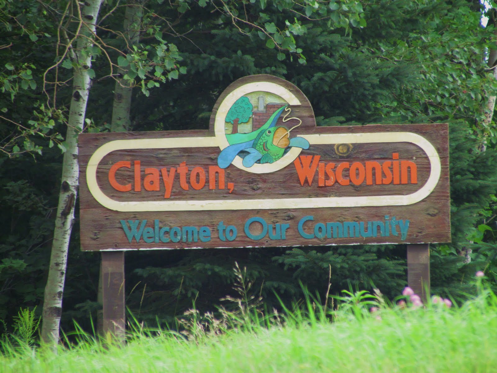
Dedication photo- Welcome sign on North of Clayton,WI August 12th 2011
For a special dedication post to my hometown of 20 years which organized in 1909 and has a updated population of about 600 residents, I decided to take a picture and of the welcome sign on the north side of Clayton along Highway 63. I really very much enjoined my time living in Clayton, so far and am very dedicated to my community. The people and sense of community in this town makes it like no ordinary town, and makes my proud to say my hometown is Clayton,Wisconsin, No madder where life takes me I will always remember remember where I'm from, and that's the great state of Wisconsin! A post on the great 2009 Clayton Centennial with photos of Downtown Clayton can be found HERE
Backyard Station History
Well the day is here. This will be my last post with my blogs name as Northwest Wisconsin Weather, but I would like to say there will be no goodbye because this is not the end of my and my connections to Wisconsin! Still I would like to take the opportunity to talk about my weather stations extremes over the past 3 years. I will cover the basic topics including strongest wind gusts, temp extremes snowfall and rainfall extremes, but I will say there is no way I could fit everything in one post! During the past few years Wisconsin has continue to show me it is truly the place of extremes. Besides bringing beautiful weather I've dealt with everything from extreme cold, heavy snow and near blizzard conditions to extreme heat, droughts, high wind, severe storms, and also extremely heavy rain. This is why I dedicated my blog to cover Northwest Wisconsin, so people could go back and look and these extremes for themselves as they occurred.
Location
My station consisted of 3 thermometers and 2 wind gauges and a official rain gauge location in various locations around the yard, which is in the Clayton Village Limits about 1 mile southeast of the residential area on top of a hill surrounded by either farm fields or trees on all sides accept the north, which is where there is distance woods.
3 year warmest and coldest temperature-Hottest: 100.F June 2011. 3 year number of 90s Total: 25 days. 2 in 2008, 1 in 2009, 10 in 2010 and 12 in 2011. Coldest: -24.F January 2008. 3 year number of days with highs below 5.F Total: 19 days. 9 in 2008, 6 in 2009, 2 in 2010 and 2 in 2011. Post with second coldest temp found HERE Post with hottest temp recorded can be found HERE
3 yearHighest Wind Gust: 46MPH Occurred in a thunderstorm in July 2011. This number was tied two times before in May 2008, again October 2010. I must mention that the windiest 24th hour day my station ever experience was during the October 27th significant storm system in 2010 which was a very strong low pressure. My post on that storm can be found HERE
3 year highest 24 hour snowfall-19.0 Inches in Major December 2010 blizzard. Highest snow depth 26.0" Mid December 2010- 2010 blizzard post HERE
3 year highest 24 hour rainfall-3.66" July 16th 2011. July 16th flooding and lightning Post HERE
Special Thanks & Alternative Western WI blog;
I would like to take the rest of this post to thank viewers for their support over the past 3 years. I've had the opportunity to see all kinds of people from weather hobbyist like myself to concern citizens who live in other parts of the state. During my blogs weather and gardening coverage in Wisconsin I had about 100 to 300 viewers per month, mostly from viewers from Western Wisconsin, but some were as far away as Kansas and Oklahoma to New York. I would also like to again thank all my past viewers for all their kind comments it was people like you that kept me continuing to cover the area! For people that continue to need coverage besides the National Weather Service for Western Wisconsin, I will direct you to a friend of mines blog who also posts in this area. He does not post forecasts as often, but during storminess and active times he is always on top of things, especially with severe weather. Please visit his blog here- Dirks Forecast Center-Rice Lake,WI You can also see Tim's Weather Blog for coverage in Washburn and Burnett Counties. There will be a link provided near the top of my new blog with these two blogs so that everyone can easily find them, otherwise they will be on the sidebar much like where they are now.
New Blog Ahead!
New blog header to be added soon.
I am happy to announce that my new blog will be called SE Minnesota Weather, I will cover 6 counties surrounding Olmstead County, making it a 7 county coverage area in Southeastern Minnesota. Some of the largest communities I will cover will include Rochester, Austin, Red Wing and Winona, and some of the smaller communities will include Cannon Falls, Zumbrota, Chatfield, Lyle, Dodge Center and Lake City to name a few. I will be making a welcome post in the next few days to announce the start of my new blog coverage area!
Noteto friends and connected blogs
I ask that all my friends who have my link typed out on their blog to please change the name to SE Minnesota Weather as soon as it's a convenience to them!
A pleasant couple of days for weather, not to cold or to hot will cover the entire region for at least two more days. Highs will be in the 70s to 80s region wide. Then a warm front will bring an increasing chance for storms on Friday across much of the region. It is too early to tell if it will be severe.
Local View.
Note: With the allowed time that I have left, This will lilkely be my last forecast for Western Wisconsin before I change coverage areas to Southeastern Minnesota.
Locally as I bring the viewers of my hometown & area my last forecast, we can expect a beautiful next couple of days, Wednesday and Thursday both should feture a lot of sunshine with warm sunny days, and pleasantly chilly nights, with low humidity. Highs will be in the upper 70s to 80, and lows will be in the mid to upper 50s. Its not until Friday that we have to worry about rain falling once again, and they may come in the form of thunderstorms. It is too early to tell if they will be severe, but I would not be surprised if some were strong, and brought heavy rainfall. It appears a warm front will be the cause of Fridays rain chances. Highs on Friday will be in the mid 70s, and lows in the low 60s.
Wednesday, Sunny and pleasant, low humidity. Highs in the upper 70s. Wednesday Night, Clear and cool, lows in the mid 50s.
Thursday, Sunny and pleasant, low humidity. Highs in the upper 70s to 80. Thursday Night, Increasing clouds, lows in the upper 50s.
Friday, Partly sunny then a chance of afternoon thunderstorms. Some could be strong and produce heavy rain. Highs in the mid 70s. Friday Night, A chance of thunderstorms, otherwise cloudy with lows in the low 60s.
Looking Ahead
Looking ahead to the all important weekend, Saturday may have some showers or thunderstorms early, then it looks to clear out some. Sunday which is also my move out day looks like the best day of the weekend. It will feature sunny skies and pleasant temps. Monday the 15th looks a bit warmer but still sunny. Then after Tuesday the 16th warmth, humidity as well as storm chances increase. It looks like Western Wisconsin will be dealing with off and on storm chances every other day or so. It cools off and dried out slightly for August 20th, before it warms up and turns wet again in time for the 22nd of August, which looks like a warm week as well. It stays warm and wet even after 25th of August for Western WI.
Focus for Saturday is on a stationary front/cold front system moving through the Upper Midwest. This system will spread hot and humid condtions back into the region, along with elevated chance for severe storms across much of the Upper Midwest including Iowa, much of Minnesota and Eastern South Dakota and northern half of Wisconsin. Heavy rain is also possible.
Local area view.
Note: This forecast has been updated and Sundays Forecast as been added.
Severe Weather Potential Saturday
Saturday will have a chance of storms, and some of them could be severe. Right now it appears after a threat of morning storms, skies will likely clear somewhat in the afternoon and it will become hot and humid. Some places could have upper 80s for highs. Then late in the afternoon Thunderstorms will develop along the cold front and stationary front. The storms that develop could become severe. The timeframe of the biggest threat seems to be evening and overnight, and the highest threats are large hail, damaging winds very heavy torrential rain, and the threat for tornado, especially north. With the rainfall that has fallen this month and last month flooding could be an issue.
Sunday besides a threat for morning left over storms, we will be left with cooler conditions and less humid conditions as well as breezy west winds. Skies will clear during the afternoon. Highs will be in the upper 70s and lows in the upper 50s
Saturday, Partly Cloudy hot and humid, with a chance of thunderstorms in the afternoon, some could be strong to severe. Highs in the mid 80s. Saturday Night, A good chance of thunderstorms, some could be severe and have torrential rain. bring or strong. Lows in the mid 60s.
Sunday, Chance of a morning left over storm, otherwise clearing skies, less humid, cooler and breezy. Highs in the upper 70s. Sunday Night, Partly cloudy, lows in the upper 50s.
Looking Ahead
Dry weather continues through Monday, before another chance of rain and storms moved in for Tuesday and Wednesday. Temperatures during that time actually look slightly on the cooler side. Thursday and Friday the 11th and 12th it clears out and becomes sunny and pleasant with nice temperatures and cool nights. before it comes warmer and more sunny by the 15th of August. The rest of Mid August shows a continued warming trend and less stormy conditions.
This post is letting viewers know of a huge change coming to my blog with in the next two weeks, but before I do I'd like to explain what my blog has been about. I'd like to first say that I grew up right here in Western Wisconsin in the village of Clayton. I started this blog in 2008 after a friend of mine originally from Washburn,WI convinced me to start one. I formulated an idea that I wanted to create a weather forecast blog for the Western Wisconsin which released forecast from a person who knows the areas climate and the communities. I also dedicated multiple posts towards helping people in their gardens, and to my hometown events and some history, and Clayton's 2009 100 year centennial which was very exciting! After I got into forecasting, I also began releasing small reports after storms had past my location, pretty soon I found myself reporting for the entire area after every storm, which I eventually found very useful because I, as well as other people could look back and see what the area got in past storms. Then I started getting people who also found the information very useful because they lived here or have cabins and they found the reports to help them find out what their area revived. So after awhile I began writing long and detailed reports after every storm. As the years went by I found many friends covering for nearby areas and even covering the same area, but all of us and my fellow blog owners worked together to provide full weather coverage, which covered much of the Upper Midwest! and especially covered Western Wisconsin in great detail.
Changes Ahead
Rochester,MN Skyline from Elton Hills.
Well it's now quickly reached August and it is nearing the end of my time living in Western Wisconsin. As many of you know I am moving to Rochester,MN later this month so that I can peruse college so that I can reach lifelong goal of getting to work in the Horticulture Field, which many may be able to tell that I've been interested in my entire childhood and young adult years.
NW Wisconsin Weather blog schedule.
Even though I'm moving I still want to continue to have a weather blog, I have not decided fully what I want to do with Wisconsin Coverage, but at this time it is probably likely I will be much busier with college so I will likely end my blogs coverage in Western Wisconsin, but I would be moving my blog to cover Southeastern Minnesota, so over the next couple of weeks I will be slowly changing things to a southeastern Minnesota theme. I will try to aim to post forecast and reports just as I've done for Western Wisconsin. I will state right now that will not be deleting all my years of old posts that I made for Western Wisconsin, they will remain in tact. My blogs web address is for NW Wisconsin Weather, so for the first couple of weeks my blog address will remain the same but will eventually it is likely I will have to change it.
In the days ahead
I want to first let viewers know I will continue to cover the area to the end, I plan on keeping everything just as it is until just a day or two before the move out day, then by the 17th or 18th of August most changes will have likely take place. My move out date is August 15th so there will likely be a time when my blog is inactive for a few days because the move is over 100 miles.
Final post still ahead.
I also wanted to let viewers know there will be one final post which will single the end of Wisconsin Coverage and will likely be my last post from Western Wisconsin before my blogs moves coverage area. I also plan talk a bit about my coverages history and thanking viewers for there support, I will also talk about the my future new plans for my blog with new blog name!
Low hanging clouds from 2nd storm to hit my location August 2nd 2011
The area again dealt with severe storms this Tuesday, There were two strong waves in particular, one during the early morning hours, and a second in the mid morning hours. Whats different about this one is a large chunk the area was effected, with some areas getting hit by both damaging storms. Some locations were hit quite hard with wind, multiple trees were down some falling on cars and homes in SW Burnett County, and even a damage reported to a business roof in Western Polk County. It was severely damaging winds was the part that caused the most issues, but there was also significant flooding rains up to 3-4 inches and hail reported. This report will focus on the areas as a hole first with 2 storms, the morning and mid morning in particular will be mentioned.
Radar of the 4-5AM storms Northern Polk County.
Area Report 5AM storm
Rain and storms from ahead of a warm front cleared out prior to the 5AM in the morning storms that moved though. Although most of the precip had moved east of the area for most of the night, a warm front was left sitting over the area. Thunderstorms developed along this front North of Duluth and literally rode the front all the way south, first hitting Minong with measured near 50MPH winds. This storm continued to ride the front south, and eventually picked up in intensity as it pushed into Polk and Barron counties. A wind gust of 59MPH was reported Northwest of Rice Lake before the storm finally pushed into southern Polk County, where it caused wind damage around Clayton and east. Barron Electric reported to my uncle they were out getting trees and limbs out of powerlines all day from there coverage area. The storm really began to weaken as it pushed into Dunn County where it eventually went below severe limits.
Radar of 10AM storm
Area Report 10AM storm For most the second storm was the most damaging. This storm developed right near the intersection of the systems cold front/warm front intersection and first developed in South Dakota. The storm moved very quickly at 50MPH across the State of Minnesota before finally reaching Wisconsin. Damage was first caused in Western Polk and Burnett counties, and damage here was quite significant. Widespread tree damage and some power line damage was reported in Trade Lake and near Osceola and Dresser. The storm began to weaken as it pushed into Northern Barron County, but still caused tree damage even as it exited Barron County. The most damage from this storms seems to be narrowed at a corridor of Northern Polk and Barron Counties, as well as Southern Burnett and Washburn counties.
* Clayton area storm-significant wind gust at my station*
Storm video around 5AM from West porch August 2nd 2011
Both storms hit my location, but the 1st 5AM storm was much more significant. and was definitely the most significant for wind I've seen in the past resent years. My gauge for the second time this year far surpassed any past reading I've recorded for a thunderstorm, with a reading of 46MPH measured on my gauge, This ties my stations highest ever wind reading. Leading up to this gust, I awoke just before the storm hit, long enough to see I was under a thunderstorm warning and see that that my friend Dirk Northwest of Rice Lake also was getting get hard with winds. The storm had no real sharp looking gust front at my location, but just before the rain hit very strong, powerful winds hit my yard with wind direction from the North even slightly easterly, which is odd for a storm. I really want to remind my self later when I read this that the wind was very strong and really came in two very strong bursts, The low pitch howl of high winds in distance trees and the eves of the house rattled most of the time when the gusts were occurring. When I looked at my gauge next to the porch I was filming from and saw 46MPH I was amazed because I've never had a reading that high on my tree canopy protected gauge from a thunderstorm. After the wind torrential rain and lots of lightning occurred until the storm finally passed. I got a total of 1.19" from both storms that hit today.
Large oak branch August 2nd.
My yard had some of the more significant damage I've seen in resent years from a thunderstorm. Roof damage occurred to our garage with shingles thrown across the yard. This oak branch above which was originally found thrown across the front yard into the lilac on the side side of the house was 3 feet in length and 1 inch in diameter, This is considered a special occasion because it is the largest living branch I've had come down in the past 3 from the Oak trees. Backyard branch.
Other damage in my yard including this 2 feet in length Ash branch in the backyard, and a 8 foot in length dead branch which fell into the SE corner lilac bush. While I was out taking pictures, the sound of shifting and snapped tree limbs could be heard in the woods on the south side of my house. Large tree down
Damage was quite a big more significant outside of my yard, with multiple trees and branches down. This large mature oak went down in my aunt and uncles cow pasture 1 mile south of town. We believe the very wet conditions may have contribute to why it fell. This is the second tree they lost in their pasture due too wind. Earlier in the morning my aunt and uncles street was blocked from two fallen dead elm trees which blocked the road and had to be removed.
Here is another image of a fair size spruce branch that fell in my aunts yard.
Tree down along N Polk/Barron st
This poplar tree also went down in the storm and was hanging near the roads edge.
Broken branch on 70th AVE
Other damage not pictured here included more large branches around various parts around, and some in Clayton.
Area Storm Reports-entire day, in order from time occurred
6AM storms
Minong 47MPH gust
6 miles NW Rice Lake 59MPH gust
Clayton, a few large branches and trees down with a 46MPH gust.
10AM storms
2 miles SW Osceola Part of a greenhouse roof blown off with multiple trees snapped in the area
Dresser, Tree down into power line
Trade Lake, Multiple trees down, falling on cars and homes.
Storm front of the morning storms on July 30th 2011
Area Report
July 30th brought yet another stormy day to Western Wisconsin, the area was actually plagued with severe storms twice on Saturday July 30th, which developed along a stationary front that was sitting over the area, After brief morning sun, and rising temperatures along with humidity, storms that were ongoing in Minnesota pushed into Western Wisconsin particularly Burnett and Polk Counties and gained strength, enough so that the NWS issued a warning. The storm produced very heavy torrential rain and very gusty winds across Polk County, and much of Western Barron County. There were two reports of funnel clouds, one from St Croix Falls and another 5 miles north of Amery, but these did not develop into tornado's. The storm weakened significantly as it pushed southeast into Dunn county shortly after. Winds near or over 40MPH were reported in Cumberland, Amery as well as my location. There was no damaged reported, in fact the damage that I have seen around my location is the only damage that is known with this storm.
Area second storms
After the 1st storms passed through skies cleared and it became hot, the atmosphere became unstable just in time for another round of strong storms to push through during the late evening hours. Much like the first brought heavy rain and gusty winds, with the strongest cell following a path nearly the same the 1st one, accept it was slightly more to the Northeast, This is why some areas ended up getting two storms in one day. There were no reports to the SPC for damage, but my friend who volunteers for Turtle Lake Fire Department said there was a tree down from wind which fell on a power line which caused a fire. The fire was put out safely.
Clayton/my yard Storm Coverage.
Video of the storm from my aunts lawn July 30th 2011
1st storm
I begun the day looking at the radar. I saw storms to the Northwest, but I was thinking the threat of strong storms would not be until evening, enough so that I went to my aunts for a day of gardening, after a couple hours of gardening in hot temps around 85, the skies darkened so I went inside my aunts house to check on the radar I could see storms moving towards our area from the northwest. We tried to get a few more minutes of gardening in but eventually had to go indoors due to increasing lightning, where I staid during the duration of the storm which is 1 mile from my house. First came wind before the storm which really cooled things off, then very heavy rain and lightning came, then there was another much stronger burst of wind from the NNW during the heavy rain this one made the tall trees at my aunts yard sway back and forth, then it slowed down as rain continued, My gauge read 39MPH when I got home, but what happened next in the storm was fairly odd to me, near the storms back side where the rain was almost over, the wind switched from a northerly direction to a southerly one, before finally switching westerly as rain ended.
Yard flooding July 30th 2011
After the storm passed, my aunt and I noticed her small trees were bent slightly to one side, and her yard was flooded in a lot of places, My gauge said 0.88" of rain fell in a 30 minute time span, and this on top of significant rains that fell in July caused some flooding, Needless to say gardening was postponed the rest of the day.
Tree down along side of the road on 70th ave
The strong NNW burst of wind was strong enough to take down a couple of sporadic trees down around the area, pictured above is a poplar tree which was snapped, Other damage in Clayton I saw which was a bit more significant then pictured above included a large section of a Sugar Maple which broke off of a tree on the south side of down, barely missing a vehicle
Large potted plant tipped over.
The storms effect in my yard was very minor, The only things that were seen was some branches down from the Willow, as well as from the pines. One thing notable was this large banana which was tipped over. This is the first time this tipped over in a storm, it weighs 10 pounds so it took some wind to push this over. A lot of my other smaller potted plants were tipped over as well.
2nd storm
Shelf cloud lit up by lightning during the night of July 30th
temperatures quickly rose back into the mid 80s just in time for more storms to develop along the same front, at my location the storm had a pretty pronounced shelf cloud along with frequent close lightning, heavy rain, and gusty winds, but the winds in this storm were not as strong as the first storm, only 32MPH. By the end of the day the rain gauge accumulated to 1.12" bringing July's total to over 8.50" Storm Reports/Wind gusts
1st storm
Amery 43MPH
Cumberland 44MPH
Clayton 39MPH, Large tree branch down, with another tree down in the area, lots of yard flooding from heavy rain.
2nd storm
Turtle Lake, Tree fell into power line and caused a fire.


 Backyard- Rochester,MN August 16th 2011-(Thermometer and wind gauge seen as the two white poles)
 Front yard street view.
 Front Yard Rochester,MN August 16th 2011


 Local View.


 Radar of the 4-5AM storms Northern Polk County.
 Radar of 10AM storm
 Large oak branch August 2
 Large tree down


