Map Image Legend Image

Iowa Weather Network Warnings Map

Iowa Weather Network Warnings Map

Winter Weather Advisory

Tuesday, January 11, 2011

Pictures from my to Marquette.

Near Cable,Wisconsin

The trip to Marquette started off around 7:40am with our drive through Northern Wisconsin and just like many other trips, I've taken to Northern WI the landscape changed from the fields and deciduous trees of Western Wisconsin to the pine filled forests of Northern Wisconsin. this change happened between Haugen and Hayward. The conditions started out just like the picture above for much of the Wisconsin part of the trip.


Chequamegon Bay Lake Superior Ashland,WI

Conditions did not change even once we reached Ashland, but to my surprised the entire bay was ice, and people were driving and ice fishing on it!
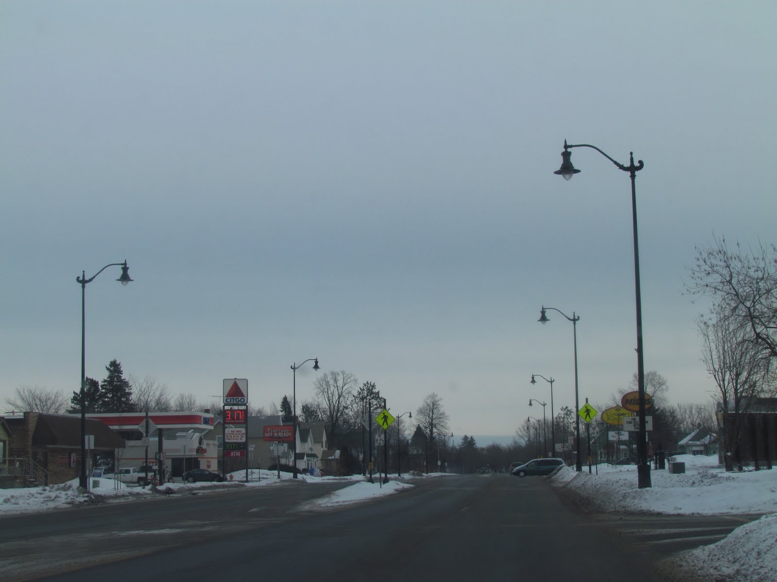
U.S highway 2 Ashland,WI

This is a picture of the actual city of Ashland, the bay is to the left of the picture.

Snow east of Ashland,WI

I talked to a friend of mine, Nathan who lives in Ashland, It was true what he said about the snow. I knew they had a resent lake effect snow storm in this area and I could really tell there was heavy snow that fell once we got just east of Ashland, it seemed to slowly start until it got heavy towards the Wisconsin Michigan boarder, the photo above was taken near Hurley,WI

Hills east of Ironwood,MI

The landscape really got hilly and rocky around Ironwood,MI, by the time we entered Michigan, we were surrounded by large hills and lots of trees. When we got east of Ironwood flurries began to fall from left over lake effect snow showers, this snow lasted right through the rest of the U.P.

Snowy scene in Central Upper Michigan.

I will say that snow from lake effect snow has a different texture to it. The snow seemed fluffier and light weight, The snow covered the trees and really made for a beautiful scene. Even me, who grew up in a snowy area snow found it has its own unique beauty.

Downtown Marquette,Michigan

We made it to Marqutte by 4PM that afternoon an hour late becuase of a time switch to Eastern time zone. I did not get to see much of Lake Superior from Marquete becuase ever where we needed to be there was away from the lake, but I did get a glimpse and it appeared to be mostly unfrozen! Weather in Marqutte was gray, cloudy and snowing the entire time we were there with temps in the 20s. It was mostly flurries, but Monday Night, for a time it was actually fairly heavy. I did get to ask the hotel owner where we staid in Negaunee,MI a inland city just outside of Marquette about the snow, and he mentioned to me then average near 200 inches per year! I was very surprised, but I could believe it because all the banks were nearly as tall as I am!


Sunday, January 9, 2011

Long duration light snow ahead minor accumulations & going to Marquette,MI!

Regional weather view

A long duration snow event is expected as a snowy system heads towards the Upper Midwest. Significant accumulations are possible in Northwest Iowa, Southwest, Minnesota and South Dakota. Minor snow will fall in Western Wisconsin and the southern 2/3rds of Minnesota. Minor snow accumulations will also fall over the U.P of Michigan from continued lake effect snow.
Local View

Note: I will be in Marquette,Michigan starting Monday through Tuesday, I will not be here to update this forecast.

Locally we can expect light snow for the entire 3 day forecast time frame as a system brings a long duration snowfall event to the area. This means that the snow will not accumulate all at once, it will be more like accumulations around an inch every day. Light snow will start Monday and last through Wednesday, with Wednesdays snow mainly being flurries. Total snowfall accumulations will range 1-4" across the entire area. Temperatures will be fair due to the snow in the 20s during the day and in the teens during the night.

Monday, Light snow, calm winds with temperatures in the low 20s. Monday Night, light snow, lows in the 10s. total day accumulation around 1 inch possible.

Tuesday, Light snow, light winds with temperatures in the low 20s. Tuesday Night, light snow lows in the mid 10s. total daytime snow around an inch possible.

Wednesday, Light snow turning to flurries. Highs in the mid 10s. Wednesday Night, mostly cloudy to partly cloudy, lows in the low single digits, total daytime accumulation a half inch to and inch. Total snowfall event 1-4" possible.

Looking Ahead

We will have one dry, but day Thursday, before yet another system tracks towards the Upper Midwest Friday, this storm has the potential to bring higher snowfall accumulations to the area so it will need to be watched. Then temperatures stay fair through Monday the 17th before another snow system moves in. on Tuesday the 18th, This one also appears to being the chance of higher, significant snowfall accumulations. Due to these storm systems the cold air forecasted last week looks to be delayed, and possibly moderated some. Behind this storm on Wednesday the 19th, cold arctic air follows the storm. Warmer and snowier conditions follow towards the area by the 21st. Fair temperatures with snow conditions look to continue through the end of the model run on the 24th. So a huge change in the models this week. It now appears we have the chance to literally get buried under snow this month, More on this later.

Heading to Marquette,MI

I had the chance to go to Marquette,MI (location above on regional map) for one night this upcoming week and I took it. I have been to the U.P before, but I've never been to Marquette and the north side side of the U.P, I will get to see Lake Superior in the winter. I am leaving early Monday spend one night there, and will head for home late Tuesday. I am looking forward to this trip. I will be taking pictures and they will be posted here after the trip. I will also be providing updates during my trip through Twitter.

Sunday Morning Cold Temperature Report

Snow drifts around a hay bale January 9th

Cold arctic air filled in behind a snow system that brought snow to us on Friday, Highs even with sunny skies were only in the single digits above zero. Clear skies with an arctic high made for a cold night across the area, every recording station was well below zero. One was even below -20.F. I noticed last night my station was 4-7 degrees warmer then other surrounding stations around me, because of this an investigation was done and I found out both my stations did not have lithium batteries, but instead have alkaline, and alkaline batteries have a tough time reading temperatures below -5.F This was likely the reason for the warmer temp. So instead I with with an estimated -13.F for me location last night.
Lows Recording Sunday Morning

The coldest low was -23.F in Minong and the warmest was Glenwood City at -9.F

Thursday, January 6, 2011

Light Friday/Saturday snow. then cold with arctic air Sunday.

Regional Weather View.

A cold weekend ahead for the Upper Midwest, first, some light snow and flurries will fall throughout much of the Upper Midwest on Friday and Saturday, then arctic air will be in place by Sunday. Heavy lake effect snows will fall in Northern Wisconsin to the Upper Peninsula of Michigan.


Local View.


Locally we will see light snow or flurries on Friday, which could fall much of the day. Accumulations will be very light under or just up to an inch. Highs Friday will be in the low teens, with lows falling to the low single digits below zero. Saturday will be cold, Highs will be in the upper single digits, light snow will be possible early before clearing arrives by the afternoon. Saturday Night will likely be the coldest night of the season so far for many as temperatures, under sunny skies will plunge to the mid teens below zero. some places approaching -20.F will be possible Sunday will be cold with arctic sunshine and highs in the upper single digits. Lows Sunday night will be in the upper single digits below zero.

Friday, Light snow or flurries. Mostly Cloudy, highs in the low teens. Friday Night, Flurries or light snow, lows in the single digits below zero.

Saturday, Cold light snow early then ending with clearing skies. Highs in the single digits. Saturday Night, Cold, Clear skies with lows in the mid teens below zero.

Sunday, Cold, Arctic Sunshine with calm winds, highs in the upper single digits. Sunday Night, Clear Skies, lows in the upper single digits below zero.

Looking Ahead- bitterly cold air ahead

Monday following this Sunday looks a bit warmer as a storm system passes to our south. Behind it our first but warmer wave of Bitterly cold arctic air will follow it, highs will look be in the single digits, with lows falling near 20 below, but this is not nearly as cold as what we will have to put up with in the second wave. Around the 15th the models shift a snow system that was south north, and now it looks to bring minor snow our way. Behind it by the 16th, a very cold arctic high pressures system from Canada makes its way southward, with it Significant bitterly cold air follows. High temperatures is this air mass look likely to be
well below zero, with lows possibly approaching 30 below This has the potential to be the coldest air mass we've seen in awhile and it could last as long as a week cold temperatures last through the 18th then light snows are possible, with more arctic air behind this system on the 20th. By the 21st, we may be looking towards a possible warm up, which by this time will be well needed.

Remembering to brush snow off of shrubs pictures included & looking forword to a colorful spring!

A distressed arborvitae bush at my grandmas house after the snow was shaken off Jan 5th Dallas,WI

This is a post reminding everyone with landscape shrubs to shake snow off of bushes as it accumulates, With this brutal winter we've had for snowfall it is especially important to remember this task. I've seen several homes around the area with significant damage to bushes and shrubs from heavy snow. Most of this damage occurred in December when we had 28 inches of snow which continued to pile up, then when the temperatures rose above freezing at the end of December the weight of the heavy snow melting snow and warm flexible branches crushed bushes like the one above which is now in the shape of a crescent. Evergreens were hardest hit especially ones on Western exposures, to make madders worse right after the melt it turned cold again and froze everything up. Arborvitaes in good winter condition in my gardens January 6th

There are some things that can be done to prevent damage, when ever it snows a heavy load, remember to shake the snow off, a easy way to remember this is when you have to shovel snow anyway. If you did catch yourself forgetting to shake off the snow it is best to leave them until temperatures warm I find it best if the temperatures is at least 25 with sunshine. Branches of evergreens become very brittle in cold temperatures, and often in this situations you will cause more damage then good when trying to get snow off.


Colors I'm expecting this upcoming spring.

Last year my spring-flower ground "curse" ended so I decided not to grow bulbs in the fridge anymore, because of this I wanted to post a picture of what I am expecting from my bulbs in the ground right now for next spring. I planted many new Tulip varieties in several gardens where I've never had them in before. I'm looking forward to seeing Tulips in colors of pink, yellow, purple, red and peach. I also planted new crocus bulbs in colors of white, striped purple and plain purple. I also got some last minute on sale Daffodils top right corner which were too hard to pass up. Those I am a little concerned of seeing if they had enough time to grow roots before the ground froze. The tulips right below them I got the same time am not worried about since they can be planted anytime the ground is unfrozen. So all in all I am expected the most colorful spring yet! Expect several postings in the spring, about 2 1/2 months to go!

Monday, January 3, 2011

Up and down tempetures, from cold Tuesday, then snow and warmer Wednesday to cold Thursday.

Regional Weather View


The upper Midwest will be active this week with off and on snow, and off and on cold bursts. Minor accumulations are possible across much of the Northern and Eastern Upper Midwest. Temperatures will cool back down for Thursday.

Local View

Locally it we will have a cold day Tuesday, with sunshine and highs only in the low teens, winds will be calm, so wind chills should not be bad Lows will be in the low single digits. Wednesday a weaker storm system will push across the Upper Midwest, it should bring snow and some point Wednesday, but accumulations will not be anything significant, I'm calling for 1-3" of snow at this time. Temperatures will be a bit warmer with the falling snow in the upper teens, and lows in the mid single digits. Thursday, cold air will rush back in behind the system and skies will clear making for a cold sunny day. highs will be in the upper single digits, and lows will be in the single digits below zero to teens below zero.

Tuesday, Sunny and cold with calm winds, Highs in the single digits. Tuesday Night, Chilly, turning cloudy with lows in the single digits.

Wednesday, Warmer with snow developing, moderate at times\. Highs in the upper teens. Wednesday Night, a good chance of snow, before tapering to flurries. System total 1-3"-entire area lows in the single digits.

Thursday, Clearing, sunny and cold with highs in the single digits, calm winds. Thursday Night, Clear and Cold lows in the single digits to teens below zero.

Looking Ahead

An active but chilly time ahead looks to continue through the rest of this week. Another light snow event looks to occur Friday the 7th, cold air follows behind it then it's dry and cold behind this storm system for the weekend. Things warm up a bit by the week of Monday the 10th. Then the models show a storm system for the 11th which could bring some more snow. Then around the 14th a strong storm system passes south of the area, dragging bitterly cold air of the 14th, a clipper passes through on the 16th and it remains chilly. Then another chuck of bitterly cold air comes down in time for the 18th. This cold air will be something to keep an eye on, Below zero highs are possible.

Saturday, January 1, 2011

2010 My Station Summary Information

This is a post listing a summary of what my station seen for weather in 2010. 2010 was a very active year, many new weather experiences were met, starting from the least snowiest March, which lead into a more active then normal severe weather season. Following this we had a historically strong weather system in October which caused a lot of wind. The active season did not end there. in Dec just when you think the year would end quietly we had a major winter storm. So 2010 definitely went out just as crazy as it came in.


At my station in my backyard in Clayton,Wisconsin I had

Precipitation

Rain- 29.26" (+ 2.56")

Snow- in 2010 calender year 50.0" (+ 4.0" ) 09-10 Winter Season 40.25" ( - 5.75")

Severe Weather

11 Severe Thunderstorm Warnings (+9 from 2009). 3 actual severe thunderstorm conditions, 1 was fairly significant causing est. 50MPH winds

1 Tornado Warning (-1 from 2009). 2 close calls including one which brought a wall cloud and significant damage n Range

41 Days with thunder. all from thunderstorms. (+ 16 from 2009)

Snowfall/Winter Storm

1 Winter Storm 2010 calender year- Dec 12th 19.0". 2 Winter Storms 09-10 winter season Dec 9th 8.50" Dec 24th 6.75"

1 Major Winter Storm 2010 calender year December 12th, Blizzard of 2010 19.0"

Highest snow depth 2010 calender year December 28th 26.0" 09-10 winter season mid to late Dec, early Jan, mid Feb 10.50"

Wettest Months

Snowiest month 2010 calender year December 28.75" (+ 17.25" for December)
09-10 season December 21.75" + 10.55" for December

Rainiest month July 6.82" (+ 2.89" for July)

Temperatures

Warmest month on average August 83.F (+4 degrees for August)

Coldest month on average January 19.0" (+ 1 degree for January)

Warmest temperate recorded 95.F

Coldest temperature recorded -20.F


Winds

Highest wind gust 46MPH WSW-during historic Oct weather system.


Links to some of my postings on some of the more notible events in 2010 in order of which they came

Snowless March

May 7th late snowfall

July 28th Storm event

August 7th-13th Heat wave

August 11th Flooding

October 27th high winds- Historic weather system

November 14th Snow storm-Heavy wet snow

Major Winter Storm-December 12th Blizzard of 2010