Map Image Legend Image

Iowa Weather Network Warnings Map

Iowa Weather Network Warnings Map

Winter Weather Advisory

Saturday, November 14, 2009

Geese Migration, and 1st Thanksgiving Cactus Flower!

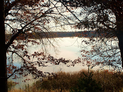
Canadian Geese on Lake Magnor.


The Geese are continuing to migrate south! While I was at my aunts house on Lake Magnor, I noticed there were so many Canadian Geese right on the lake! they were enjoying the waters there.
A closer up picture of the Geese on the lake. definitely a lot of them!


Yellow Thanksgiving Cactus.

After Weeks of waiting, The 1st flower on my Thanksgiving Cactus finally opened! This is the 1st flower I've actually grown myself.These Cactus, are my favorite type of house plant. These cactus flowers as the nights get longer and They are really loving our dark long nights that we have here in Wisconsin! I'm still waiting for my other colors to open. but This is the 1st of many flowers, I have 7 Thanksgiving Cactus some large and small most are different colors! I will be posting picutres as they open.

Wednesday, November 11, 2009

Nice November weather. A few lake picutres.


Lake Magnor on a clear calm day.

We have had some great weather over the past few days, Sunshine with highs in the upper 50s. Perfect for early November. I just had to show this picture of Lake Magnor that I took, When I saw how waves less the lake was, I knew I needed a picture because normally there are always at least some waves on the lake but on this day, there was None.
Here is a second picture of Lake Magnor. Lake Magnor is the largest lake in the Clayton area, It has about 3 miles of short line and is fairly deep. It has been quite low for water level this year, Although it is up a some after above average rainfall in October.

Sunday, November 8, 2009

Looking Nice mainly for start of week.

Weathermap for Monday, Tuesday and Wednesday.

Things are looking pretty nice for the start of the week, besides a small chance for rain early Monday. High pressure will effect the weather late Monday through Wednesday, this will pretty sunny warm condtions. Temps will warm into the 50s which isn't bad! night lows will be coolish in the low 30s. Detailed forecast below.

Monday, slight chance for rain early, Then mostly cloudy with gradual clearing later in the day. highs in the low 50s. Monday Night, partly Cloudy, lows in the low 30s.

Tuesday, Mild, Sunny and staying dry, Highs in th low 50s. Tuesday Night, Partly cloudy lows in the low 30s.

Wednesday, A bit cooler but still nice, Sunny highs in the low 50s. Wednesday Night, Partly Cloudy, lows in the low 30s.

looking ahead, looks towards the end of next week we could be looking at another chance for rain. then early the Next week, The models show some colder air pulling in with a couple of snow chances. I will be watching this through the week, but it doesn't look too major at this point.

Saturday, November 7, 2009

Preip Data Changed.

This is a notification that my Precipitation data for my blog has been changed. after looking at the October total rainfall, I noticed it seemed high, but I believed it, but after farther investigation, it proved There was definitely something wrong with the totals. the NWS sites has said most places got between 4-6 inches in Oct. and my total of 10.52" this was far too high. My friend of OSN blog sent me a new gauge and thankfully it came no later. The gauge help me find out the old gauge was reading 2 times too high, the new gauge recorded 0.20" while the old gauge read 0.40"

I was disappointed to find out I might have had to loose nearly 1 years worth of rainfall data, so I wanted to save it. so after a lot of research with a friend of mine, I decided that I would divide all the Rainfall totals in half for the months June through October.

Changes Made.

The changes I made were to Rainfall data, monthly totals for June, July, August and October were changed all the numbers were devided in half. September didn't need changed so it was left alone. Feb,Mar,Apr and May were also left alone, with the months I did change the seasons total was changed, I believe this data is much closer to what it should be. Snowfall data was not changed because I use a different method of measuring which is accurate. Here is a list of monthly totals I got below this includes months I changed.

Feb 2009: Rain 0.08"

Mar 2009: Rain 1.16"

Apr 2009: Rain 2.16"

May 2009: Rain 2.54"

June 2009: Rain 2.91"

July 2009: Rain 1.50"

Aug 2009: Rain 3.84"

Sep 2009: Rain 1.40"

Oct 2009: Rain 4.74" Snow 5.75"

November 2009 -So Far Rain 0.20" Snow 0.00

Seasons Total Rain 21.44" Seasons Total Snow 5.75"

Tuesday, November 3, 2009

A bit of snow, before warming up.

Forecast for Wednesday Thursday and Friday.

Were looking at a chance of snow early Wednesday, from a weak area of low pressure, but I have a feeling most of it will be over before daylight hours, Accumulations will be light, up to a half inch or less. I believe all the preip will come as snow, but there could be a bit of rain mixing in. Highs Wednesday will only be in the low 40s. Thursday will be partly cloudy with temps a bit warmer, highs will warm to the mid 40s. lows in the 30s. Friday is when things really warm up nicely, under sunny skies, Highs will warm into the mid 50s. Detailed forecast below.

Wednesday, a chance of light snow in the morning before ending, total accumulations a half inch or less. cloudy decreasing late in the day, Highs in the low 40s. Wednesday Night, Partly Cloudy, lows in the upper 20s.

Thursday, Partly Cloudy a bit warmer highs in the mid 40s. Thursday Night, partly cloudy lows in the mid 30s.

Friday, Warmer! Nice, Sunny highs in the mid 50s. Friday Night partly cloudy, lows in the low 40s.

Looking ahead our warm and nice day trend will continue into the weekend, Highs may get close to 60 Saturday, then a bit of a cooling trend towards next week. early next week looks like it might be dry and coolish, then the middle to end of next week a system may pull through which could bring is colder weather this system may bring both rain and snow with it. more on this later.

Low Tuesday morning lows!

photo showing whats left of some Oak tree leaves on a cool November day.


The leaves went real quick! seems like they all fell off in the matter of 2 weeks! only late trees have leaves now, It is very bare. Monday night skies cleared and temps dropped like a rock as we are in a dry air mass, most places fell to the low to mid 20s, But a few upper teens were even reported! lows reported below.


Low reported Tuesday Morning.

Places with light cloud cover were held up a bit. but places they were completely clear really fell, some places fell to there coldest leaves so far this season! My station reported a low of 22.F and the coolest spot reported was Baldwin with a low of 18.F! It will get warmer, but not before a bit of snow, My forecast is coming up in a few minutes.

Sunday, November 1, 2009

Very cool & Wet October What I had for totals.

October was Very cool and Wet across northwest Wisconsin, We have lots of rainy weather systems and plenty of snow, We definitely had a well above normal month for preip.

My Rain total for Oct.
The Average October rain is 2.39"

October literally started out above normal for rainfall at my location, the 1st-2nd day of October we already had 2.60" from a heavy system. so even the first weather system of the month put us above normal. Through the month we had many low pressure systems, We ended the month of October with an amazing 9.50" for a monthly rain total, This is the highest rainfall amount I've recorded in a month since I started recording.

My Snow total.
The Average October snow is 0.50"

We also had a well above normal snow amounts in October, this started out with a half inch the 10th then an early wintry system brought 2.75" of snow the 12th. October totaled 5.75" of snow for me

Temperatures & wind
October was a much cooler then normal month, I did not even have 1 high in the 60s during the entire month. My highest temp reading was 59.F October 7th, and my coolest day reading was 36.F both Oct 10th and 11th. my Highest wind gust in the month of Oct was 35MPH from the SW on Oct 30th.

Thanks for reading my totals for the month of October!